Current Issue
2026, Volume 45, Issue 2
Display Method:
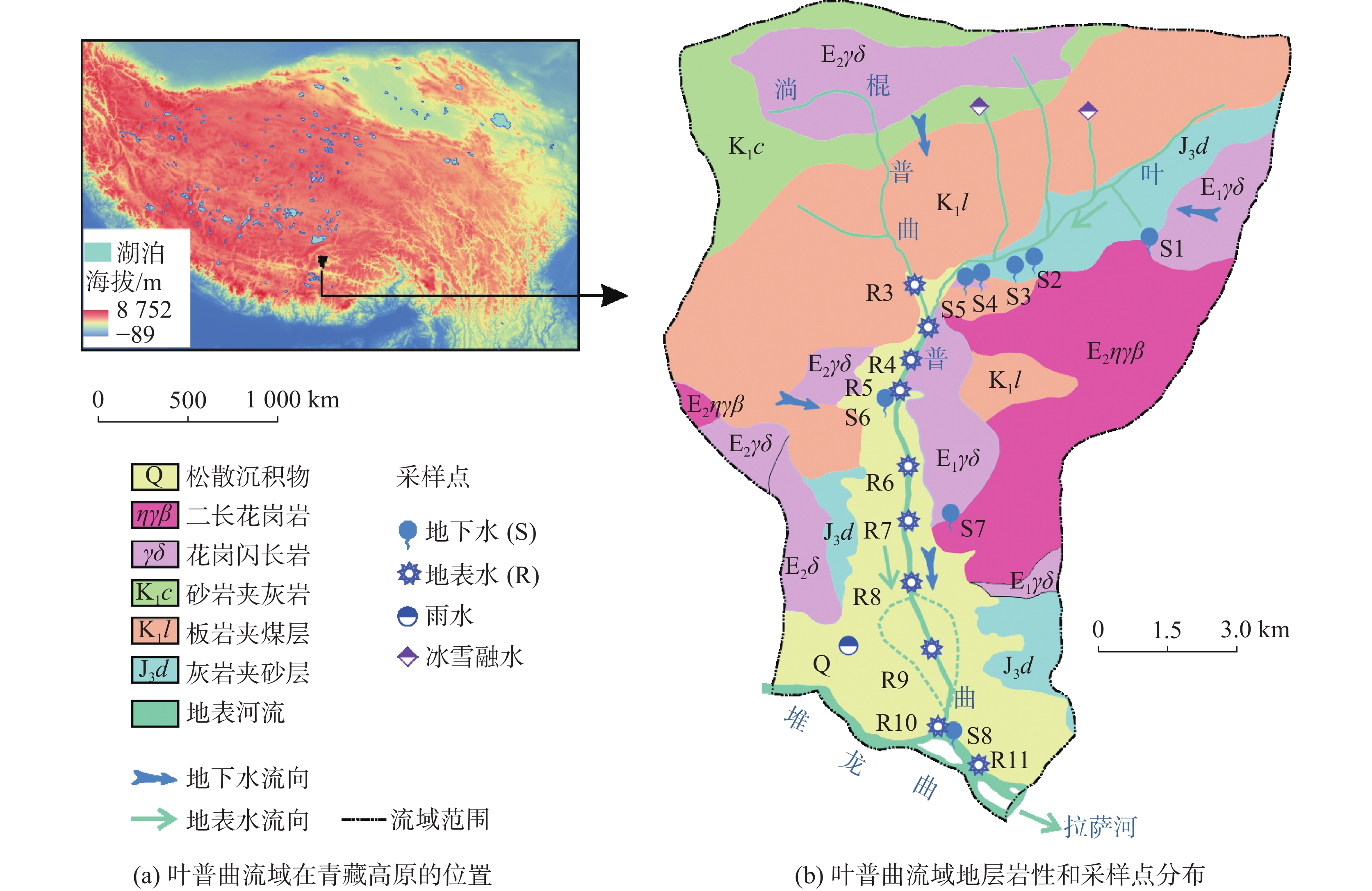
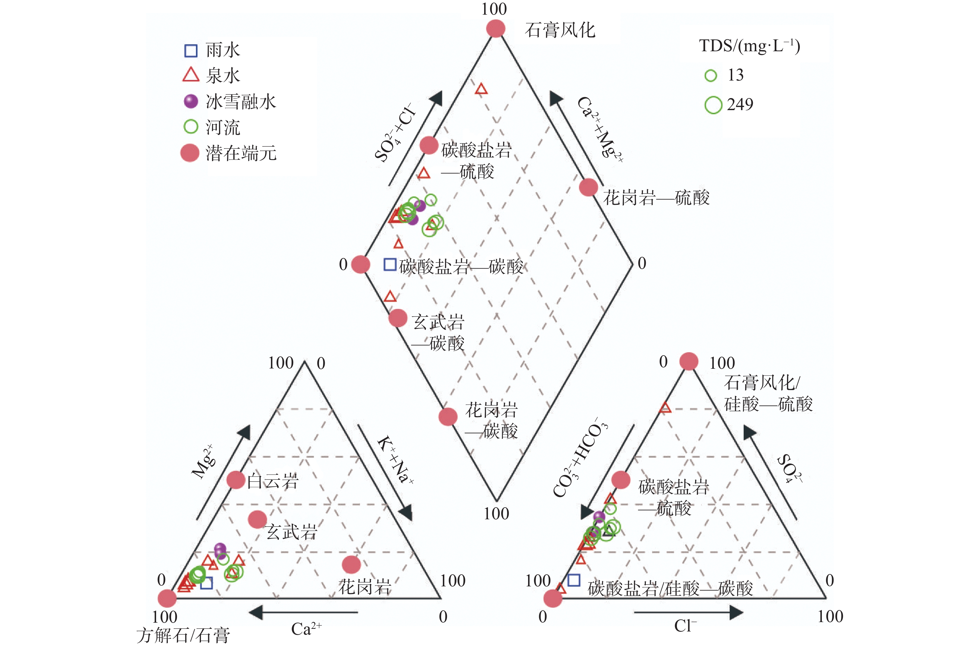
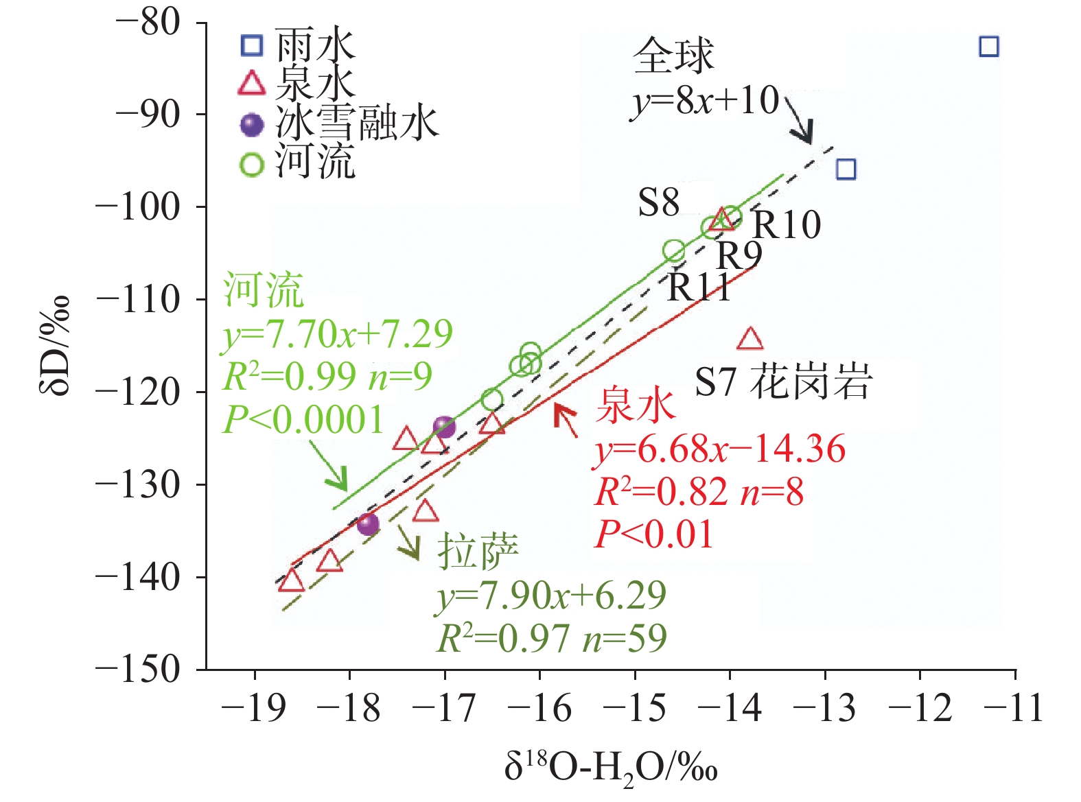
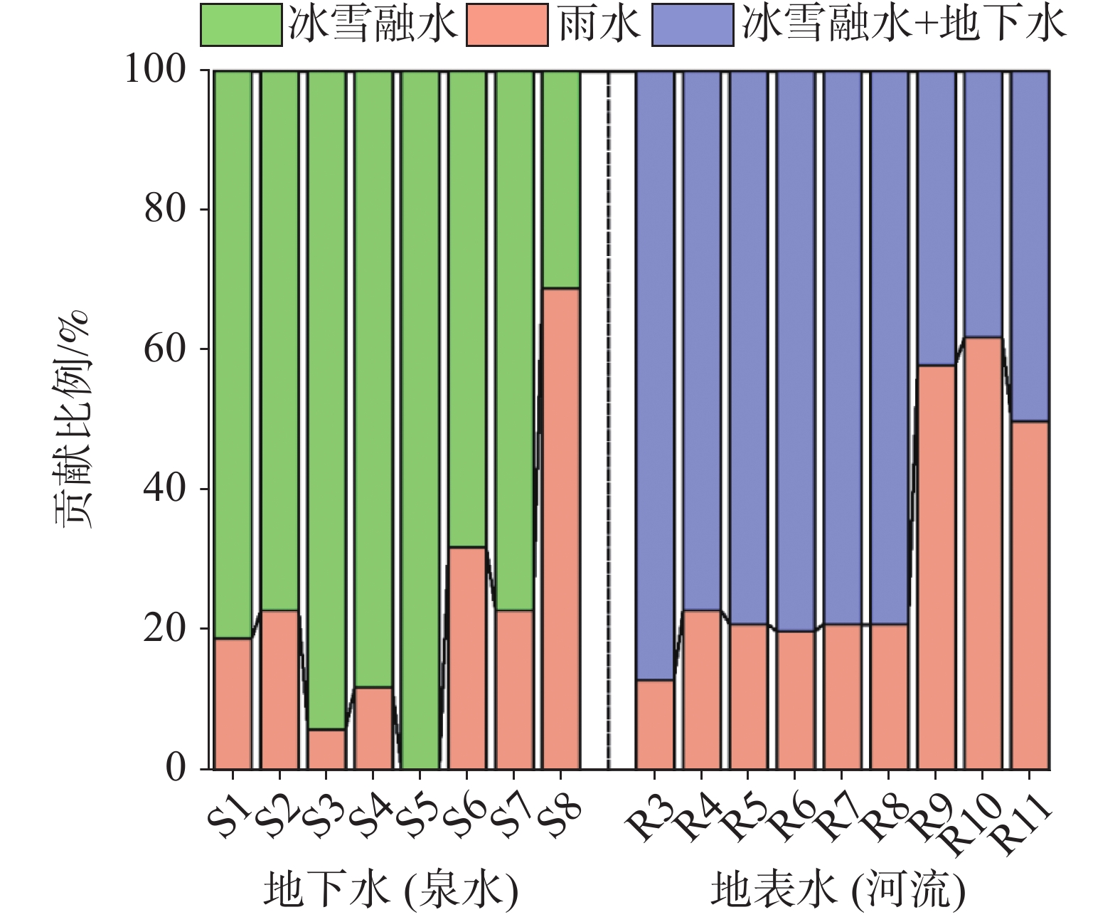
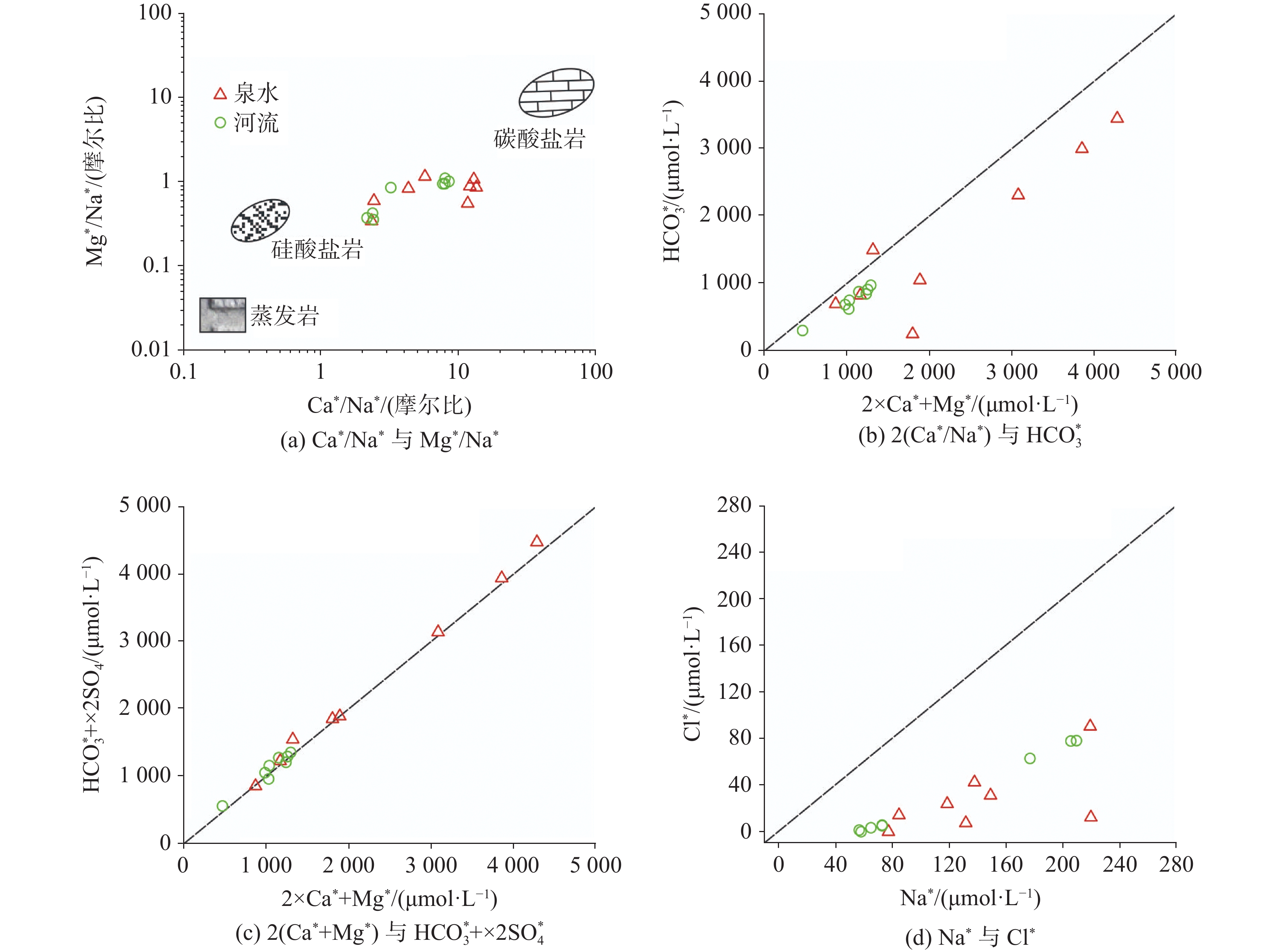
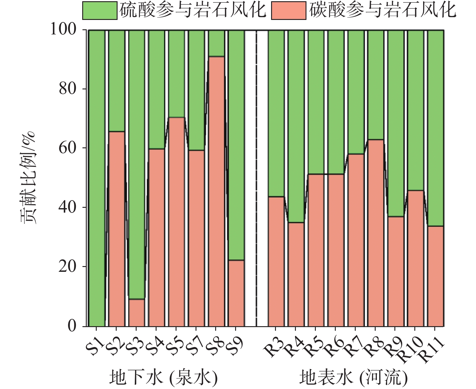
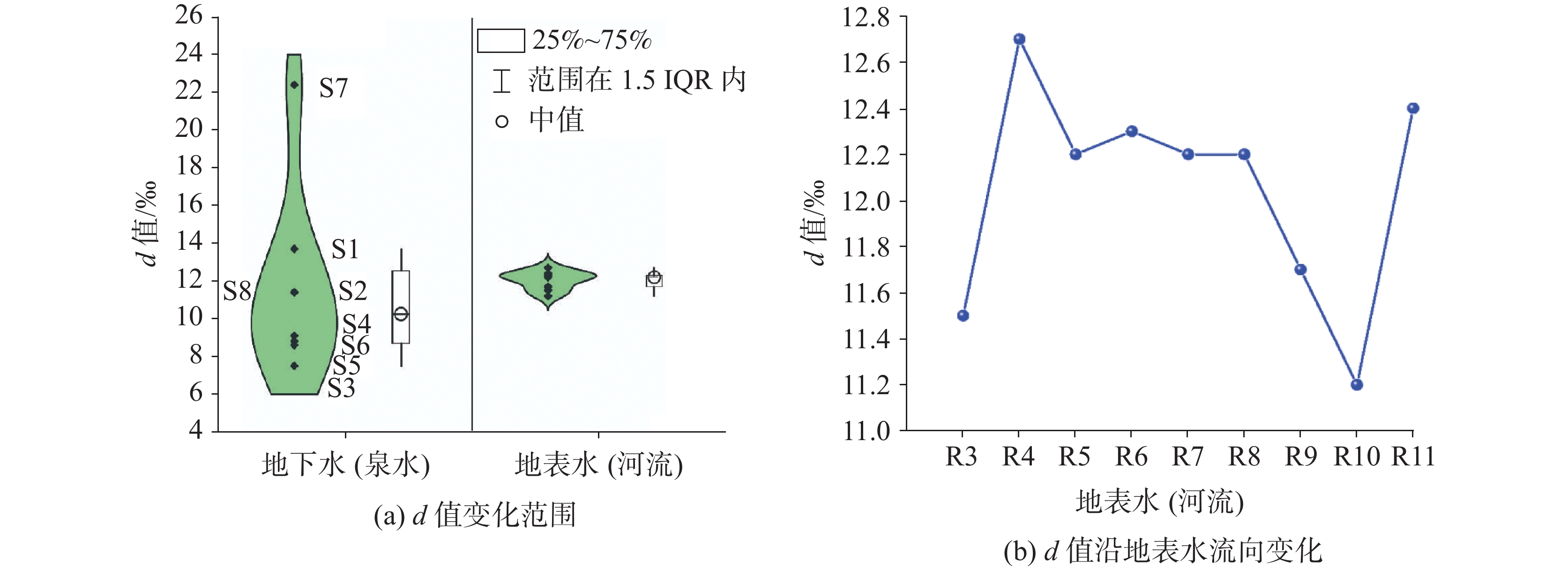
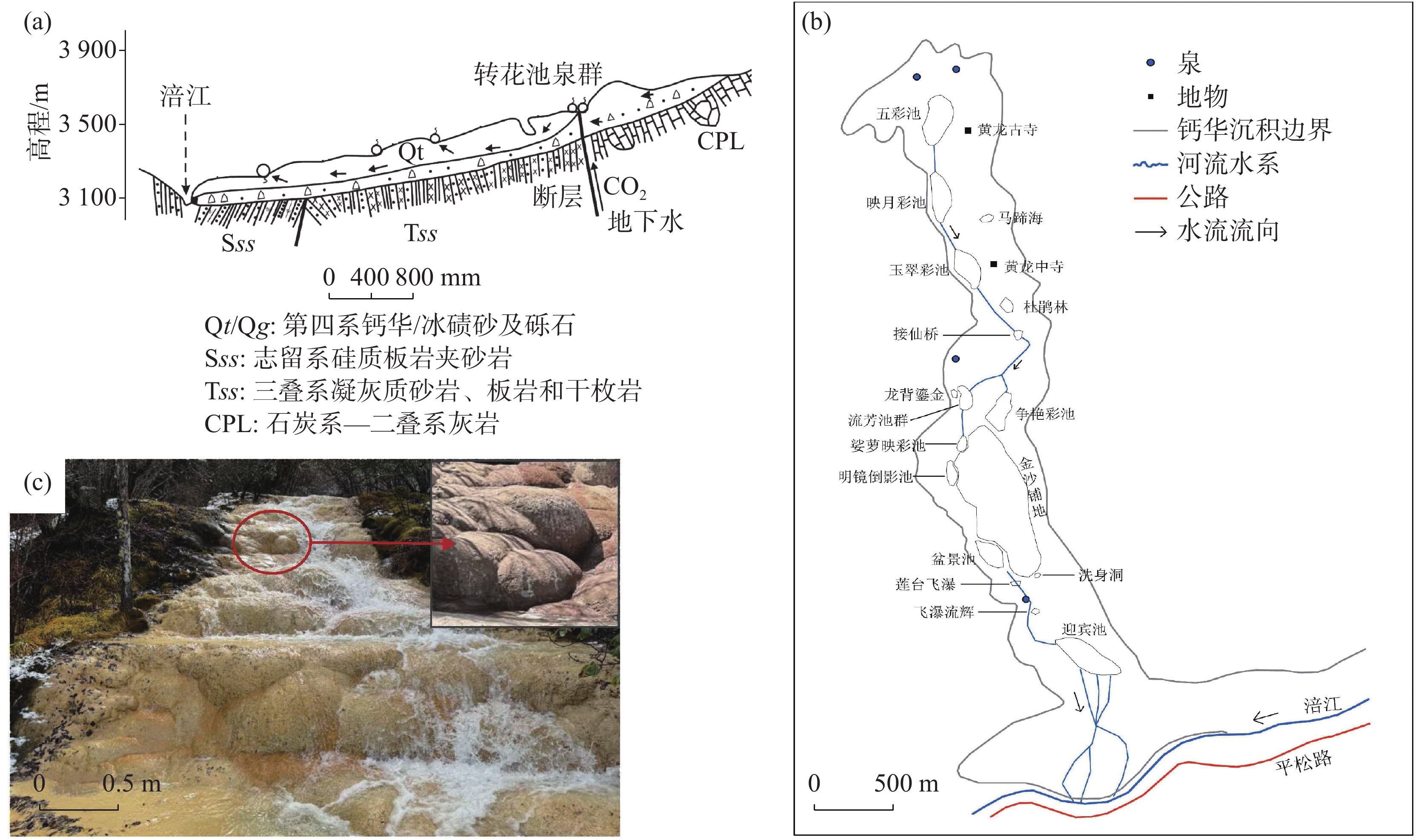
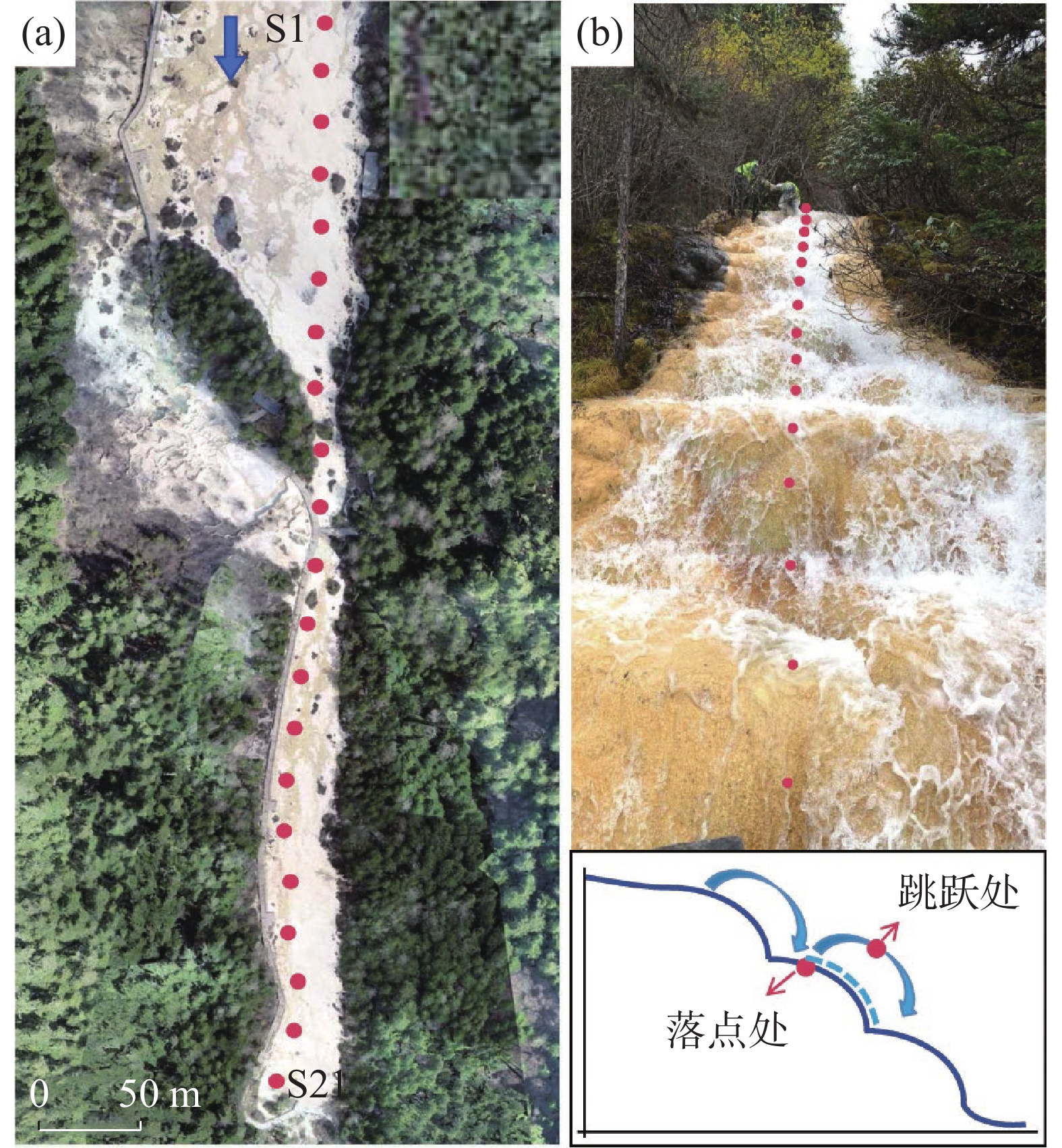
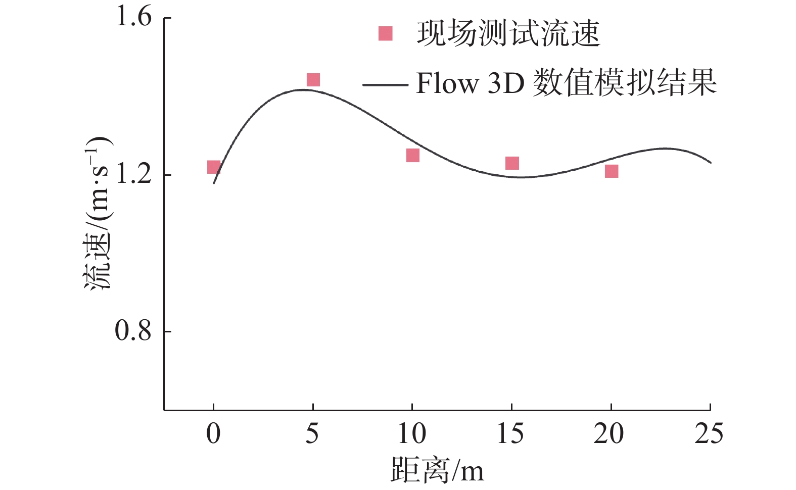
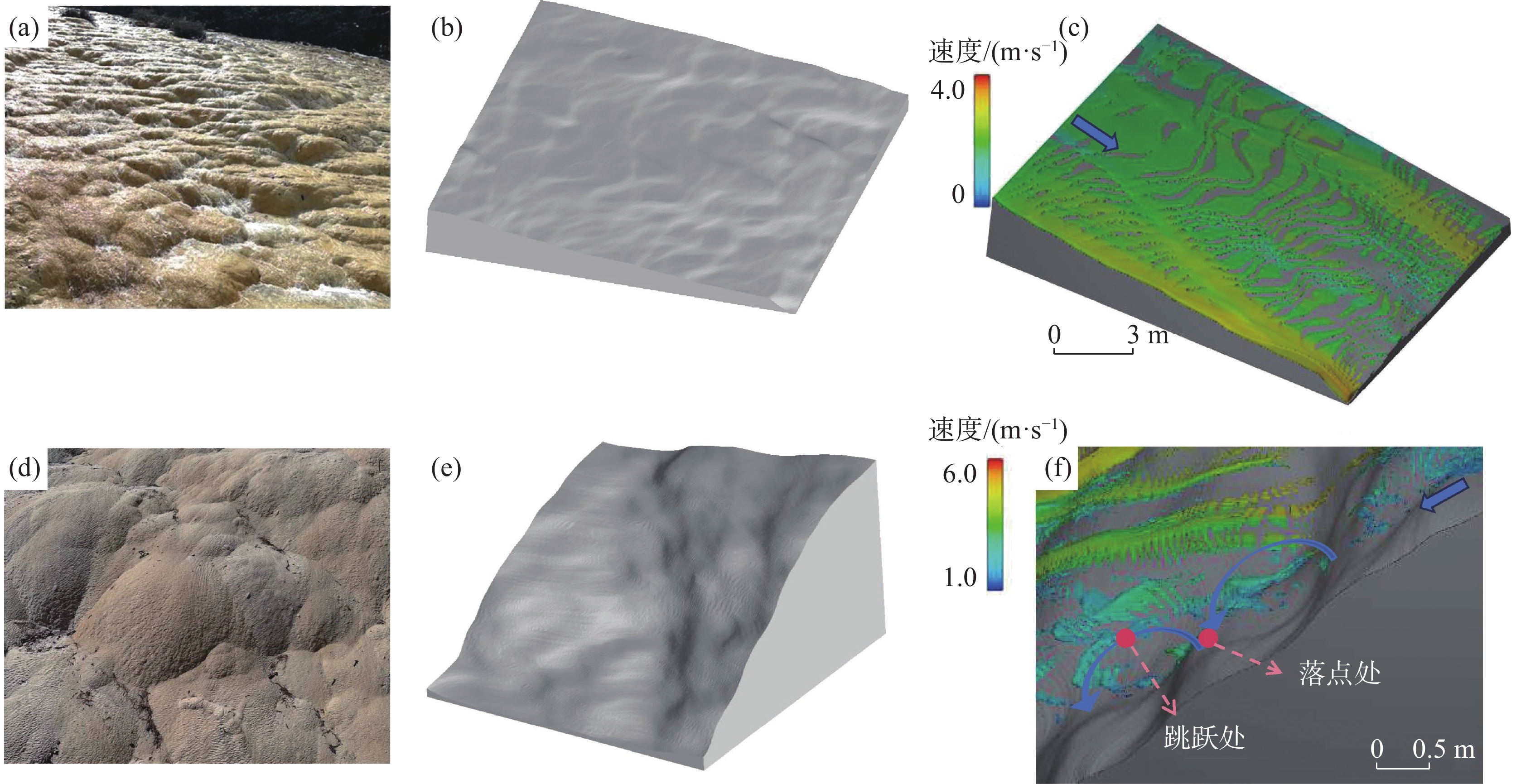
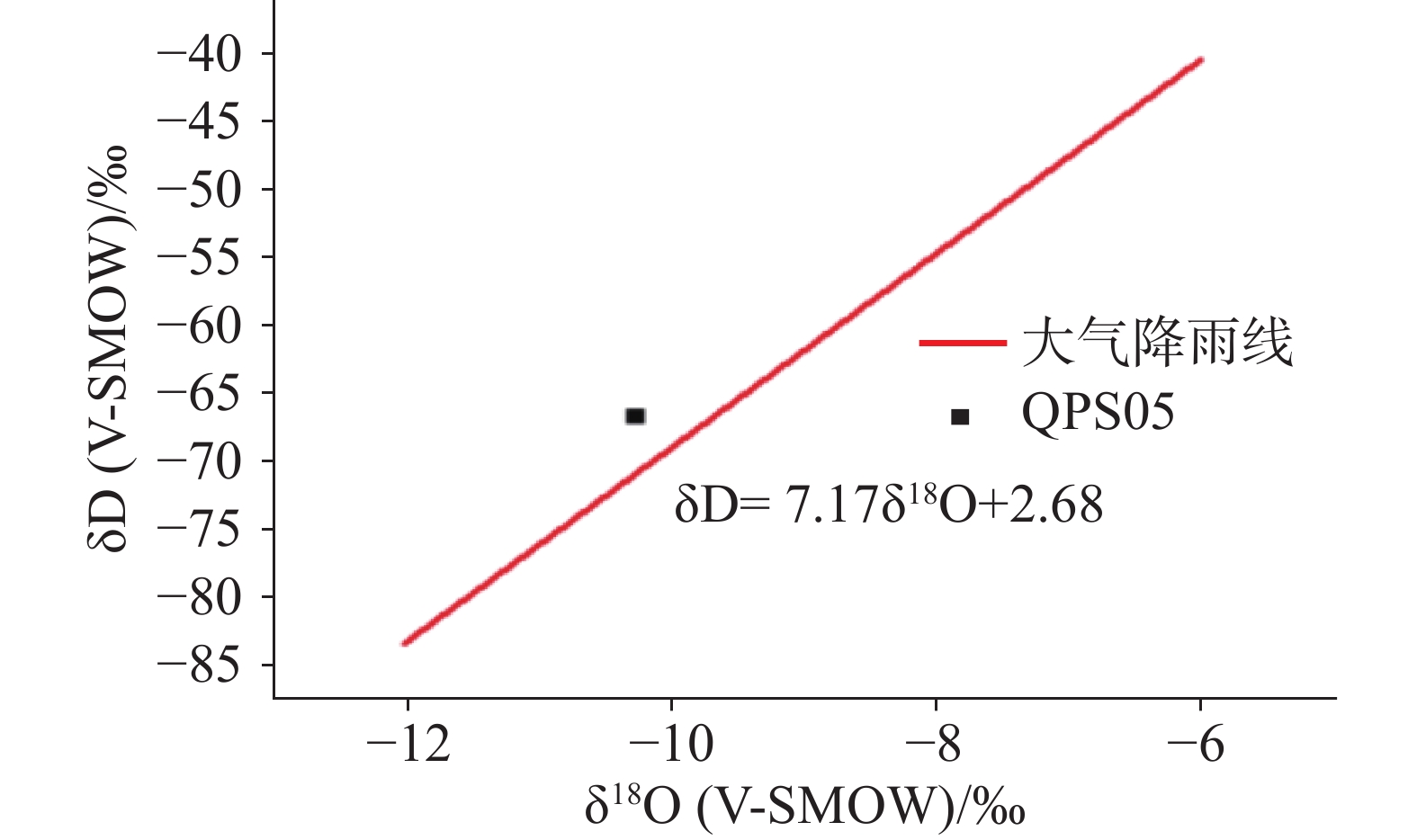
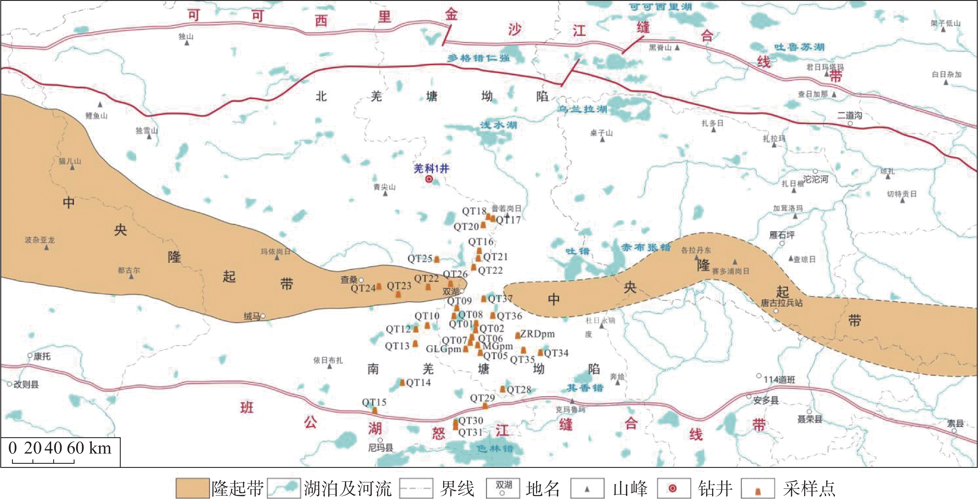
Preliminary study of hydrochemical and isotopic characteristics of the Yepuqu basin, southern Xizang
2026,
45(2):
239-248.
doi: 10.11932/karst2026y004


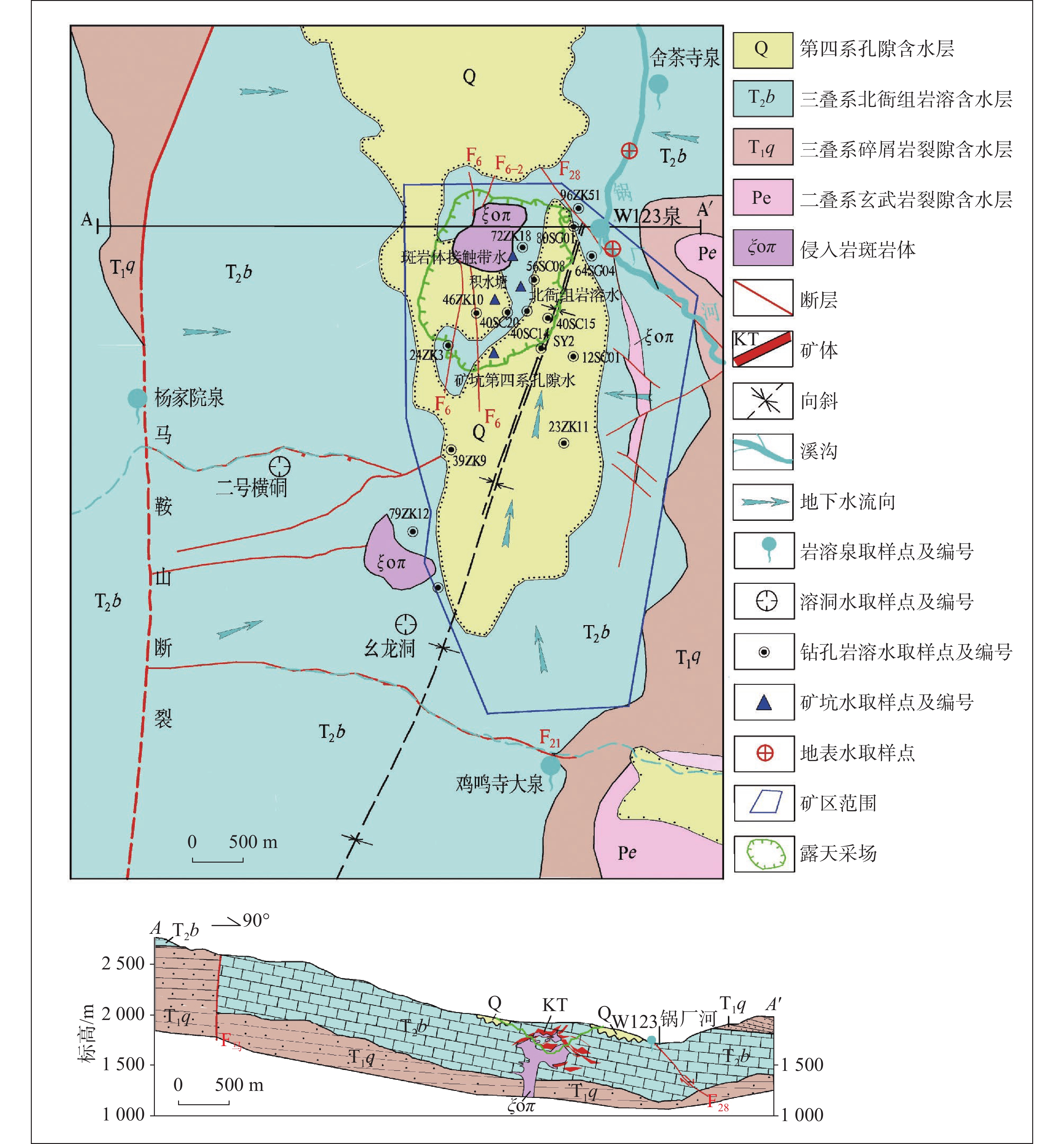
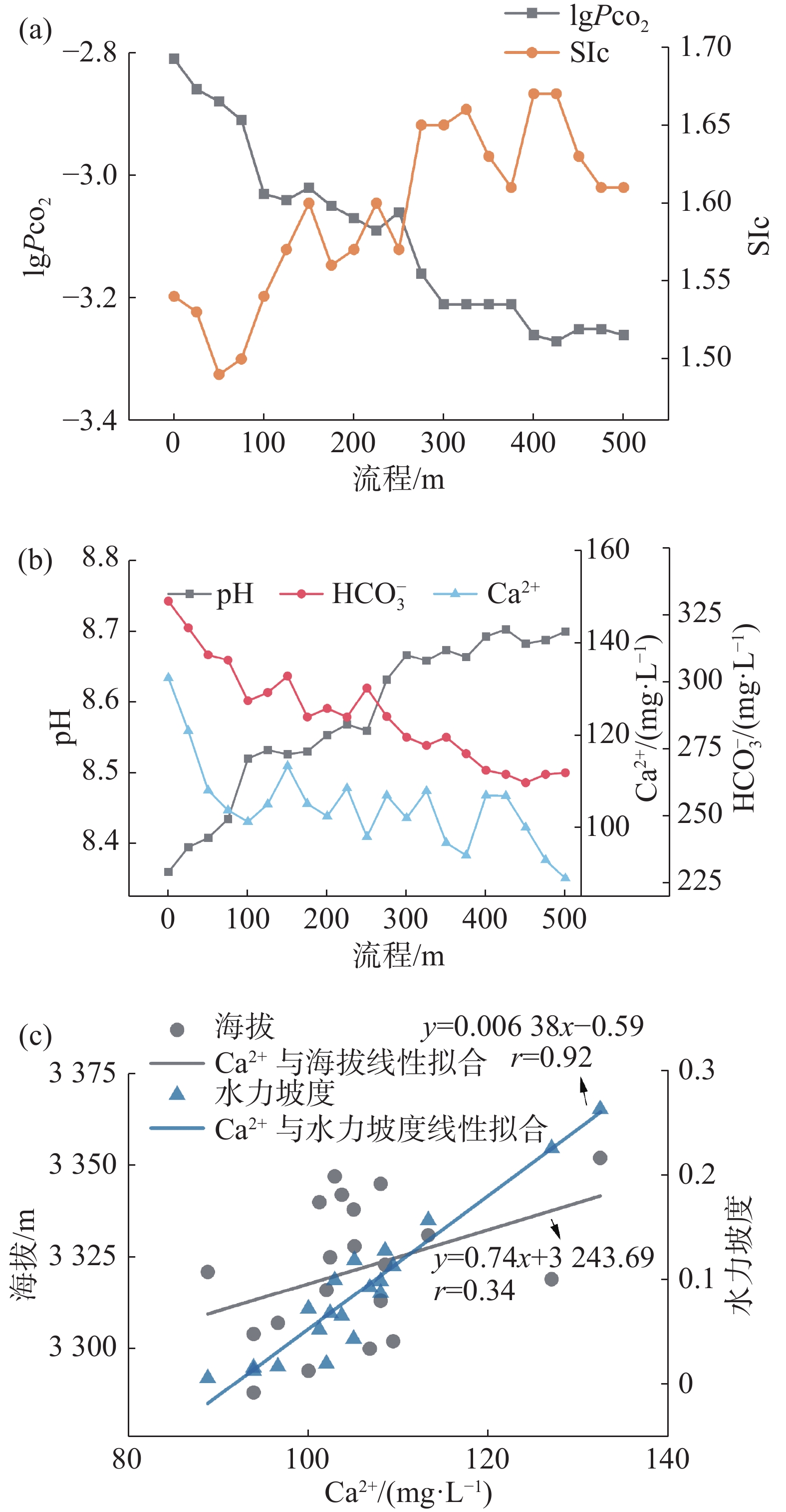
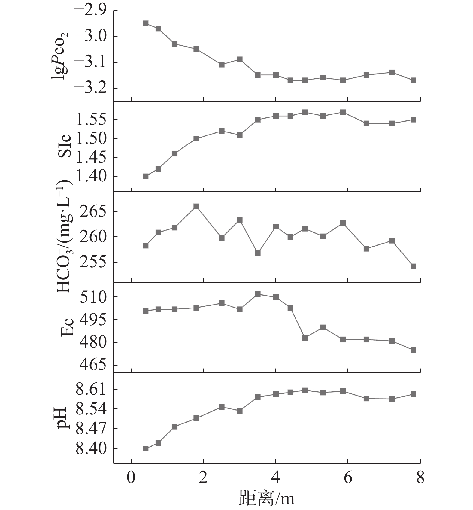
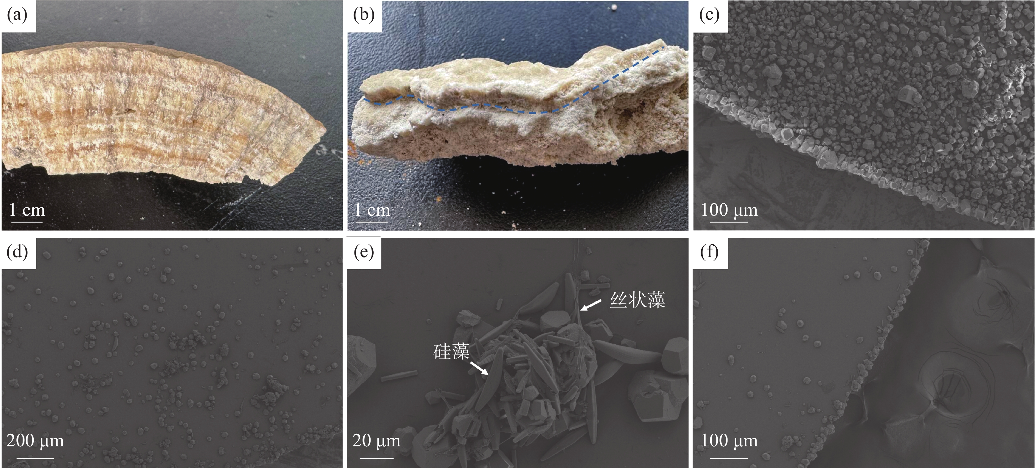
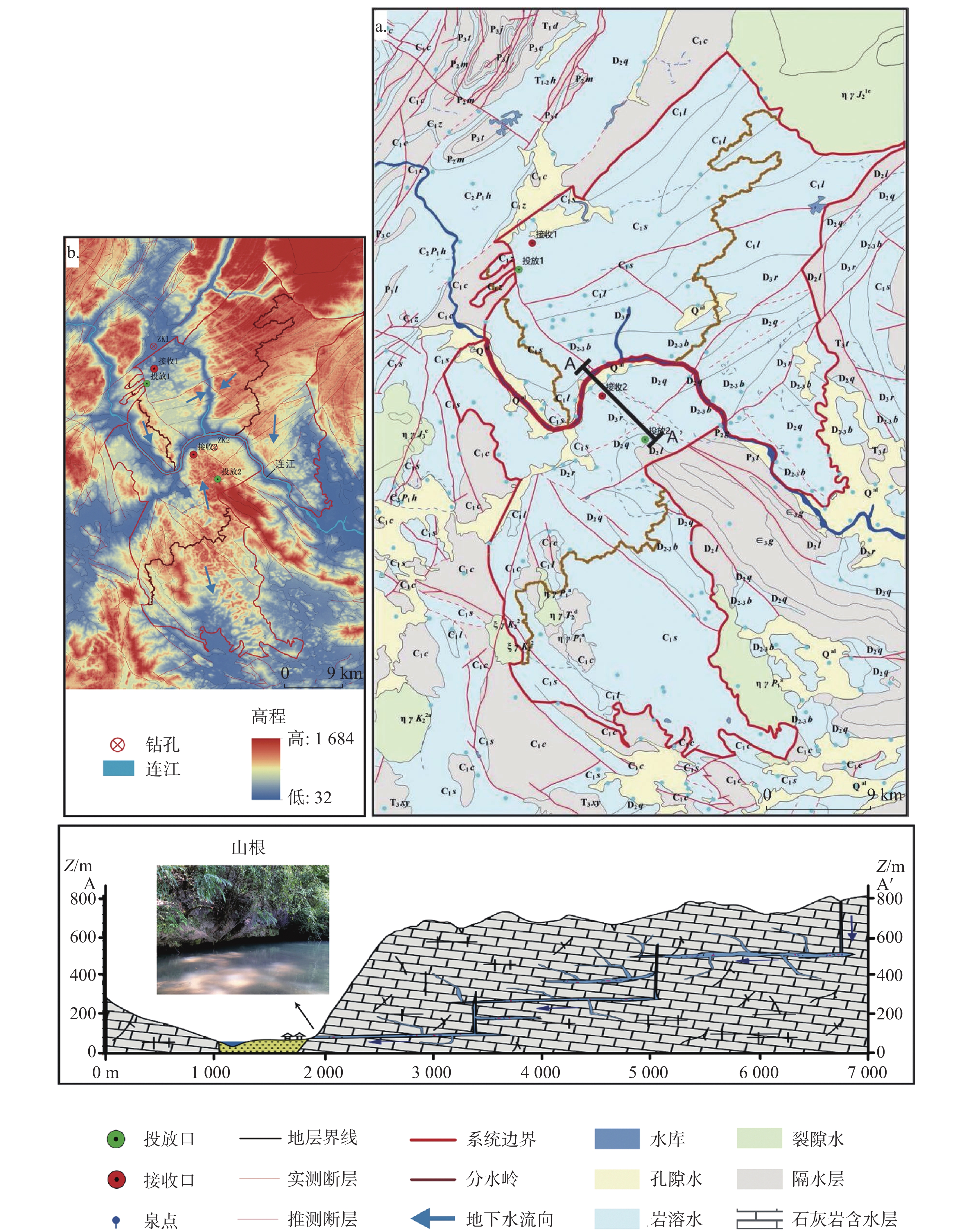
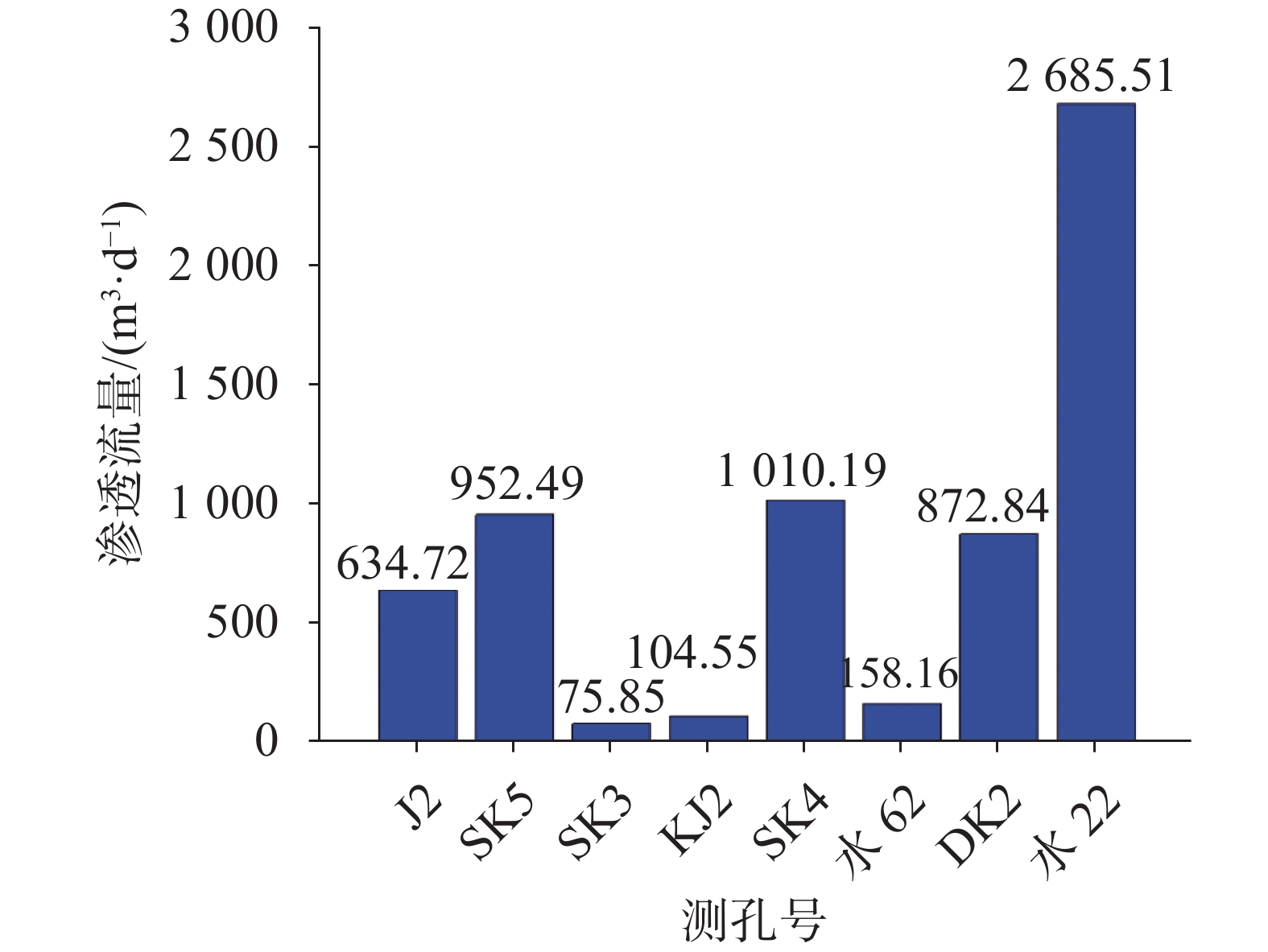
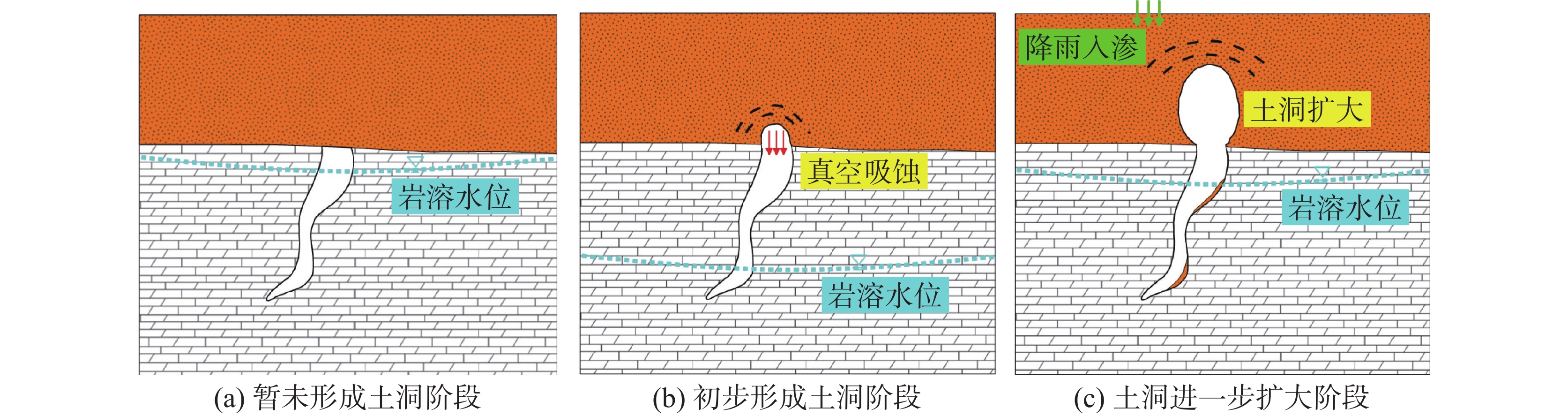
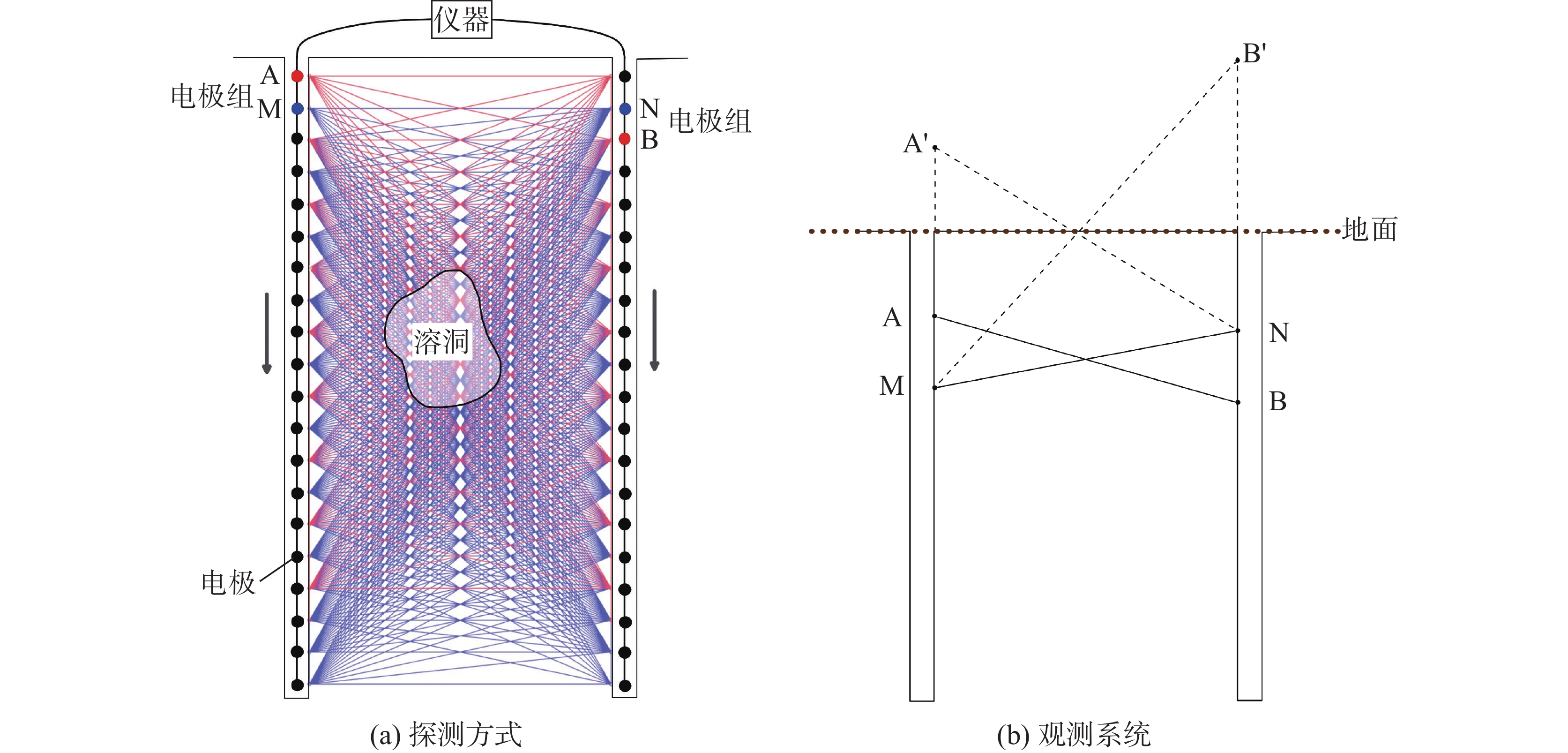
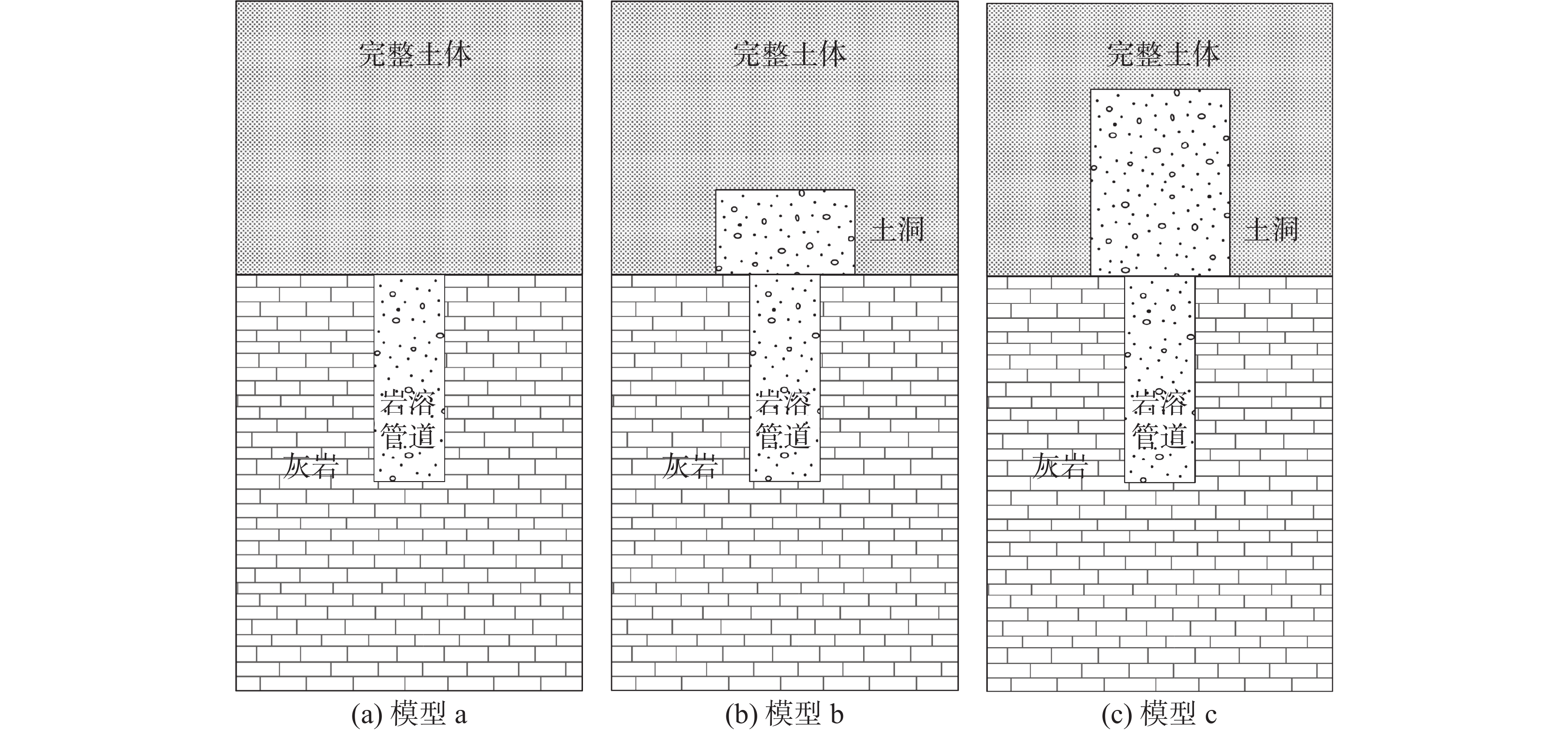
Abstract:
2026,
45(2):
260-270, 281.
doi: 10.11932/karst2025y14
Abstract:
2026,
45(2):
271-281.
doi: 10.11932/karst20260201
Abstract:
2026,
45(2):
282-291.
doi: 10.11932/karst2025y002
Abstract:

2026,
45(2):
292-301.
doi: 10.11932/karst20260202
Abstract:
2026,
45(2):
302-315, 328.
doi: 10.11932/karst20260203
Abstract:


2026,
45(2):
329-341.
doi: 10.11932/karst20260204
Abstract:
2026,
45(2):
342-351, 398.
doi: 10.11932/karst20260205
Abstract:

2026,
45(2):
368-379.
doi: 10.11932/karst20260206
Abstract:

2026,
45(2):
380-398.
doi: 10.11932/karst2026y009
Abstract:


2026,
45(2):
420-430, 442.
doi: 10.11932/karst20260208
Abstract:
2026,
45(2):
431-442.
doi: 10.11932/karst2026y007
Abstract: