2022, 41(2): 259-275.
doi: 10.11932/karst20220207
Abstract:
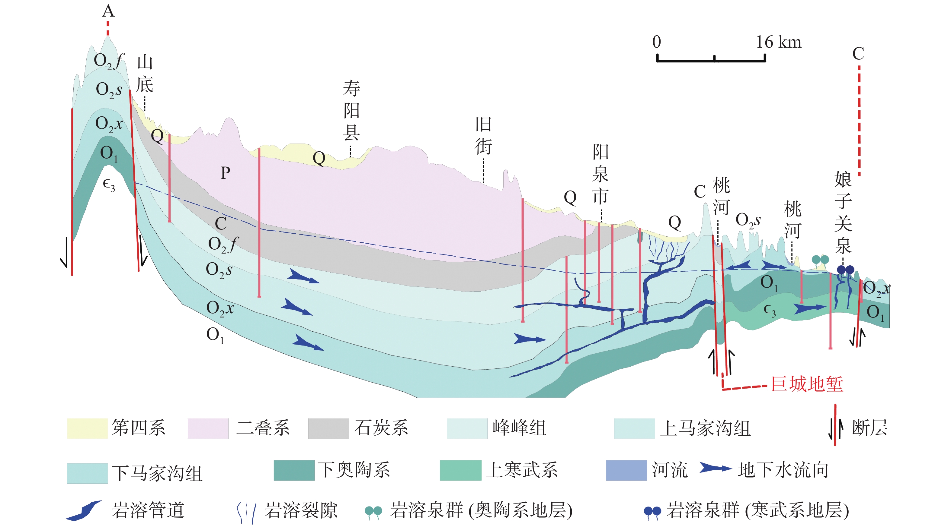
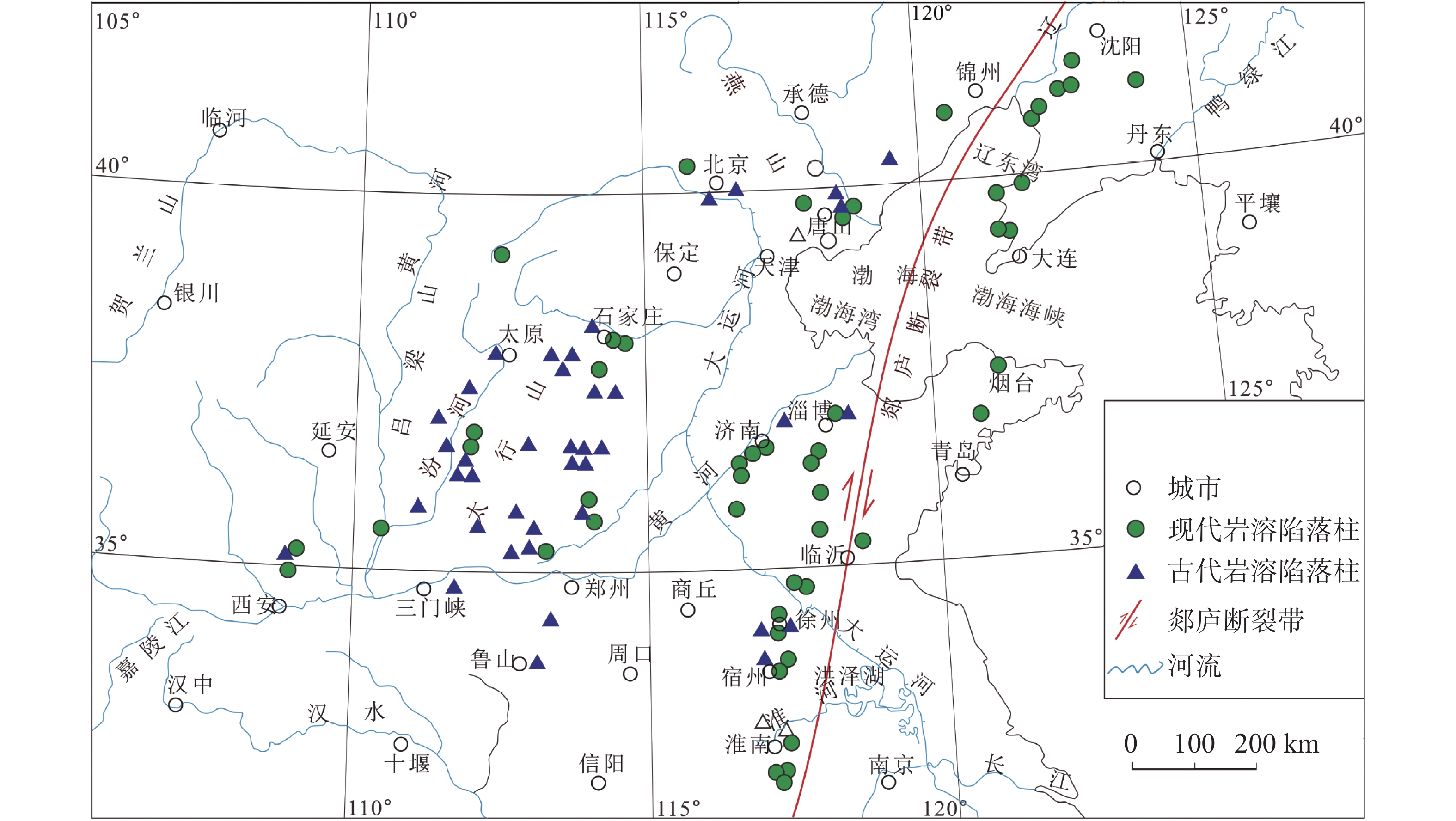
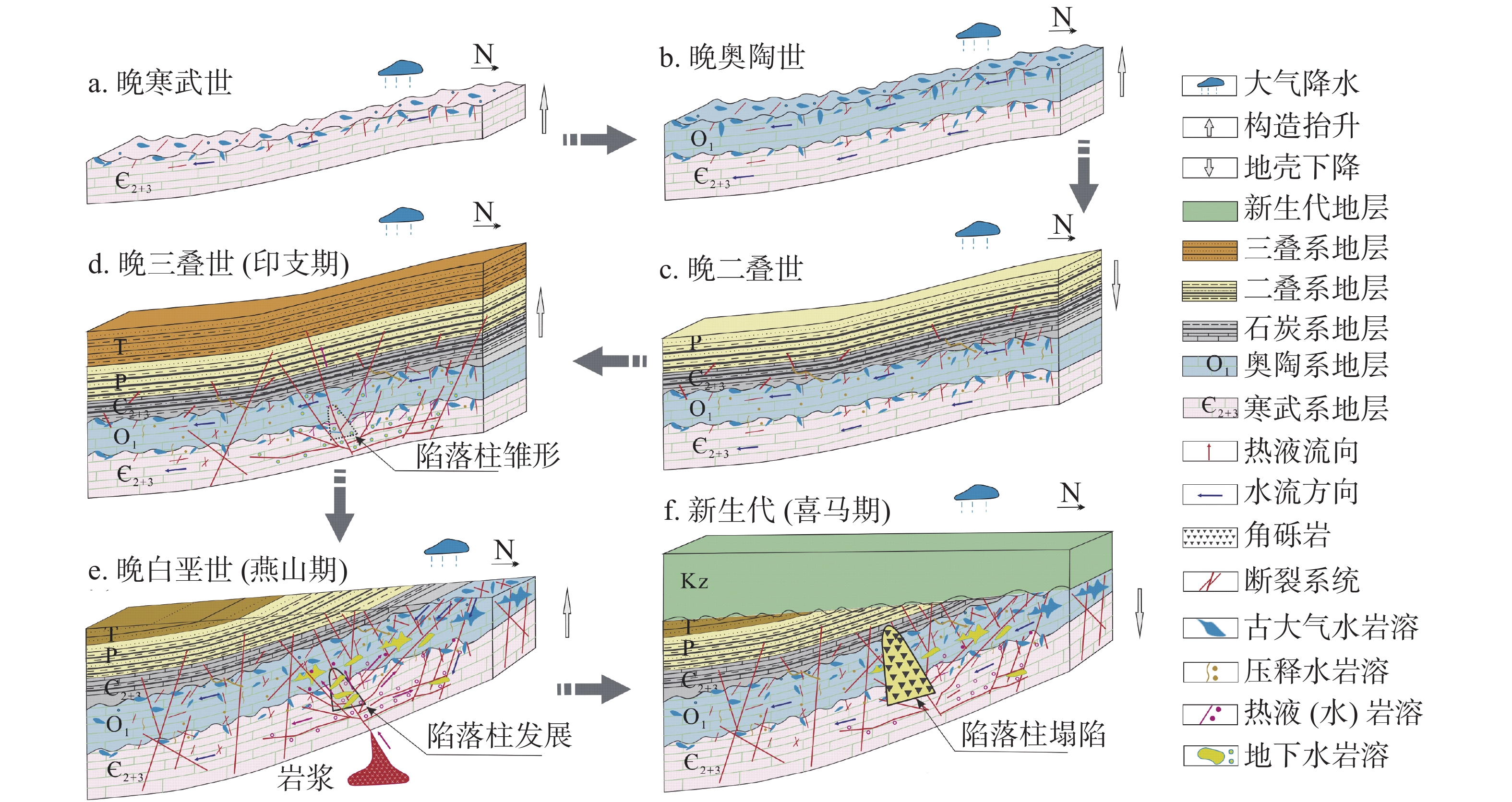
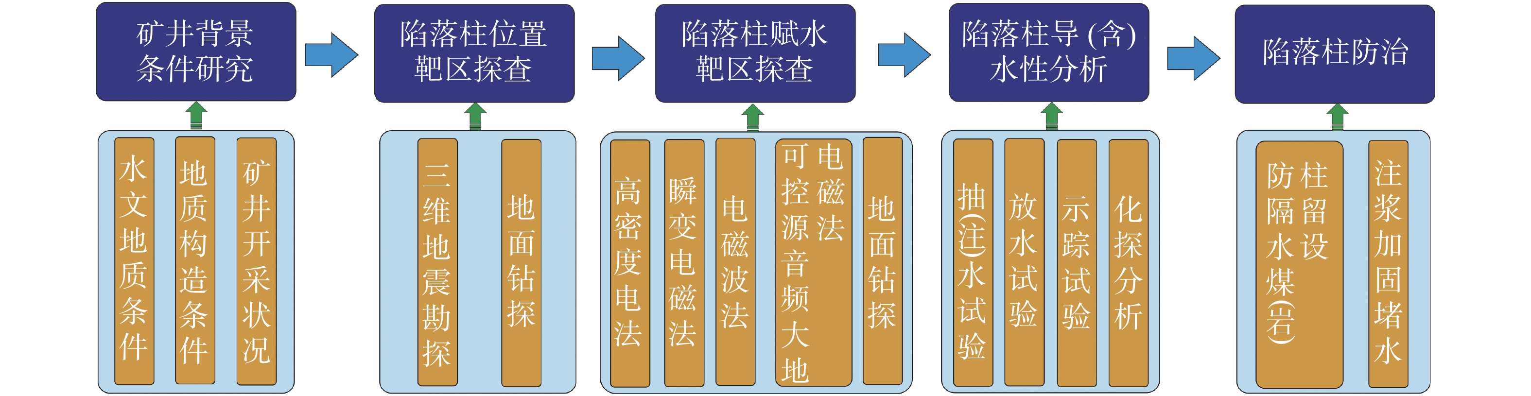
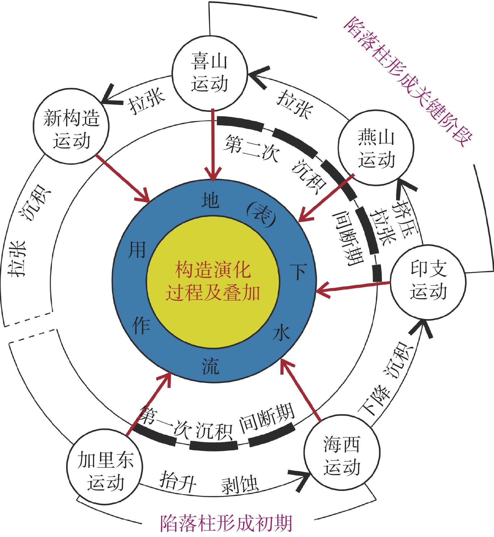
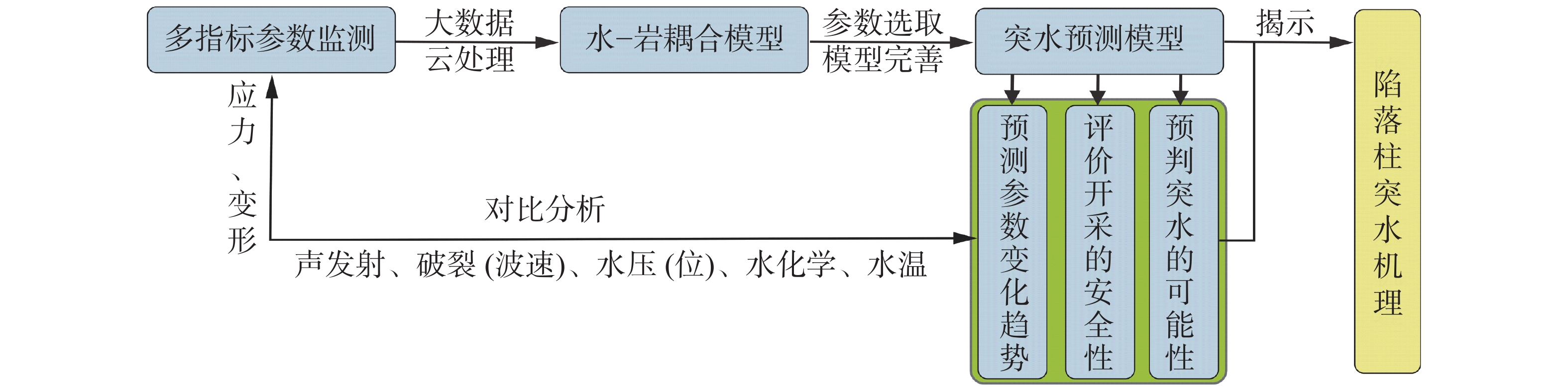
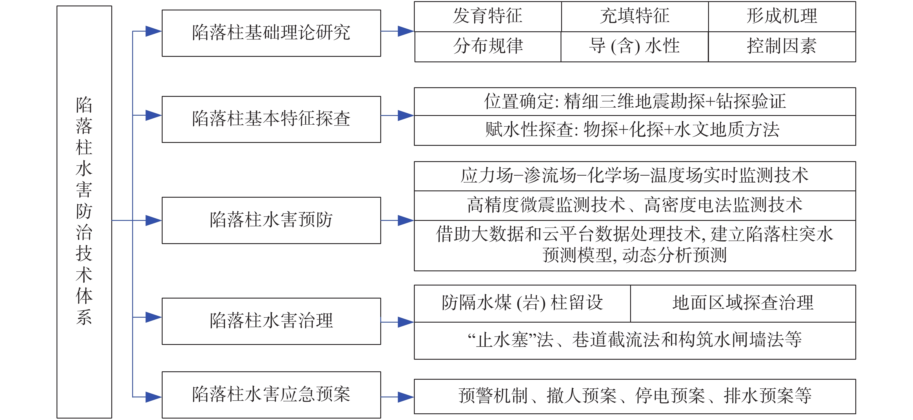
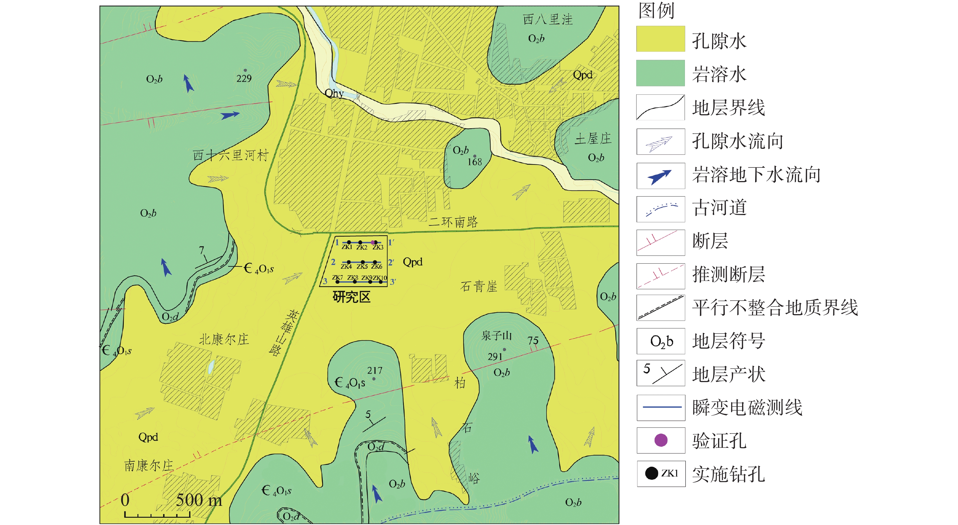
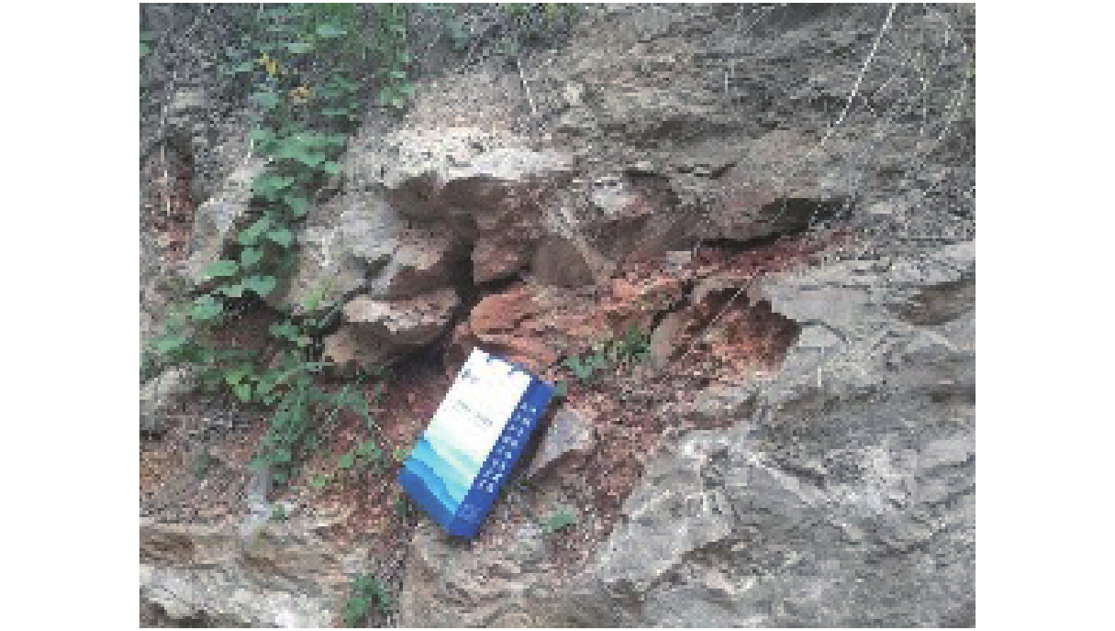
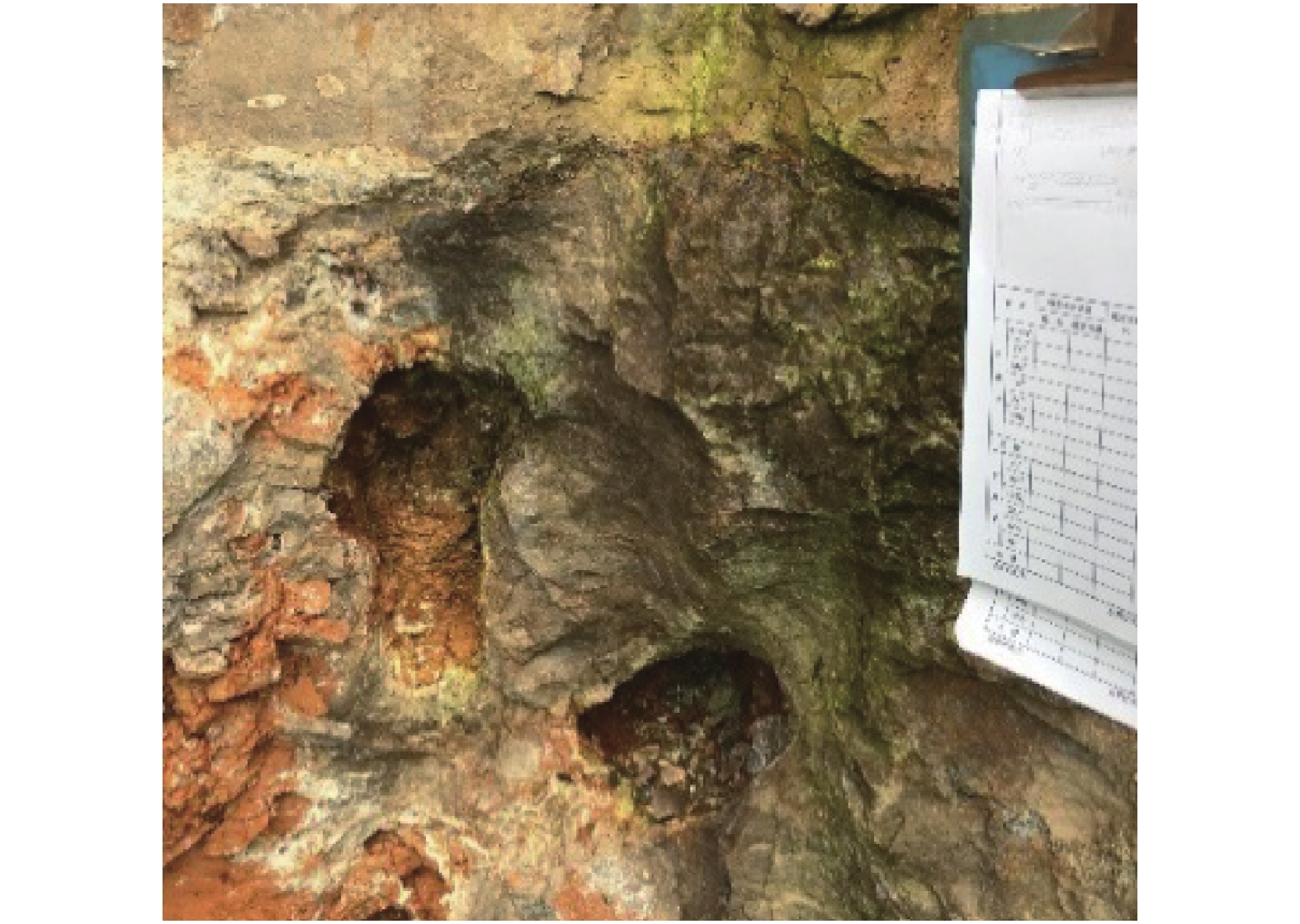
Karst collapse columns (KCCs) are formed in the process of geological evolution in North China coalfield. Their roots are developed in the Ordovician or Cambrian carbonate rocks, and pass upward through Carboniferous, Permian, Triassic strata, and even enter the Jurassic, Cretaceous and Quaternary loose rock strata. Over the past 80 years, more than 10,000 mines have been exposed in 39 mining areas in the coalfields of North China, resulting in more than 20 major water inrush accidents. Therefore, the study on KCCs is of important theoretical and practical significance for the systematic understanding of karst hydrogeological conditions of mines in North China and of prevention and control of karst water disaster as well.This study systematically summarized the spatial distribution characteristics of KCCs in the coalfields of North China, mainly focusing the areas along the Fenhe river, the western foothills of Taihang mountain, the foothills of eastern and southeastern Taihang mountain, the foothills of southern Yanshan mountain, and the west side of the Tanlu fault zone. The plane shapes of KCCs are mostly circular and elliptical, and their cross-sections are mainly cone-shaped. KCCs are usually filled and cemented by broken debris of wall rock and secondary minerals, so most of the collapsed columns in the coalfields do not conduct (contain) water, and only few cases of water inrush occur there. KCCs usually form in such basic conditions as soluble rocks and special stratigraphic structures, multi-stage and multi-source fluid erosiveness, geological tectonic evolution, and paleokarst groundwater flow. Five theories on the genesis mechanism have been put forward, namely “karst gravity collapse”, “gypsum dissolution collapse”, “vacuum absorption collapse”, “hydrothermal origin” and “groundwater internal circulation”.According to the current research on the formation and evolution of KCCs in the Huainan coalfield in the southern margin of North China, this study shows that consisting of Ordovician or Cambrian carbonate rocks, KCCs move through fluid migration channels of faults and fractures generated by multi-stage tectonic movements in this area, and are accommodated with the paleokarst formed by dissolution in the carbonate rocks. After a long-term process of dissolution, transportation, and collapse, KCCs are finally formed with the joint effect of the self-gravity of the rock mass, the in-situ stress, and the vacuum negative pressure in the cave. The formation of KCCs is related to the multi-stage tectonic movements in Mesozoic, and the Yanshan movement might be the key stage of its formation and development.In this study, the water inrush mechanism of KCCs in the mining process is reviewed from the aspects of mining-induced water inrush mechanism, seepage transformation mechanism, and water inrush model. Four modes of water inrush of KCCs in working face or roadway, as well as the mechanical mechanism and seepage transformation mechanism of water inrush are analyzed, and the reasons for the sudden and hysteresis of water inrush are also explained. The technical route for KCC detection and prevention are determined by geophysical prospecting, geochemical prospecting, roadway prospecting, drilling, and hydrogeological conditions.At present, the prevention and control of KCC water disaster is mainly carried out from two aspects,exploration and treatment. In terms of exploration, several methods can be used. The technology of three-dimensional seismic exploration can be adopted to preliminarily determine the impacted area of collapse columns. The comprehensive geophysical method can be used to detect the water-bearing area of KCCs. The exact location, shape and hydrogeological characteristics of KCCs can be determined by methods of drilling, the test of pumping (draining) water, geochemical exploration and others. In terms of treatment, two methods can be mainly adopted,water-proof coal (rock) pillar retention and grouting reinforcement/water blocking to cut off the hydraulic connection between the KCCs water channel and the water inrush source. This technology has been successfully applied in the treatment of KCCs in the mining areas subject to karst water disaster such as Hebei and Anhui.As to the research gap and deficiency in the prevention of water disaster caused by KCCs, the following suggestions are put forward,(1) Under the guidance of earth system science, the study on evolution of KCCs can be conducted combined with the formation mechanism of KCCs. Meanwhile, a multidisciplinary method involving petrology, structural geology, hydrology, geomorphology, karst hydrogeology, GIS, RS, and others can also be applied based on the time axis of evolution of regional geological structure.(2) For the precise detection, data and interpretation of small hidden collapse columns, efforts should be made to perfect the basic theory of full-space physics, to develop new equipment, new technologies and new methods, to further improve the precision, resolution, anti-interference competence of geophysical exploration, and to increase the detection depth.(3) Research on the KCCs model of “dynamic monitoring-prediction model-water inrush mechanism” should be conducted. Firstly, a dynamic monitoring system to obtain parameters such as stress, deformation, acoustic emission, rupture (wave velocity), water pressure (position), water chemistry, and water temperature during the water inrush process of KCCs can be established, and an indicator monitoring instrument of stable multi-parameter can be developed. Secondly, with the help of big data and data processing technology of cloud platform, a multi-parameter integrated water inrush prediction model of KCCs can be established based on the dynamic monitoring system characterized by information transmission and the existing water-rock coupling numerical model.(4) The prevention and control technology system of KCCs water disaster should be established and improved. This system will mainly include the technical subsystem such as basic theoretical research on KCCs formation, exploration of KCC basic characteristics, prevention, management and emergency planing of KCC water disaster. In short, the establishment of the system is of important theoretical and practical significance for the research of KCCs and water disaster control.