• Included in CSCD
  • Chinese Core Journals
  • Included in WJCI Report
  • Included in Scopus, CA, DOAJ, EBSCO, JST
  • The Key Magazine of China Technology

Current Issue

2026 Vol. 45, No. 2

Display Method:
Preliminary study of hydrochemical and isotopic characteristics of the Yepuqu basin, southern Xizang
REN Kun, WANG Yan, LIU Haiyong, WANG Yu, WU Huaying, ZENG Jie, PENG Cong, PAN Xiaodong, LAN Ganjiang, TANG Weiwei, JIANG Dansi
2026, 45(2): 239-248. doi: 10.11932/karst2026y004
Abstract:
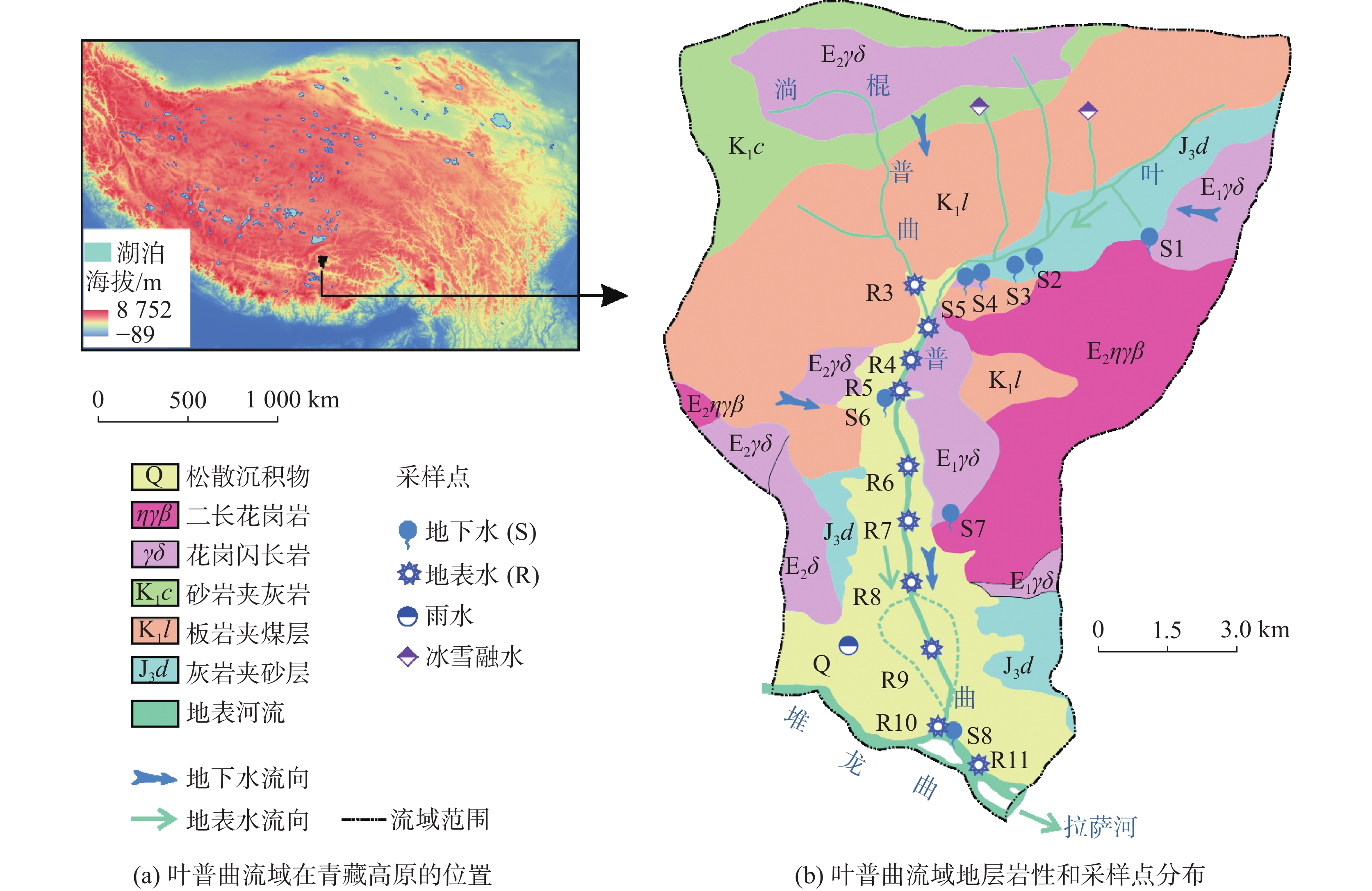
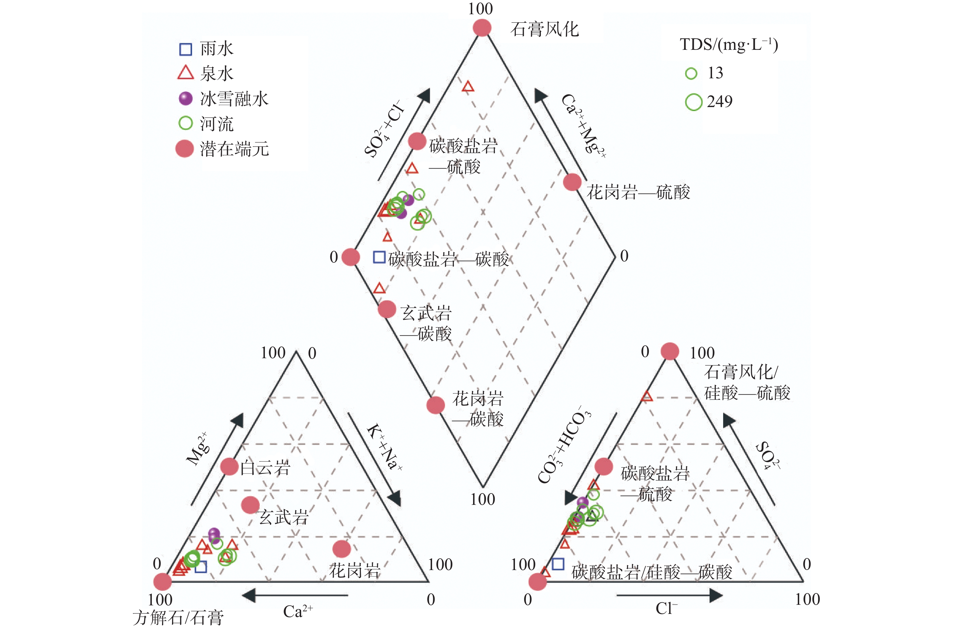
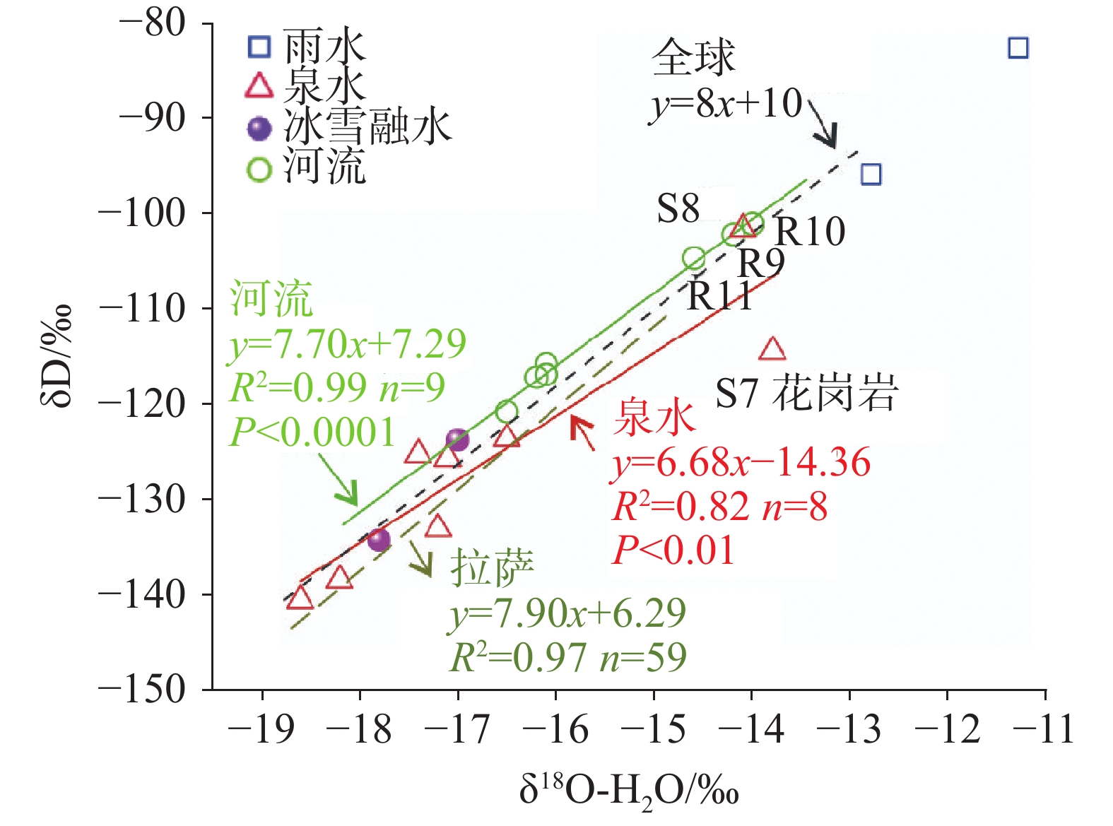
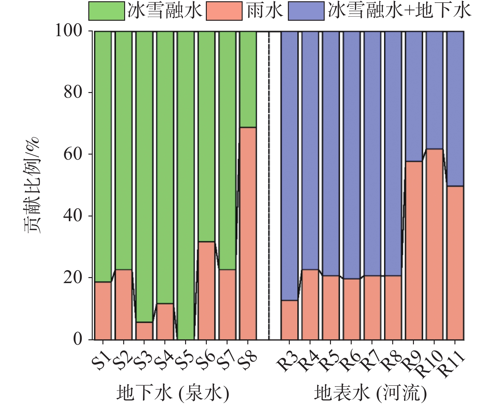
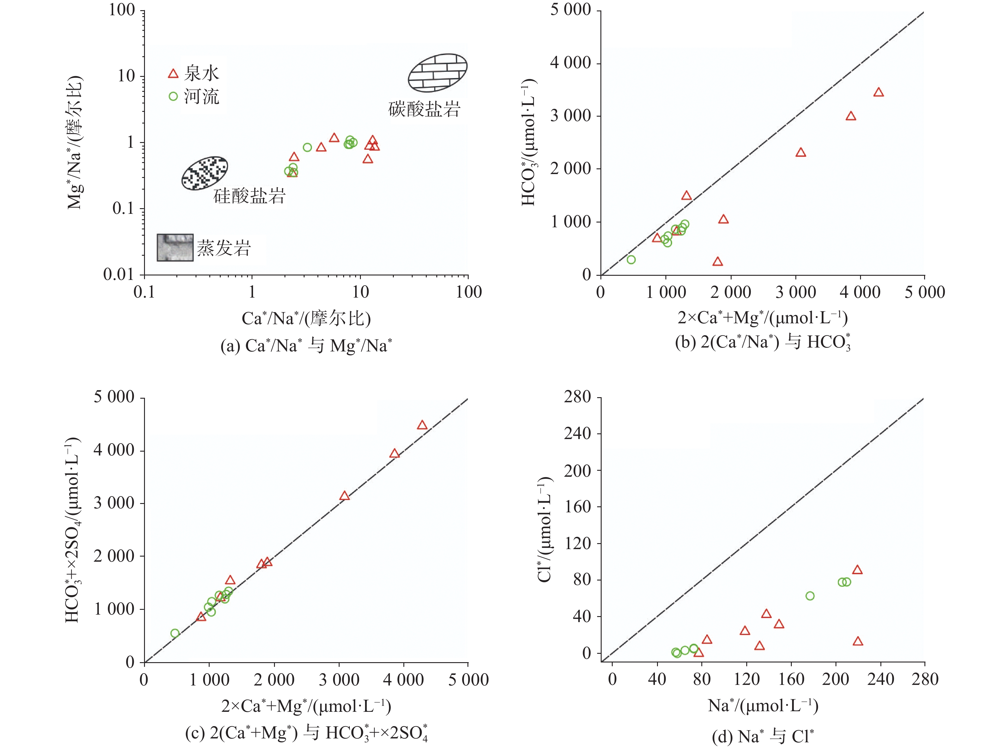
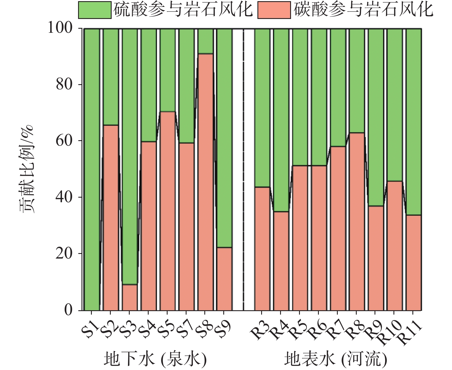
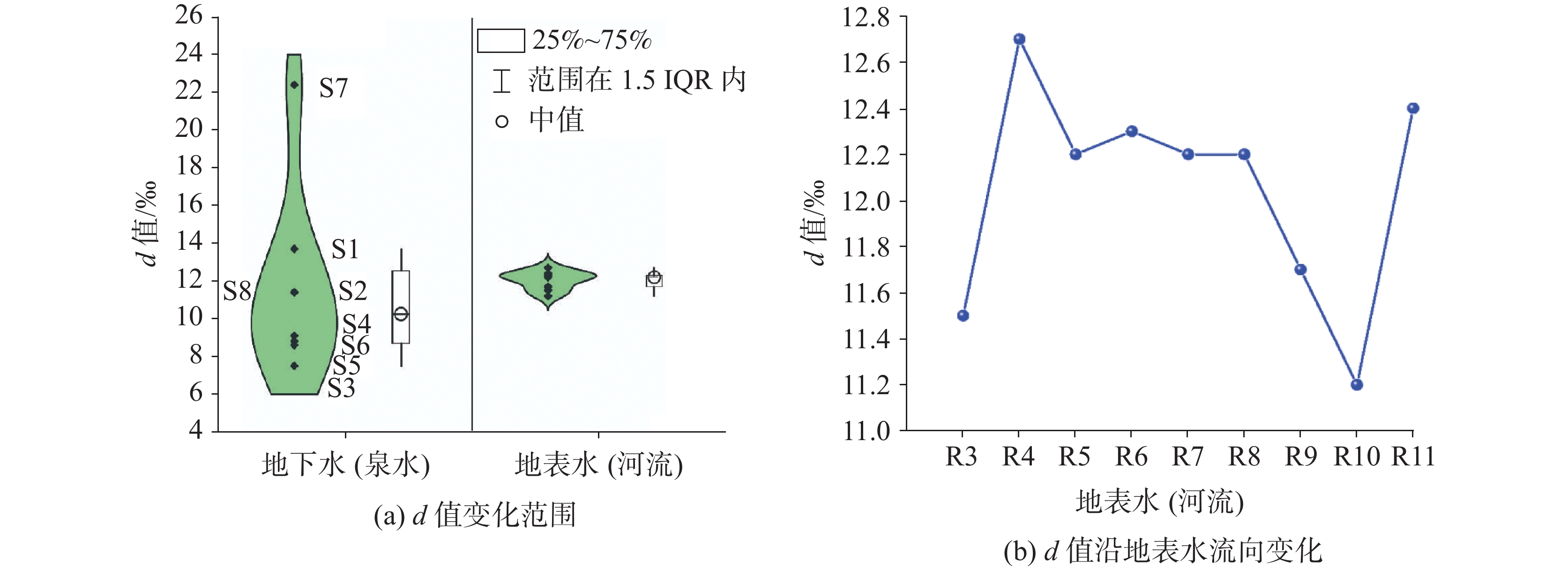
Known as the "Asian Water Tower", the study of water cycle in typical basins of the Qinghai-Xizang Plateau plays a critical role for water resources conservation. This study takes the Yepuqu basin in southern Xizang as the research object, through systematic sampling of spring water, river water, snowmelt, and rainwater (a total of 21 samples collected in June 2023),we comprehensively employed hydrochemical analysis, hydrogen-oxygen isotope tracers (δD, δ18O), and deuterium excess (d-excess) techniques to investigate water circulation pathways,solute sources and rock weathering mechanism. Key findings include: (1) The dominant water chemical type is Ca-HCO3·SO4 (82%), followed by Ca-HCO3 (12%). Isotopic hydrograph separation reveals distinct recharge patterns: spring water recharge derives 84% from snowmelt and 16% from rainfall, while river water recharge comprises 68% from snowmelt and groundwater and 32% from rainfall. Furthermore, the contribution ratio of snowmelt and groundwater decrease progressively along the river flow direction. (2) The solutes are primarily derived from atmospheric precipitation and the weathering of carbonate and silicate rocks. Rainwater contributes 7.6% and 4.2% to the total cation concentration and ${\rm{SO}}_4^{2-}$ in spring water, respectively, and 6.7% and 2.5% in river water, respectively. Notably, sulfate plays a significant role in the rock weathering, accounting for 53% in springs and 52% of the total cation content in spring and river water, respectively, which exceeds the contribution from carbonate weathering. This is mainly attributed to acid production via sulfide oxidation in coal-bearing strata. (3) Springs exhibit highly variable and scattered d-excess values (7.5‰ to 22.4‰), indicating that most springs belong to independent hydrogeological units. In contrast, the d-excess values of river water are concentrated (11.2‰ to 12.7‰), suggesting more stable recharge sources. The downstream decline in river d-excess values reflect an increasing proportion of groundwater recharge. This study quantitatively identifies the dominant contribution of sulfide oxidation-induced acidification to rocking weathering in typical Qinghai-Xizang Plateau basins for the first time. It elucidates the hydrogeological significance of the d-excess parameter in identifying hydrated structural units and water-rock interactions. These findings advance the theoretical framework of water-rock interaction in alpine regions and provide a scientific basis for sustainable water resource management and development on the plateau.
Hydrochemical evolution of karst groundwater under the mining influence in Beiya Mine, Northwest Yunnan Province
HE Xiang, YANG Chao, DONG Xuelan, GUO Xiaojiao, YANG Haifeng, LI Jiahuai, YANG Fengji
2026, 45(2): 249-259. doi: 10.11932/karst2025y026
Abstract:
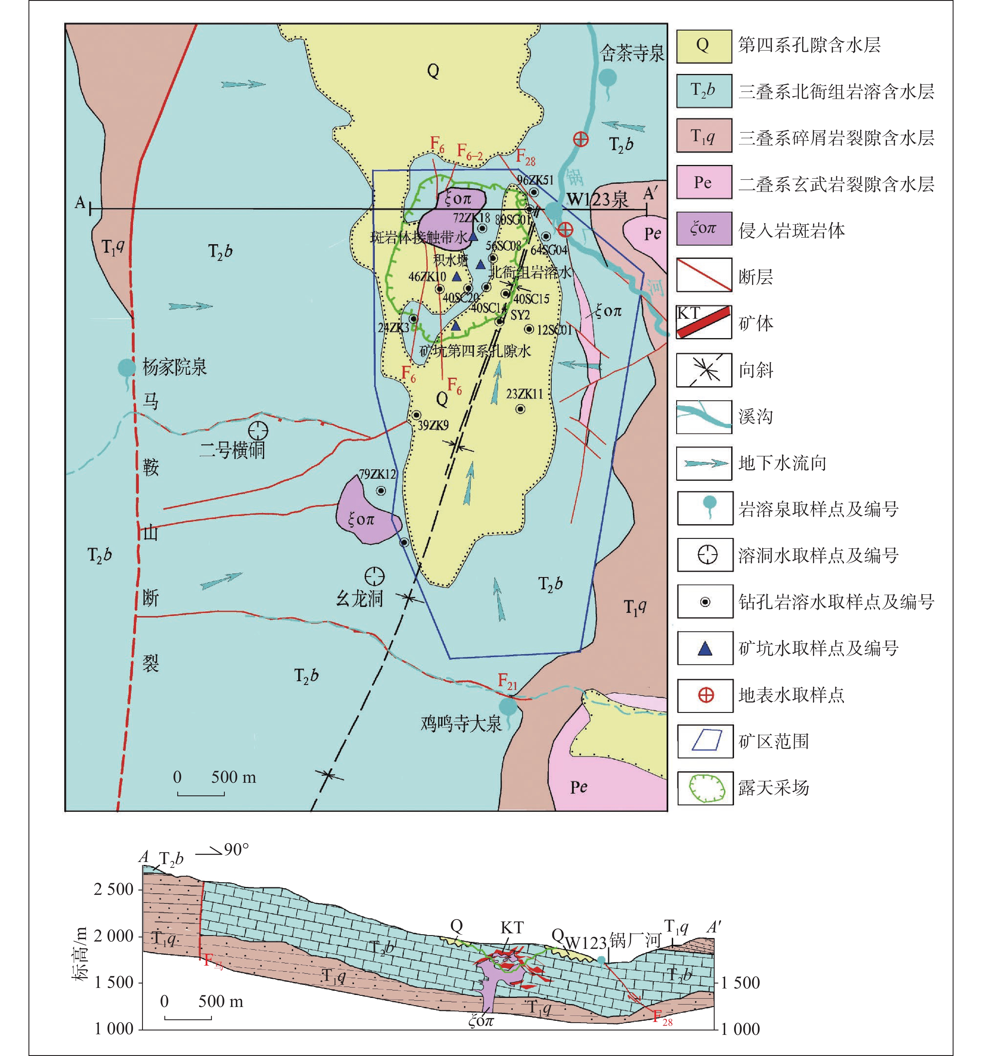
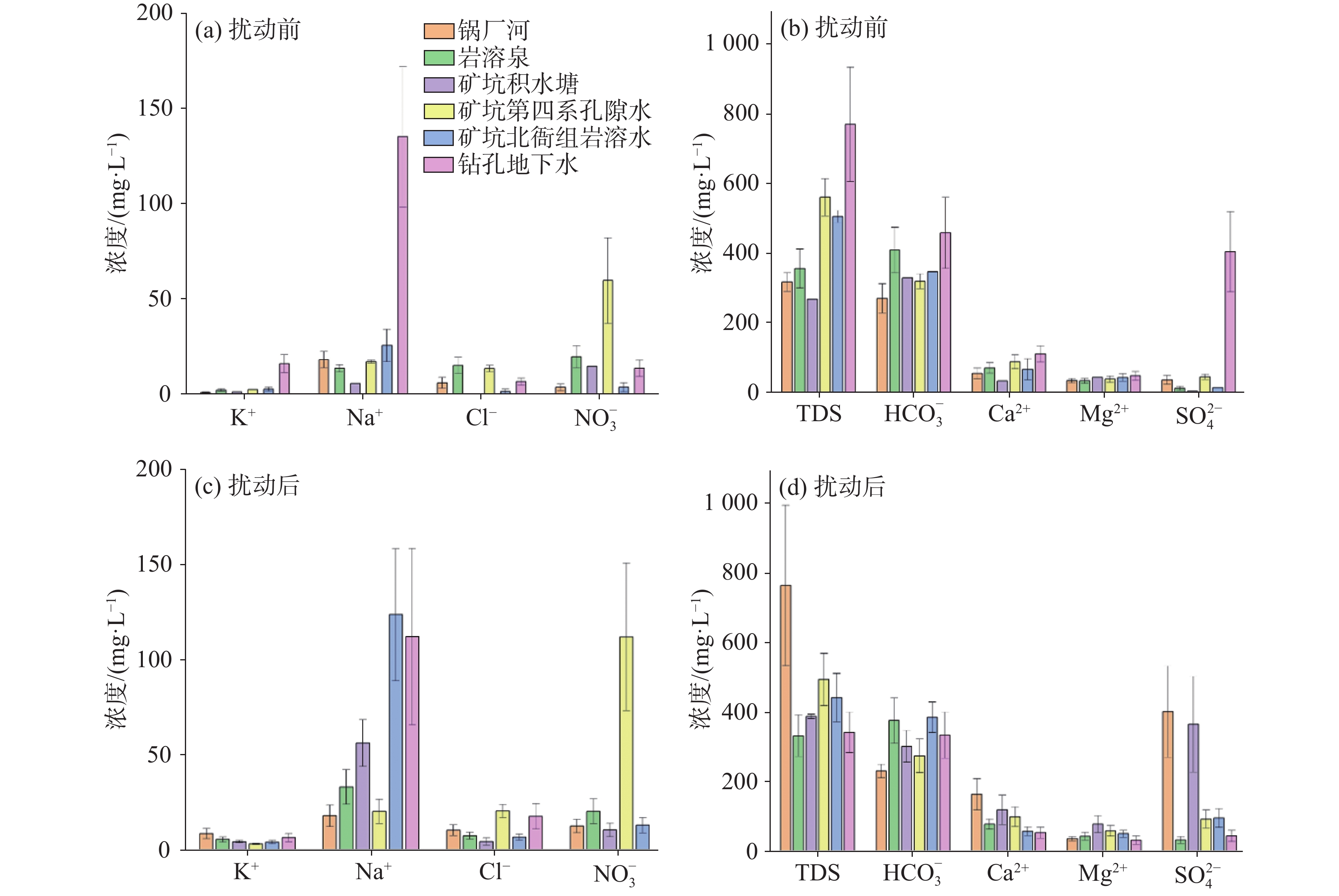
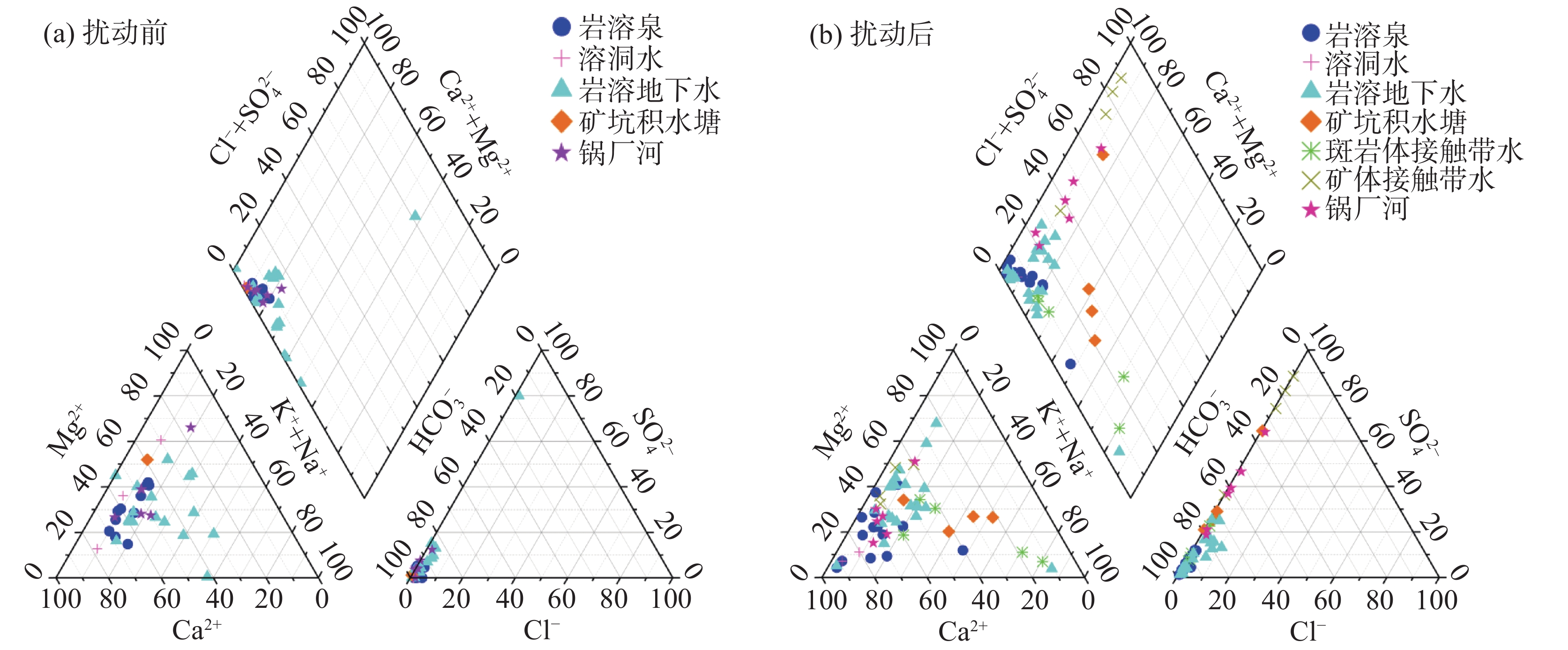
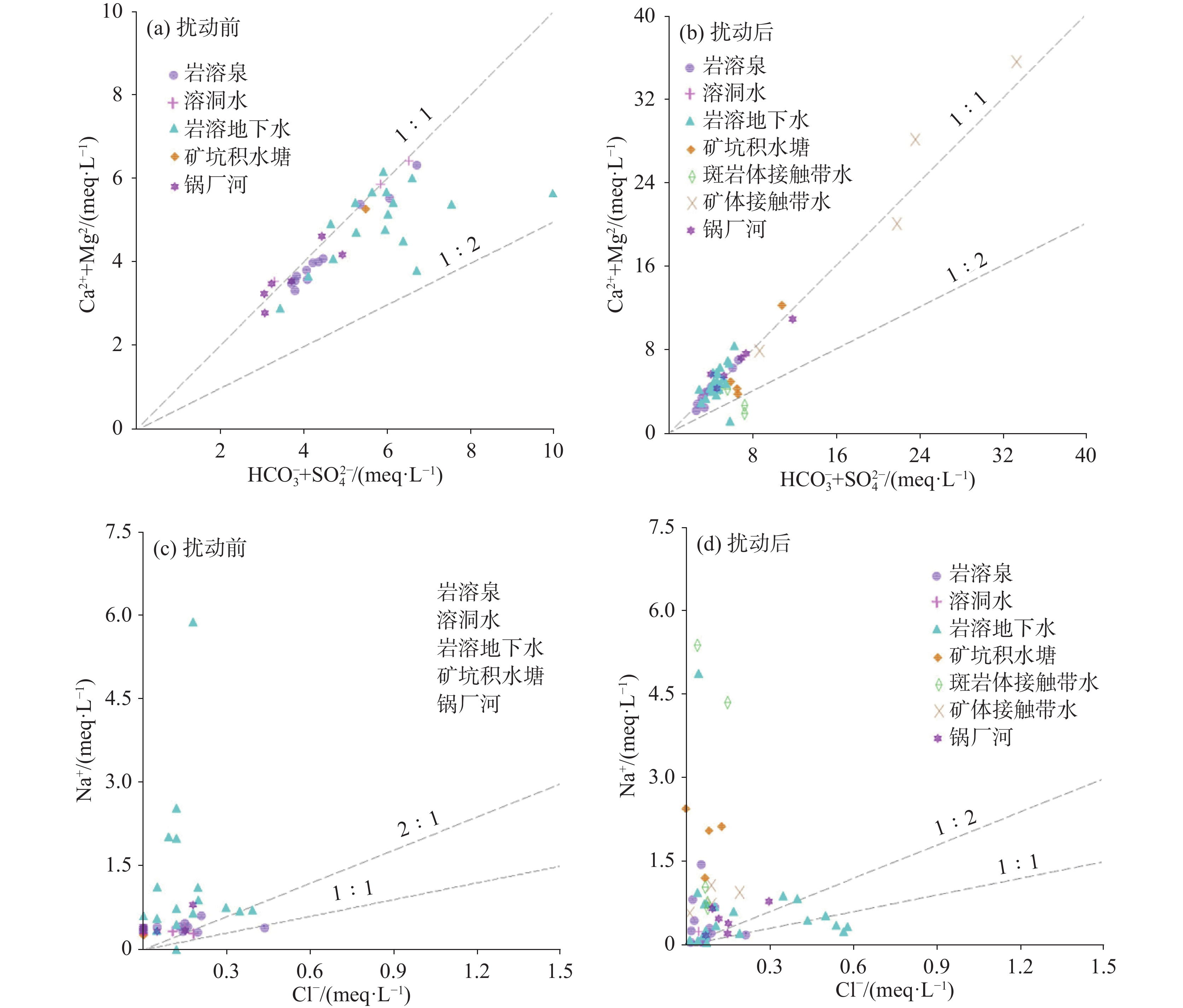
The Beiya Gold Mine in Yunnan Province, a karst water-filled mine, is a typical skarn-porphyry type deposit in China. Its groundwater has been imbalanced for a long time caused by mining activities, which have affected or damaged the aquifer to varying degrees. This has resulted in continuous changes of the groundwater dynamic and chemical fields, forming a typical groundwater system influenced by human activities. To reveal the impact of mining activities on the chemical evolution of groundwater and changes in the water sources used for mine pit filling, this study analyzed the water chemical evolution under long-term mining conditions. It also examined the implications of conventional components of the karst groundwater chemistry in the Beiya mining area for changes in water filling sources used to fill in the mine pit. This study employed Piper tri-linear diagrams and ion ratio methods, based on water chemical data from different mining stages.Research indicates the followings: (1) Influenced by mining activities, the overall concentrations of TDS, Na+, ${\rm{SO}}_4^{2-}$, and ${\rm{NO}}_3^{-}$ have increased, with the concentrations of Na+ and ${\rm{SO}}_4^{2-}$ rising significantly in deep mining zones. The water chemical evolved from calcium-carbonate water to calcium sulfate and sodium sulfate types, while the chemistry of karst spring water is less affected by mining activities. (2) Significant mixing occurred in mine pit water. Initially, shallow groundwater was identified as HCO3-Ca·Mg water or HCO3-Mg·Ca water, whereas groundwater in structural zones and deep layers was classified as SO4-Na·Ca water or HCO3-Na water. Karst water in the contact zone between limestone and porphyritic rock belongs to HCO3·SO4-Na and HCO3-Na types. The water gushing points at 1,614 m on the southwest side and 1,564 m on the southeast side of the mining pit exhibit similar hydrochemical types-HCO3-Ca·Mg water or HCO3-Mg·Ca water-indicating a close hydraulic connection and a common water source. (3) The karst water chemistry in the study area is mainly controlled by carbonate water-rock reaction. Ca2+, Mg2+ and ${\rm{HCO}}_3^{-}$ in groundwater and surface water mainly originate from carbonate dissolution. Na+ in shallow zones derives from the weathering and dissolution of porphyry, while in deep zones, it mainly comes from the dissolution of sodium-containing feldspar sandstone and underground low-temperature geothermal water. ${\rm{SO}}_4^{2-}$ is mainly affected by mining activities and originates from the oxidation of metal sulfides. ${\rm{NO}}_3^{-}$ in the shallow Quaternary pore water is mainly affected by agricultural activities and mining blasting operations. (4) The hydrochemistry of karst water in the study area is controlled by mining activities, mixing processes, and water-rock interactions. Mining activities constitute the primary factor influencing hydrochemical characteristics wthin the karst system. With the gradual progression of deep mining, the confinement of the aquifers is compromised, and the rate of groundwater circulation increases,thereby affecting the intensity of water-rock interactions. It is recommended that mining schemes be optimized to improve the comprehensive utilization effeciency of water resources,and that a robust environmental monitoring system for surface water and groundwater be established to protect the karst aquatic environment.
Hydrodynamic controls on differential travertine deposition: A case study of Huanglong Scenic Area, Sichuan, China
ZHANG Ting, DAI Qunwei, WANG Jiani, CAI Jiangrong, DU Xunqiu, WANG Guoyue, LI Qiongfang, DONG Faqin
2026, 45(2): 260-270, 281. doi: 10.11932/karst2025y14
Abstract:
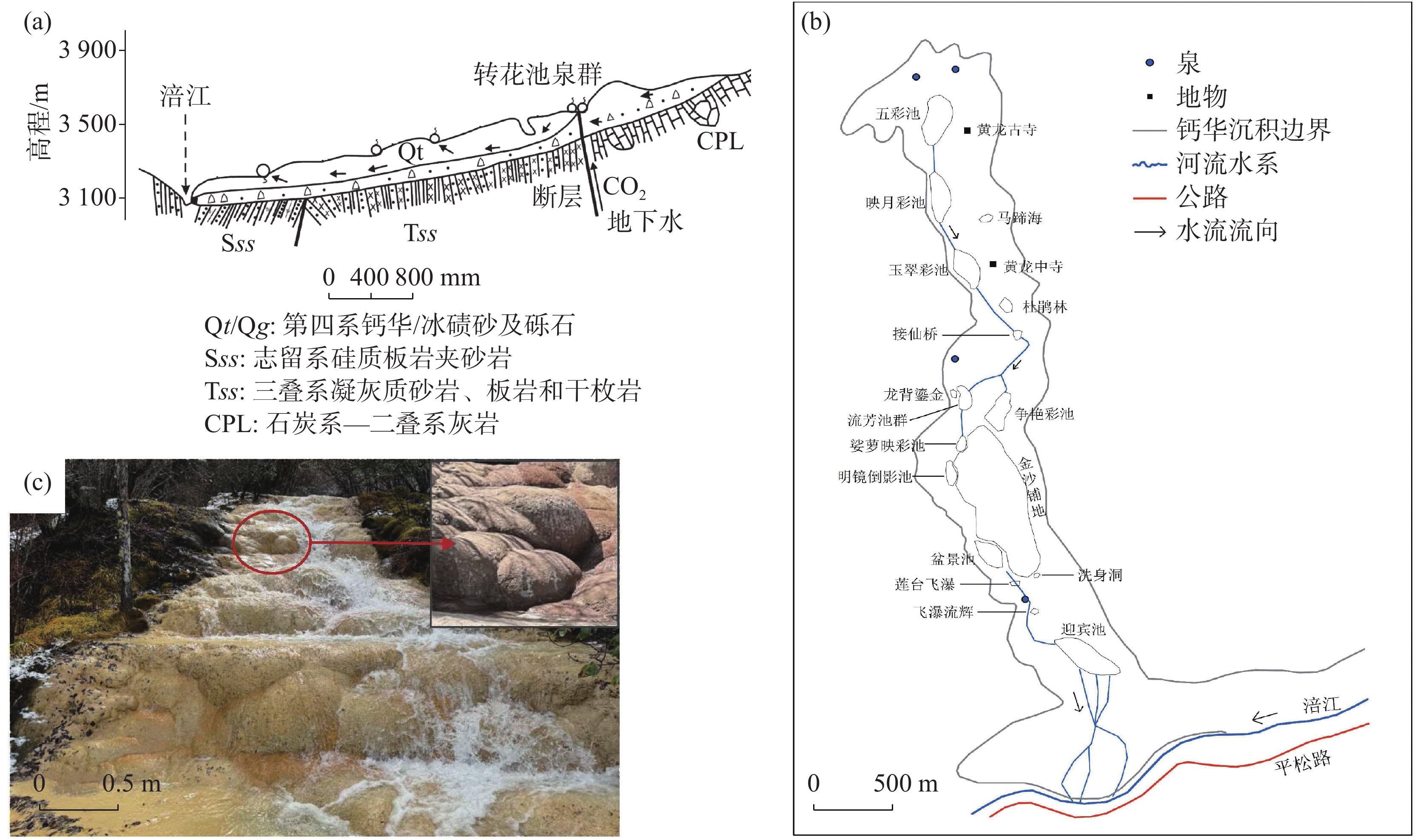
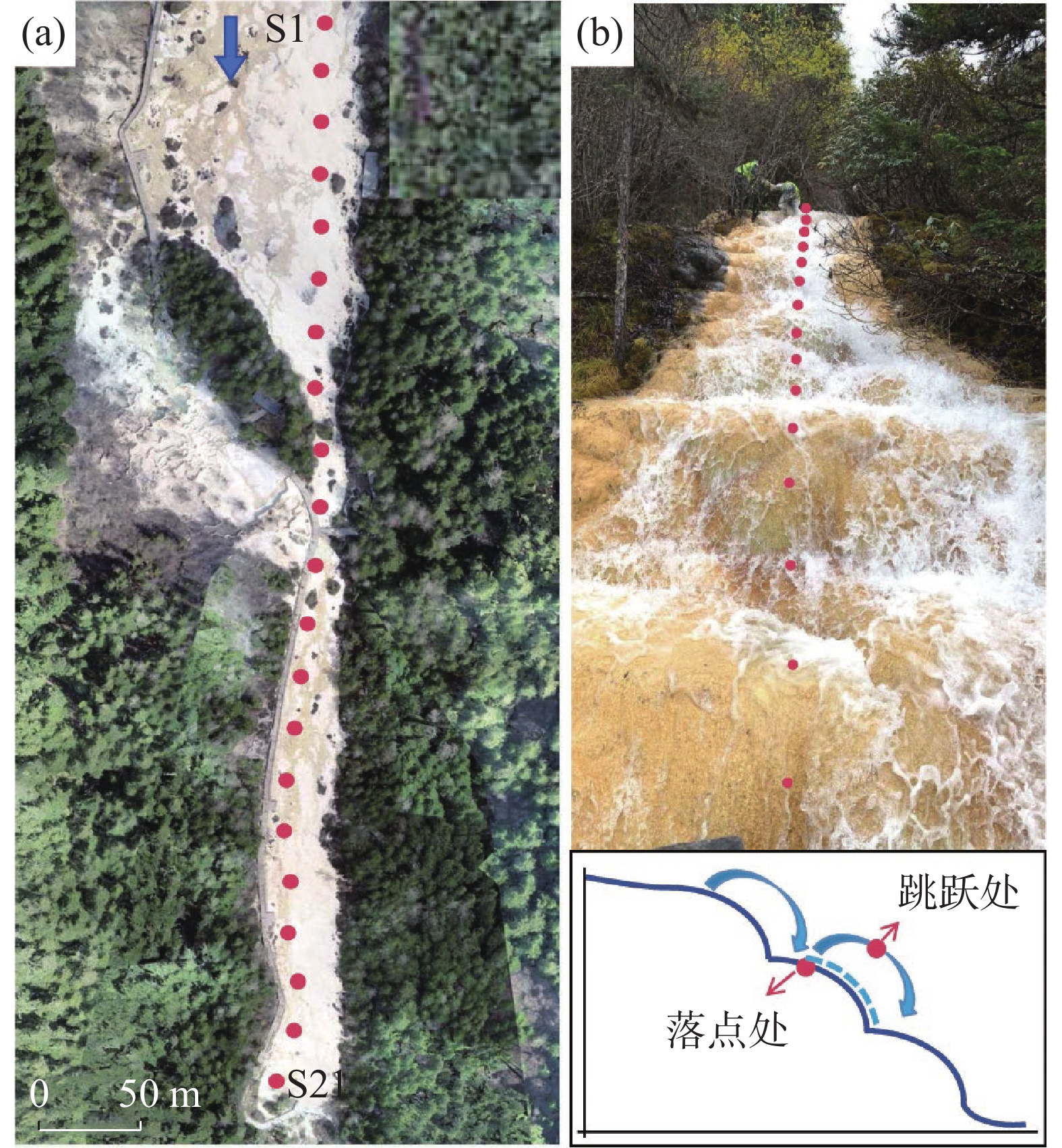
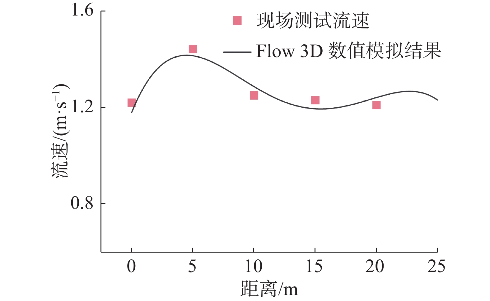
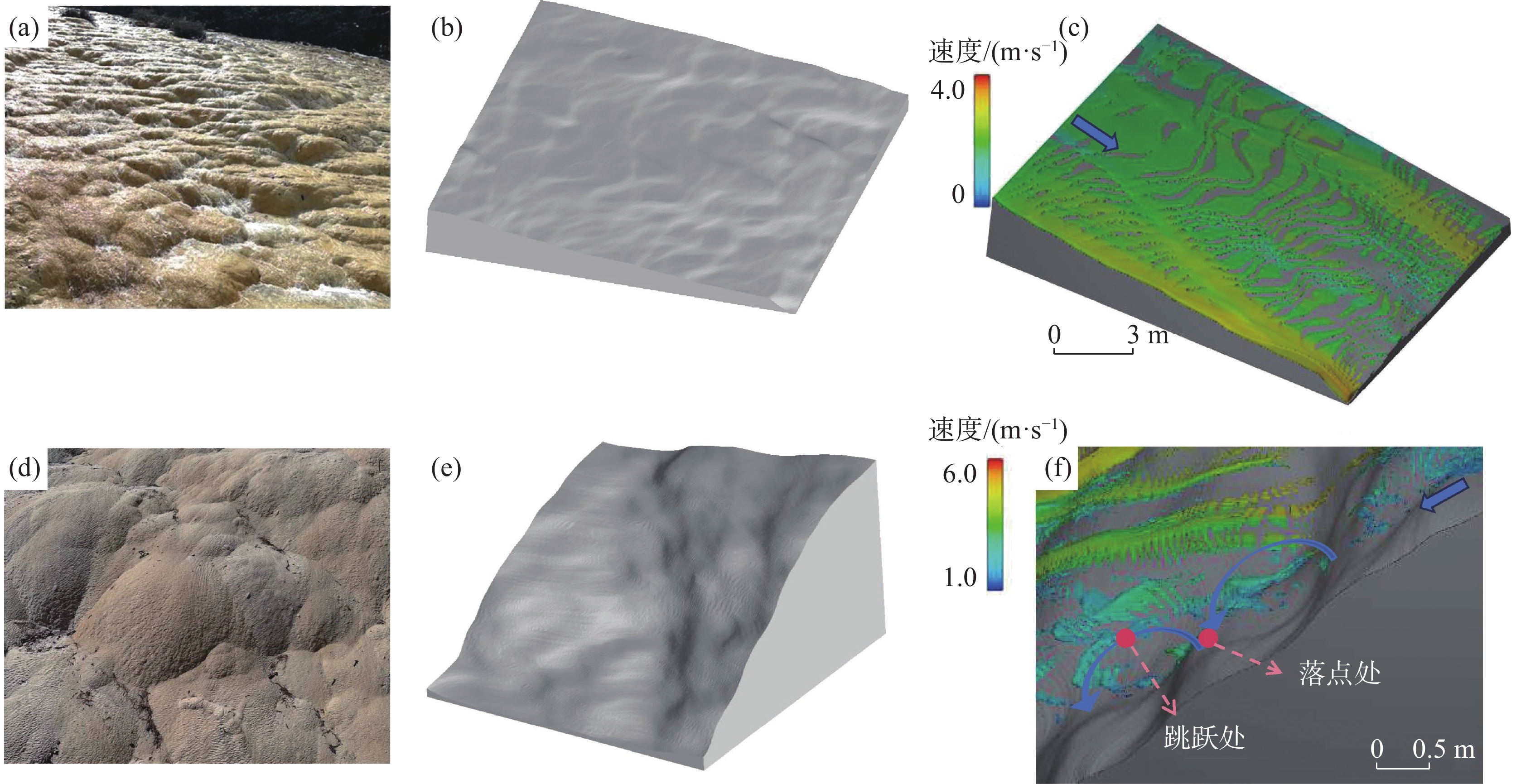
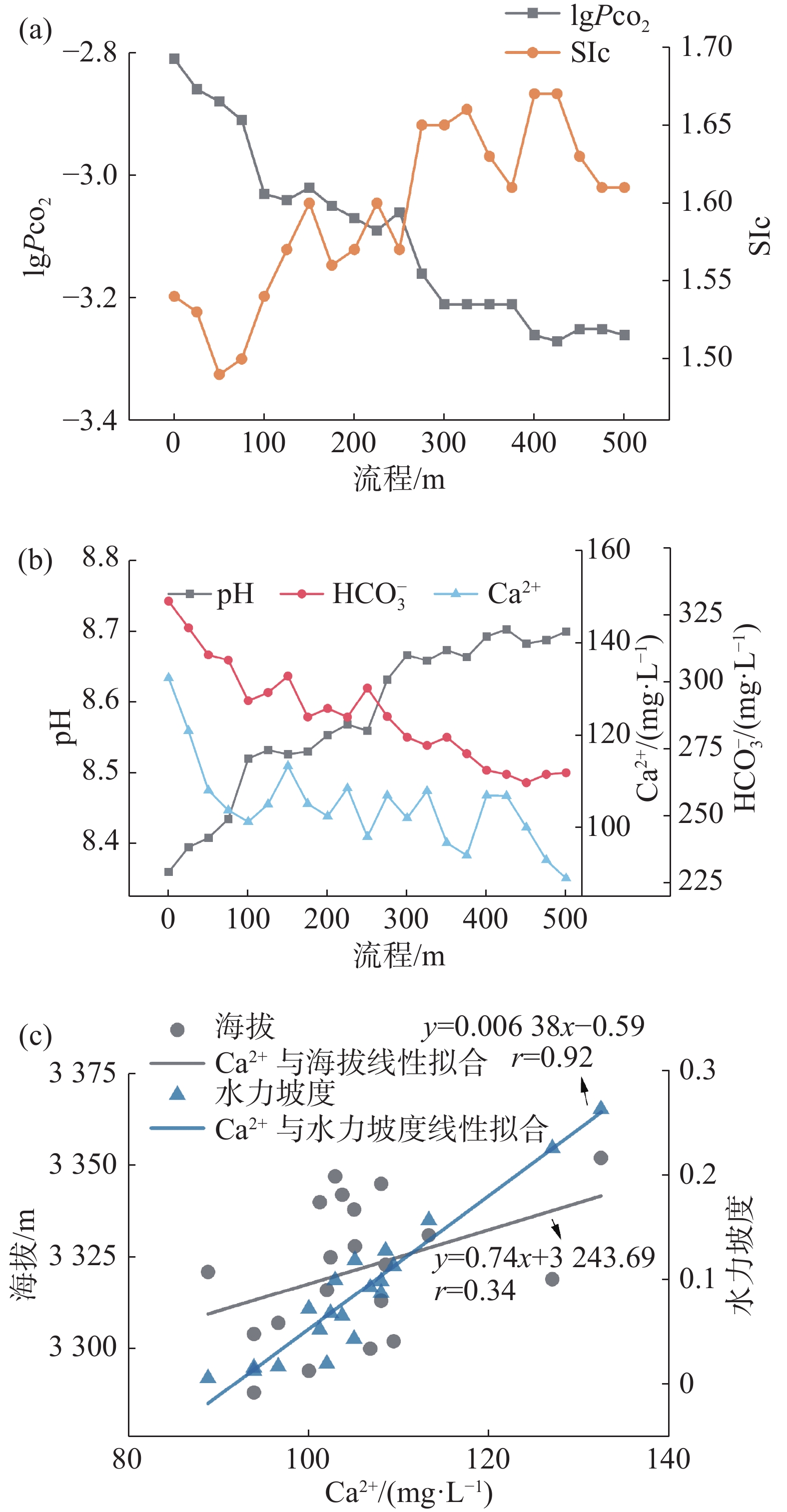
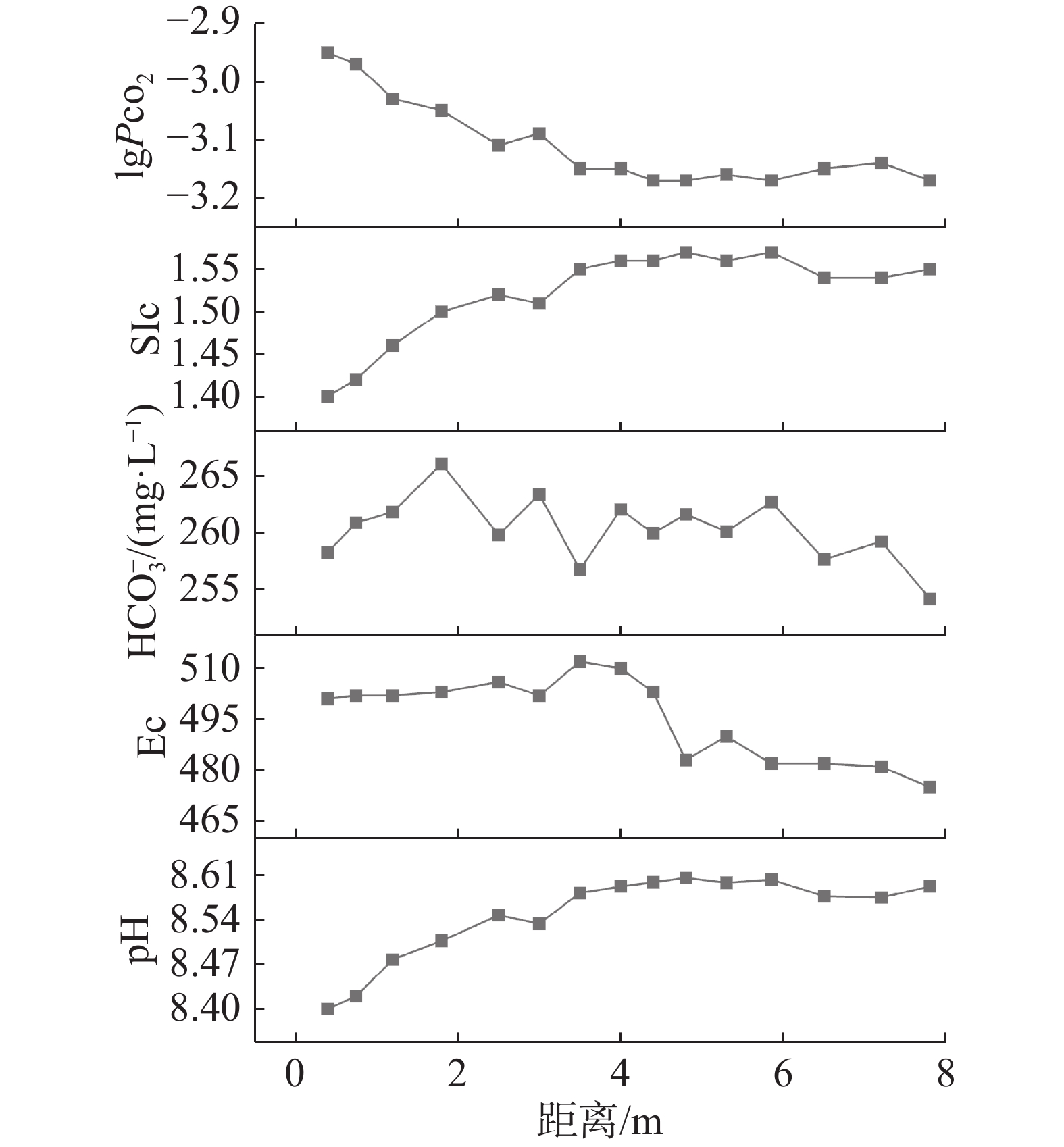
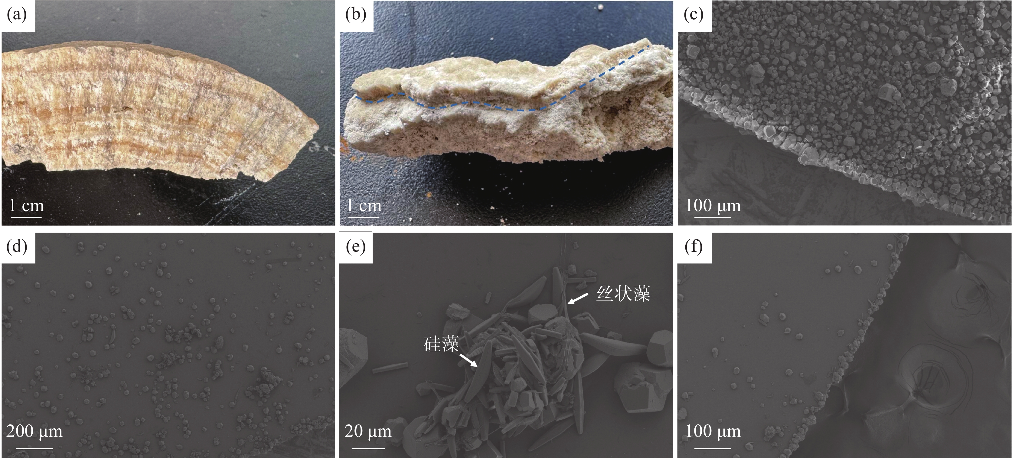
Travertine deposition is governed by a complex interplay of physical, chemical, and biological factors, among which hydrodynamic conditions are widely recognized as a key control fatcor on CO2 degassing efficiency and calcite precipitation rate. However, a systematic understanding of how hydrodynamic differences across distinct geomorphological units regulate the entire chain from CO2 degassing to calcite deposition characteristics remains insufficient. To address this issue, the Huanglong World Natural Heritage Site in Sichuan Province, southwestern China, at elevations of 3,000 to 3,600 m above sea level, was selected as the study area. Huanglong is renowned for its actively depositing travertine landscape, which encompasses diverse geomorphological units-sheet flows, rimstone dams, pools, mounds, and waterfalls-distributed along a valley approximately 3.6 km in length. CO2-rich groundwater emerges from springs at the valley head and flows downstream over the travertine surface, undergoing progressive CO2 degassing and CaCO3 precipitation. Two representative and contrasting geomorphological units-gentle slopes with sheet flow characteristics (slope<15°) and curved convex features on steep slopes (slope>20°)-were selected as research objects.An integrated approach combining Computational Fluid Dynamics (CFD) simulation, systematic hydrochemical monitoring along flow paths, and in-situ deposition experiments was employed. Three-dimensional terrain models of typical gentle slopes and steep slopes were constructed from high-resolution topographic survey data and served as the geometric basis for CFD simulations, validated against field-measured flow velocities. Water samples were collected at 21 stations along a 500 m gentle slope transect and at paired landing-point and jumping-point locations across successive steep slopes. Major hydrochemical parameters including Ca2+, ${\rm{HCO}}_3^{-}$, pH, Ec, pCO2, and the calcite Saturation Index (SIc) were determined. Additionally, glass deposition slides were deployed in situ at representative positions within both areas for five days and examined by Scanning Electron Microscopy (SEM) to characterize the mineralogy, morphology, and biological content of newly formed precipitates.Hydrodynamic simulations revealed pronounced contrasts between the two units. The gentle slope area exhibited flow velocities of 0.52 to 3.07 m·s−1 with a thin water layer; turbulence was primarily triggered by micro-topographic features on the bed surface formed by earlier travertine deposition. The steep slope area displayed higher velocities of 1.32 to 4.15 m·s−1, where the distinctive semi-circular arcuate convex morphology of successive crests drove continuous hydraulic jumps. Hydraulic head, velocity, and turbulent kinetic energy at landing points significantly exceeded those at jumping points, indicating that the most intense hydrodynamic action concentrates at landing points. Topographic gradient constitutes the fundamental cause of hydrodynamic differentiation between the two geomorphological units.Hydrochemical monitoring demonstrated that contrasting hydrodynamic conditions directly control CO2 degassing efficiency and the spatial pattern of water chemistry evolution. In the gentle slope area, Ca2+ concentration decreased by 43.5 mg·L−1 over the 500 m transect, accompanied by a gradual pH increase of 0.26 and progressive pCO2 decline; all SIc values exceeded 1, indicating sustained calcite oversaturation and a mild, gradual degassing process. Regression analysis revealed that the hydraulic gradient exhibited a strong positive correlation with Ca2+ concentration, far exceeding that of elevation alone, identifying it as the key hydrodynamic parameter governing travertine deposition intensity. In the steep slope area, ${\rm{HCO}}_3^{-}$ concentration displayed a characteristic zigzag decline: at each successive crest, the jumping-point concentration was consistently lower than that at the upstream landing point, directly evidencing rapid, pulsed CO2 degassing driven by hydraulic jumps across very short distances. Comparison across different slope gradients confirmed that steeper terrain corresponds to higher flow velocity, more vigorous degassing, and greater reductions in Ca2+ and ${\rm{HCO}}_3^{-}$ per unit distance.In-situ deposition experiments provided direct evidence linking hydrodynamic intensity to depositional characteristics. Steep slope area slides exhibited the most abundant calcite precipitation, with crystals densely packed into thick compact layers, reflecting high-intensity inorganic chemical precipitation driven by rapid CO2 degassing. Gentle slope flow slides showed comparatively sparse precipitation, with notable aggregated co-precipitation of calcite with diatoms and filamentous algae, indicating significant microbial participation under weaker hydrodynamic conditions. Downstream gentle slope flow slides displayed minimal precipitation, consistent with progressive ion consumption.This study establishes a complete control pathway, "topography-hydrodynamic conditions-CO2 degassing efficiency-calcite precipitation rate and deposition characteristics". Stronger hydrodynamic conditions enhance CO2 degassing and inorganic chemical precipitation while suppressing microbial colonization through continuous scouring, producing dense, inorganically dominated deposits. Conversely, weaker hydrodynamic conditions reduce chemical driving forces while providing stable environments favorable for microbial participation, yielding biologically influenced, less compact deposits. A positive feedback loop between deposition and topography continuously reinforces the distinctive characteristics of each unit. These findings provide a process-based framework for interpreting travertine spatial heterogeneity and a theoretical foundation for utilizing depositional density and structure as sedimentological indicators of paleo-hydrodynamic environments.
Study on the structural characteristics of typical karst water systems in northwest Guangdong
TU Shiliang, ZHUANG Zhuohan, LIN Zhuobin, JIANG Shoujun, GONG Xing
2026, 45(2): 271-281. doi: 10.11932/karst20260201
Abstract:
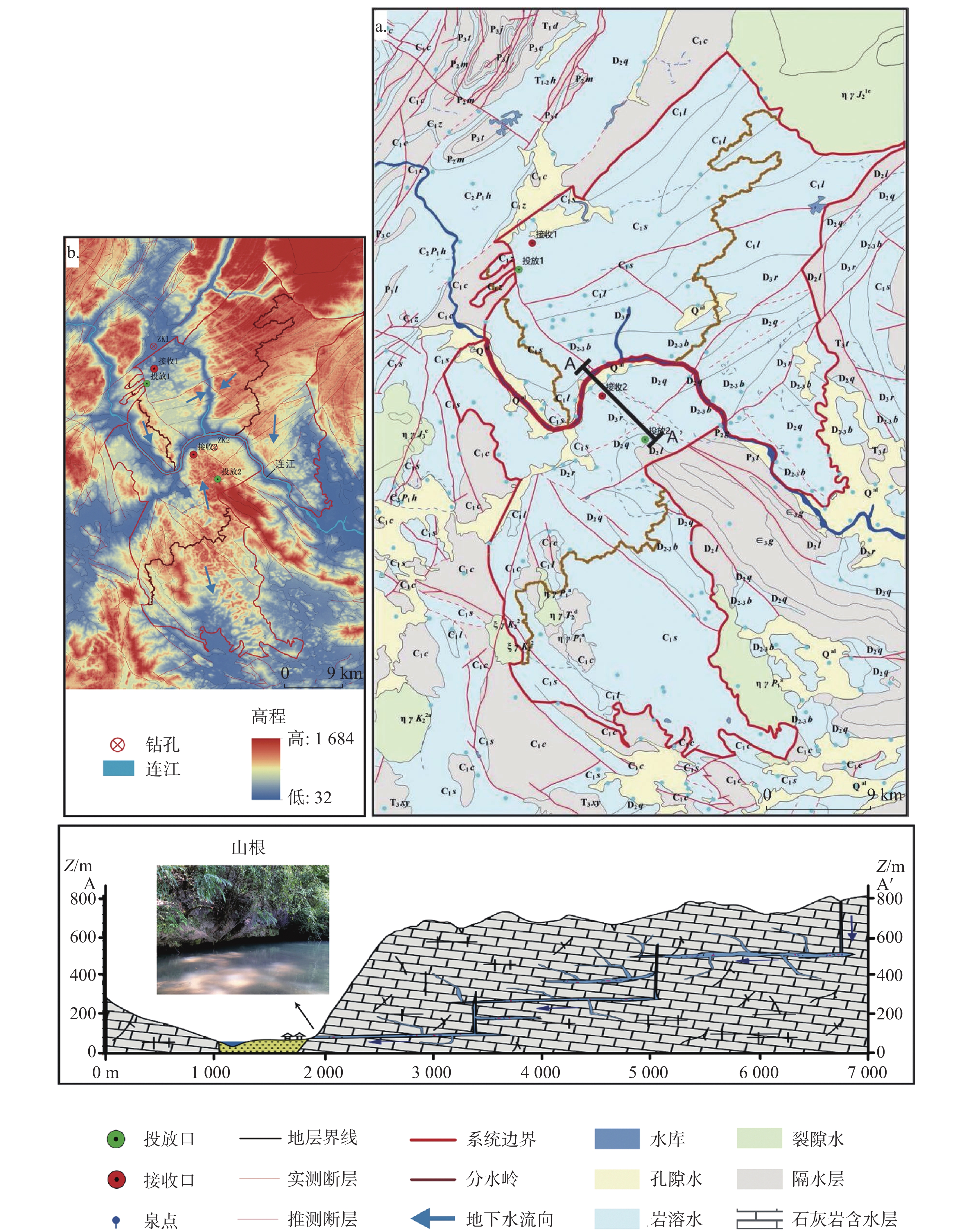
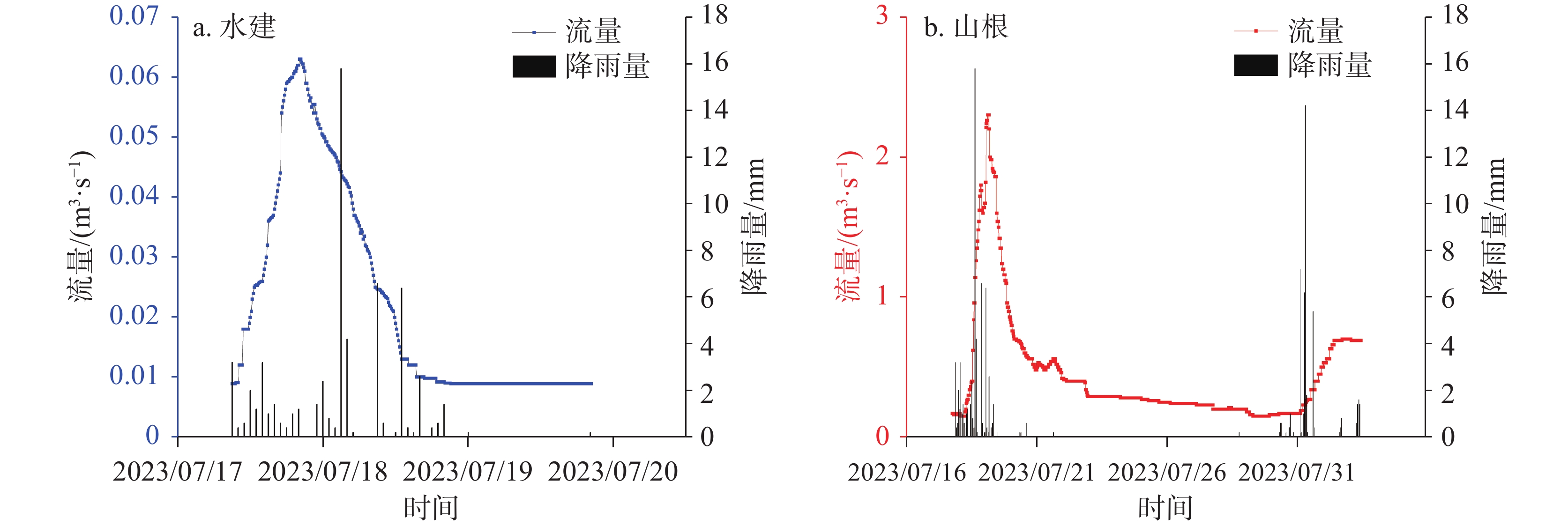
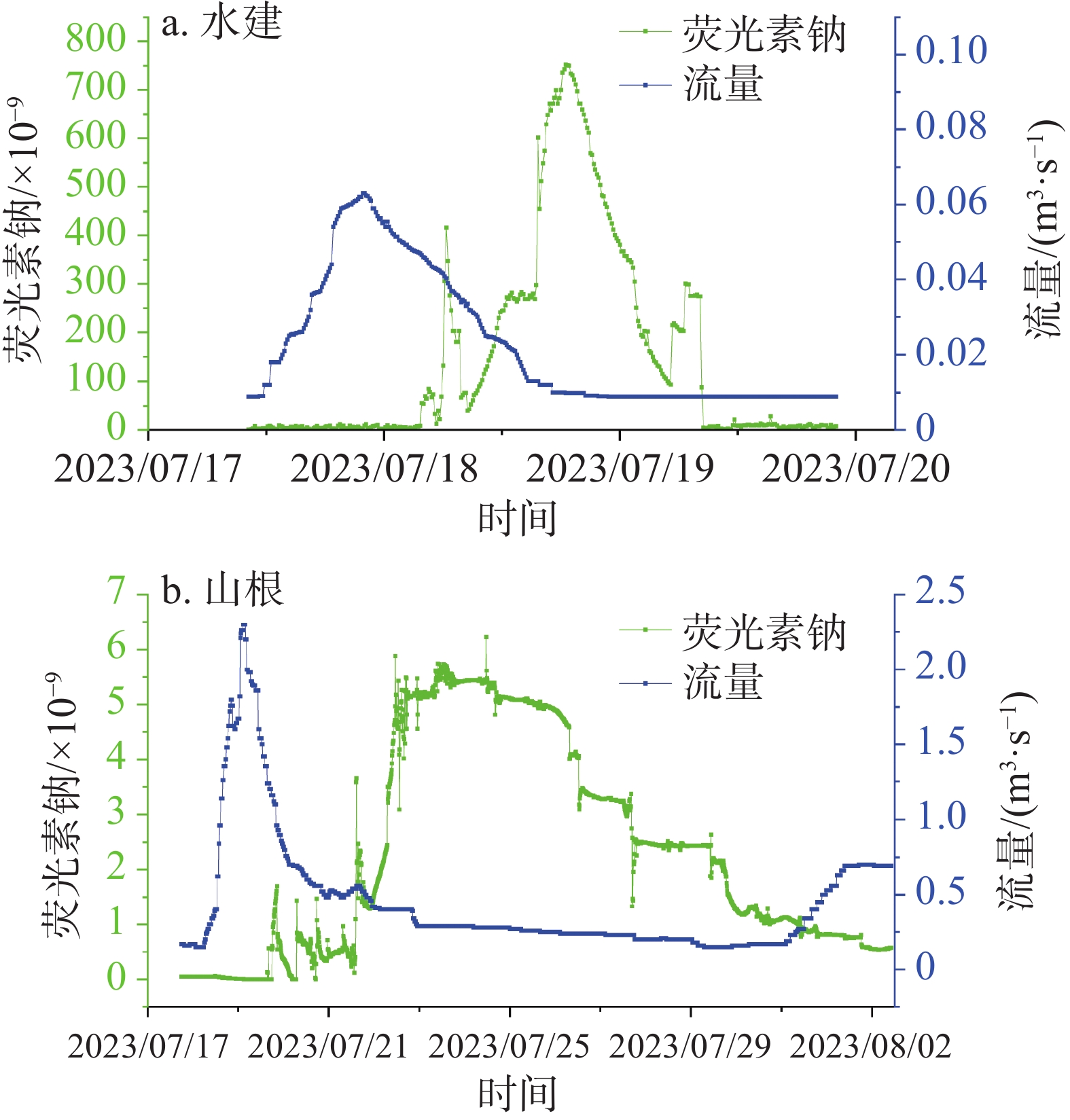
Karst water systems formed by carbonate dissolution comprise a complex multi-medium framework of pores, fractures, caves, and conduits. They are not only the principal reservoirs and conduits of groundwater supply, but are also closely linked to environmental and engineering-geological hazards such as karst collapse, drought, and karst rocky desertification. In northwestern Guangdong, karst groundwater is the primary source of domestic, agricultural, and industrial water. Against the backdrop of global climate change and intensifying extreme weather events, these systems are confronting severe challenges-including seasonal drought, underground river pollution, expanding rocky desertification, and frequent karst collapses-which significantly constrain regional sustainable development and ecological security. Consequently, there is an urgent imperative to gain deeper insights into the structure of karst aquifers, so as to guide the rational development of water resources and the protection of karst aquatic ecosystems.This study focuses on Yangshan county, Qingyuan City, Guangdong Province, where Carboniferous and Devonian limestones are extensively distributed, and both surface and subsurface karst features are well developed. The primary aquifers in the region include mountainous karst aquifers and Quaternary alluvial valley porous aquifers distributed along river corridors. The region is characterized by a subtropical monsoon climate, with an average annual temperature of 20 ℃ and a multi-year average precipitation of approximately1,800 mm (with about 75% occuring between April and September). The Lianjiang River flows west-to-east; the terrain along its banks consists mainly of mountains and hills (elevation of 25 to1,150 m), featuring peak-cluster depressions and peak-cluster valleys, with a high vegetation coverage rate.We established an integrated, multi-method framework to resolve the structure of the karst water systems: (1) Hydrogeological drilling and pumping tests in karst mountains on both banks of the Lianjiang River-Carboniferous borehole ZK1 (80 m) and Devonian borehole ZK2 (81 m)-to obtain the degree of karstification and hydrogeological parameters of different karst aquifers; (2) Periodic stage and discharge monitoring at multiple karst springs and underground-river outlets to differentiate karstification intensity among aquifers; (3) Field tracer tests conducted in representative Carboniferous and Devonian groundwater systems during the period of July to August 2023, with synchronous observations of hydrodynamics, to identify aquifer structural types and media parameters.Based on these surveys and monitoring datasets, we quantitatively analyzed discharge-recession curves, Tracer Breakthrough Curves (BTCs), and karst-media parameters. The main findings are as follows.(1) Devonian limestone (ZK2) intersected four karst caves (void height ranging from 1.1 to 3.6 m) and exhibited a hydraulic conductivity (K) of 22.17 m·d−1, which is significantly higher than that of the Carboniferous limestone (ZK1, K = 2.15 m·d−1), indicating more intense kartsification in the Devonian strata.Furthermore,the Devonian system also showed more outlets/springs (49 vs 30), higher wet-season mean discharge (1,099.45 L·s−1 vs 454.09 L·s−1), and better discharge stability (CVs of 1.26 and 1.35).(2) Karst systems across the area responded rapidly to rainfall. Carboniferous underground-river hydrographs were sharply peaked and quasi-symmetric, whereas Devonian hydrographs were sharply peaked but asymmetric. Recession behavior can be partitioned into three stages: conduit flow (fast; α = 10−2~10−1), cavern flow (intermediate; α = 10−3~10−2), and fracture flow (slow; α = 10−4~10−3). The Devonian fracture-flow fraction (68.2%) exceeded the Carboniferous conduit-flow fraction (56.6%), indicating stronger regulation and storage capacity of the Devonian period. (3) Tracer recovery in the Carboniferous aquifer was 42.32%, consistent with a "single-source, multiple-sinks" structure. The recovery rate of Devonian reached 60.58%, and BTCs displayed multi-peaks of tailings, indicating multiple flow paths and the presence of large karst pools (sumps). The conduit parameters further supported this point: The Devonian had a mean conduit diameter of 7.53 m, a dispersion coefficient of 6.43 m2·s−1, and a Reynolds number (Re) of 87,046, all exceeding the Carboniferous values (1.29 m, 2.30 m2·s−1, Re = 31,309), imdicating enhanced turbulent flow and solute dispersion.This study elucidates the structural disparities and hydrogeological behavior of Carboniferous and Devonian karst water systems in northwestern Guangdong. By supplementing key quantitative parameters, it provides a theoretical basis for regional karst hydrogeological studies. Given the high environmental vulnerability of local karst aquatic ecosystems, we propose the following measures: (1) Prioritizing the planning and conservation of karst water resources; (2) Strengthening land-use controls in recharge areas (e.g., restricting highly polluting agricultural and industrial activities); (3) Establishing an early warning mechanism for hydrochemical contamination.
Research on the mechanism of water inrush in tectonic fracture zones of karst water-rich mines
QIAO Yu, KANG Xiaobing, SUI Sugang, WANG Bangtuan
2026, 45(2): 282-291. doi: 10.11932/karst2025y002
Abstract:
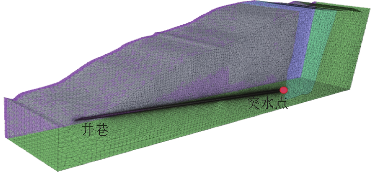
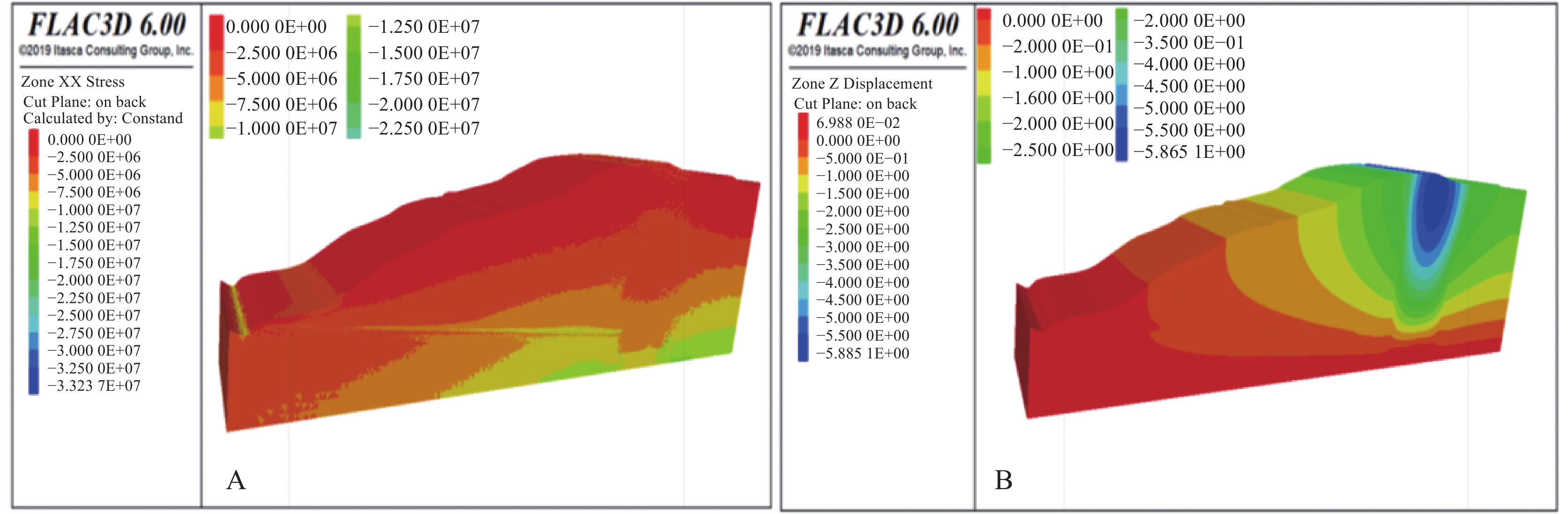
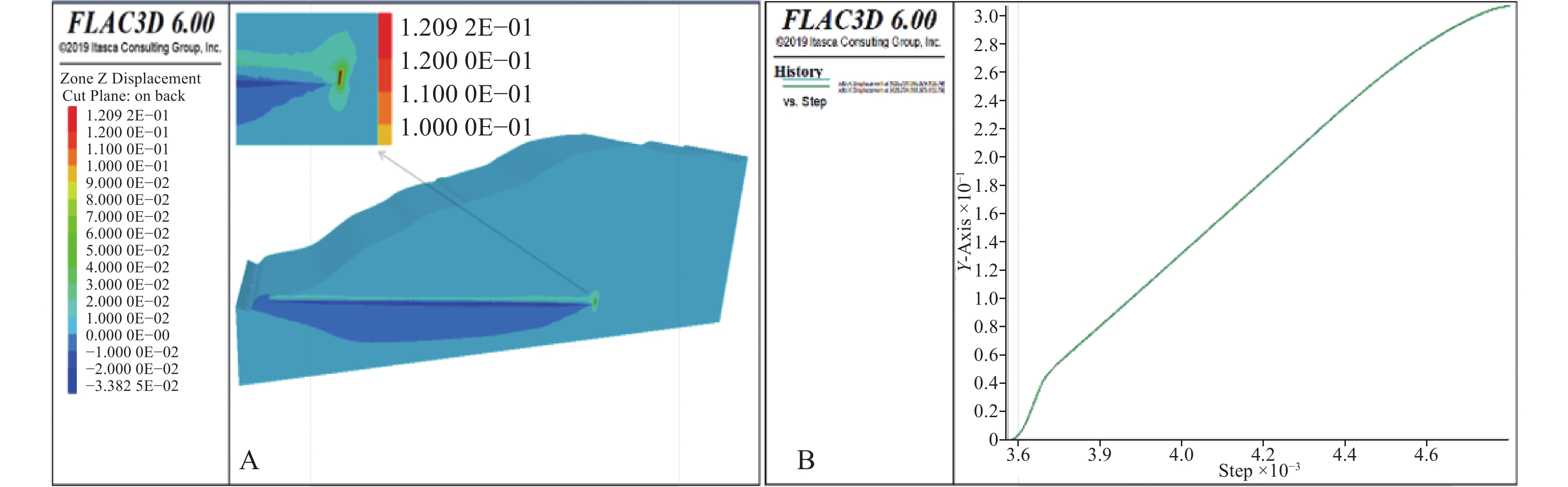
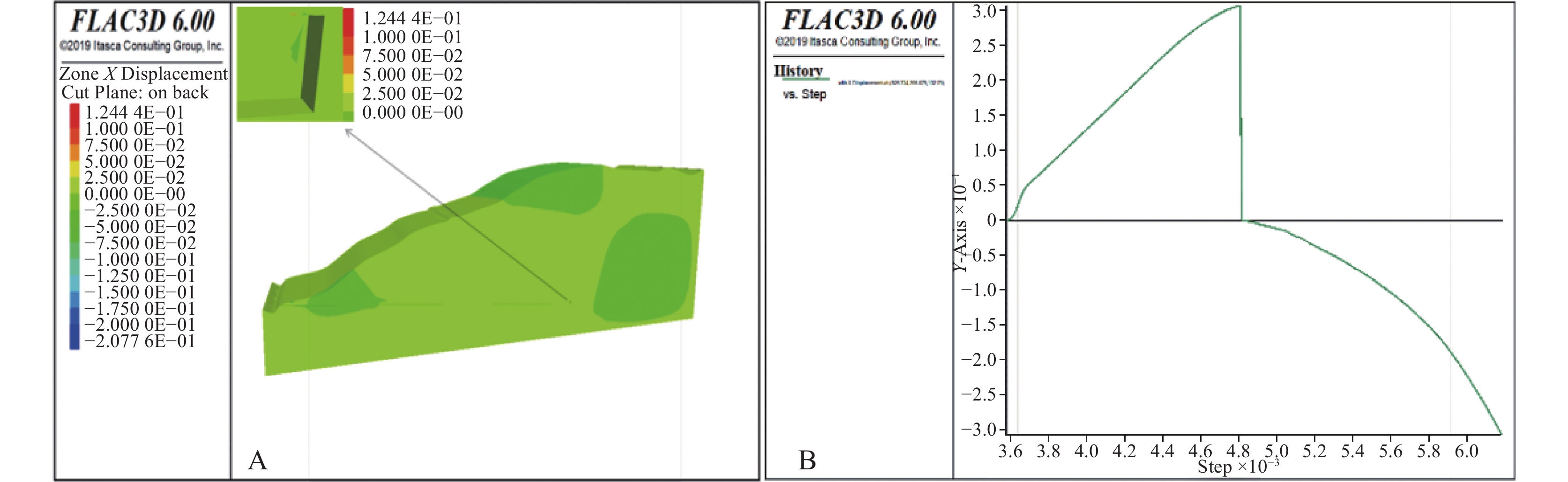
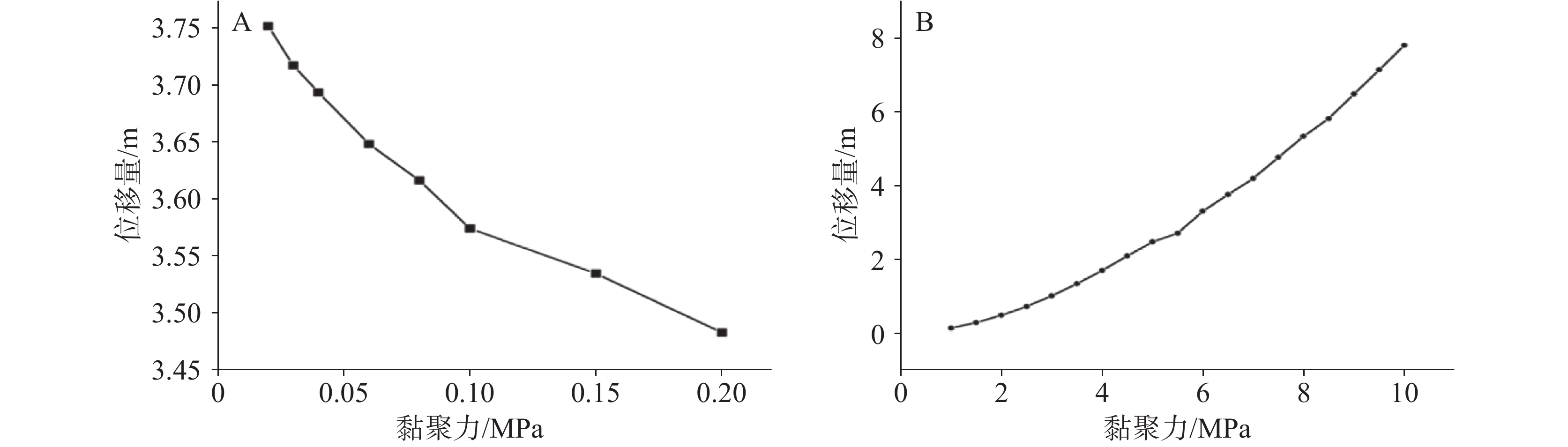
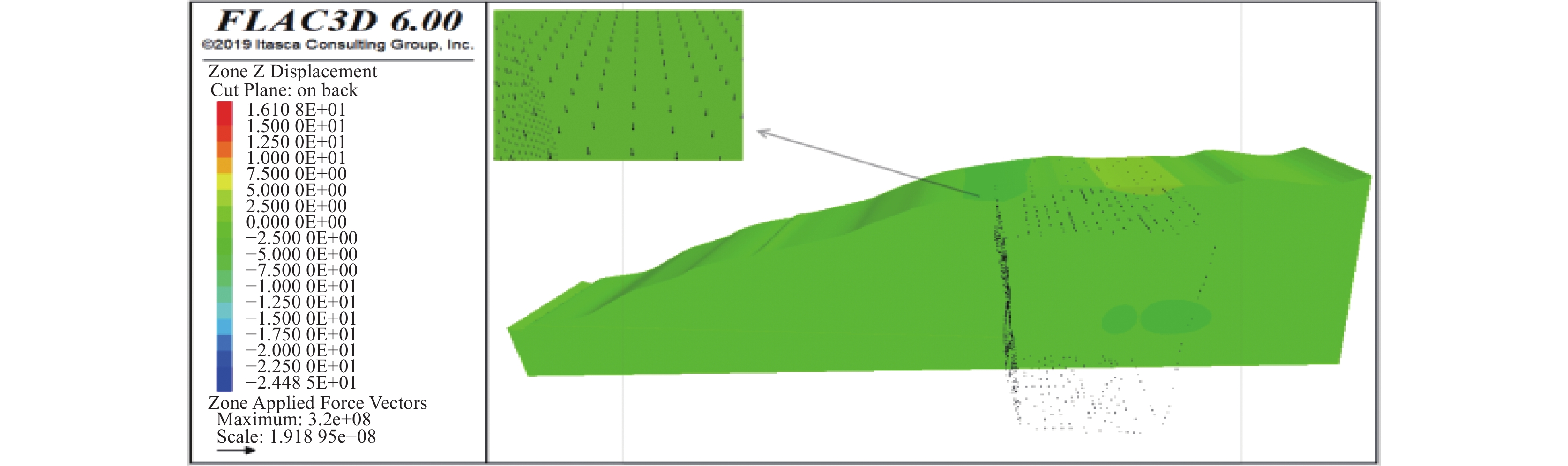
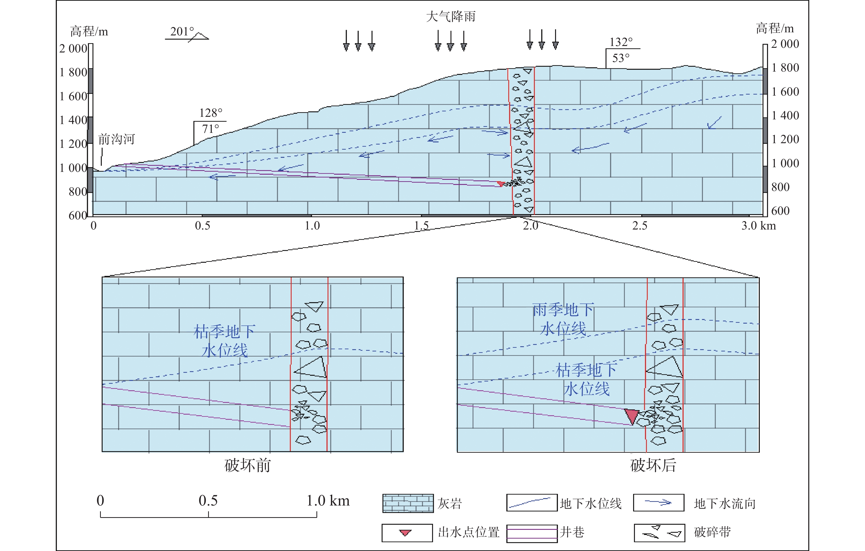
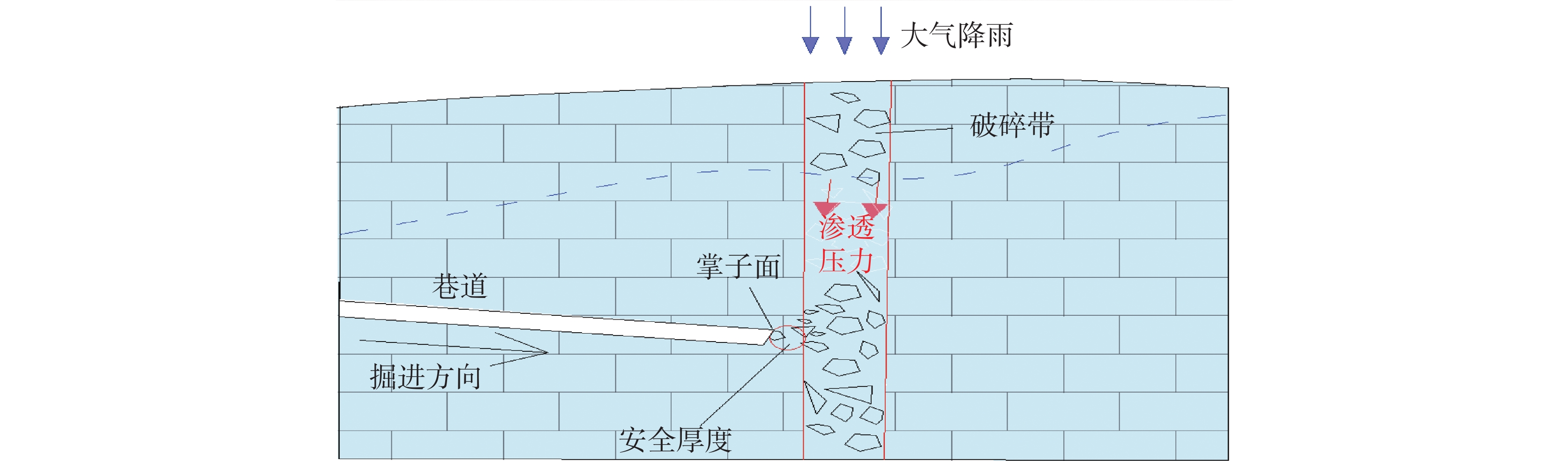
With the continuous growth of China's demand for mineral resources, mining activities have gradually transitioned from the shallow surface areas to deeper areas. This shift has significantly increased the risk of water inrush, especially in water-rich mines situated in karst regions. Conducting a genetic analysis of water inrush in the structural fracture zones of these karst water-rich mines is crucial for the prevention and control of mine water inrush disasters.This study takes a typical karst water-rich mine as an example. First, a detailed investigation of the karst hydrogeological conditions in the mining area has been conducted. This includes mapping the distribution of karst features, such as caves and fissures, and analyzing the groundwater flow patterns and recharge mechanisms. The study area is characterized by complex geological structures, with multiple fault zones intersecting the strata. The rock formations mainly consist of carbonate rocks, which are highly susceptible to karstification, resulting a network of underground cavities and conduits that facilitate water movement. To accurately understand the hydrogeological conditions, long-term monitoring wells are installed in different parts of the mining area. These wells record real-time data on groundwater levels, water quality, and flow rates, providing a comprehensive dataset for further analysis.A comprehensive approach combining theoretical analysis and numerical simulation has been employed. In the theoretical analysis, principles from hydrogeology and rock mechanics are applied. Hydrogeological theories are used to identify the potential water sources for inrush. It is found that the main water-filling sources in this mine are atmospheric rainfall and groundwater. Rainwater infiltrates into the ground through surface cracks and sinkholes, replenishing the groundwater system. The groundwater then accumulates and flows through fracture zones toward the mining excavations. Rock mechanics theories are used to study the stability of the fracture zones under different stress conditions. The strength properties of the rock mass in the fracture zones, including its compressive strength, tensile strength, and shear strength, are carefully analyzed. This analysis helps to understand how the rock mass responds to the increasing pressure from the groundwater.For the numerical simulation, the FLAC3D software was utilized. A three-dimensional numerical model of the mining area was established, incorporating the geological structure, rock mass properties, and hydrological conditions. The model simulates the process of rainfall-induced water inrush. Simulation results show that during heavy rainfall, the groundwater level in the mining area rises rapidly. As the water level rises, the seepage pressure within the fracture zone also rises. When the seepage pressure in the fracture zone reaches 0.9 MPa, it causes deformation and eventual failure of the rock mass in front of the heading face. This leads to the breakthrough of high-pressure water, resulting in a severe water inrush event. Sensitivity analyses were also conducted to examine the impact of different parameters-such as the permeability of the fracture zone and the rainfall intensity-on the occurrence and severity of water inrush.Furthermore, the simulation determined the safe thickness of the fracture zone ahead of the heading face under extreme water level conditions. It is concluded that maintaining a safe thickness of more than five meters between the roadway heading face and the structural fracture zone can effectively prevent water inrush disasters. This is because a sufficient thickness of the rock mass can withstand the pressure exerted by groundwater, thereby maintaining the stability of the mining face. In addition to thickness, other preventive measures were also explored. For example, grouting techniques can be used to reinforce fracture zones, reducing their permeability and enhancing their strength. Chemical grouting materials with high viscosity and quick-setting properties were considered, as they can penetrate the tiny fissures in the rock mass and form a solidified barrier.In conclusion, this study has systematically analyzed the characteristics, sources, channels, and causes of water inrush in the structural fracture zones of the karst water-rich mine. The study results not only clarify the mechanism of water inrush but also provide practical guidelines for mine safety management. For similar karst water-rich mines, these findings can serve as valuable reference for predicting and preventing water inrush disasters, thus ensuring the safe and sustainable development of the mining industry. Future research should focus on improving the accuracy of the numerical models by incorporating more detailed geological and hydrological data, as well as exploring innovative prevention and control technologies for water inrush in complex karst environments.
Application of microtremor survey and three-dimensional geological modeling in urban karst geological survey
GUO Jianmin, ZHENG Canzheng, DING Qingzhong, WANG Hongzhen, FU Yang, Gong Liang
2026, 45(2): 292-301. doi: 10.11932/karst20260202
Abstract:
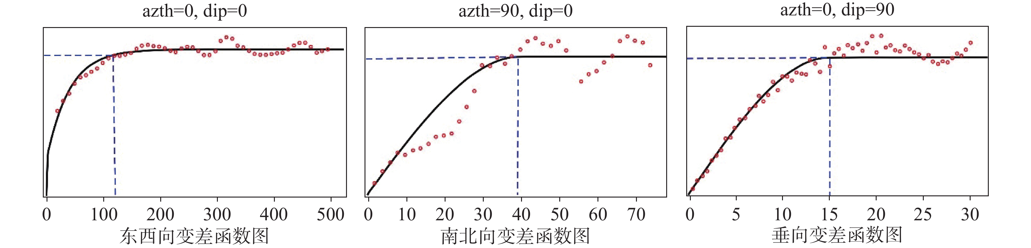
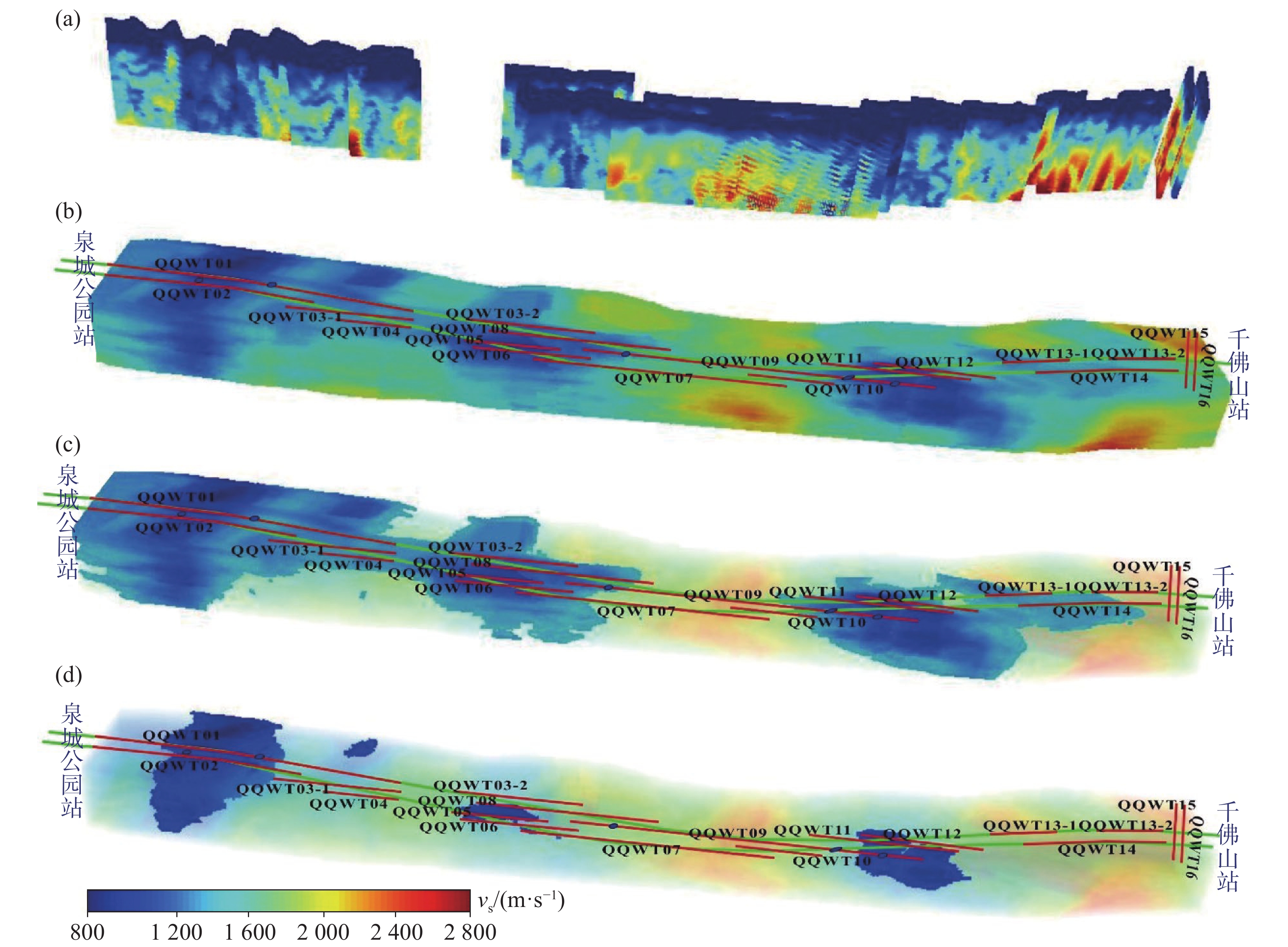
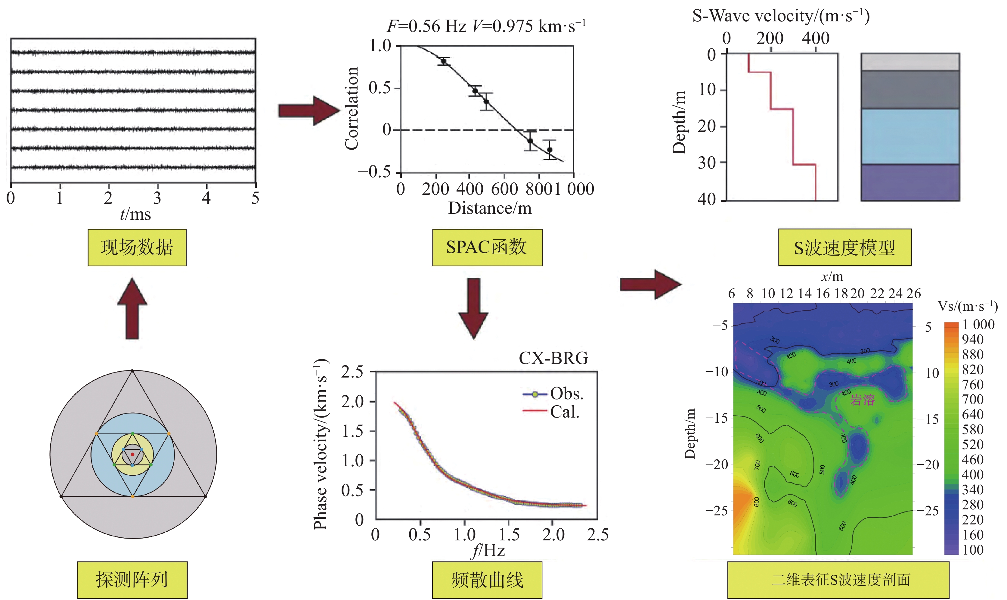
The exploration of underground karst geological structures in urban environments poses significant challenges for conventional geophysical methods. These methods often suffer from high levels of noise, constraints on survey line layouts due to dense infrastructure, and the inherent limitation of two-dimensional (2D) data in representing the three-dimensional (3D) spatial complexity of geological bodies. To address these issues, this study proposes and demonstrates an integrated methodological framework that combines microtremor survey technology with 3D geo-statistical modeling to enhance subsurface characterization in karst terrains.The research was conducted within the planned section between Quancheng Park Station and Qianfo Mountain Station on Line 4 of the Jinan Urban Rail Transit System, a typical urban area underlain by karst-prone strata. Initially, a two-dimensional microtremor survey was implemented. Employing a linear array configuration with two-meter receiver spacing using three-component geophones, data were collected along 18 survey lines totaling 2,242 meters in length, encompassing 1,139 physical points. This passive-source method effectively utilizes ambient seismic noise generated by urban activities (e.g., traffic) and natural phenomena as the signal source, thereby overcoming the noise sensitivity of active-source methods and simplifying field logistics. Data processing involved preprocessing the recorded signals, extracting Rayleigh wave dispersion curves using the Spatial Auto-Correlation (SPAC) method, and subsequently inverting these curves to derive 2D shear-wave velocity (Vs) profiles. These profiles visually delineate subsurface velocity structures, where low-velocity anomalies against higher-velocity bedrock backgrounds indicate potential karst features such as cavities, dissolution zones, or fractured rocks.The inversion results from representative lines (e.g., QQWT01 and QQWT09) reveal a vertically layered velocity structure: very low velocities (500 m·s−1) in the shallow Quaternary overburden; intermediate velocities (500–1 500 m·s−1) corresponding to moderately weathered and karstified dolomite; and higher velocities (1 500 m·s−1) representing more competent, less weathered bedrock. Laterally, several distinct low-velocity zones were identified and interpreted as areas of karst development. Importantly, the interpretations from these 2D profiles showed a high degree of consistency with borehole data (e.g., boreholes W2, W3, W4), which encountered cavities and filled materials at depths predicted by the velocity anomalies, thereby validating the reliability of the microtremor method for karst detection in this setting.However, 2D profiles provide information only along specific lines, leaving gaps in understanding the full 3D spatial distribution of karst features. To address this limitation, the study employed 3D geostatistical modeling techniques. The densely sampled Vs data points from all 2D profiles were treated as a regionalized variable. Variogram analysis was conducted to quantify the spatial correlation structure of shear-wave velocity in three principal directions: along the dominant survey direction (approximate E–W), perpendicular to it (N–S), and vertically. An exponential variogram model was fitted, revealing spatial correlation ranges (e.g., 120 m maximum, 15 m minimum) that characterize the continuity and variability of the geological units. Using ordinary kriging as the estimation method, a continuous 3D Vs model of the entire study volume was constructed based on the 2D profile data and the derived variogram parameters.This 3D model was then visualized using volume rendering techniques. By setting transparency thresholds for different velocity ranges, the model enables intuitive 3D visualization of karst-prone zones. For instance, rendering zones with Vs < 1,500 m·s−1 as opaque highlights volumes with potential karst development. Further refinement, such as extracting volumes with Vs < 1,200 m·s−1, helps identify areas with a high incidence of cavities. Comparative analysis between the 3D model extracts and detailed 2D profile interpretations indicates that the geo-statistically derived model does not precisely delineate individual, isolated cavities. This limitation is attributed to the smoothing effect inherent in kriging interpolation, which tends to amalgamate closely spaced anomalies. Instead, the model effectively outlines the broader "karst high-incidence zones" or "karst development regions", where the probability of encountering karst features is significantly elevated.Despite this smoothing limitation, the primary value of the integrated approach lies in its comprehensive 3D perspective. It synthesizes scattered 2D line data into a coherent volumetric model, providing a more holistic view of subsurface karst hazard distribution than is possible with 2D sections alone. The clearly visualized 3D zones of elevated karst risk offer invaluable, spatially explicit guidance for engineering planning, risk assessment, and targeted mitigation strategies in urban rail transit and other underground projects. This methodology enhances exploration efficiency by maximizing information extraction from passive seismic data, reduces costs associated with excessively dense drilling, and provides a novel, more comprehensive pathway for precise imaging of urban underground karst systems-ultimately contributing to safer construction and long-term infrastructure maintenance.
Application of microtremor exploration for karst investigation in the construction area of a highway,Guangxi
PAN Hongxu, LYU Yuzeng, ZHAO Rongchun, LU Jieming, ZHAO Dewei
2026, 45(2): 302-315, 328. doi: 10.11932/karst20260203
Abstract:
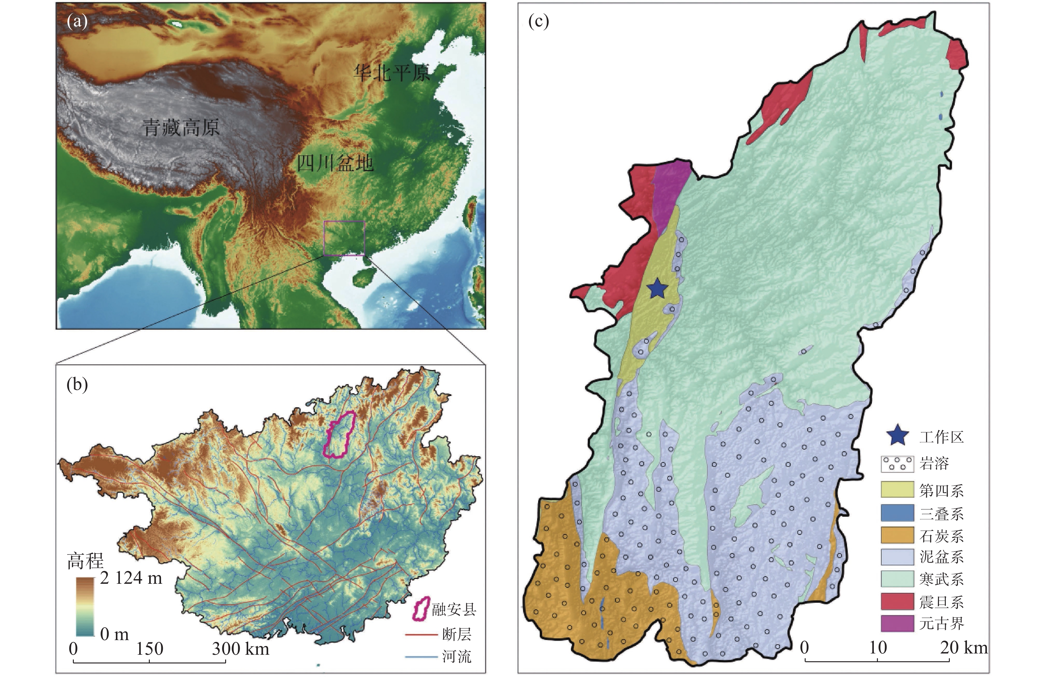
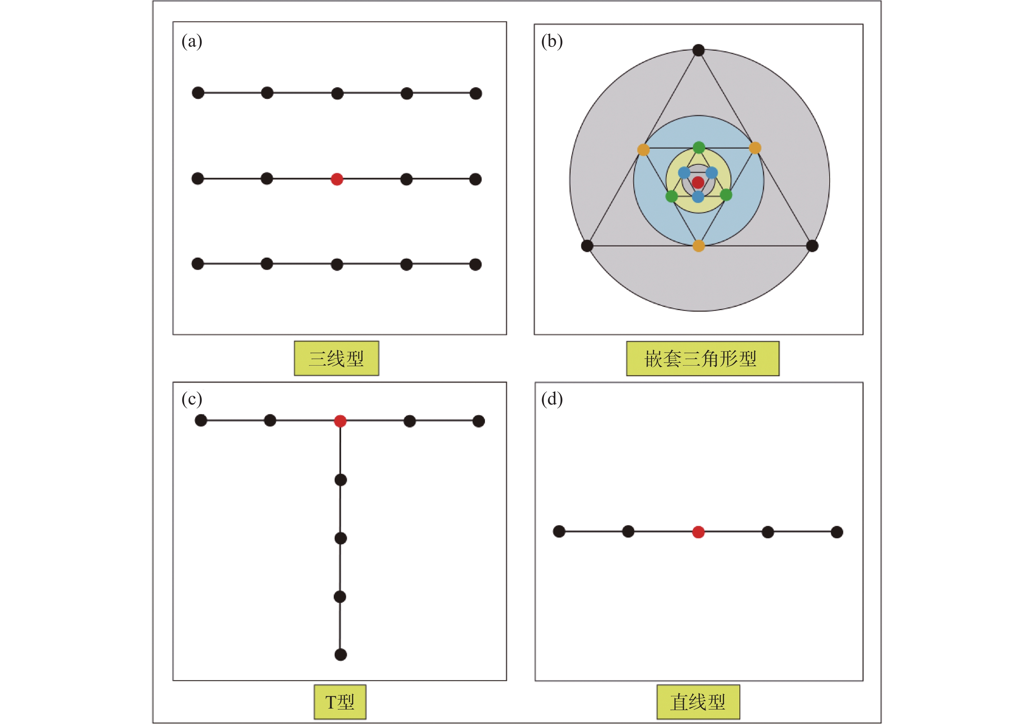
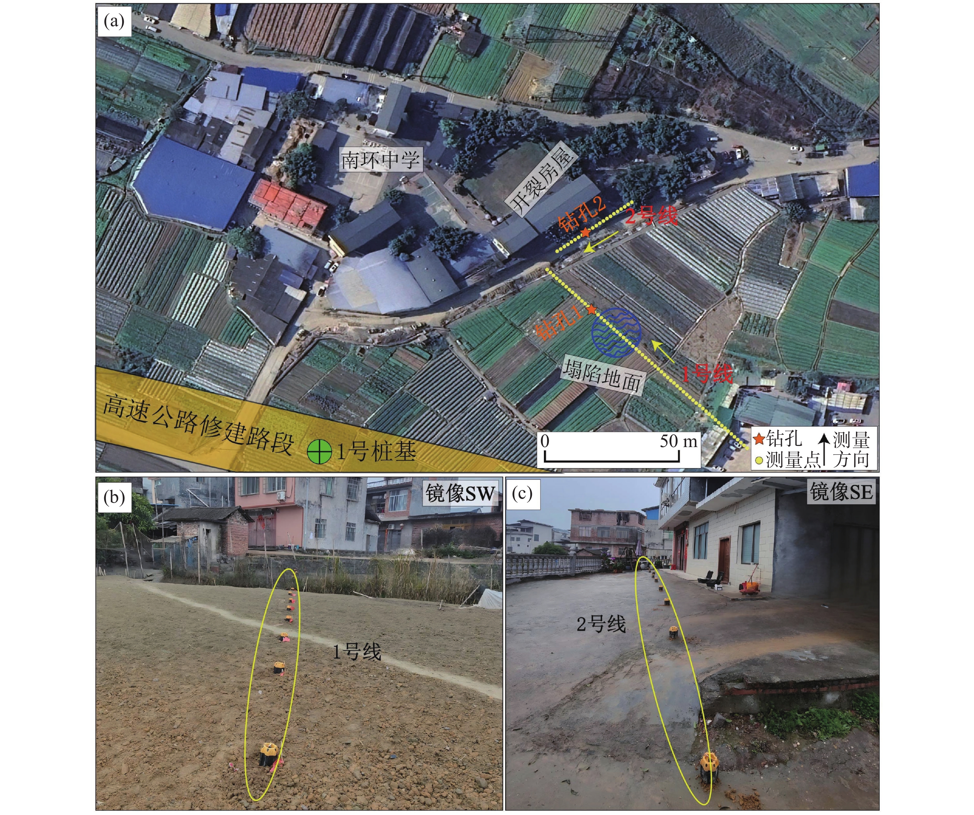
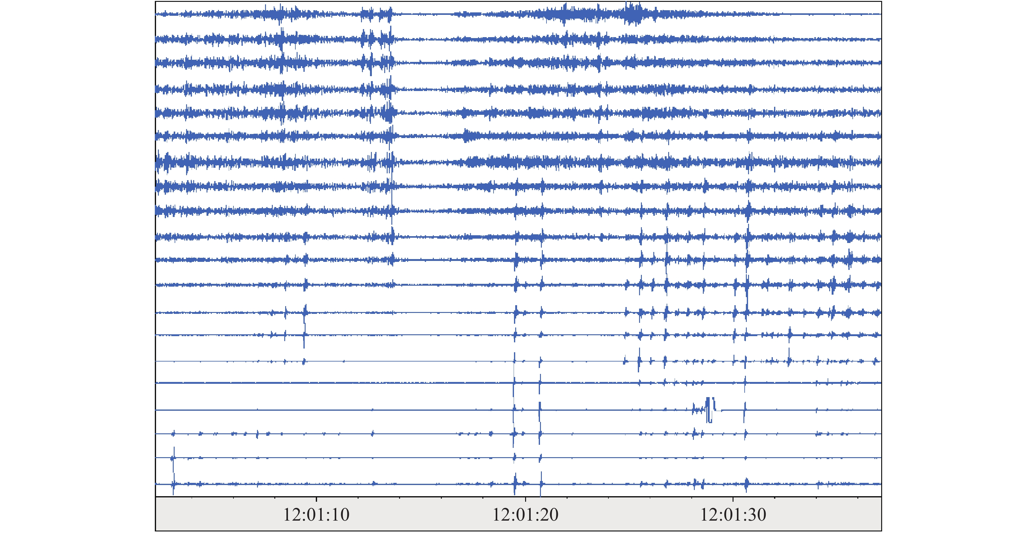
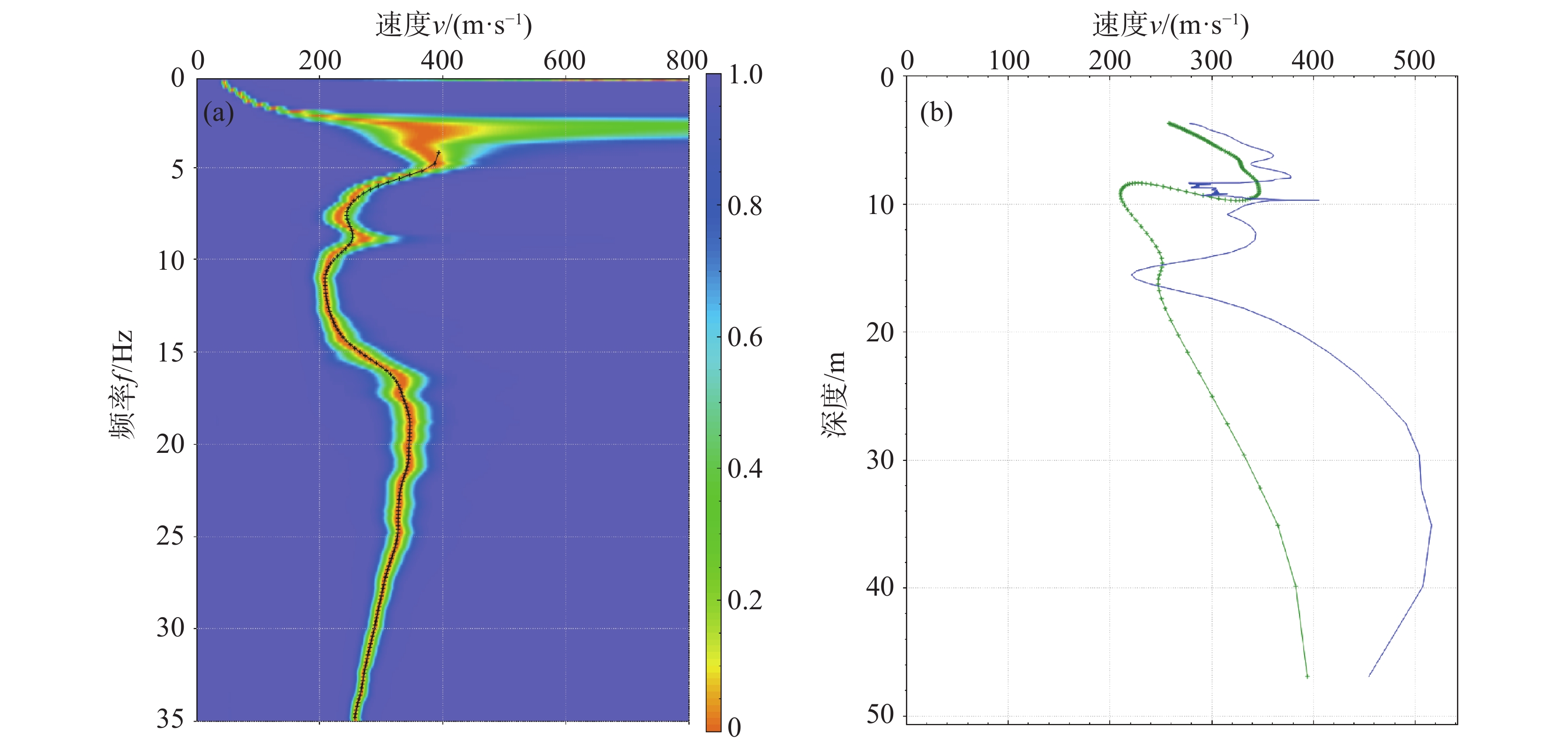
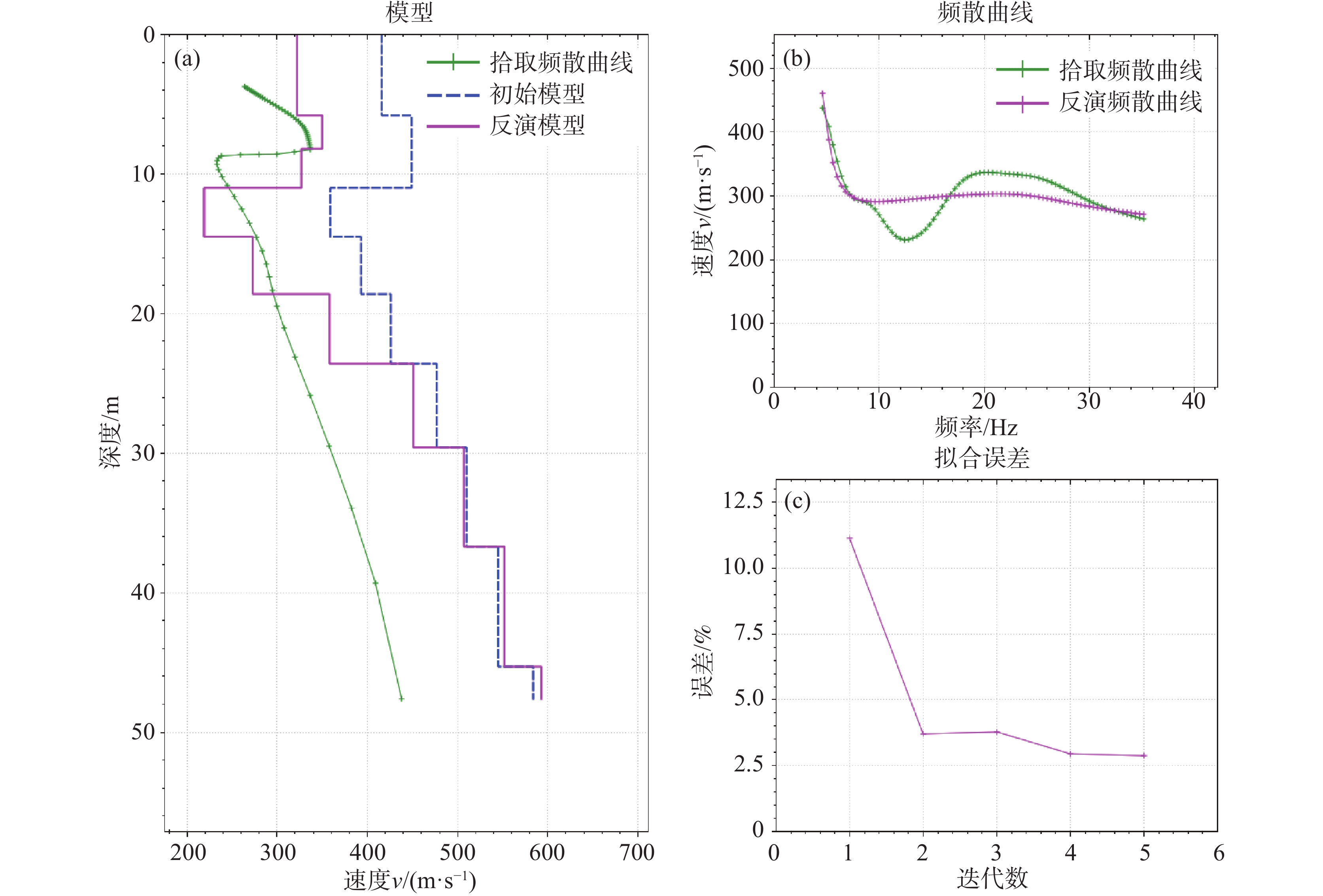
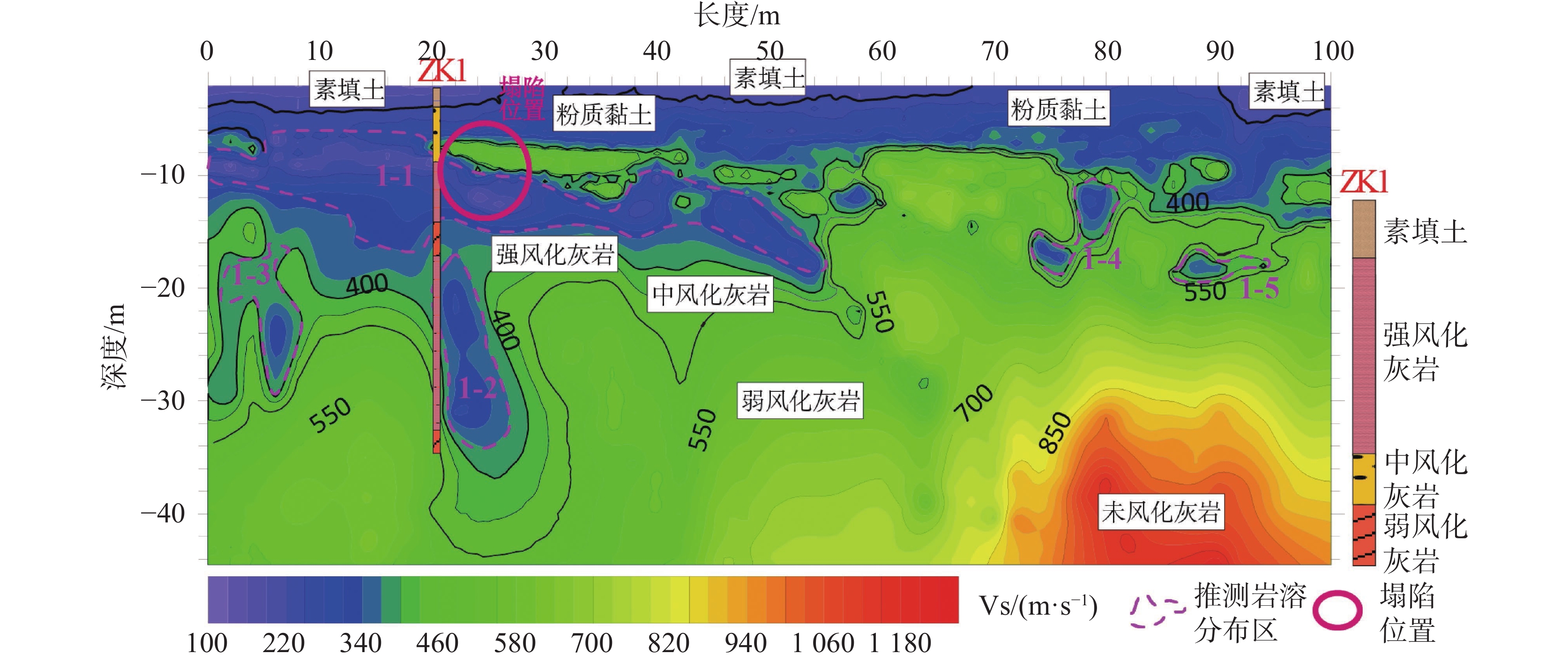
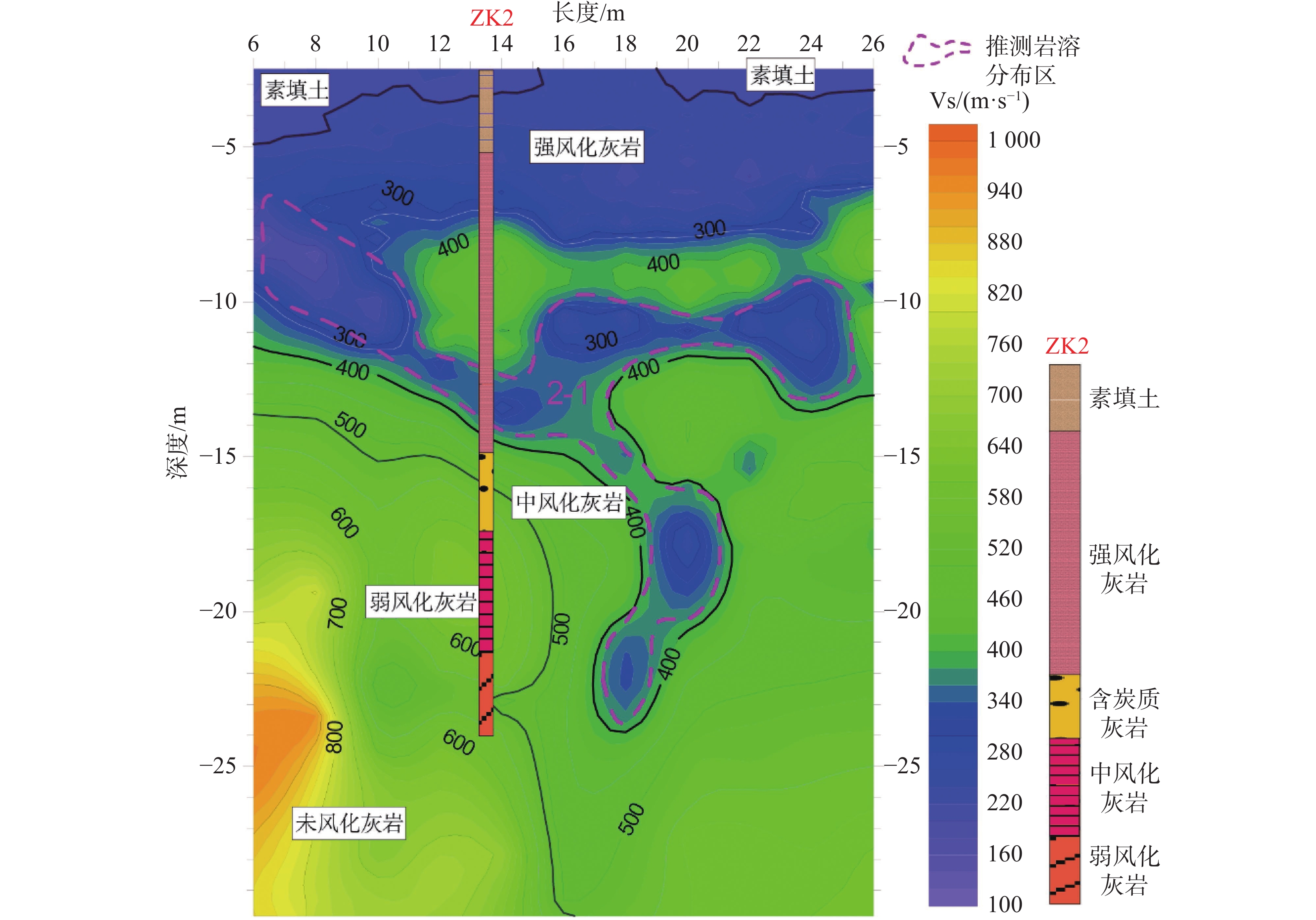
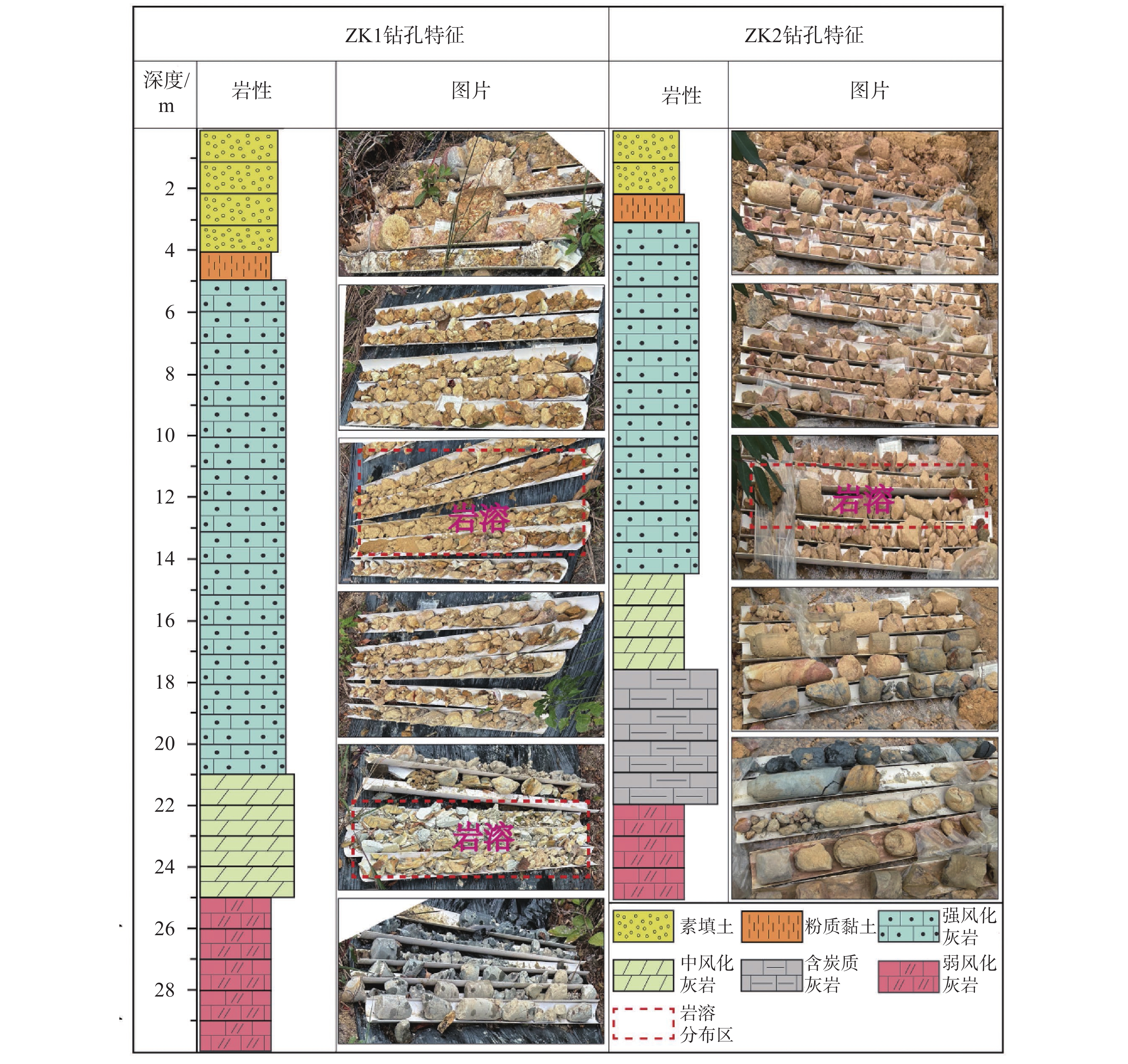
Karst collapses are major geological hazards that severely threaten the safety of engineering infrastructure due to their concealed nature, complex formation mechanisms, and sudden occurrence. These hazards are particularly prevalent in regions with extensive carbonate rock exposure and active groundwater systems, such as southwest China. Detecting and characterizing concealed karst features with high accuracy is a critical challenge for geotechnical engineering and hazard prevention. This study systematically investigates the application of microtremor exploration technique for detailed karst detection and evaluates its effectiveness through a case study of a collapse-prone section of a highway in Rong’an County, Guangxi, China.Karst terrains are formed by the chemical dissolution of carbonate rocks under hydrodynamic and climatic conditions, covering large areas worldwide and creating complex subsurface environments prone to hazards such as sinkholes, subsidence, and uneven settlement. Traditional methods for karst detection, including geological mapping, borehole drilling, and geophysical surveys, face limitations in urban or densely populated areas. Geological surveys often lack precision for concealed voids; drilling provides direct evidence but is expensive and spatially discontinuous; and conventional geophysical techniques, such as electrical resistivity tomography, seismic refraction, and ground-penetrating radar, suffer from shallow penetration, sensitivity to noise, or operational constraints in complex environments. Microtremor exploration, which uses ambient vibrations as the natural energy source, has emerged as a promising non-invasive alternative. This technique extracts Rayleigh-wave dispersion characteristics from recorded microtremor signals and applies inversion algorithms to construct subsurface shear-wave velocity models. Since karst cavities and dissolution zones exhibit low density and reduced rigidity, they appear as low-Vs anomalies, providing a diagnostic indicator for detection.The research area lies within a complex structural zone at the southern margin of the Jiangnan ancient landmass, characterized by multiple folding and faulting events. The lithology includes thick sequences of limestone, dolomite, and marl interbedded with clastic sediments, creating ideal conditions for karst development. Abundant fractures and active groundwater circulation further accelerate dissolution processes. During construction of Pier No. 1 on an elevated highway bridge, sudden ground collapse and adjacent building cracks occurred, indicating active subsurface karst processes. The site posed challenges for conventional surveys due to dense residential housing, high traffic flow, and limited space for large-scale instrument deployment, making microtremor exploration the preferred choice. A linear microtremor array configuration was adopted to balance detection resolution and operational efficiency under spatial constraints. Thirteen stations were deployed with a 2 m spacing along two profiles: Line 1 (100 m length) crossing a known collapse zone and Line 2 (20 m length) near damaged residential buildings. Each station was precisely positioned using Real-Time Kinematic (RTK) GPS to achieve centimeter-level accuracy. Special attention was given to station−ground coupling through excavation and backfilling with clay for loose soils or gypsum bonding for hard surfaces. Continuous microtremor recordings were acquired for 15 minutes per station, ensuring adequate signal quality and noise suppression.Data preprocessing involved noise filtering, Fourier and wavelet spectral analysis, and bandpass filtering to enhance signal fidelity. Rayleigh-wave dispersion curves were extracted using the Extended Spatial Autocorrelation (ESPAC) method, which improves resolution for complex arrays through multi-station cross-correlation and Bessel function fitting. Nonlinear inversion was performed using a genetic algorithm, iteratively adjusting model parameters until synthetic and observed dispersion curves achieved optimal fit. The final Vs models were visualized using contour mapping to highlight lateral and vertical heterogeneities. Profile analysis revealed distinct four-layer stratigraphy: (1) 2 to 3 m thick Quaternary fill and fluvial-alluvial clayey soil (Vs = 100 to 220 m·s−1); (2) 3 to 8 m thick strongly weathered limestone (Vs = 220 to 340 m·s−1); (3) Moderately weathered limestone (Vs = 340 to 460 m·s−1); (4) Weakly weathered limestone and unweathered limestone (Vs = 460 to 1180 m·s−1). Multiple low-Vs anomalies (100 to 340 m·s−1) were identified within the bedrock, appearing as funnel-shaped or Y-shaped zones extending to depths of 8 to 23 m. Line 1 revealed five major anomalies, including a continuous 50 m-long zone at 8 to 16 m depth corresponding to known collapse locations. Line 2 detected a prominent Y-shaped anomaly beneath cracked buildings, indicating dissolution conduits and fracture networks linked to uneven settlement.Borehole verification at key anomaly locations confirmed the presence of karst features. For example, borehole ZK1 intersected cavities and fractures filled with severely fractured and disintegrated limestone at 10 to 14 m depth, matching the Line 1 anomaly. Similarly, borehole ZK2 intersected poorly consolidated material at 12 to 14 m depth within the Line 2 anomaly. These findings validate the reliability of microtremor exploration in delineating karst features with high accuracy. Compared with conventional methods, microtremor exploration demonstrated clear advantages: (1) Strong spatial resolution for identifying both horizontal and vertical karst structures; (2) Adaptability to urban environments without the need for artificial seismic sources; and (3) Minimal environmental impact. However, limitations include sensitivity to station coupling and reduced resolution for deep structures, the future research are suggested focusing on the multi-array joint inversion and low-frequency enhancement techniques. This study demonstrates the microtremor exploration technique, combined with ESPAC dispersion analysis and genetic algorithm inversion, provides an effective and non-invasive approach for high-resolution karst detection in complex environments. The method successfully identified concealed cavities, dissolution channels, and fracture zones that were later confirmed by drilling. Its proven capability to operate under space-constrained and noise-prone conditions makes it an essential tool for risk assessment and hazard mitigation in engineering projects across karst terrains.
Research on groundwater seepage parameters in deep mine exploration based on 3D sonar detection technology
HUANG Hailong, LU Jiayan, JIANG Fan, YANG Pengshuai
2026, 45(2): 316-328. doi: 10.11932/karst2025y023
Abstract:
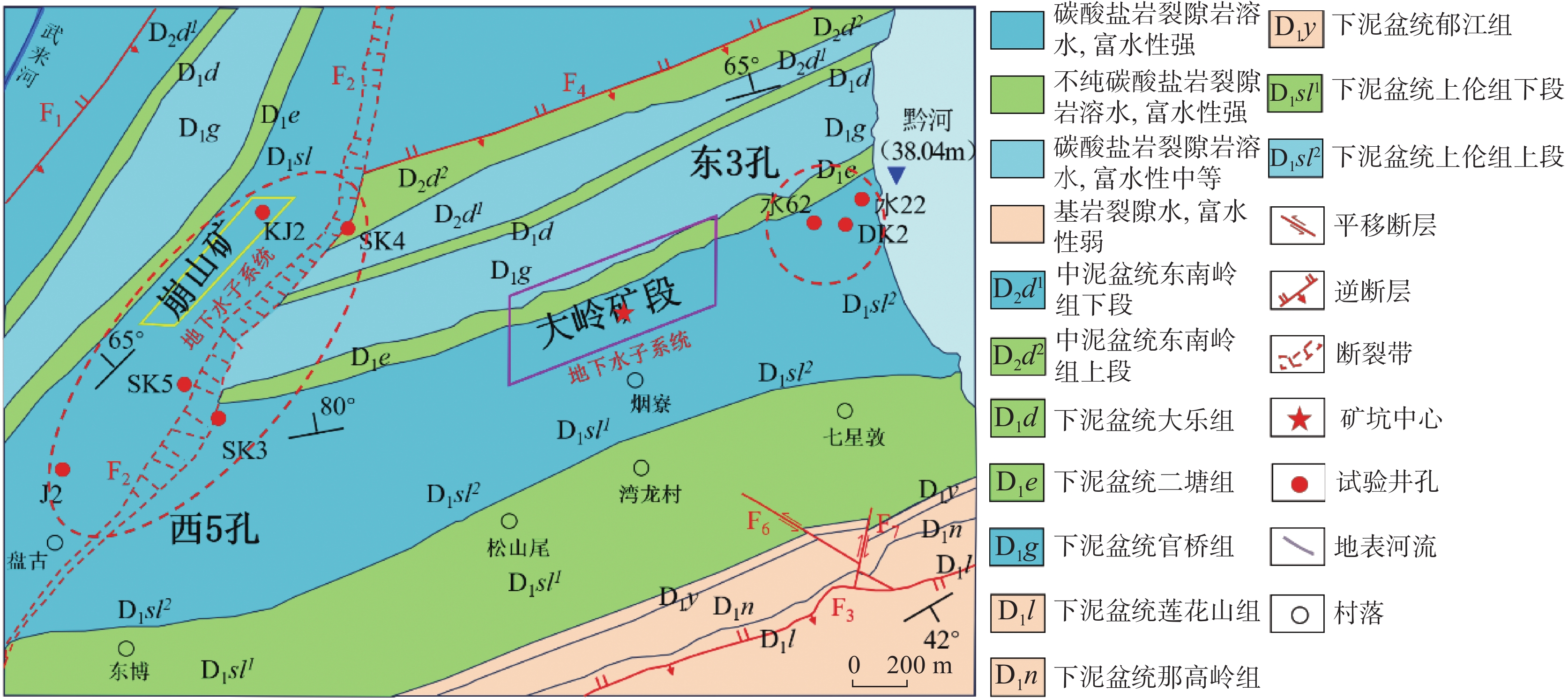
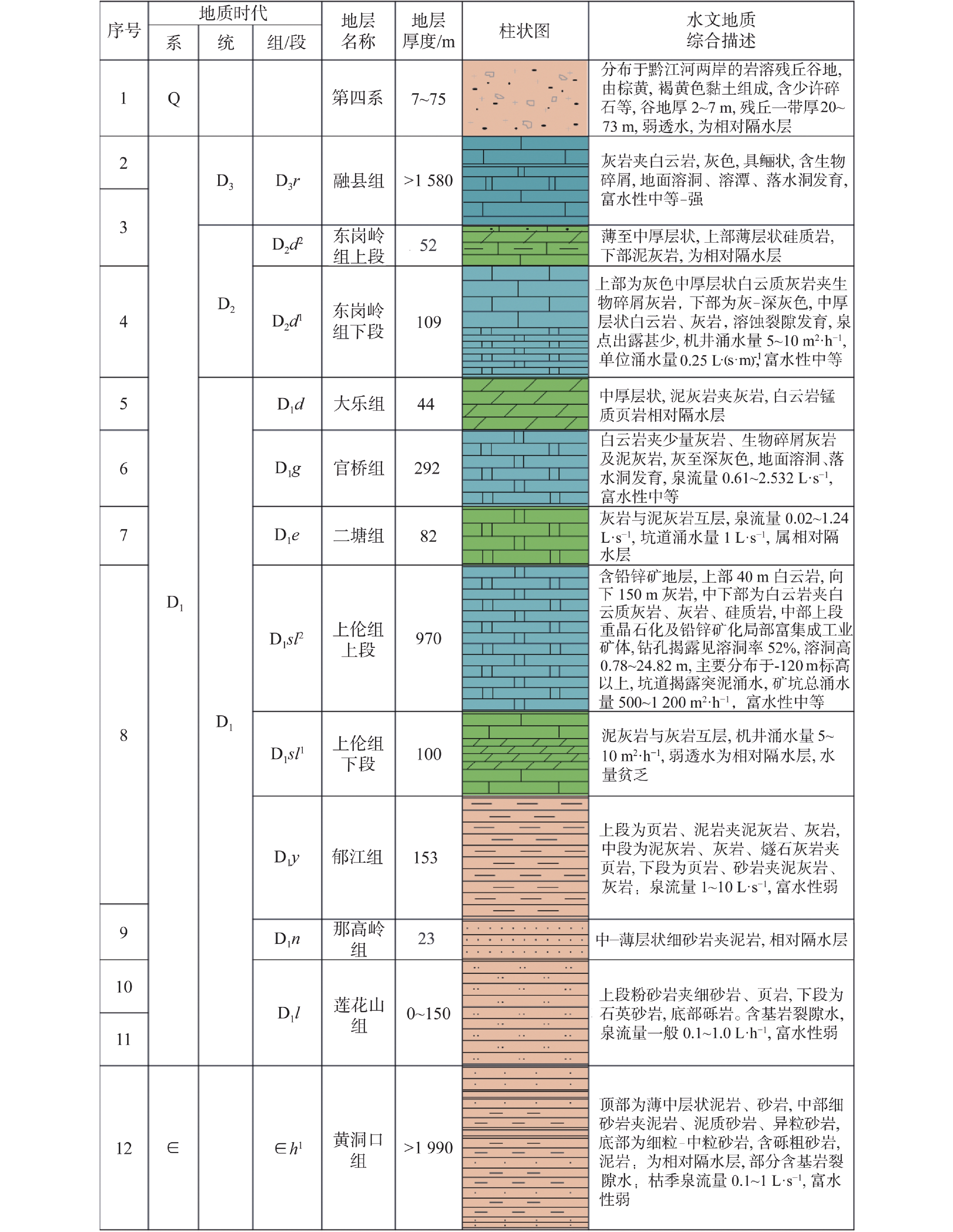
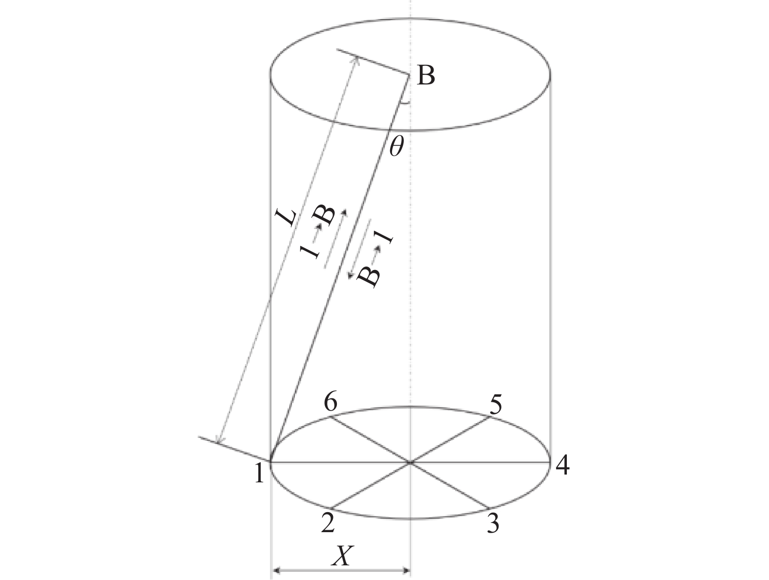
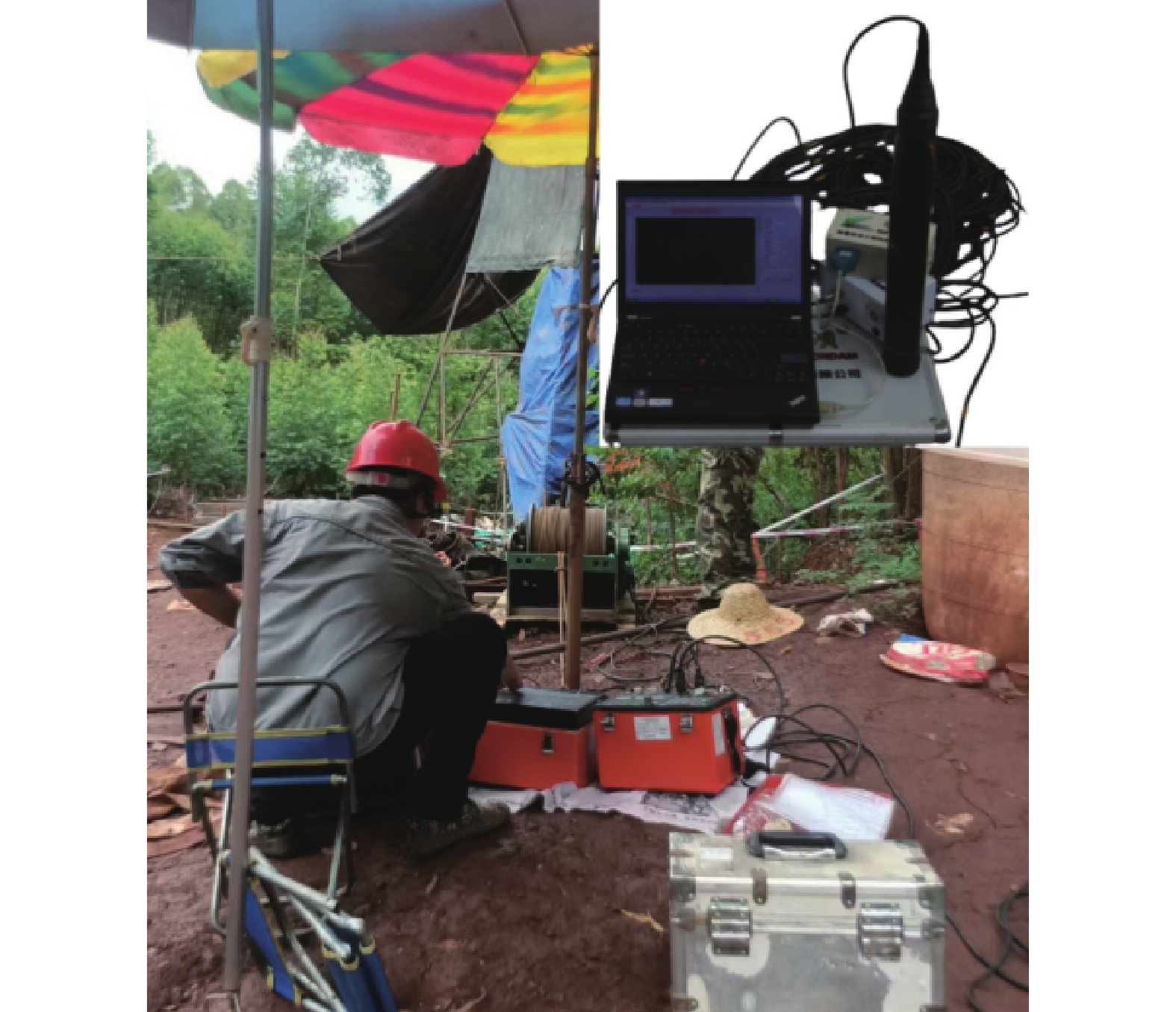
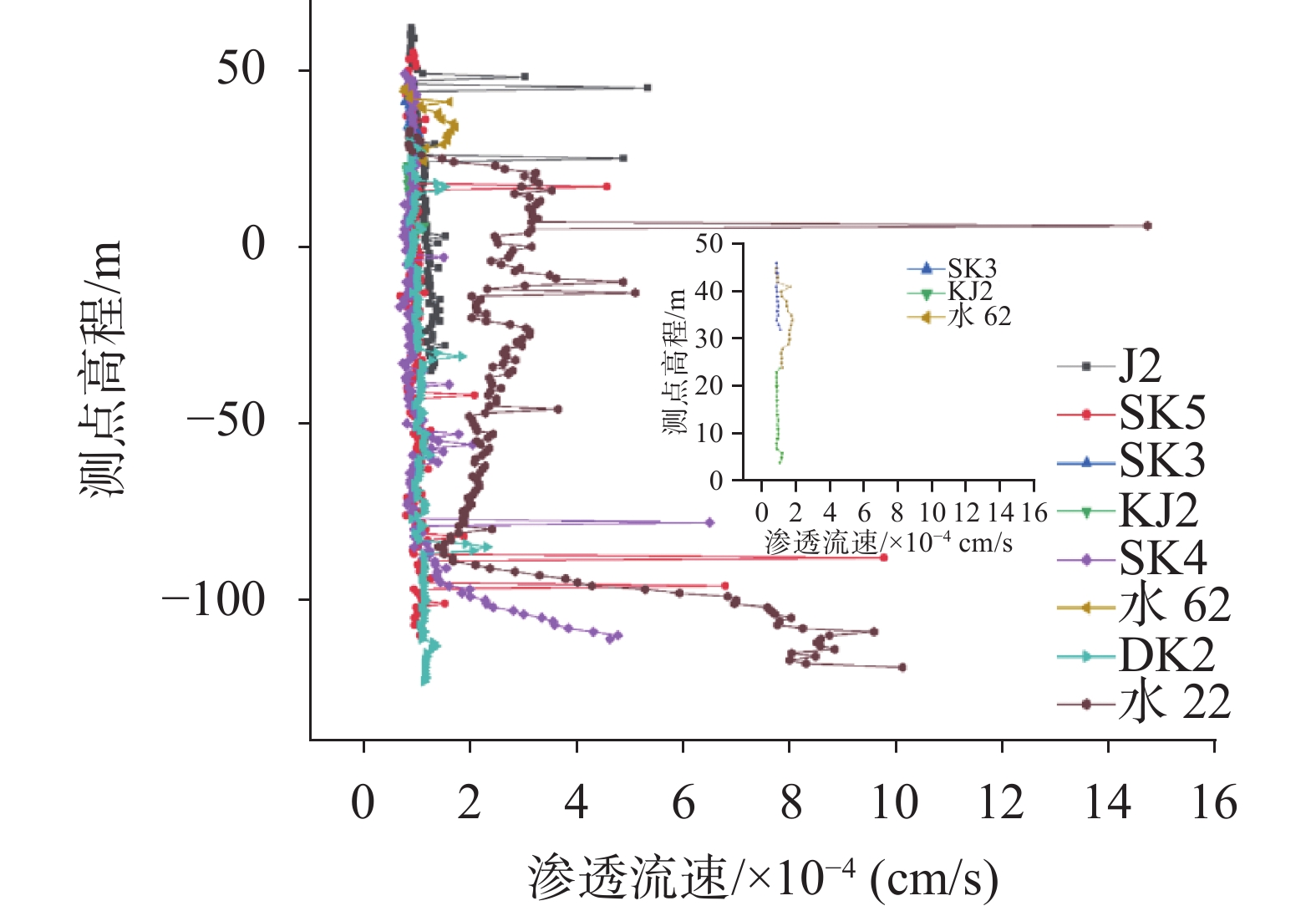
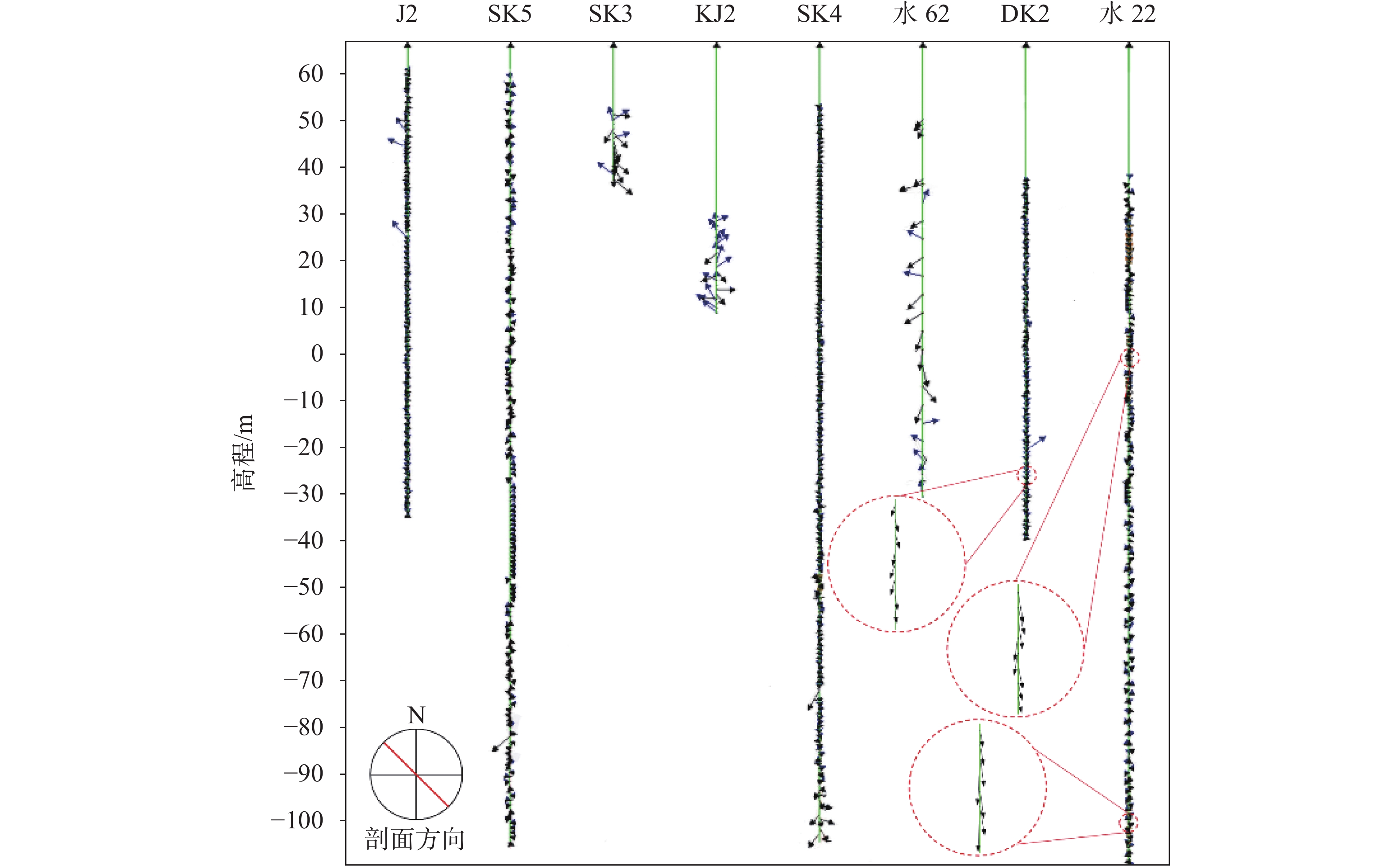
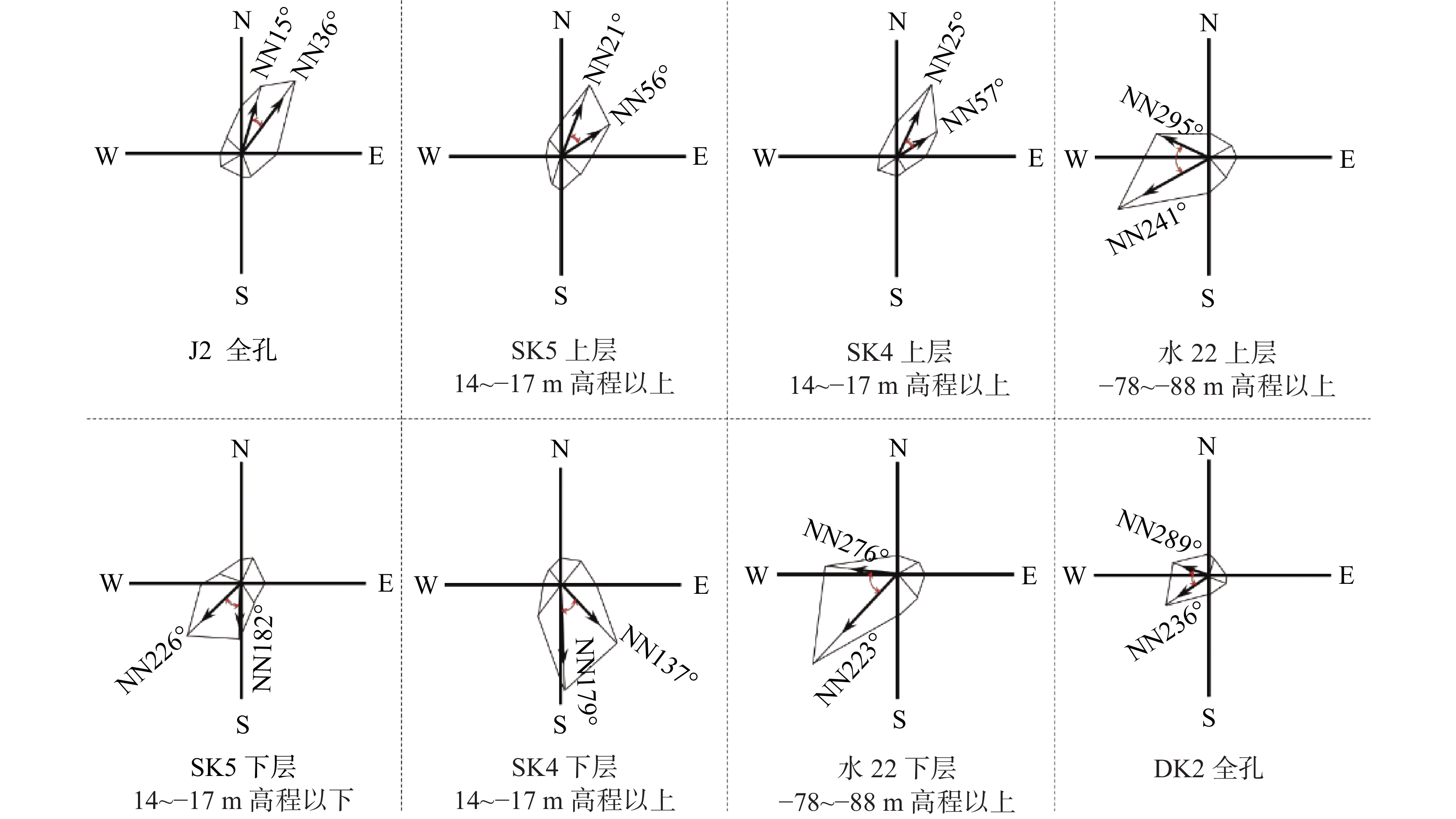
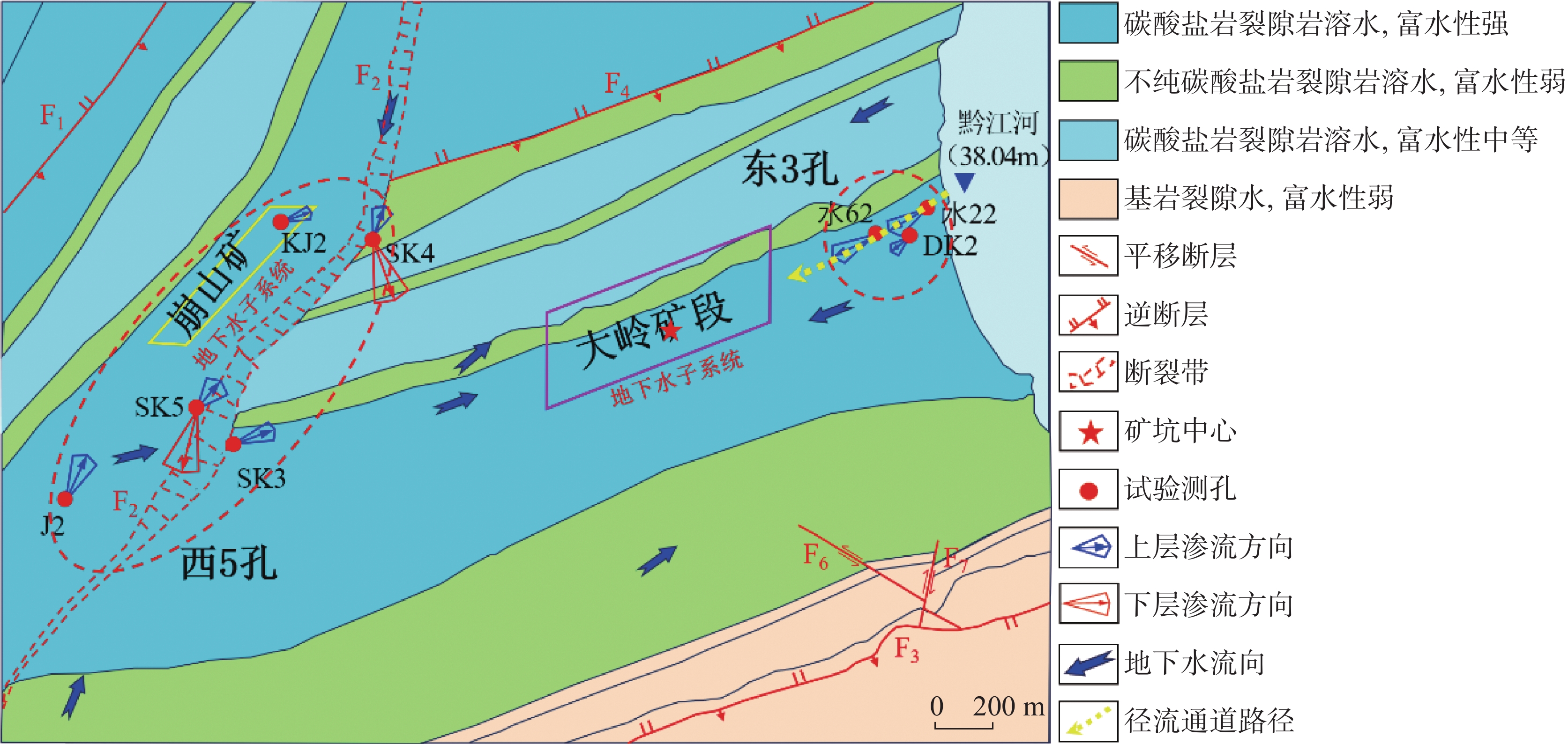
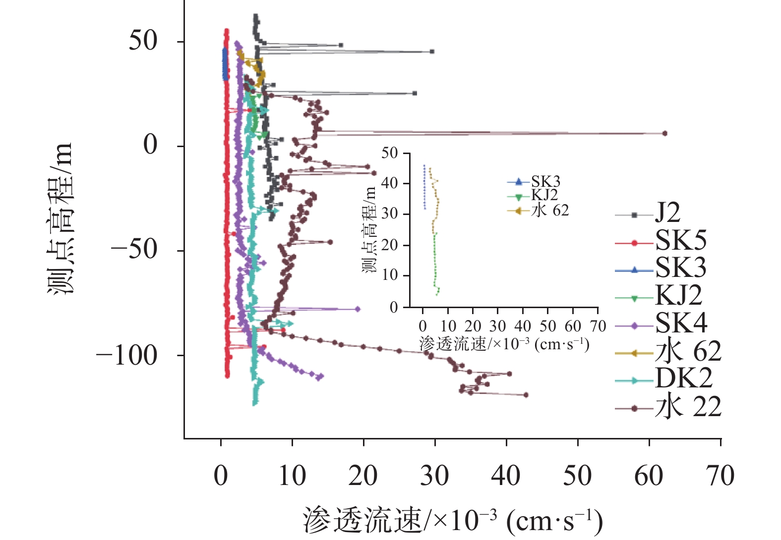
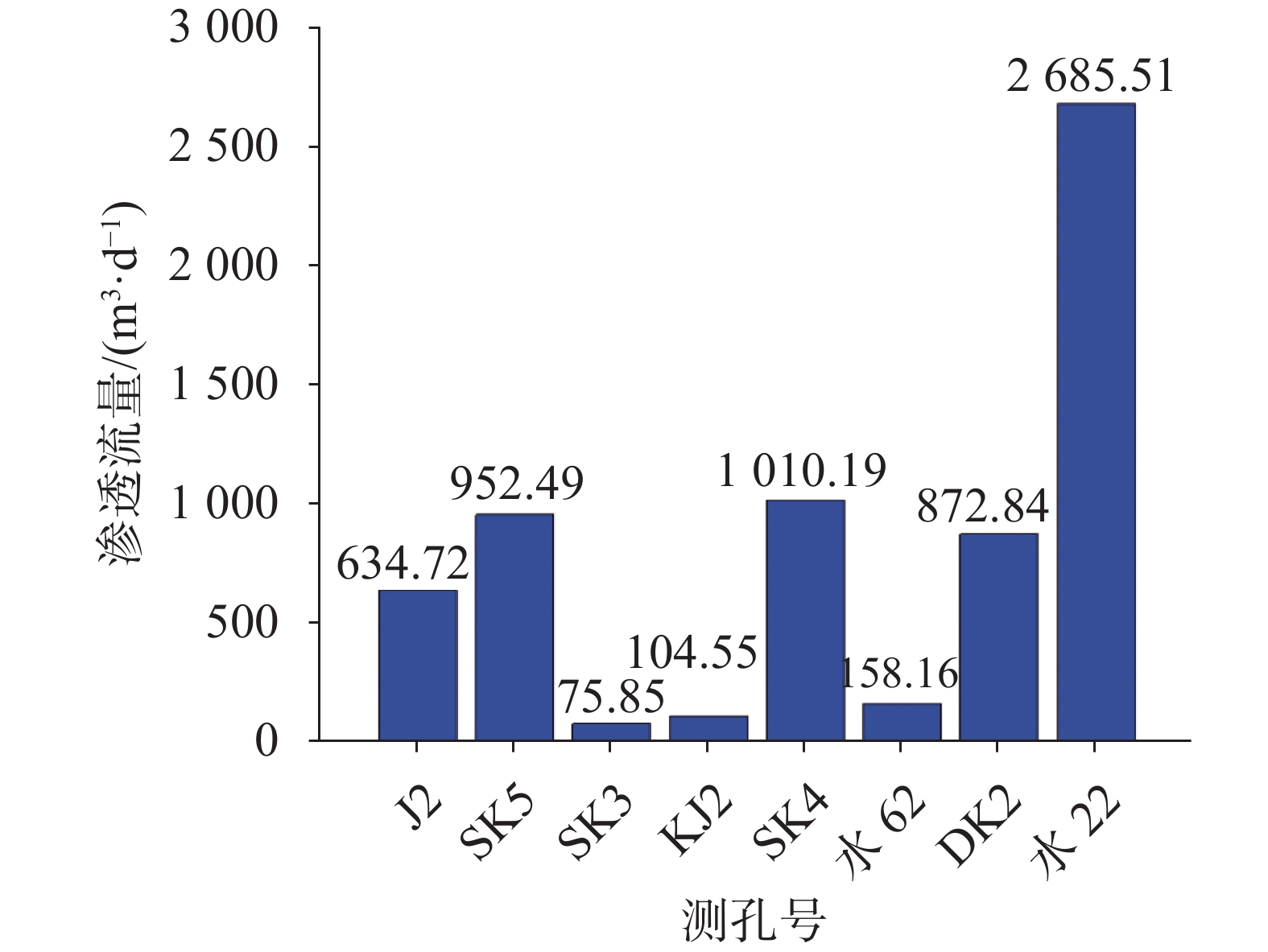
In regions characterized by extensive development of karst landform, the extraction of deep mineral resources faces significant challenges in preventing and controlling water hazards. Hydrogeological parameters, which are essential for understanding groundwater flowing patterns and assessing water hazard risks, critically influence the effectiveness of prevention measures in mining areas. Inaccurate determination of these parameters can easily lead to disasters such as water inrushes and sudden water surges during mining operations. These events not only jeopardize the safety of underground personnel but also pose risks to equipment, disrupt mining progress, result in substantial economic losses, and cause ecological damage.Currently, traditional methods for obtaining hydrogeological parameters on-site primarily include pumping tests, water injection tests, and water pressure tests. These techniques, which involve direct interaction with groundwater systems, can accurately determine key parameters of aquifers and have long been considered essential in the field of hydrogeological research. However, they are often associated with labor-intensive on-site testing and high costs in practical applications. Furthermore, the process-from experimental design and on-site implementation to stable data collection and final analysis-can take several months or even years. This extended timeline significantly lags behind the demands of mining area development and construction, making it challenging to address the urgent need for dynamic water hazard prevention and control. Geophysical methods have become widely adopted in the industry for obtaining hydrogeological parameters due to their distinct advantages. Unlike traditional experimental approaches, geophysical techniques do not require large-scale destruction of geological formations, substantially reduce operational costs, and enable preliminary exploration of extensive areas within a short timeframe, thereby enhancing efficiency. However, as detection depth increases, signals from deep strata are affected by various factors, including complex geological structures, the degree of rock weathering, and the chemical composition of groundwater. Consequently, the signal attenuation and distortion during propagation lead to a significant decline in detection accuracy. This challenge is especially pronounced for deep karst aquifers, where intricate cave and fissure systems complicate the interpretation of geophysical signals, making it difficult to accurately characterize true hydrogeological parameters. Such complexity poses potential risks for water hazard prevention and control in deep mining areas. In response to these technological challenges, 3D sonar seepage detection technology has emerged as an innovative method for obtaining hydrogeological parameters of deep karst aquifers. This technology effectively mitigates the issue of reduced detection accuracy with increasing depth. Whether addressing shallow weathered fissure aquifers or deep karst conduit systems extending hundreds or even thousands of meters, it enables high-precision parameter determination. Additionally, its high-resolution imaging capability visually represents the three-dimensional flow dynamics of water within the borehole, providing a powerful tool for a deeper understanding of groundwater seepage behavior.Based on this background, this study focuses on the deep mining area of the Panlong Lead-Zinc Mine in Guangxi. Located in the western region of Guangxi, an area characterized by intense karst development, the mine features an active subsurface karst system that poses significant water hazard threats during deep mining operations. This study employs 3D sonar seepage detection technology, strategically deploying monitoring boreholes on both the eastern and western sides of the mining area to achieve a comprehensive and detailed characterization of groundwater seepage within the boreholes. Through prolonged and high-frequency data acquisition, a substantial volume of accurate seepage parameters-including seepage velocity, direction, flow rate, and permeability coefficient-was obtained. Building on this data foundation, the spatial distribution patterns of these parameters were analyzed in depth to investigate differences in groundwater seepage across various depths and regions. This analysis aims to reveal the water-conducting characteristics and karst development features of the aquifers on the eastern and western flanks of the mining area, thereby providing robust data support and a theoretical basis for the scientific formulation of water hazard prevention and control strategies for deep mining operations in the region. The research results indicate that sonar seepage detection technology can accurately evaluate the variation of parameters such as seepage velocity, seepage direction, permeability coefficient, and seepage flow rate with depth in deeply buried karst aquifers. It can also accurately predict the presence of groundwater runoff channels in the eastern part of the mining area at elevations between -25 m and -78 m, as well as below -85 m at Sampling Hole 22. Additionally, it can identify groundwater runoff channels in the western part of the mining area at elevations below -90 m at Sampling Hole SK4. The total proven seepage flow in the mining area is 6,494.31 m3·d−1, which represents only one-third of the daily drainage in the region. Groundwater seepage flow on the eastern and western sides of the mining area accounts for 58% and 42% of the total seepage flow, respectively. The accuracy of sonar seepage detection technology is limited by the arrangement of sampling holes. Utilizing key sampling holes-holes revealing the main runoff channels-for detection significantly enhances the accuracy of predicting water inflow in mining areas.
Study on cross-borehole resistivity CT method for detecting typical karst collapses in the Chongqing region
LI Xingru, GONG Siyu, CAO Cong, LIU Zhi, JIANG Xun, LIANG Yun
2026, 45(2): 329-341. doi: 10.11932/karst20260204
Abstract:
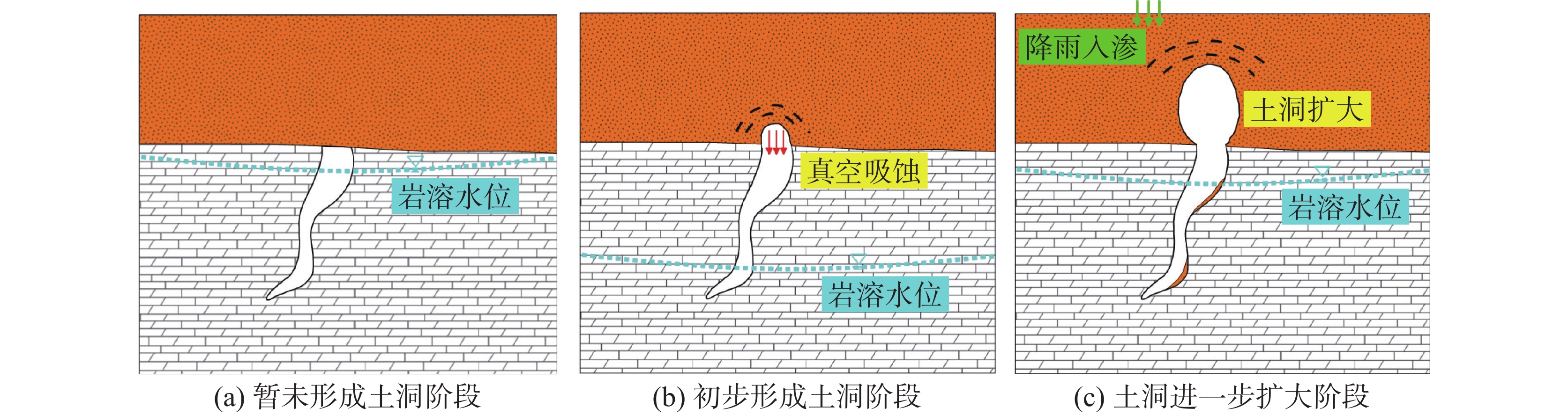
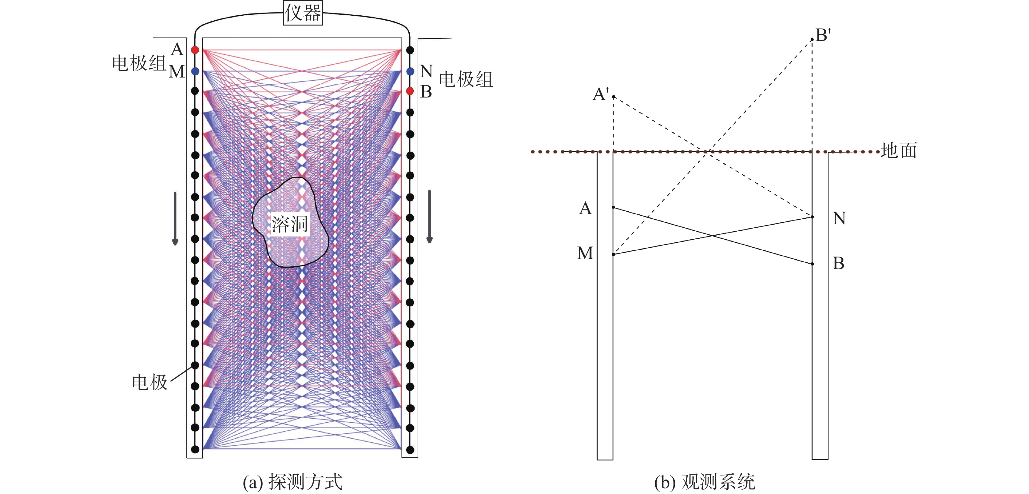
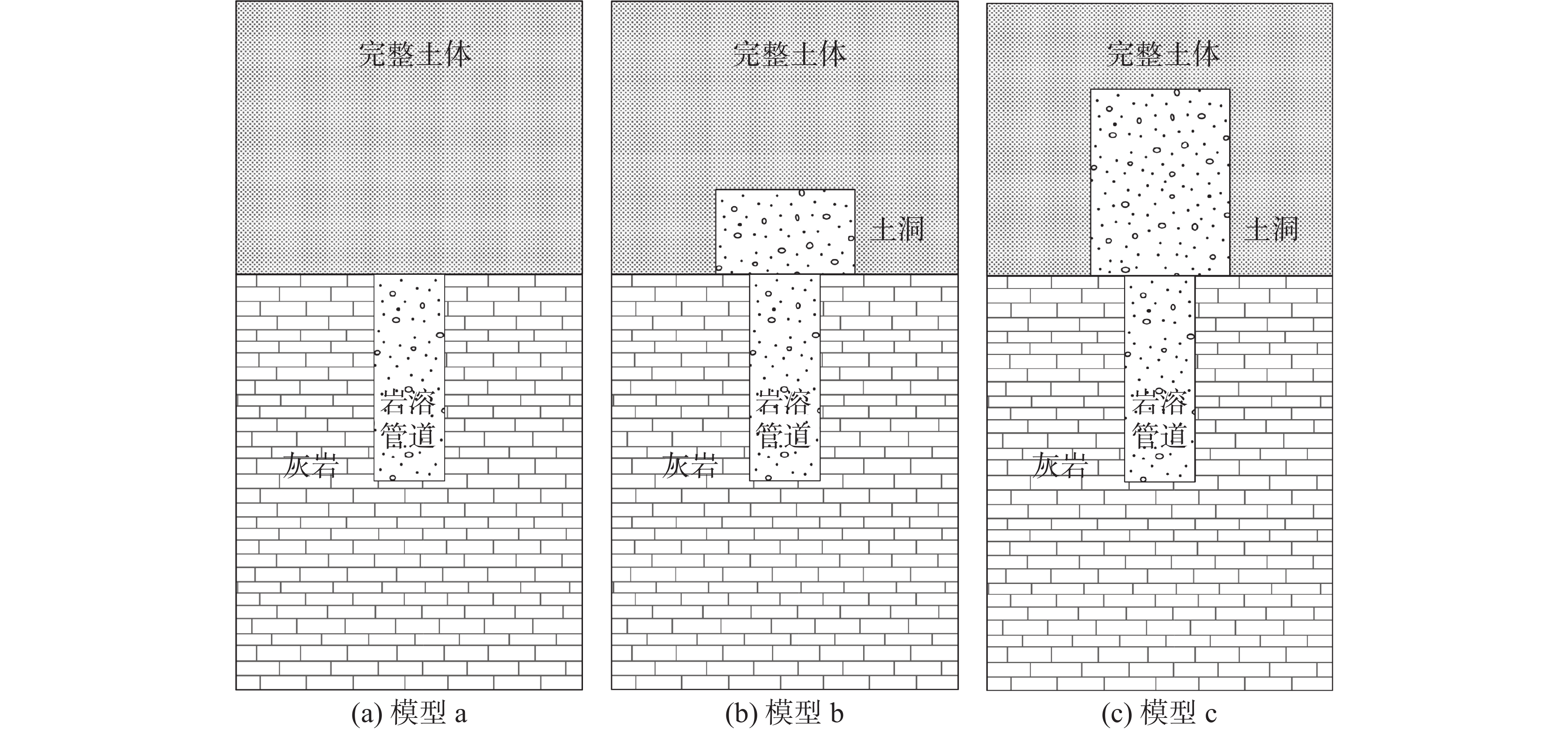
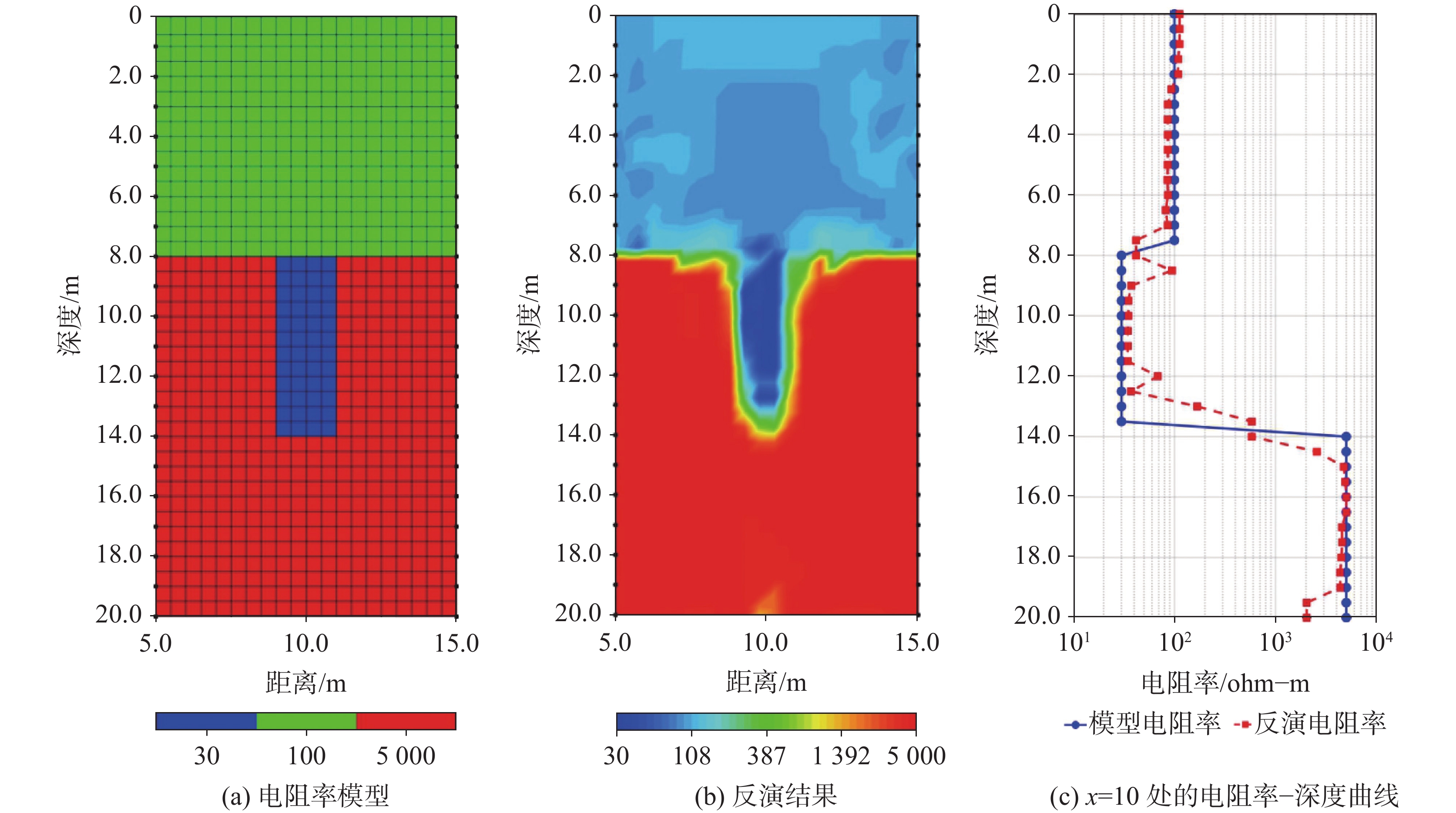
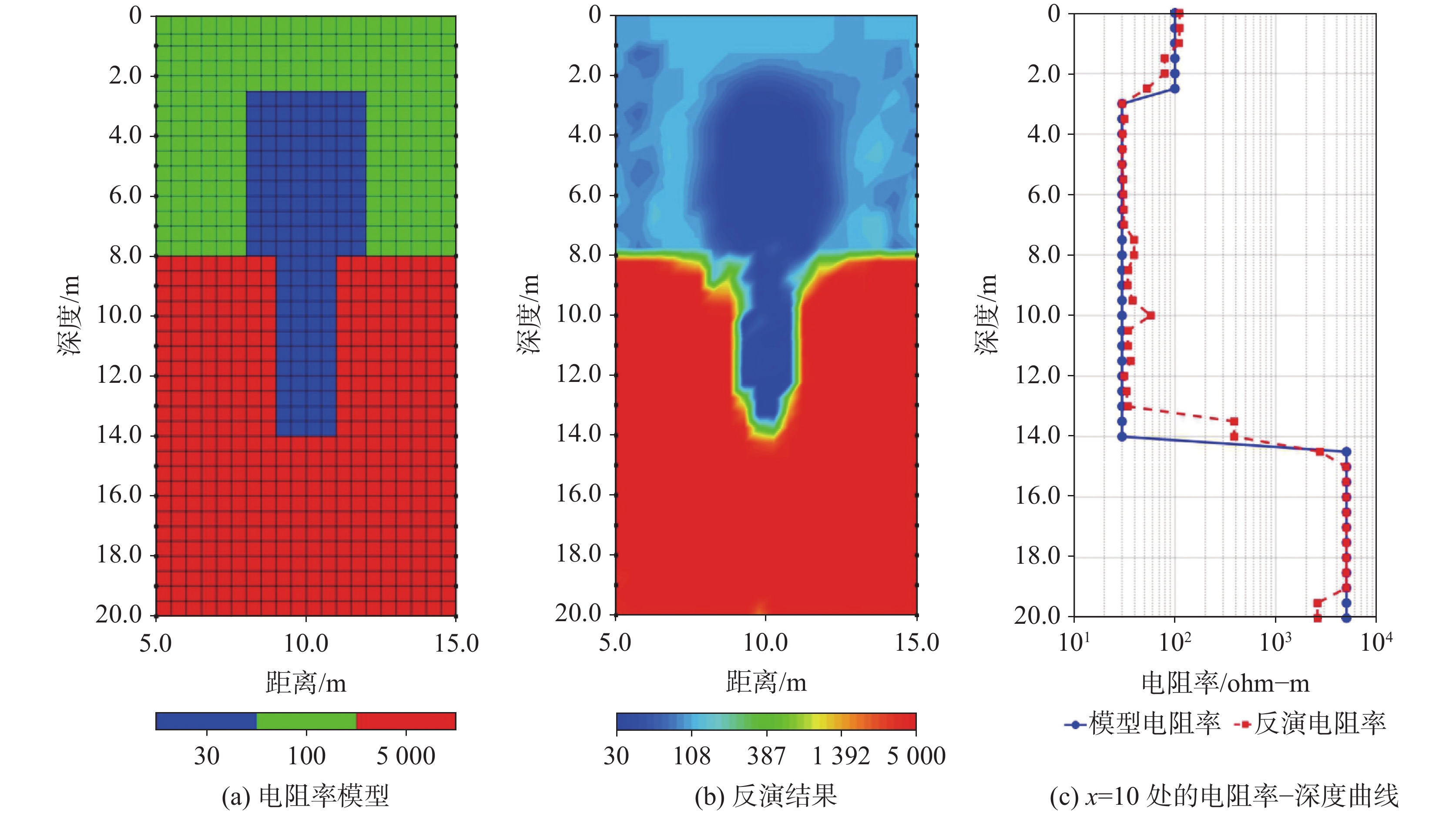
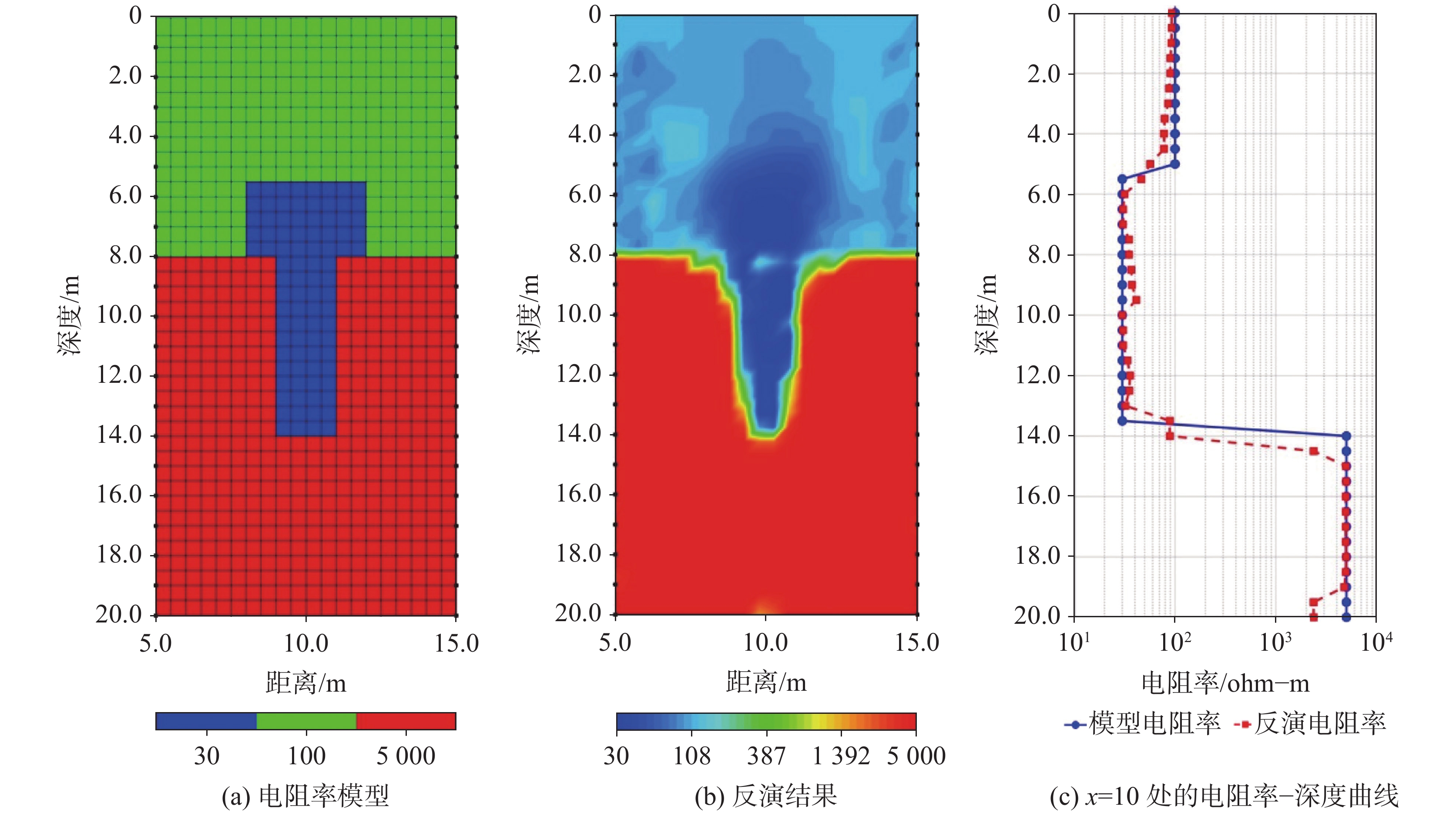
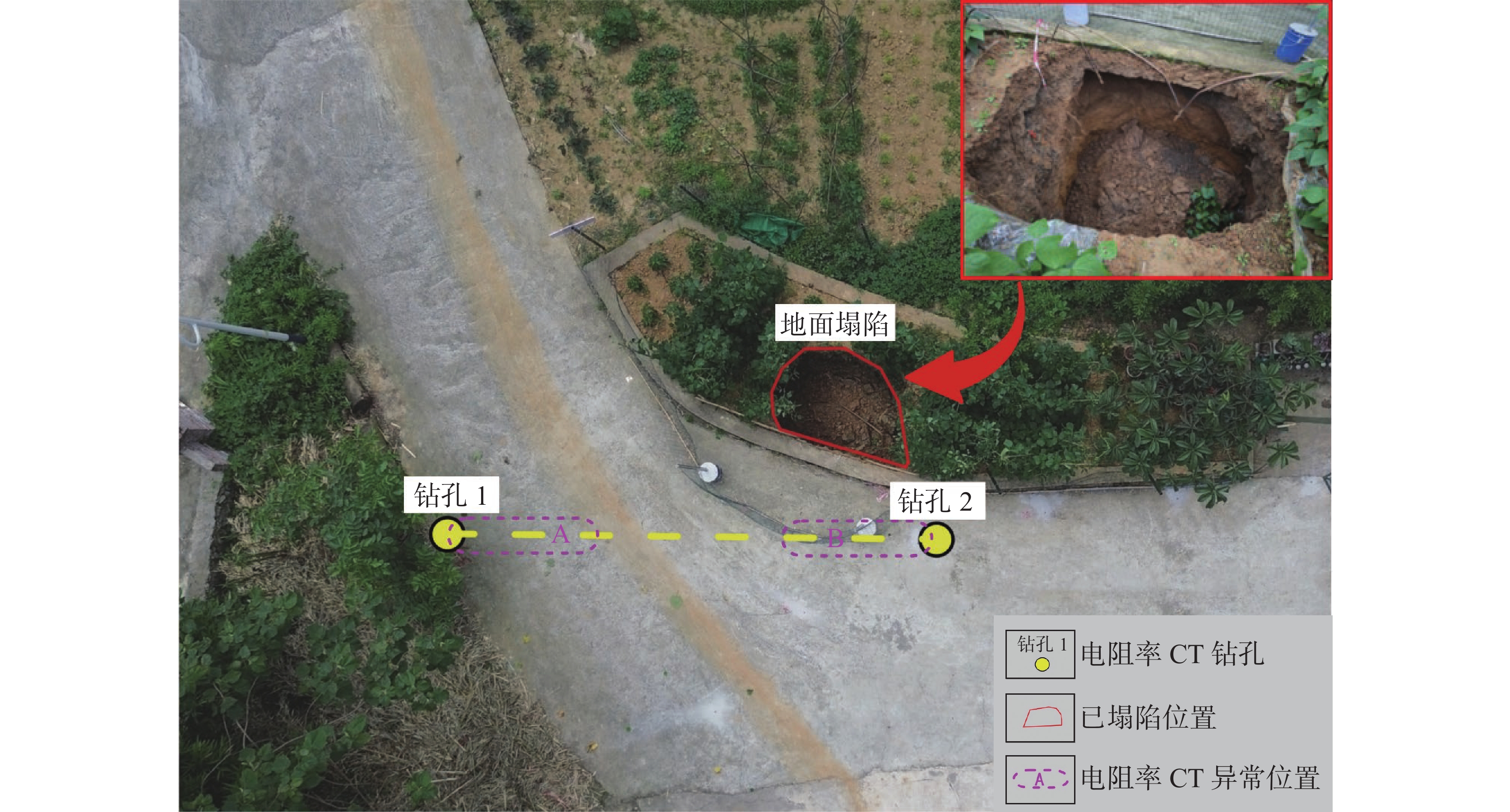
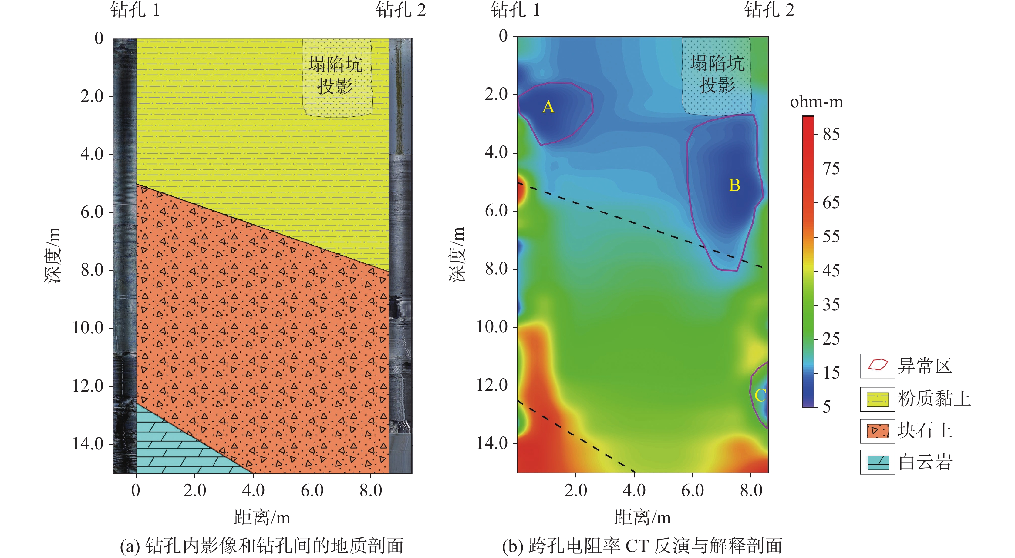
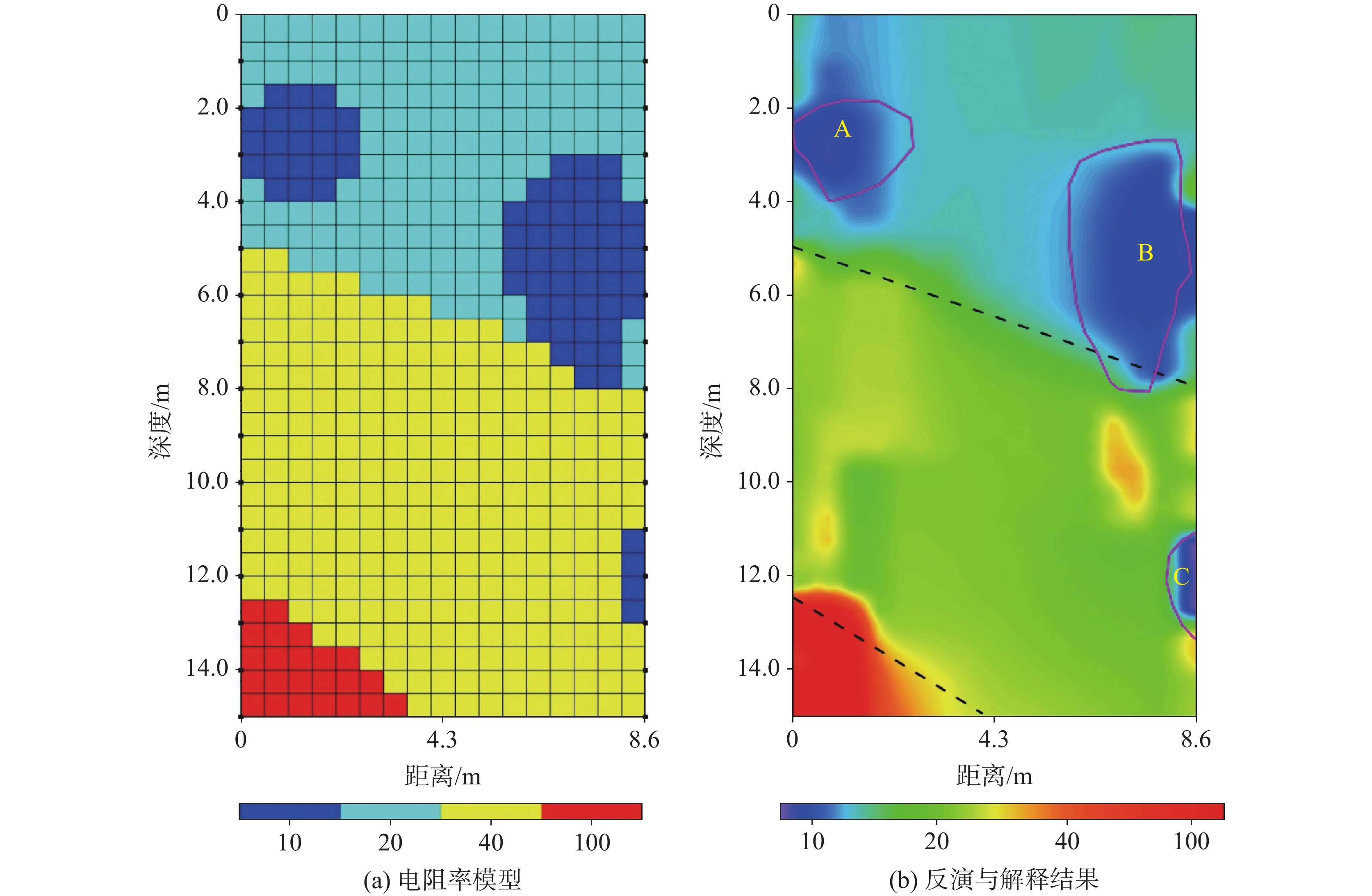
Karst ground collapses in the Chongqing region are characterized by concealment, sudden occurrence, and unpredictability, making them difficult to detect accurately using conventional geophysical methods. Cross-borehole resistivity computed tomography (CT), with its unique observation geometry and high imaging resolution, is well-suited for the detailed detection of hidden hazards in karst regions.The evolution of typical karst collapses in the Chongqing region can be summarized into three stages: soil cave incubation, formation, and expansion. During the incubation stage, the soil above the bedrock remains intact and stable, with water levels in karst conduits fluctuating periodically due to rainfall but without significantly affecting the stability of the overlying layer. In the formation stage, activities such as tunnel construction cause a rapid drop in groundwater levels, leading to a sharp increase in negative pressure within the karst conduits. This results in increased seepage pressure and gradual loosening of the overlying soil, forming localized cavities. During the expansion stage, repeated suffusion and erosion cause the soil cave to enlarge further, the roof depth to decrease, and eventually, surface collapse occurs.Based on a review of the formation mechanisms of karst collapses in Chongqing, this study developed geophysical resistivity models for the three stages mentioned above. Finite element forward modeling and smooth inversion calculations were employed to verify the effectiveness of cross-borehole resistivity CT in detecting karst collapses at different evolutionary stages. In the models, electrode spacing was set to one meter, and borehole spacing was set to 10 m. Simulation results demonstrate that cross-borehole resistivity CT technology can clearly delineate the spatial distribution characteristics of karst conduits and soil caves at each stage, with inversion errors less than 0.5 meters. In practical applications, cross-borehole resistivity CT successfully identify the morphology of hidden collapses and their associated karst conduits, effectively overcoming the limitations of traditional surface resistivity methods in terms of vertical resolution and detection accuracy, thereby providing an efficient solution for detecting karst collapses in complex geological settings. This study expands upon the traditional methodologies for detecting karst collapses, demonstrating the significant advantages of cross-borehole resistivity CT in improving the accuracy of identifying hidden karst conduits and soil cavities. Future research should focus on refining the technical parameters of this method to enable dynamic monitoring and more precise interpretation of concealed karst collapses. Such advancements will provide critical support for the scientific prevention and mitigation of karst disasters in Chongqing, thereby contributing to the sustainable and safe development of the Chengdu–Chongqing economic circle.
Research on karst detection based on full waveform inversion imaging technology
GUAN Depeng, GAO Yong, LI Yi, LIU Yaohui
2026, 45(2): 342-351, 398. doi: 10.11932/karst20260205
Abstract:
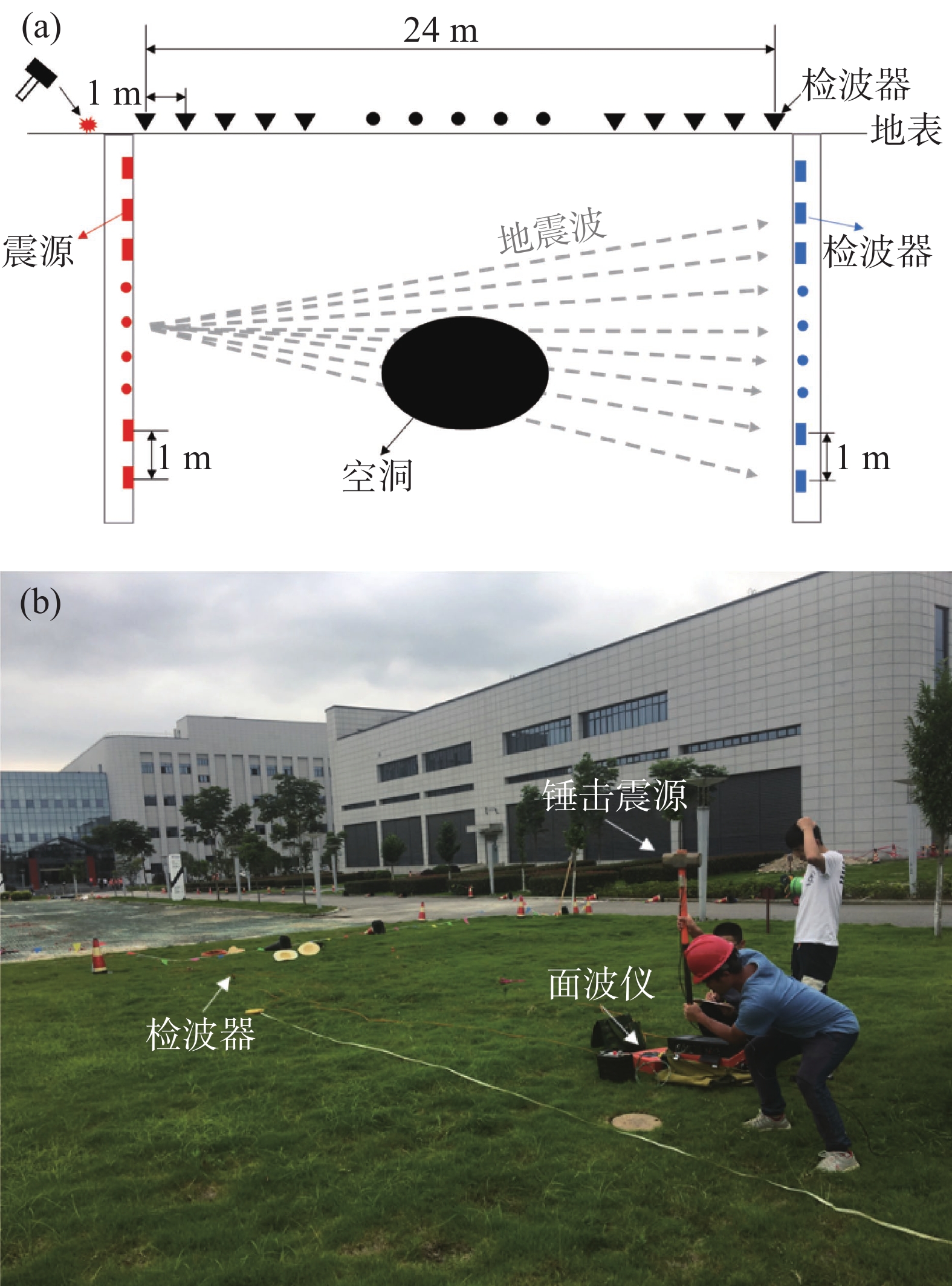
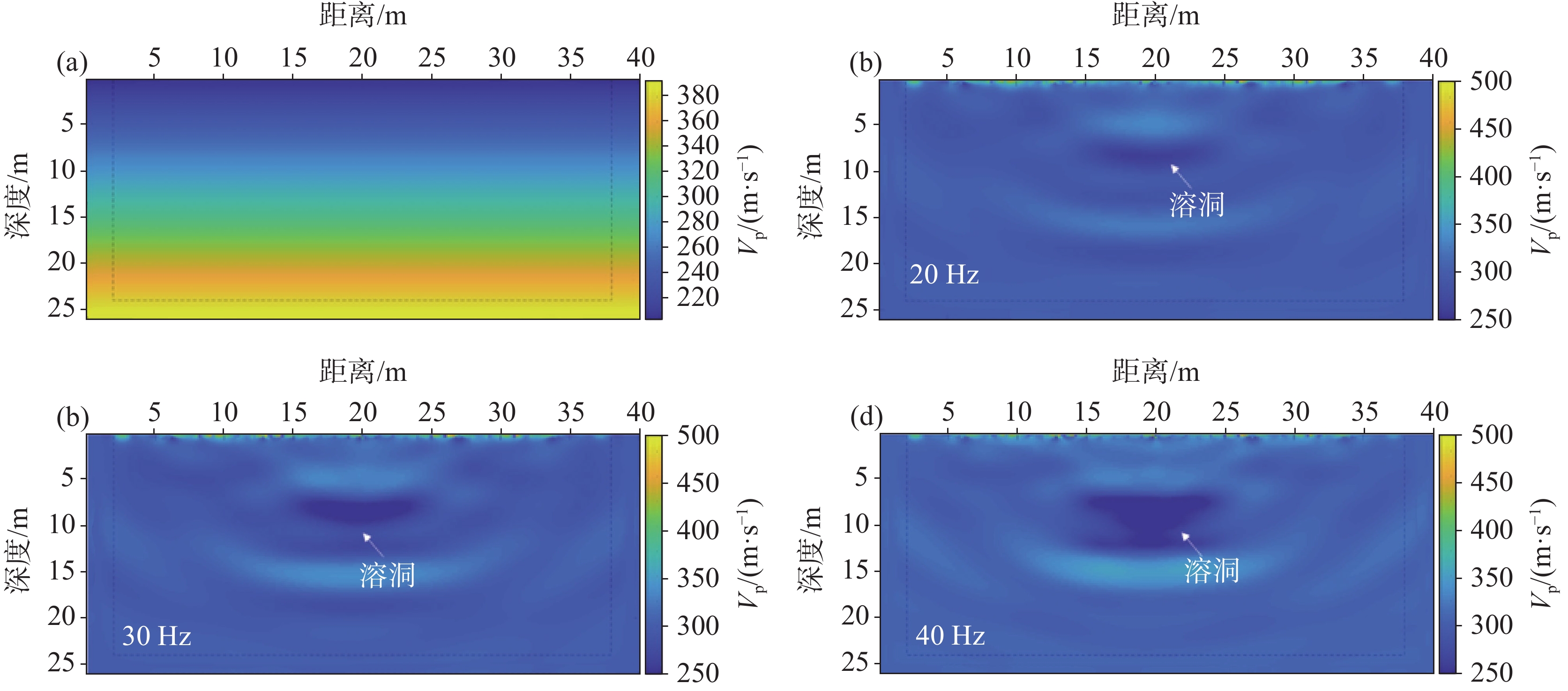
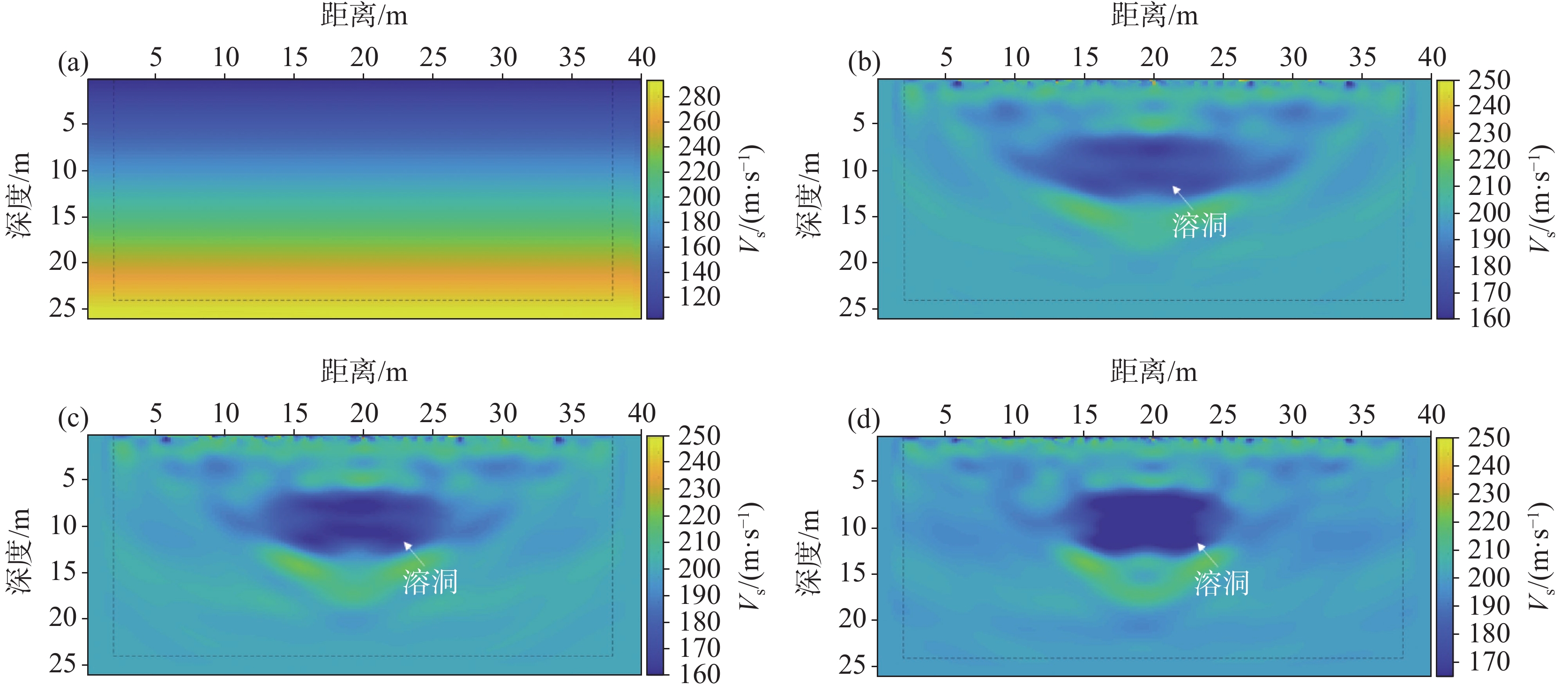
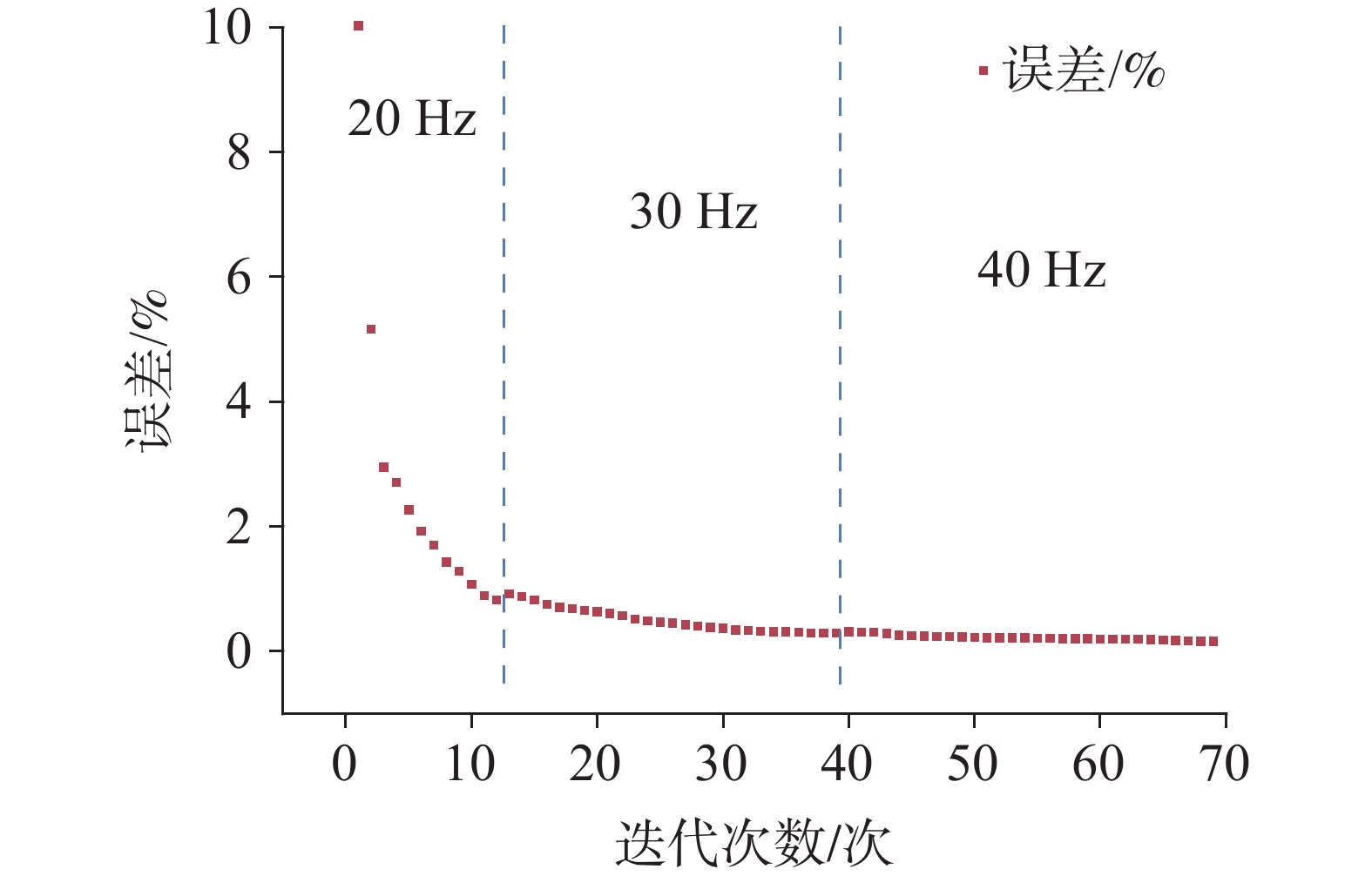
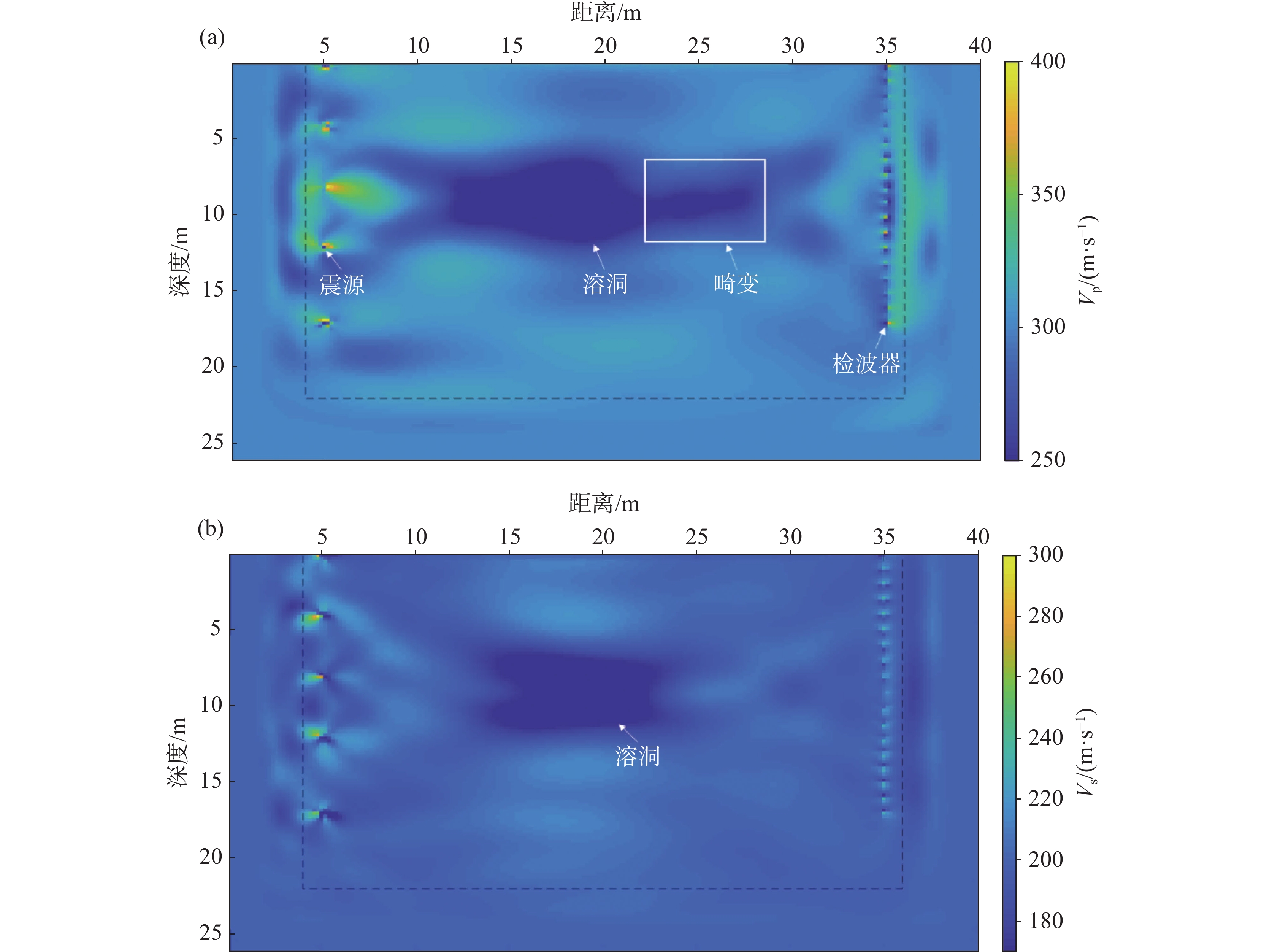
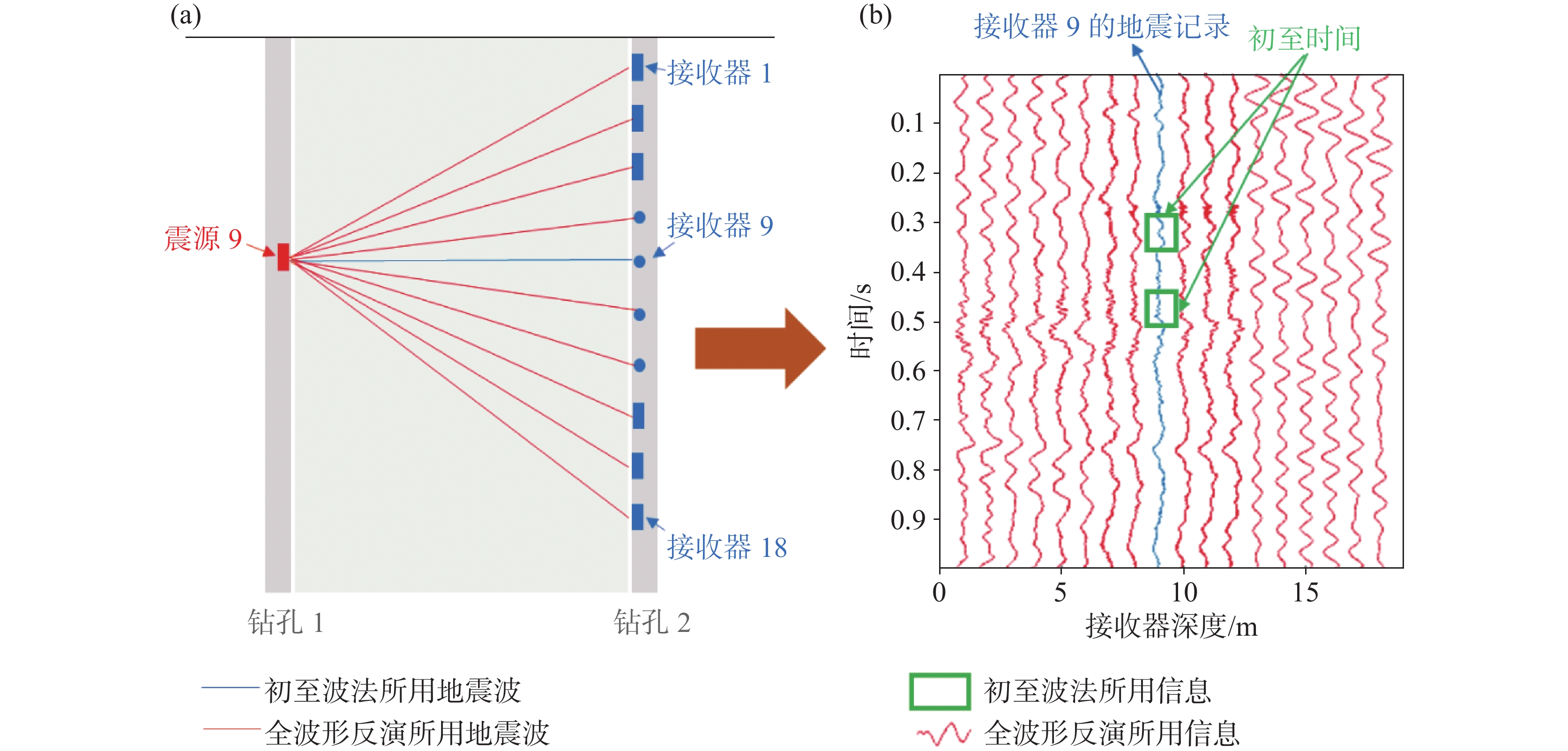
The geological development of karst areas is highly complex, and accurately detecting underground karst caves presents a significant technical challenge to ensure the safety of construction projects. Karst features, including underground caves and subterranean rivers, are widely distributed across China. Characterized by high concealment and spatial randomness, these geological structures are highly prone to inducing disasters such as ground collapse and water or mud inrush. While traditional geophysical methods are effective at certain depths, they tend to rely heavily on wave velocity parameters but underutilize waveform information, such as amplitude and phase. These results in significant errors in identifying cave boundaries and a high rate of missed detections.To enhance detection accuracy, this study proposes a combined approach that integrates the surface wave method with the cross-hole elastic wave method and introduces full waveform inversion imaging technology to create a comprehensive detection system. The surface wave method is cost-effective and suitable for rapid surveys, though its interpretation is significantly affected by surface heterogeneity. The cross-hole elastic wave method, while effective in minimizing shallow interference by utilizing hole-based excitation and reception, offers superior resolution at greater depths but incurs higher costs and requires pre-drilling.Full waveform inversion technology utilizes all available waveform information-such as wave velocity, amplitude, and phase-based on numerical inversion of the wave equation. It overcomes the limitations of the traditional horizontal layered medium assumption, significantly improving the accuracy of karst cave boundary identification. A field test conducted in a karst area in Guizhou adopted a joint observation approach, yielding promising results. Full waveform inversion clearly delineated the spatial distribution of karst caves (depth of 6 to 12 m, lateral range from 15 to 25 m), with imaging resolution far surpassing that of first arrival wave analysis and Synchronous Iterative Reconstruction Technology (SIRT). A serial inversion strategy, progressing from low to high frequencies, effectively suppressed noise and ensured stable convergence to the global optimum. The conjugate gradient iterative algorithm was used for inversion, with an attenuation boundary width set at 2 m, a grid size of 0.2 m × 0.2 m, and serial optimization divided into three stages at 20 Hz, 30 Hz, and 40 Hz. The error decreased progressively with increasing iterations, demonstrating the method's numerical stability and convergence.The results further highlight that joint inversion of P-wave and S-wave data offers mutual verification, with a high degree of consistency in identifying the anomaly locations. The boundary of the S-wave inversion result was clearer, in contrast to the first arrival wave method, which only provides a one-dimensional wave velocity curve. SIRT reconstruction, on the other hand, is prone to boundary ambiguities and geometric distortion. In comparison to traditional methods that rely solely on first arrival travel time, full waveform inversion leverages the dynamic characteristics of the wave field, significantly enhancing the ability to identify small anomalous bodies and complex boundaries.Additionally, comparing the inversion results from the surface wave and cross-hole elastic wave methods reveals good consistency in identifying the main forms of the karst caves. However, cross-hole data provided more reliable deep structural details, whereas surface wave inversion exhibited local false anomalies due to shallow inhomogeneities. This underscores the importance of the combined surface and hole-based observation method. The fusion of these methods maximizes the complementary strengths of the surface wave method's efficiency and the cross-hole method's detailed depth resolution, offering a high-reliability, adaptable technical solution for engineering geological surveys in complex karst environments, with substantial engineering application value.
Application of integrated geophysical exploration methods for target area selection in the geothermal field of Xianxian county
REN Xiaoqing, GAO Xiaorong, XU Yong, LIU Jian, WANG Hao, SUN Caixia, LU Xingchen, ZHENG Ruosi, SONG Xianlong, CHEN Chong
2026, 45(2): 352-367. doi: 10.11932/karst2026y002
Abstract:
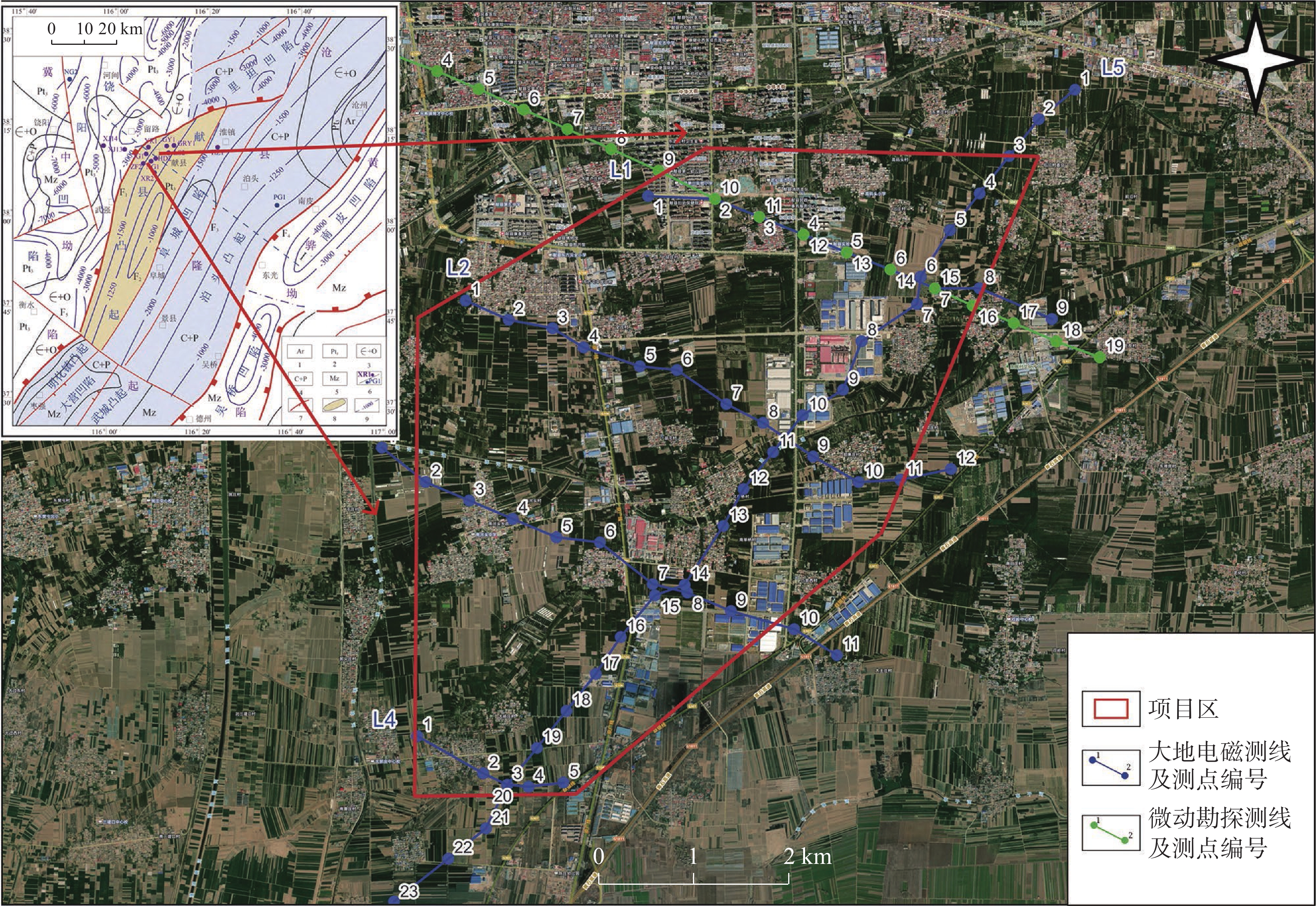
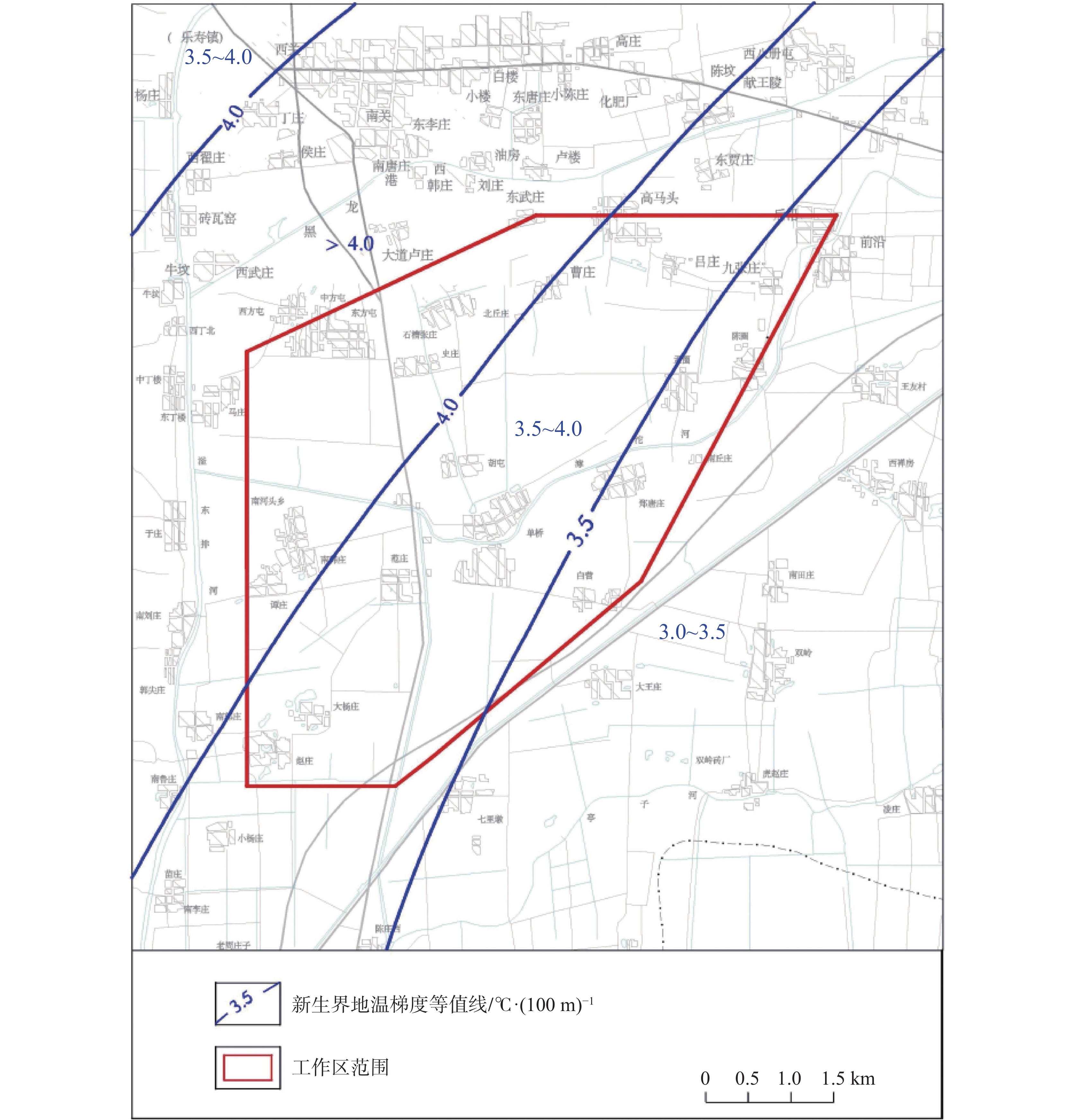
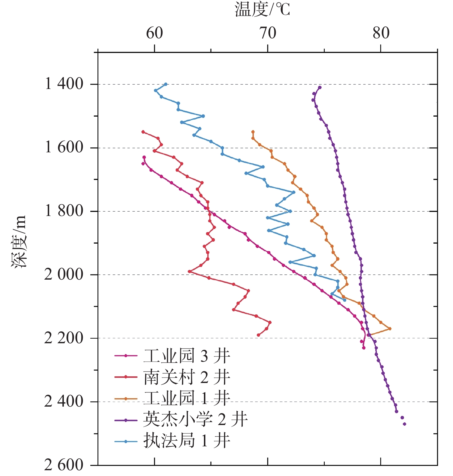
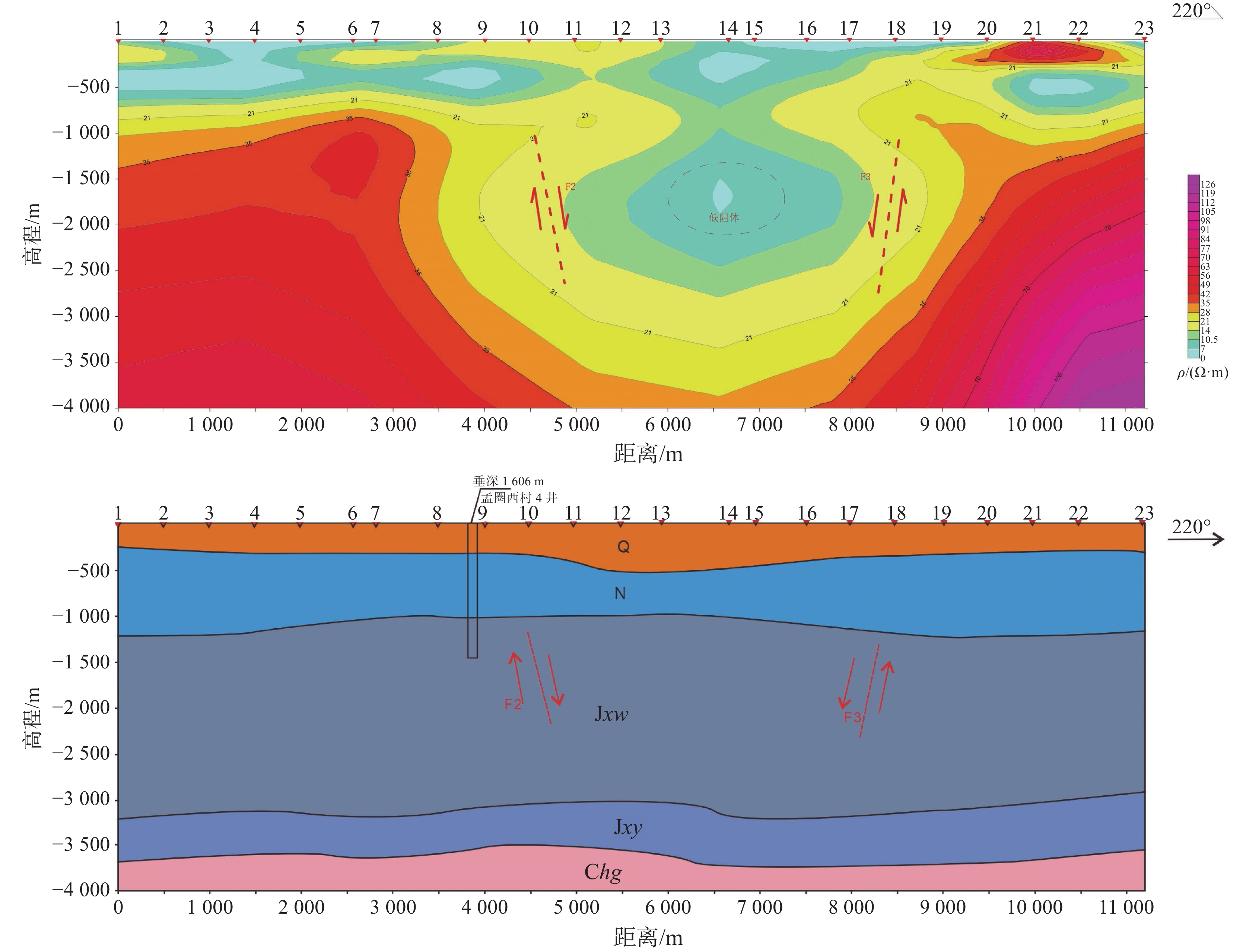
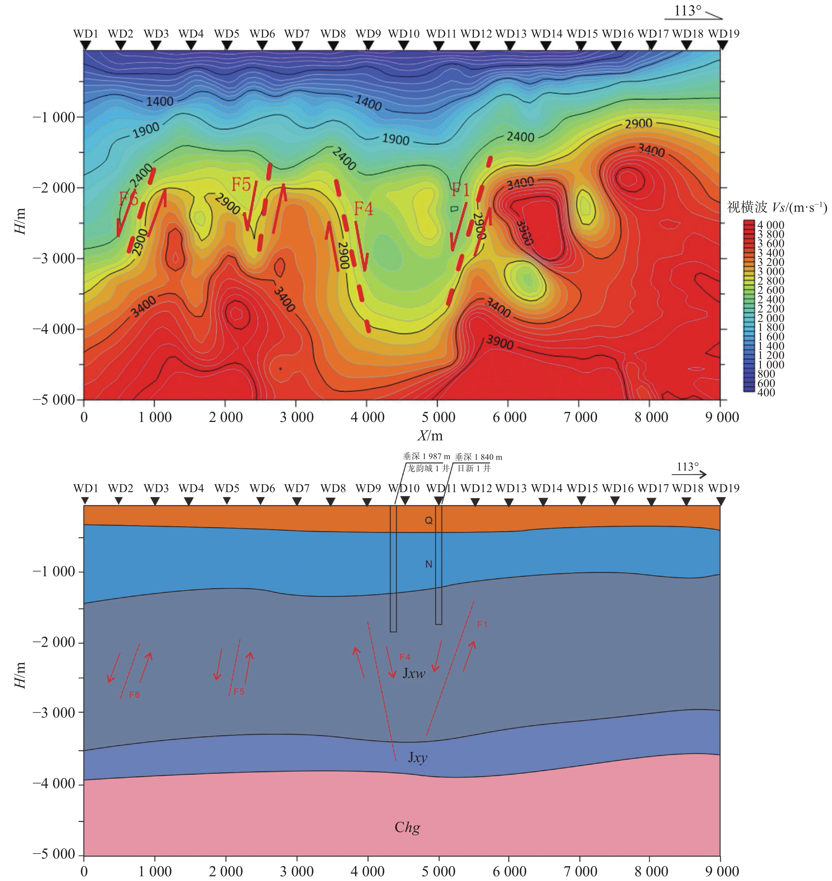
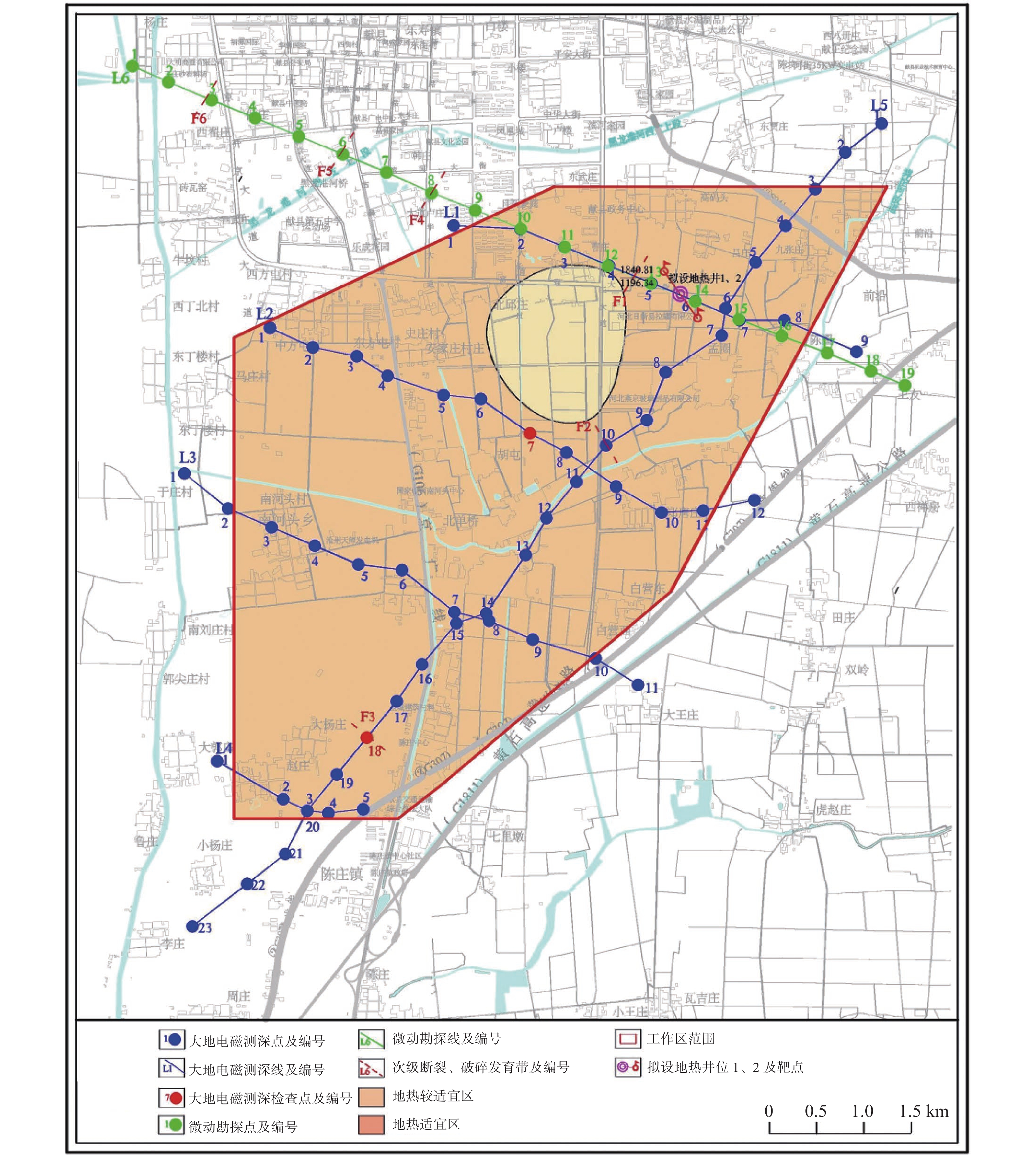
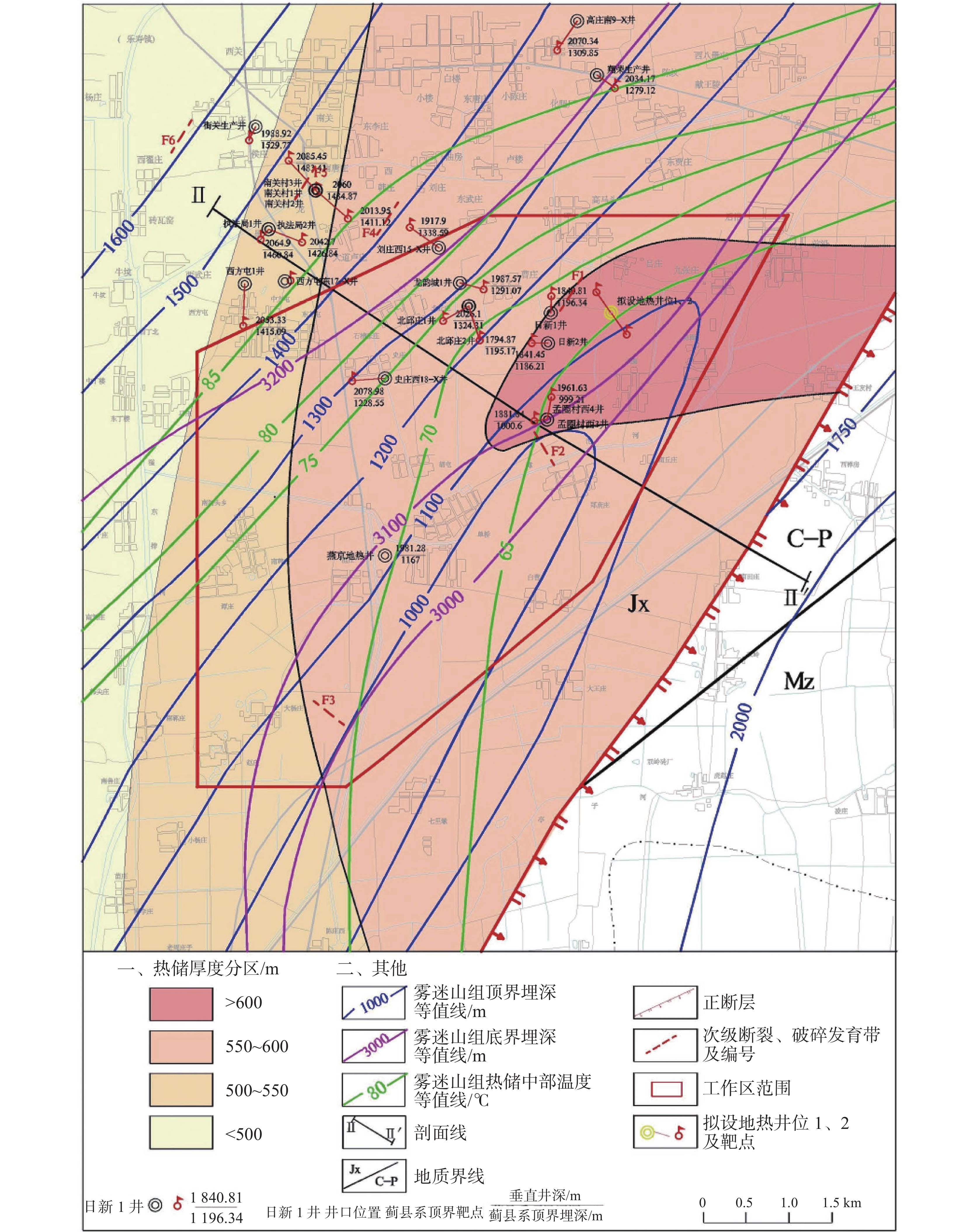
Xianxian county is recognized as "the largest geothermal enrichment area in North China," boasting abundant medium- and low-temperature geothermal resources. To address the limited understanding of deep geothermal resource distribution and the development of heat-controlling structures in the southeastern block of Xianxian county, and to support the large-scale development of bedrock fracture-type thermal reservoirs, this study employed an integrated geophysical exploration approach combining the magnetotelluric (MT) method and microtremor surveys. It involved the exploration and interpretation of stratigraphic, fault, and thermal reservoir characteristics in the study area, with the reliability of the results verified using drilling data.The study area is located in the northern part of the Xianxian uplift in the Cangxian uplift, within the Bohai Bay Basin. Within a depth of 4,000 m, the stratigraphic sequence from top to bottom includes the Cenozoic, Mesozoic, Paleozoic, and Middle-Upper Proterozoic Erathems. For fieldwork, five MT profiles were deployed, totaling 28.67 km in length with 60 survey points. A V8 electrical instrument recorded orthogonal electromagnetic field components, and electrical structures were derived through multi-method inversion techniques, including 1D Bostick, 2D RRI, and 2D Occam. For microtremor surveys, one profile was established, measuring 8.54 km with 19 survey points. An EPS-D10 broadband seismograph was used to extract Rayleigh wave dispersion curves, which were then inverted to determine the underground shear wave velocity structure. The two methods constrained each other to reduce geophysical non-uniqueness. The results show: (1) Six secondary faults and fractured zones were identified, mainly distributed in the northwest of the study area. Well-developed fractures around fault zones provide channels for geothermal fluid migration, making them key targets for drilling. (2) Burial depths of the top and bottom boundaries of major strata were clarified: the bottom boundary of the Quaternary system (Cenozoic) ranges from 415 to 471 m; the bottom boundary of the Neogene system ranges from 980 to 1420 m; and the top boundary of the Wumishan formation (Jixian system, middle-upper Proterozoic) ranges from 980 to 1,430 m. The strata exhibit a pattern of deeper burial in the northwest and shallower burial in the southeast. (3) Geothermal gradient characteristics were revealed: the highest heating rates occur in the Cenozoic and Mesozoic strata, with the Cenozoic geothermal gradient ranging from 3.5 to 4.0 ℃·(100m)−1; upon entering the middle-upper Proterozoic basement, the heating rate decreases with bedrock geothermal gradients ranging from 1.0 to1.5 ℃·(100m)−1. The temperature in the middle of the Wumishan formation thermal reservoir is 70 to 80 ℃, gradually decreasing from northwest to southeast. (4) Suitable and relatively suitable geothermal mining areas were delineated. Karst-fracture thermal reservoirs of the Jixian system (middle-upper Proterozoic) are distributed throughout the area, with thermal reservoir thickness of 500 to 600 m, water inflow rates of 57 to 140.19 m3·h−1, and specific water inflow rates of 0.27 to 8.67 m3·(h·m)−1. Verification through Exploration-Production Well 1 in southeastern Xianxian county (well depth: 2,508 m; water temperature: 70 ℃; water inflow: 100 m3·h−1) shows high consistency between geophysically interpreted stratigraphic sequences and burial depths and actual drilling data.This study confirms that the combined application of MT and microtremor methods effectively characterizes geothermal geological structures, providing technical support for the scientific development of Xianxian country's geothermal resources and the achievement of regional "dual carbon" goals.
Application of comprehensive detection techniques in leakage analysis of karst reservoirs
FAN Hongwei, YANG Xingyu, ZHOU Huoming, GUO Xifeng, HUANG Qibo
2026, 45(2): 368-379. doi: 10.11932/karst20260206
Abstract:
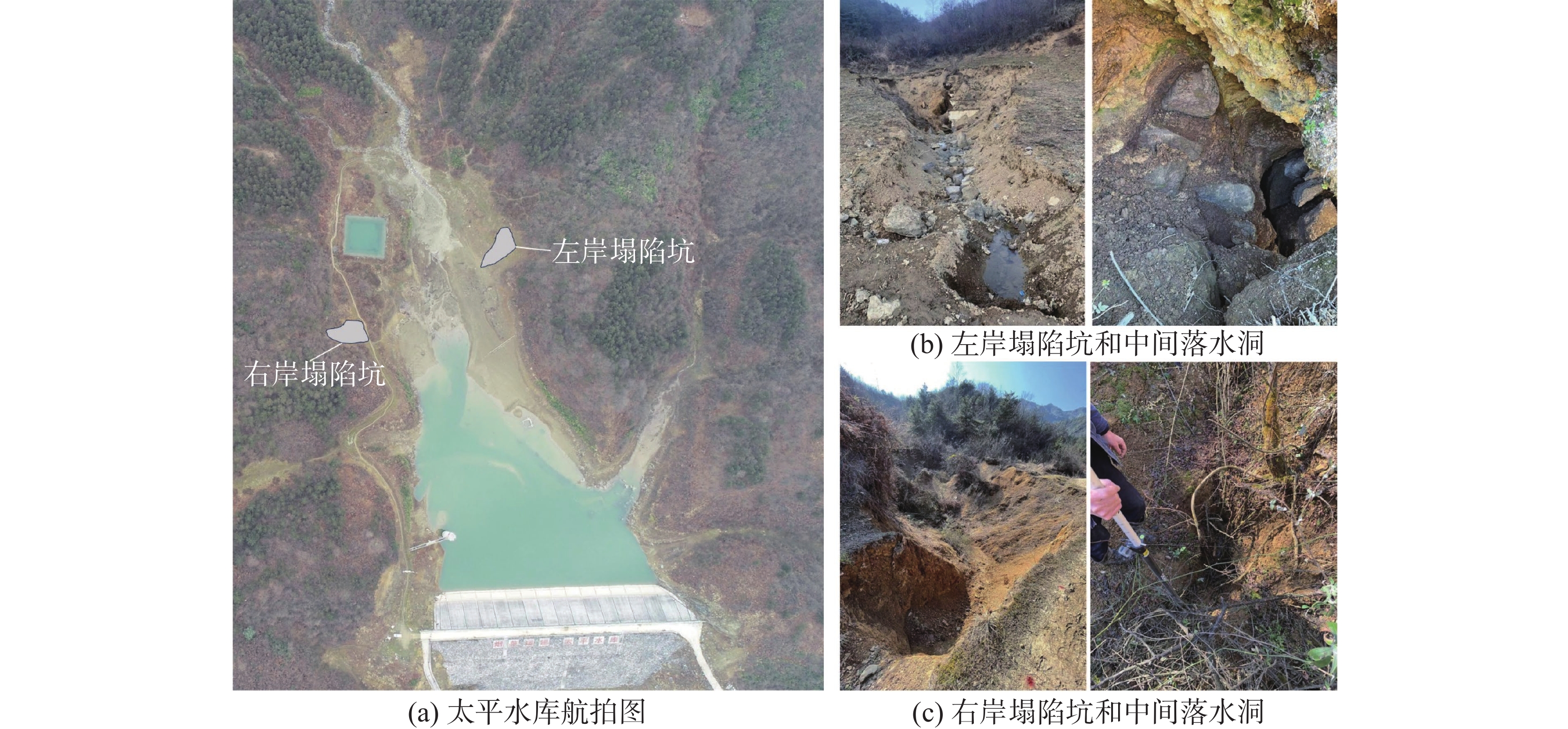
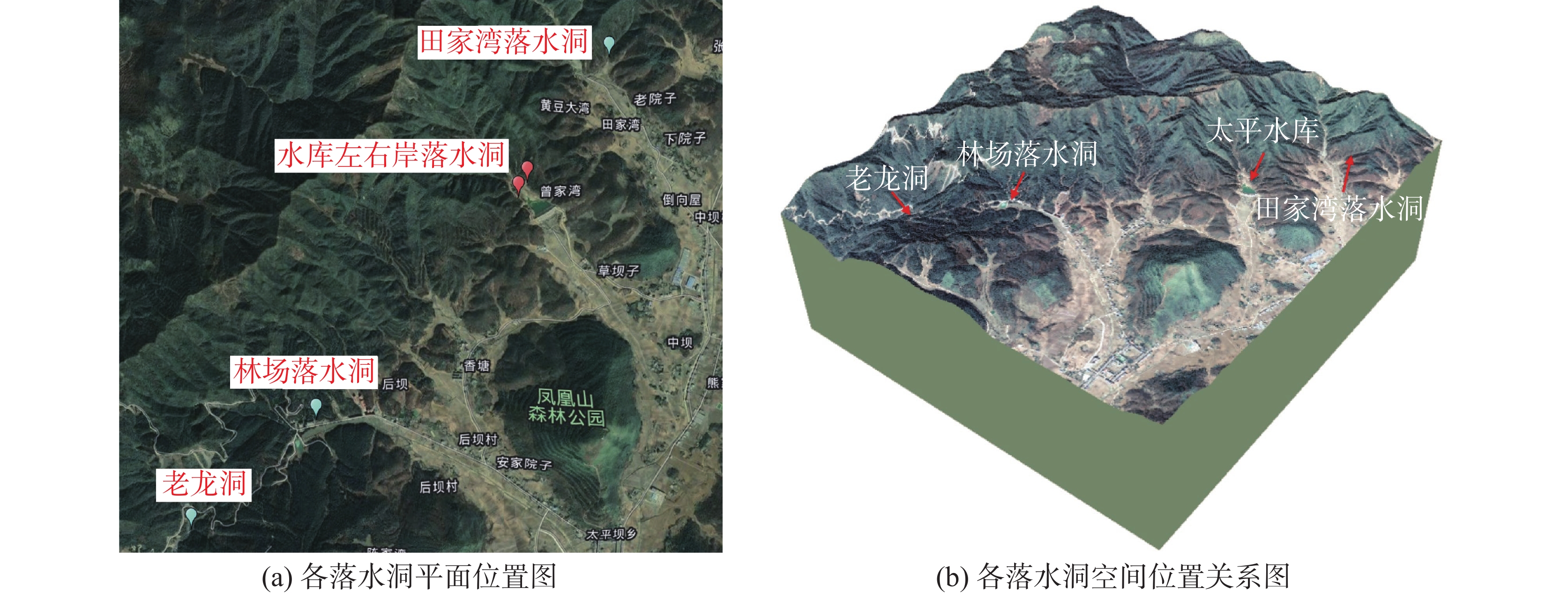
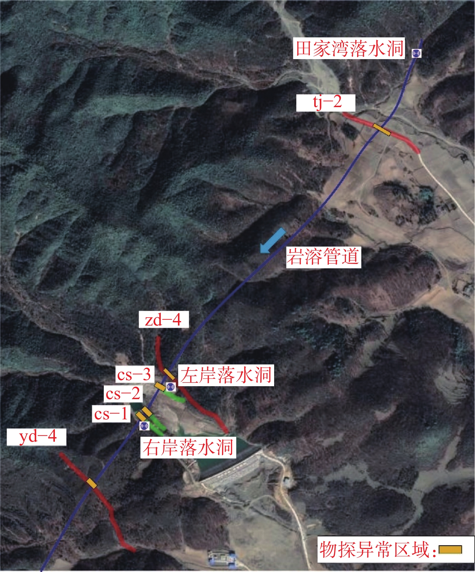
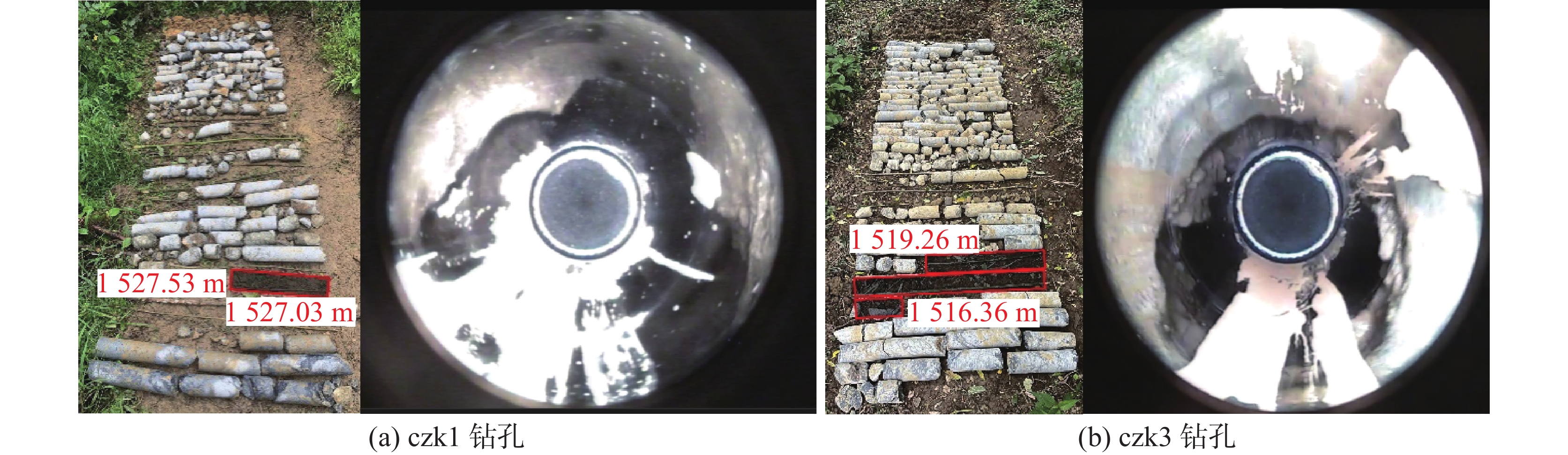
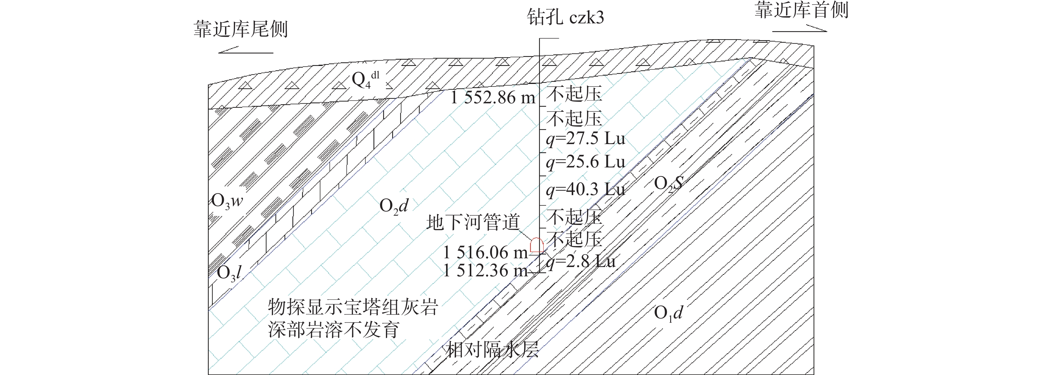
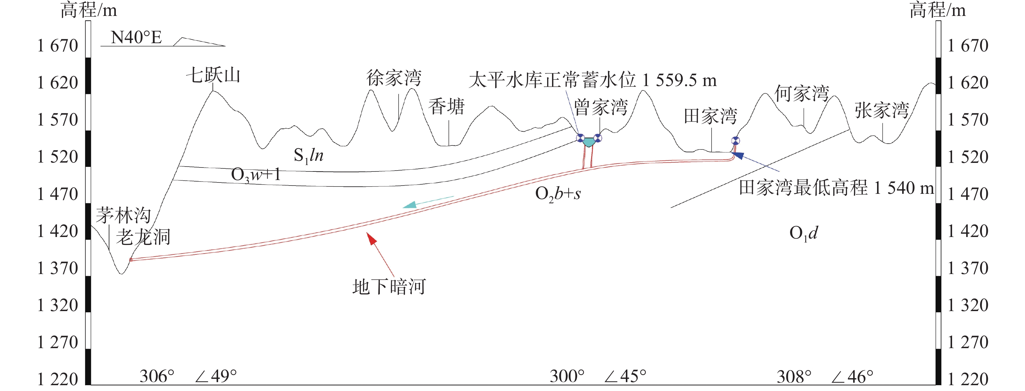
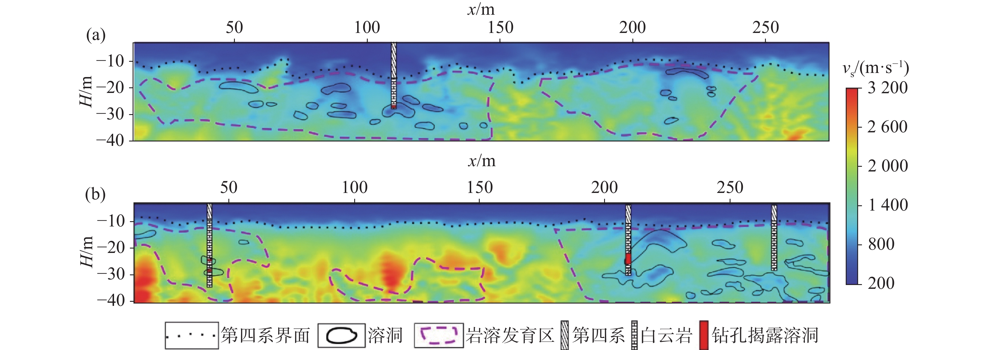
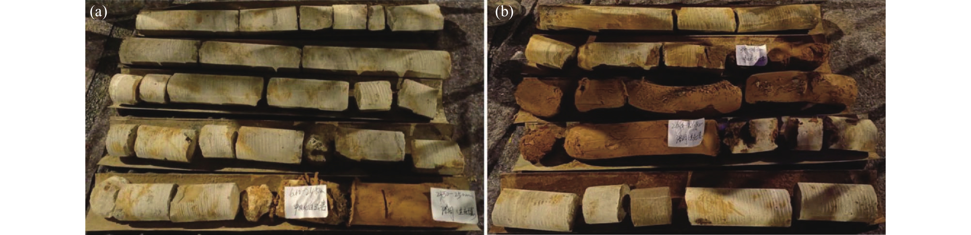
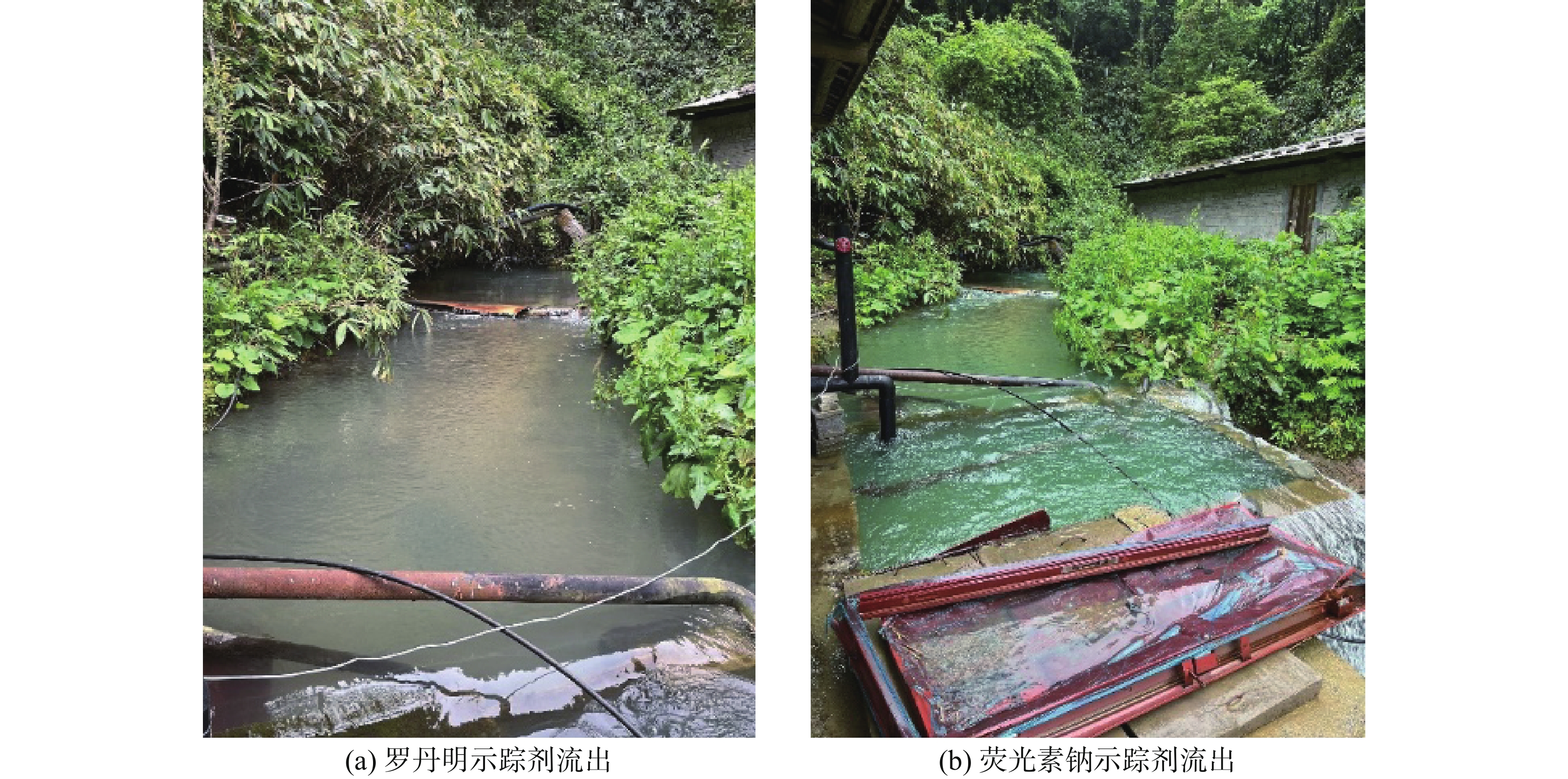
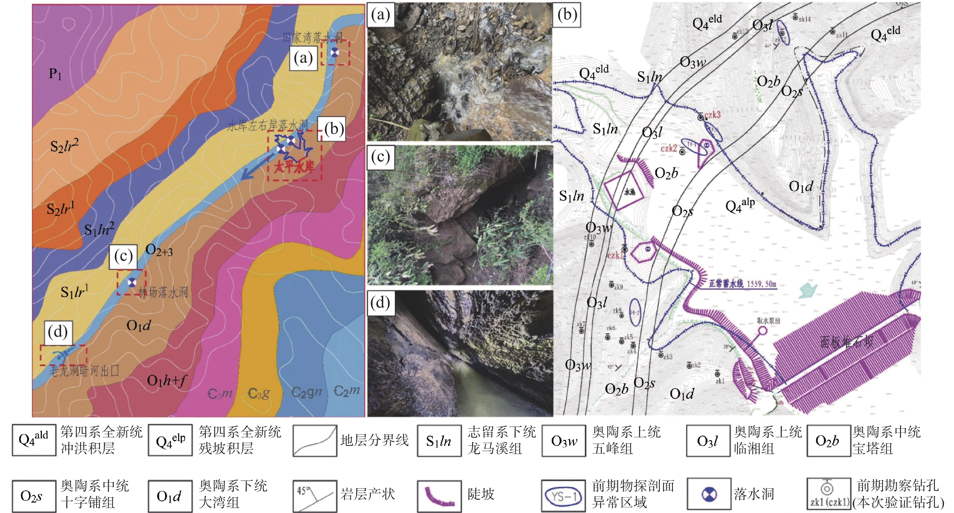
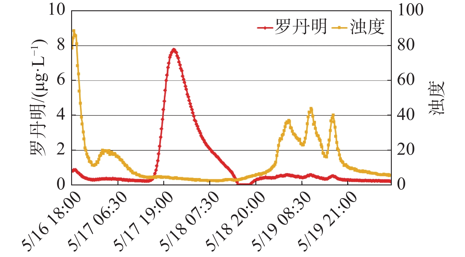
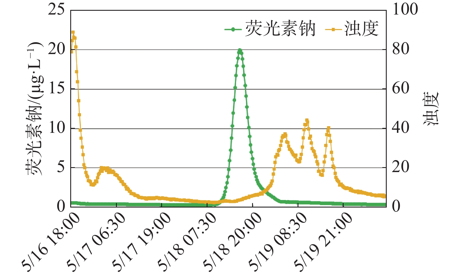
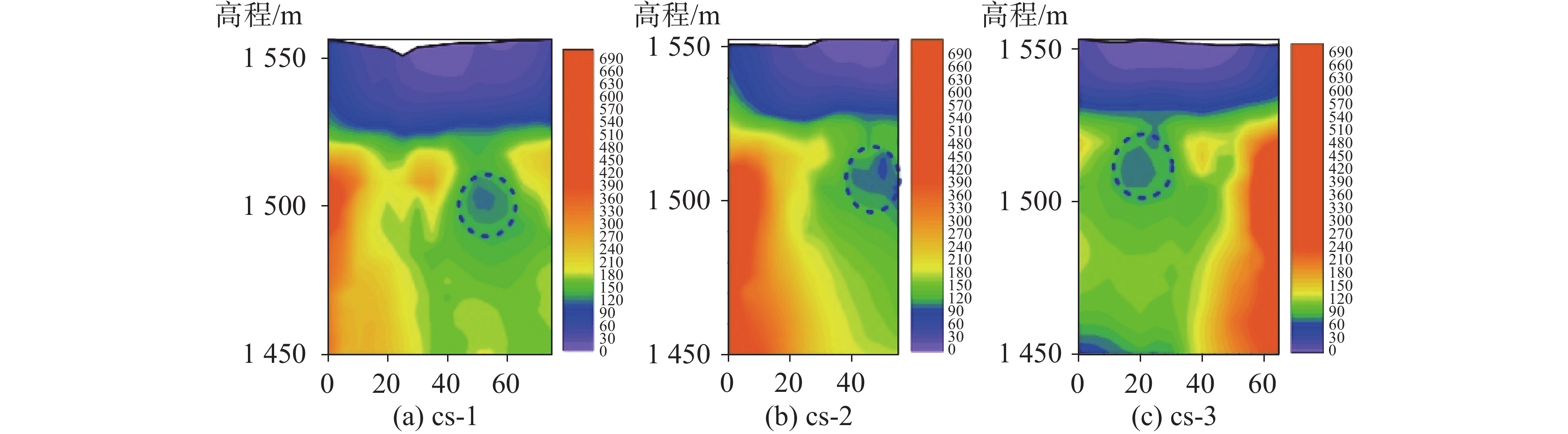
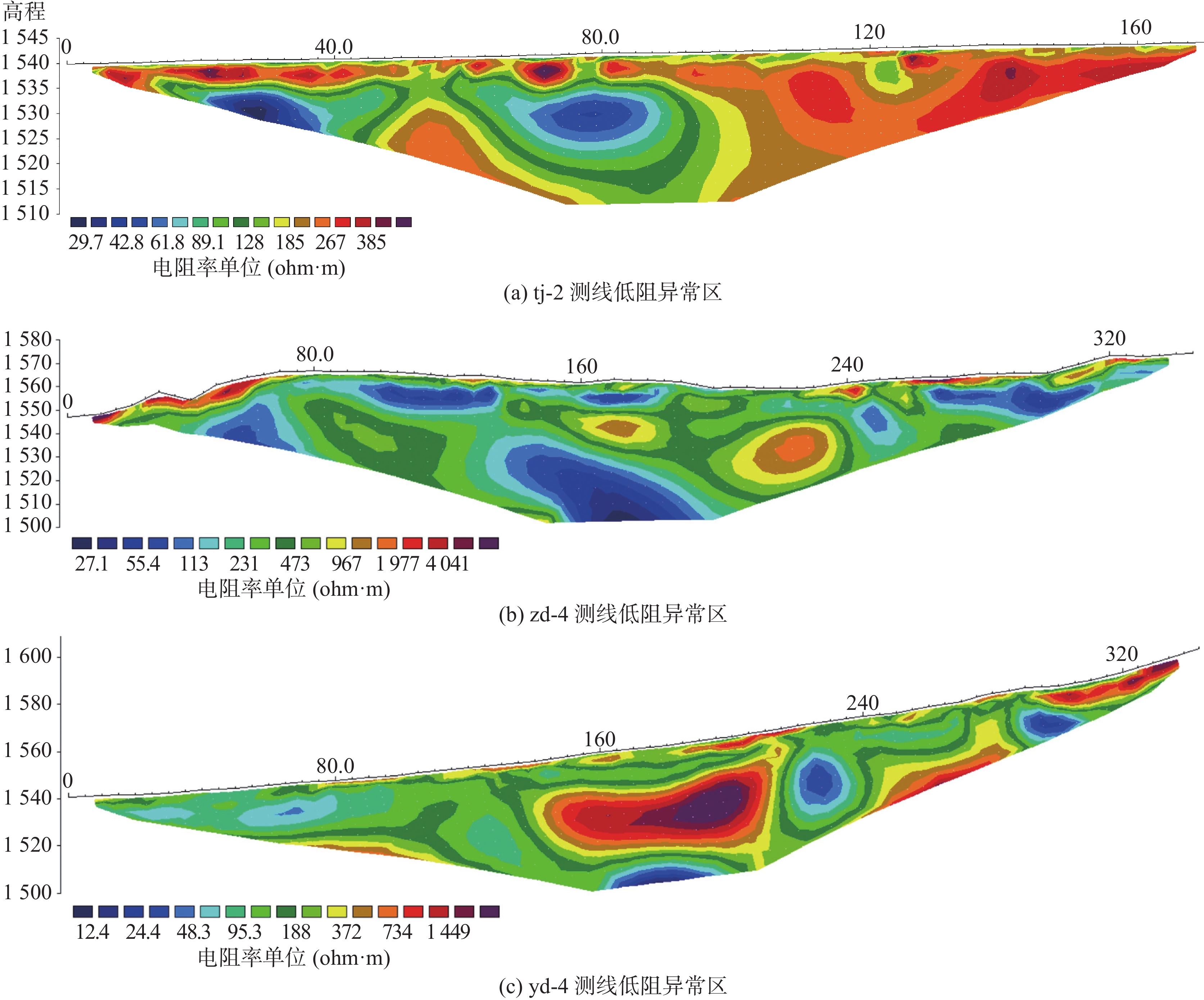
The reservoir is located in Fengdu county, Chongqing Municipality. After impoundment, karst collapses occurred successively on both the left and right banks at the reservoir tail. Reservoir water rapidly leaked through sinkholes within the collapse pits, causing a sharp decline in the water level and severely impacting normal functioning of the reservoir.To identify the cause and characteristics of the leakage, this study employed a combination of regional karst hydrogeological surveys, geophysical exploration, and geological drilling techniques to systematically investigate the leakage problem at the reservoir tail. The following new insights were obtained: (1) Regional karst hydrogeological surveys indicate the presence of a NE–SW trending limestone belt of the middle Ordovician Baota formation (O2b) traversing the reservoir tail. Karst development is highly pronounced within this layer, commonly featuring solution fissures, caves, and conduits. Field surveys identified multiple sinkholes distributed in a bead-like pattern along the strike of this limestone formation. Tracer tests confirmed the existence of an underground river flowing through the reservoir in a NE–SW direction, with its outlet at Laolong cave, located 3.2 km southwest of the reservoir. The longitudinal gradient of this underground river system is steep, with a vertical drop of approximately 130 m. The development of various karst features at the reservoir tail and the direction of groundwater flow are both influenced by this underground river system. Reservoir impoundment induced the collapses of sinkholes on both banks, allowing reservoir water to directly access into the underground river and discharge at Laolong cave. This has been identified as the fundamental cause of the sudden drop in the reservoir water level. (2) Controlled Source Audio-Frequency Magnetotellurics (CSAMT) and the High-Density Resistivity (HDR) method were selected as geophysical exploration techniques to characterize the spatial distribution of the underground river. These two methods complemented and mutually validated each other's findings. Three CSAMT survey lines were deployed. The results revealed a relatively enclosed low-resistivity zone extending from the left bank to the right bank, with elevations ranging from 1,510 m to 1,500 m, showing a gradual decrease in elevation from left to right. Additionally, three HDR survey lines were conducted. The results indicated underground river elevations of approximately 1,530 m at the low adjacent valley on the left bank, approximately 1,515 m at the left bank of the reservoir, and approximately 1,500 m at survey line yd-4 on the right bank mountain. The gradient of the karst conduit within the reservoir area is inferred to be 1.5% to 2.0%. The alignment of anomalous zones identified by both methods generally follows a NE–SW direction, consistent with the bedrock strike. Furthermore, the elevation of these anomalous zones gradually decreases from the left bank to the right bank, further confirming that the underground river primarily develops along the bedrock strike, flowing from NE to SW. (3) Geological boreholes were drilled based on geophysical anomalies. These boreholes revealed significant vertical karst development within the Baota formation limestone at the reservoir tail. Borehole CZK1 intersected a karst cave; the elevated position of this conduit and its proximity to a sinkhole on the right bank suggest that it is a branch conduit connecting the right bank sinkhole to the underground river. Borehole CZK3 encountered a cavity nearly three-meter high, located near the bottom of the Baota formation limestone at elevations between 1,519.26 m and 1,516.36 m. Water level monitoring in the boreholes indicated shallow water levels within the conduits and significant silt accumulation, supporting the interpretation that this feature represents the underground river karst conduit. (4) Based on integrated geophysical exploration and geological drilling, the elevation of the karst conduit floor of the underground river in the reservoir area ranges from 1,516.36 m on the left bank to 1,513.36 m on the right bank. The estimated conduit dimensions are approximately 2.7 m in width and 2.9 m in height. Near the reservoir head and surrounding areas, the Shizipu formation (O2s) serves as a relatively impermeable layer. On the left bank, the underground river conduit near the reservoir tail passes through the Baota Formation limestone, where the burial depth of the relatively impermeable layer increases closer to the tail. Weakly karstified rock masses on this side act as the lower impermeability boundary. The recommended anti-seepage floor elevation for the left bank is approximately 1,516.0 m. (5) During the investigation phase of karst reservoirs, comprehensive regional karst hydrogeological surveys must be conducted to accurately characterize groundwater flow paths. Only through this approach can the impoundment conditions of the reservoir be clearly understood. In reservoir leakage investigations, relying solely on a single geophysical method or a single borehole to identify leakage pathways and directions is suggested be avoided.This study has elucidated the causes, pathways, and key channel characteristics of leakage at the reservoir. The findings provide a direct foundation for the subsequent design of anti-seepage engineering measures for this reservoir and offer valuable reference for the detection and prevention of similar leakage issues in reservoirs located in karst regions.

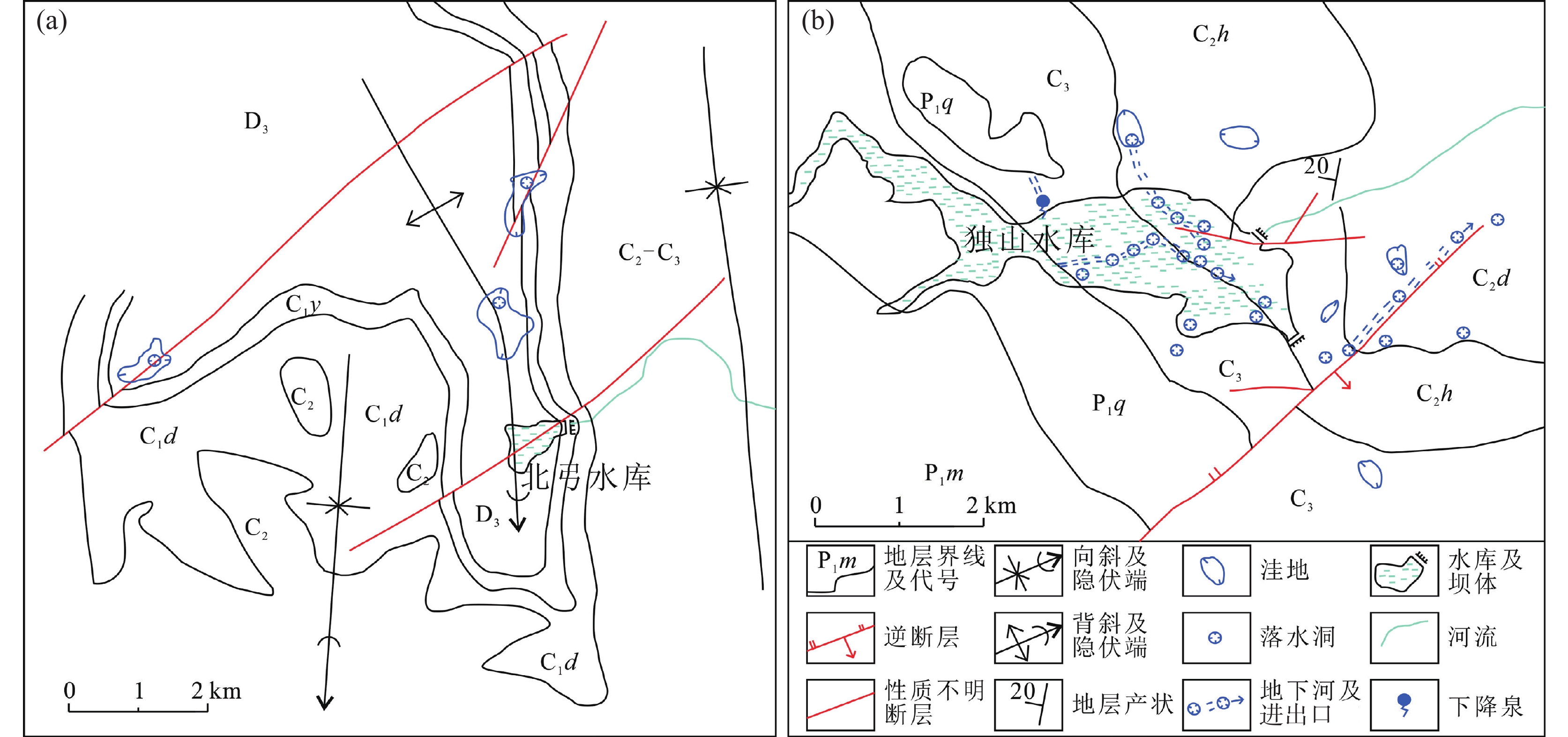
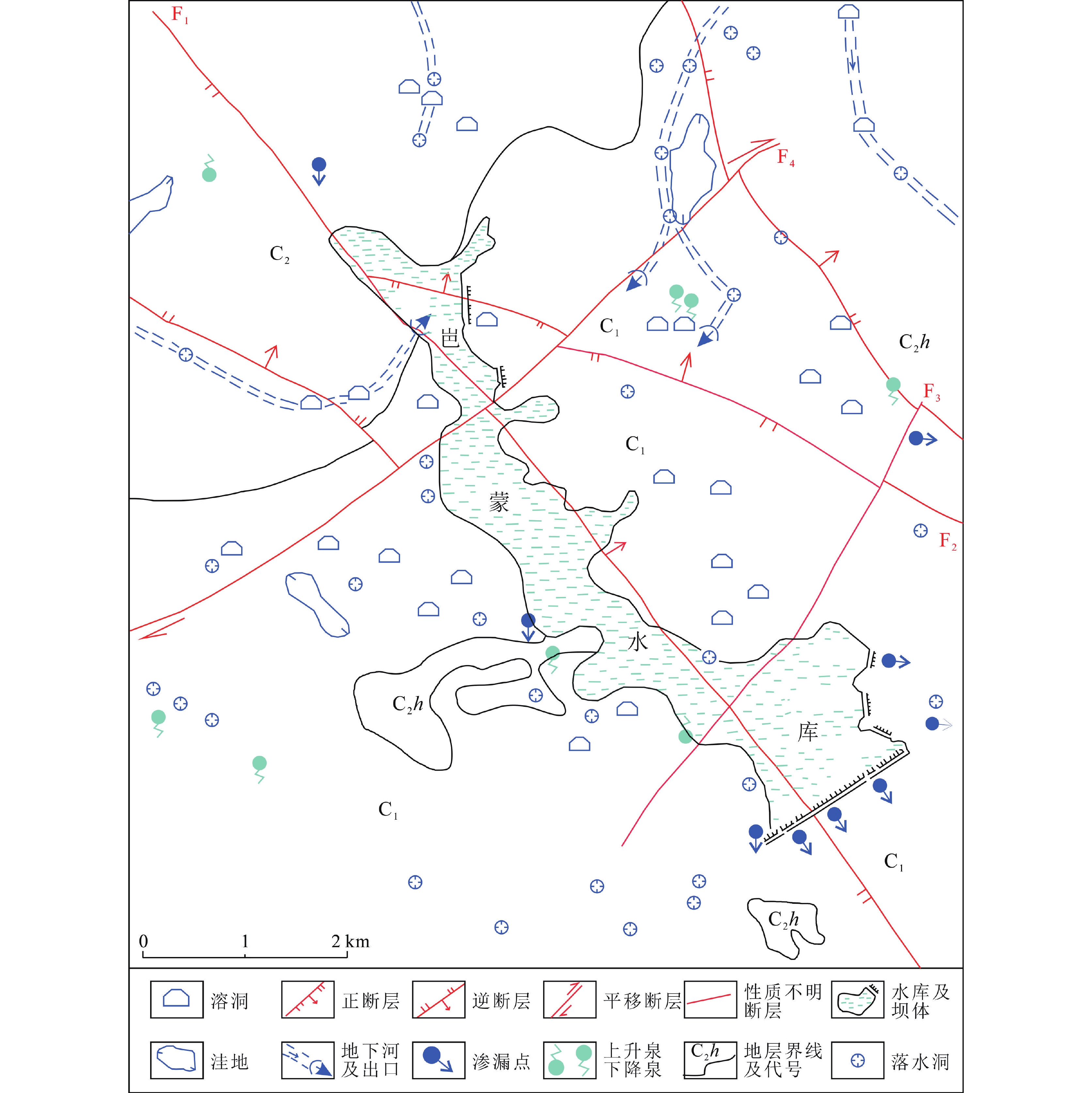
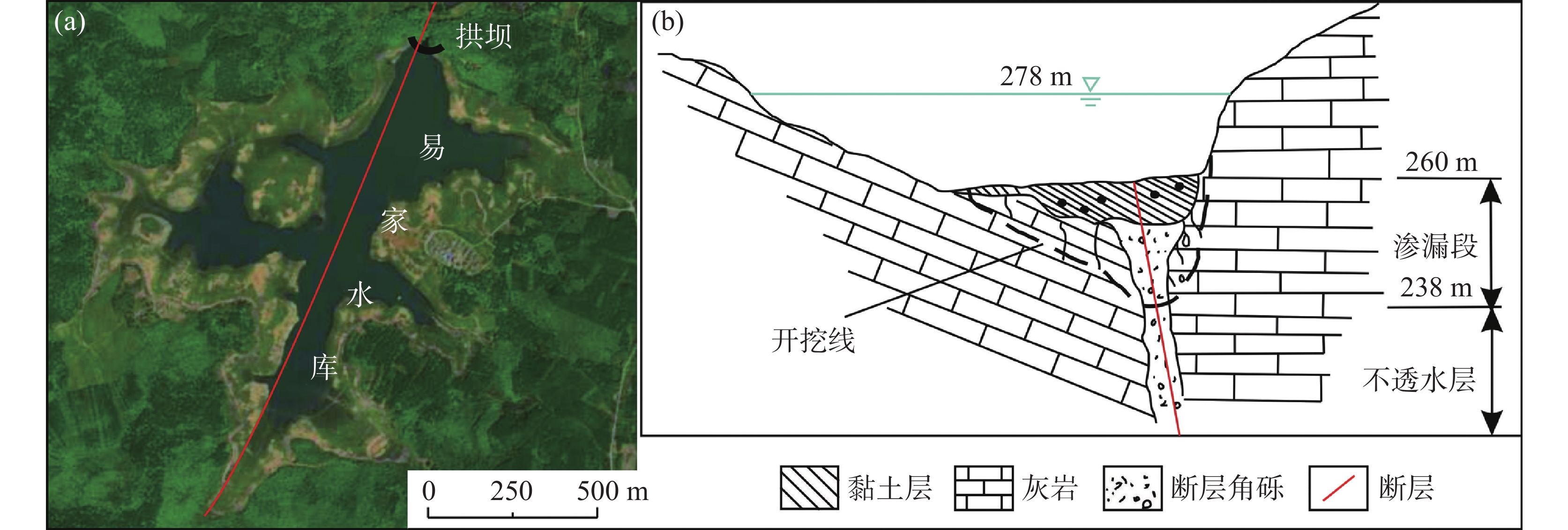
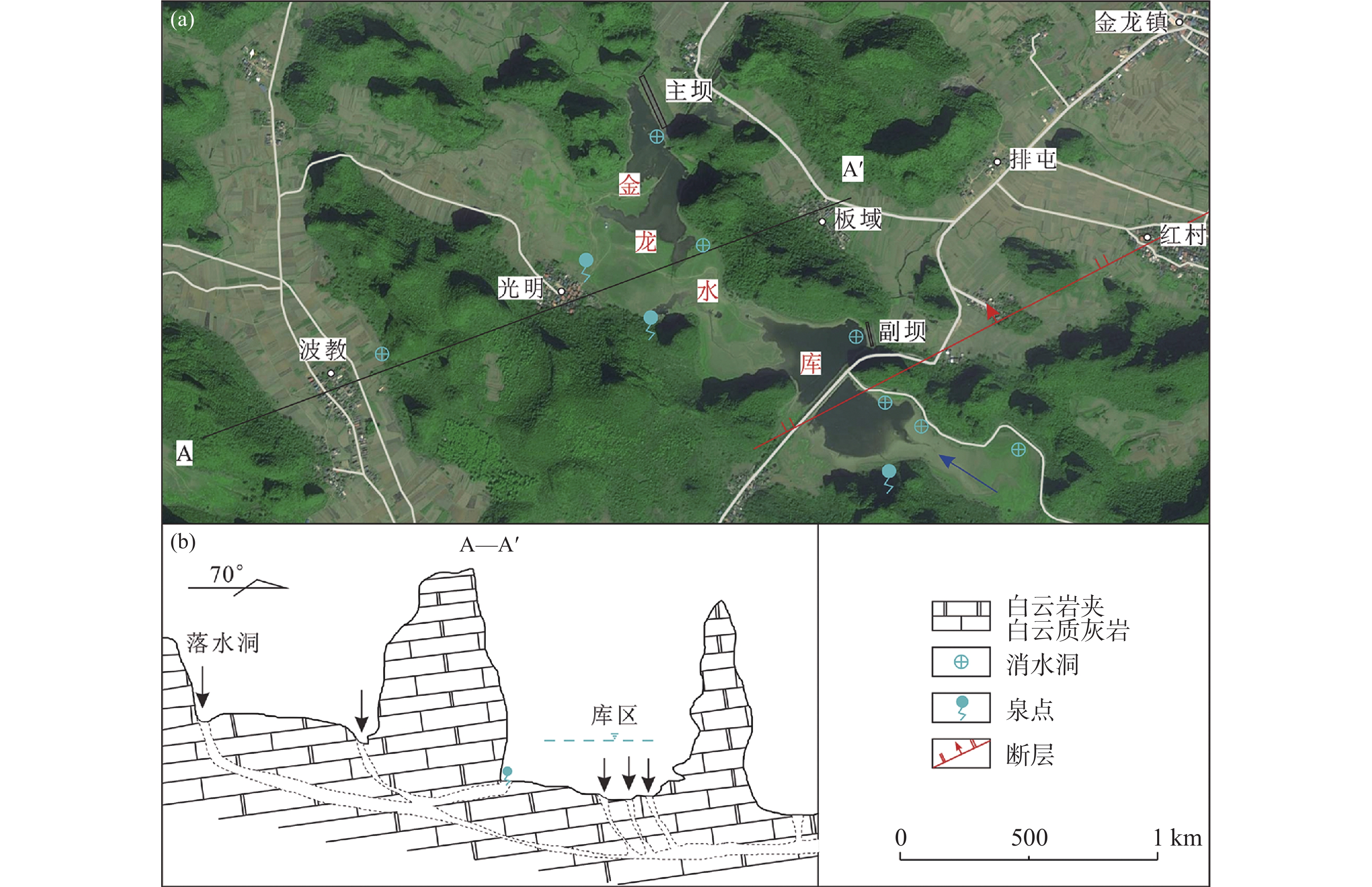
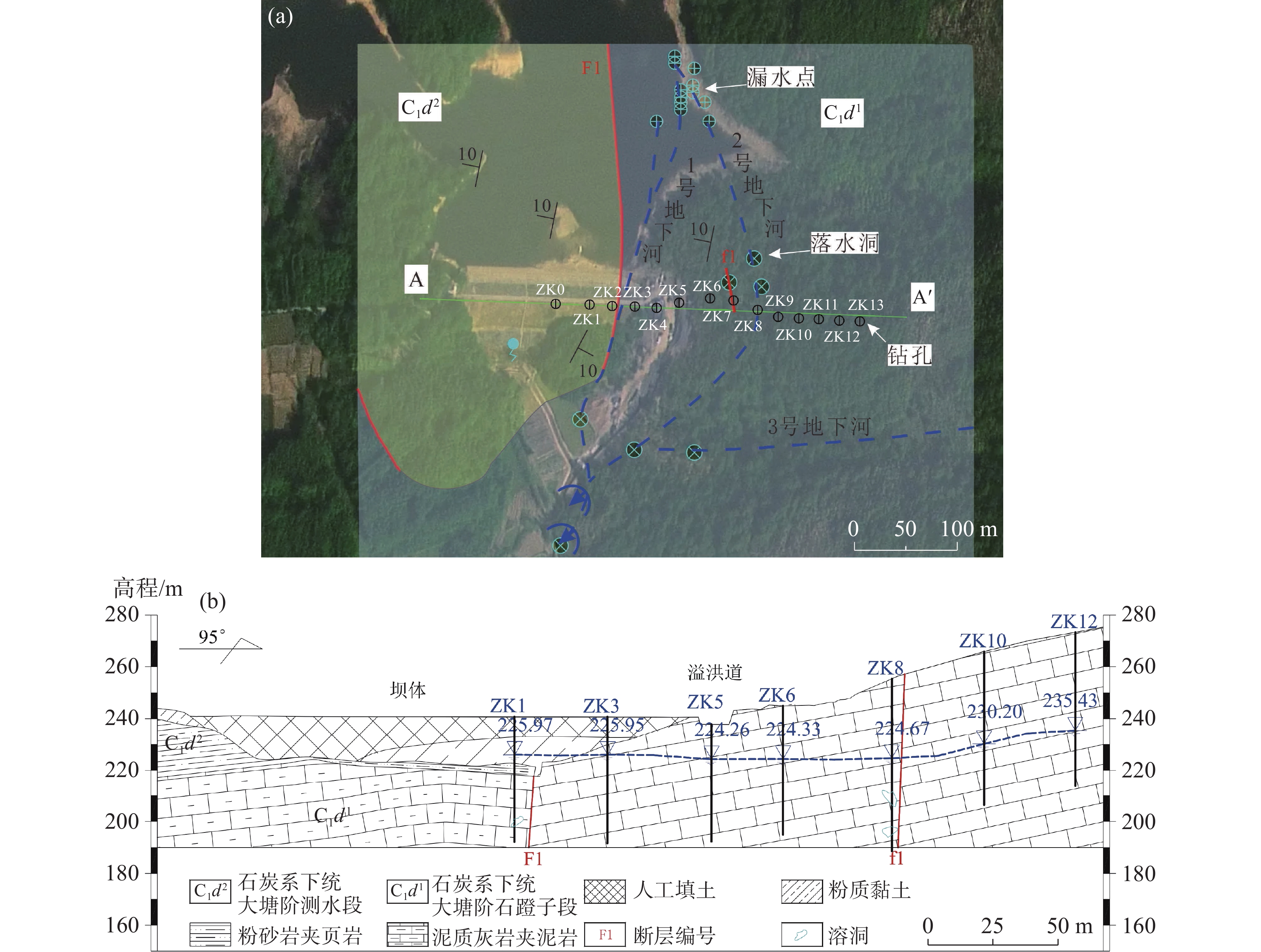
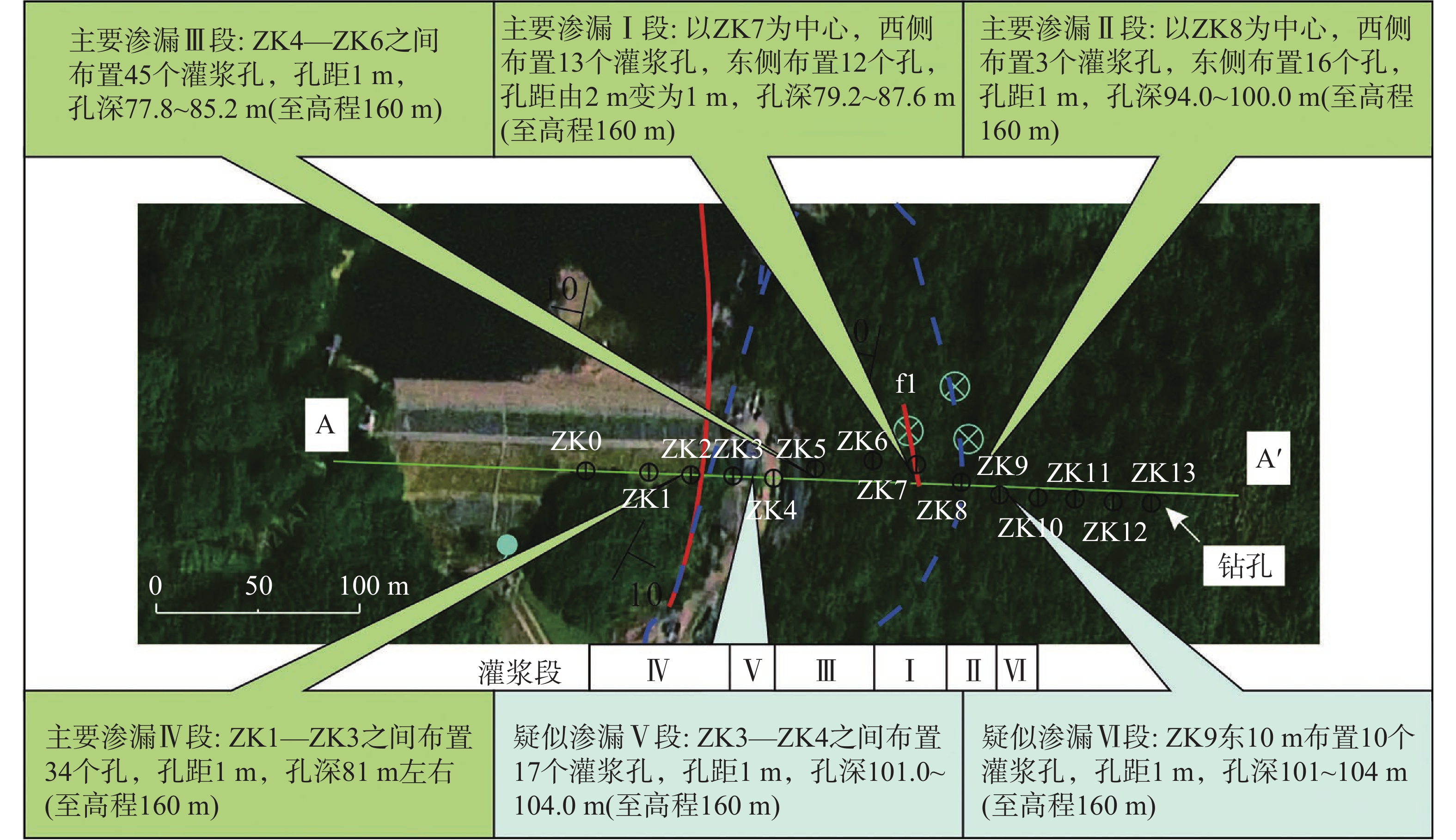
Leakage analysis and remediation measures for typical karst reservoirs with structural deficiencies in Guangxi
ZHUO Chun, SUI Huasheng, SU Weiguo, HAN Kai, LIU Yongliang
2026, 45(2): 380-398. doi: 10.11932/karst2026y009
Abstract:
Karst leakage poses a critical engineering challenge to the safety and functionality of reservoirs in Guangxi, potentially leading to water loss, reduced performance, or even operational failure. Based on 50 typical cases from Guangxi, this study analyzes the controlling factors, main types, formation mechanisms, and mitigation strategies for karst reservoir leakage. The study aims to establish a typology-based analytical framework to enhance the understanding of leakage mechanisms and to provide reference for engineering remediation. The study shows that karst reservoir leakage in Guangxi can be classified into three main categories: tectonic leakage, contact-surface leakage, and underground conduit leakage. The development and distribution of leakage are jointly controlled by geomorphology, lithology, geological structures, and hydrodynamic conditions. The specific characteristics and intensity of karst development play a crucial role in determining the type, scale, and severity of leakage. In-depth analysis of typical cases indicates significant differences in the formation mechanisms of each leakage types: (1) Tectonic leakage is controlled by deep-seated structural discontinuities, such as faults, resulting in deep, anisotropic seepage networks. (2) Contact-surface leakage occurs through differential dissolution and structural detachment along the interface between soluble and insoluble rocks, exhibiting a strata-bound distribution. (3) Underground conduit leakage comprises well-connected concentrated conduit systems formed by the long-term positive feedback between dissolution and seepage.Given the concealed nature, complex morphology, and often high-pressure dynamic groundwater associated with karst leakage pathways, traditional mitigation techniques-such as curtain grouting, impervious blankets, conduit plugging, and cut-off walls-are often inadequate for efficient leakage control. Remediation measures must be specifically tailored to the type of leakage. For tectonic leakage, a combination of deep curtain grouting for interception and surface blanketing for sealing is typically required. For contact-surface leakage, physical interception using deep cutoff walls combined with grouting for reinforcement is a common and effective method. For underground conduit leakage, which is characterized by large flow rates and high velocity, specialized techniques that resist to high-velocity erosion, along with integrated "grouting-plugging-intercepting" strategies-such as bag grouting and quick-set pastes-are necessary. Traditional anti-leakage technologies face limitations when addressing high-pressure, large-flow conduit leakage, including issues such as grout being easily washed away, significant impact on the dam structures, and insufficient durability. Therefore, future remediation work should adopt a more refined approach. During the investigation phase, combining high-precision geophysical surveys with numerical modeling can more accurately determine the location and geometry of leakage pathways. During the construction phase, the use of new environmentally friendly materials, such as polymer grout and bio-cement, is recommended, as these materials have lower environmental impact and greater durability. Furthermore, by employing IoT-based monitoring and intelligent analysis, a leakage prevention and control system encompassing the stages of "precise detection, dynamic regulation, and targeted sealing" can be established. This approach aims to achieve precise responses and long-term effective control of karst leakage pathways.
Study on the mechanism and treatment of water inrush in the inclined shaft of the Siding tunnel on the new Guilin-Liucheng expressway in Guangxi
YAO Kezhui, KANG Xiaobing, XU Mo, LU Danmei, LAN Haimin, WANG Shengjie, DAI Wenhao
2026, 45(2): 399-410. doi: 10.11932/karst20260207
Abstract:
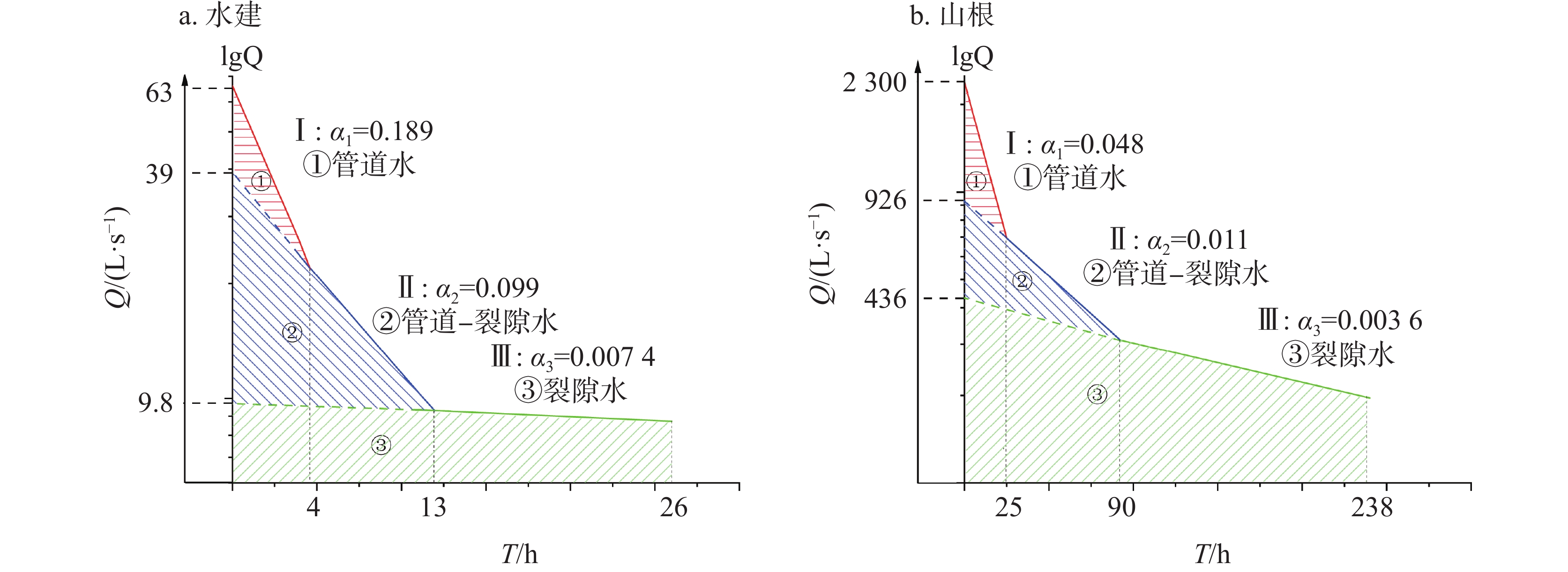
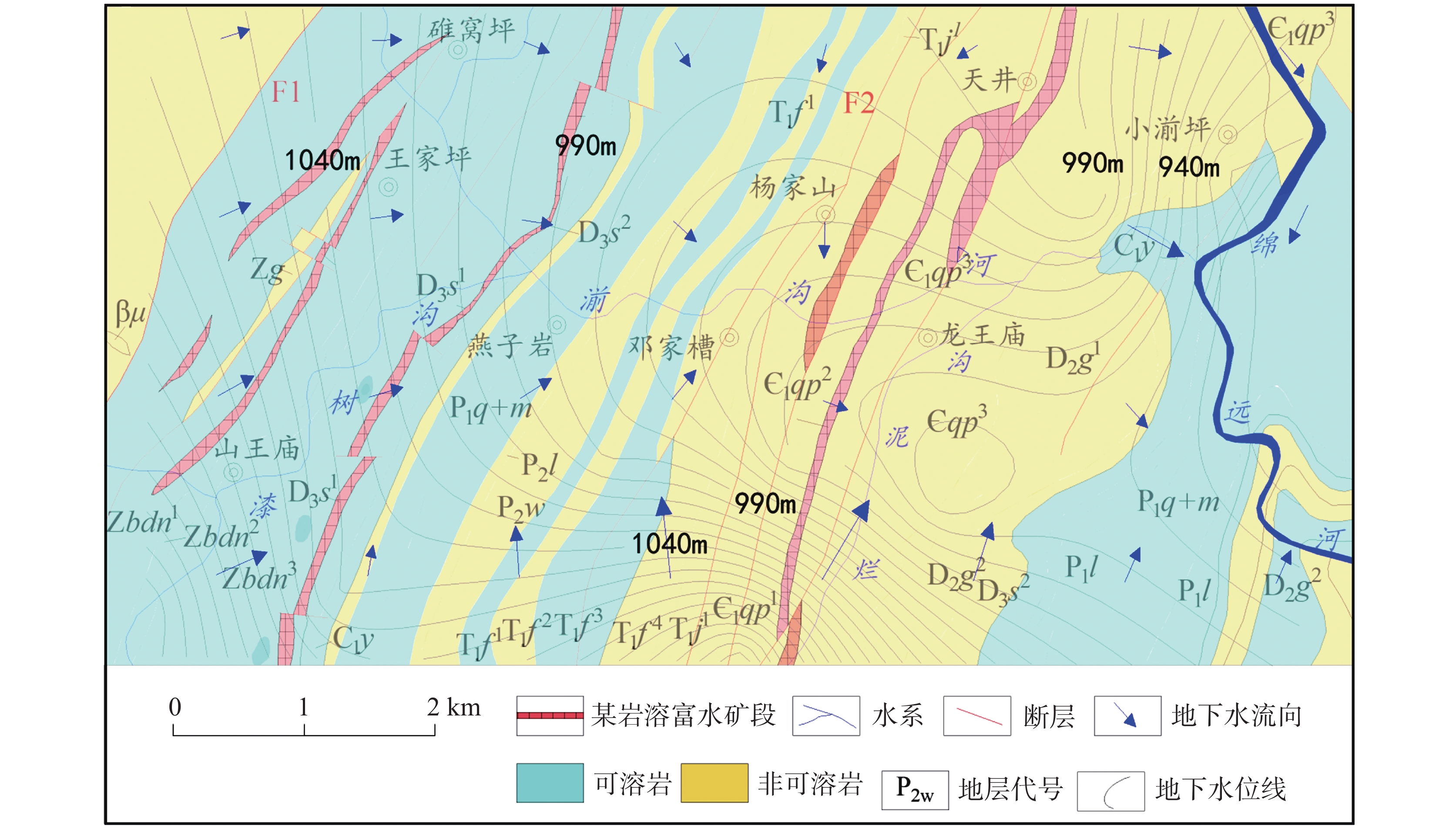
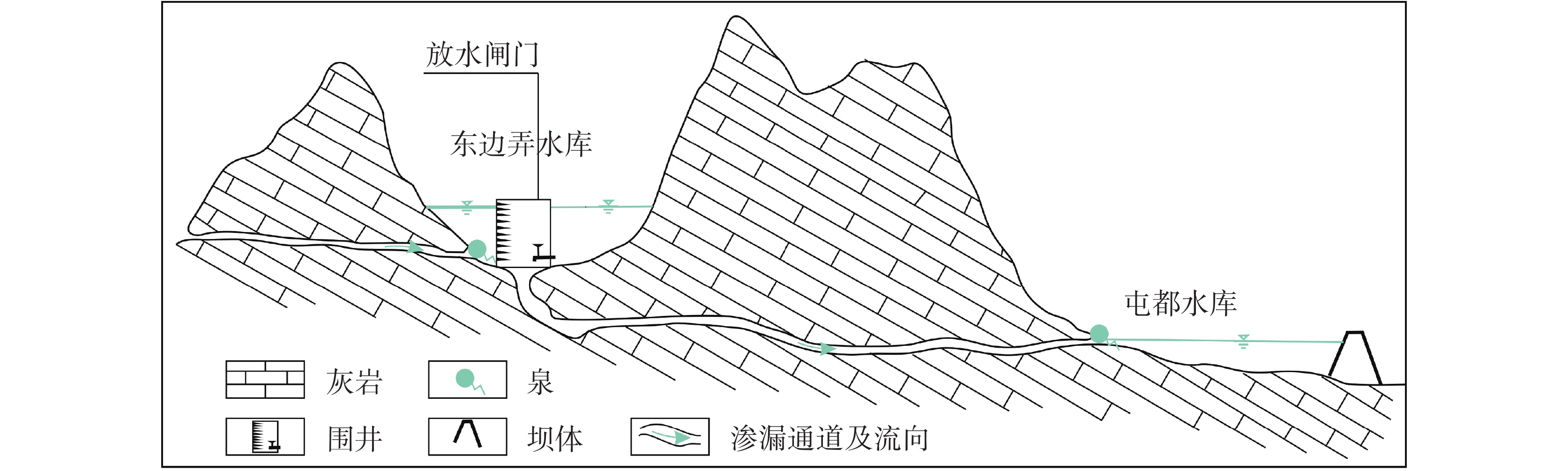
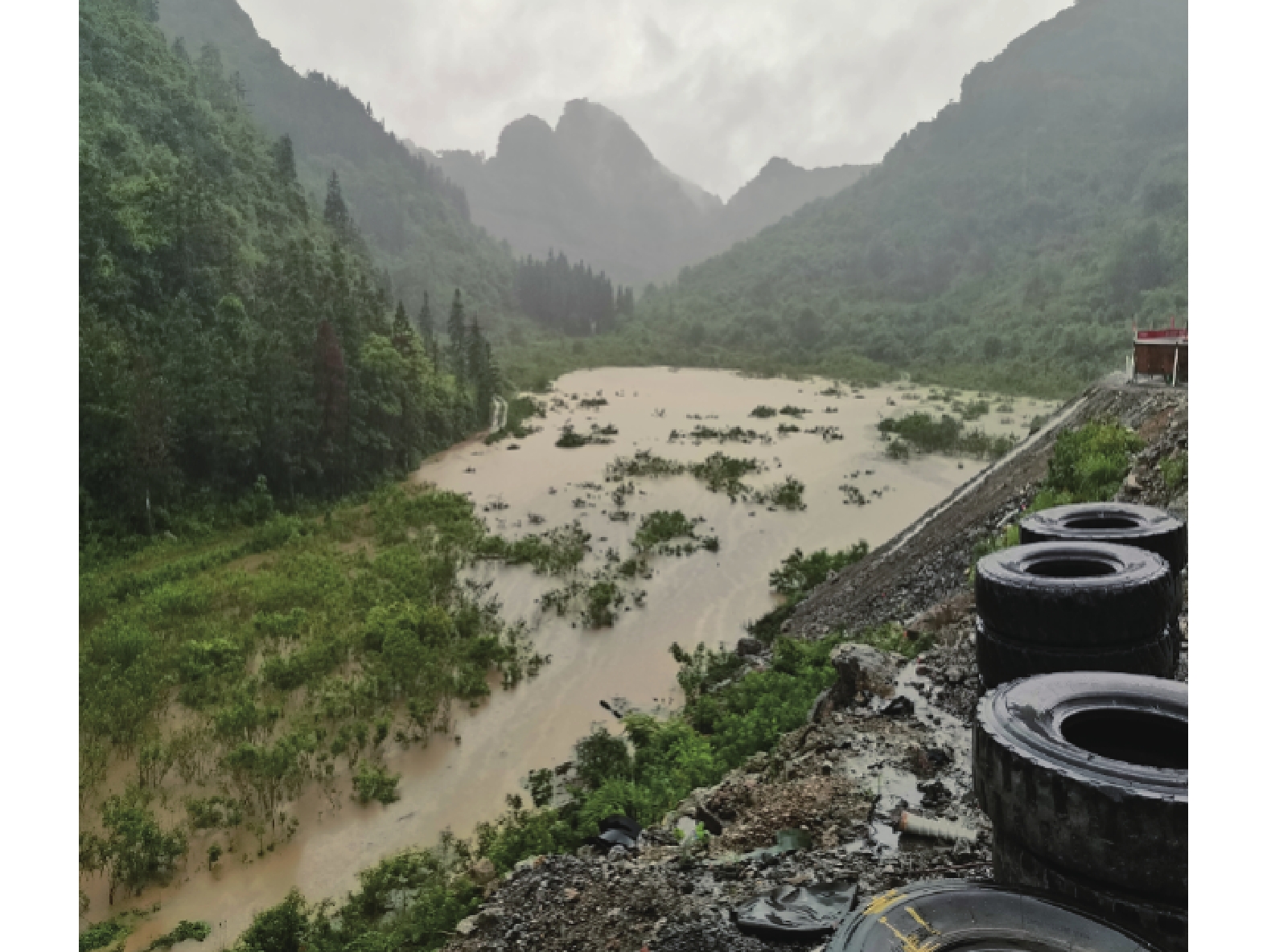
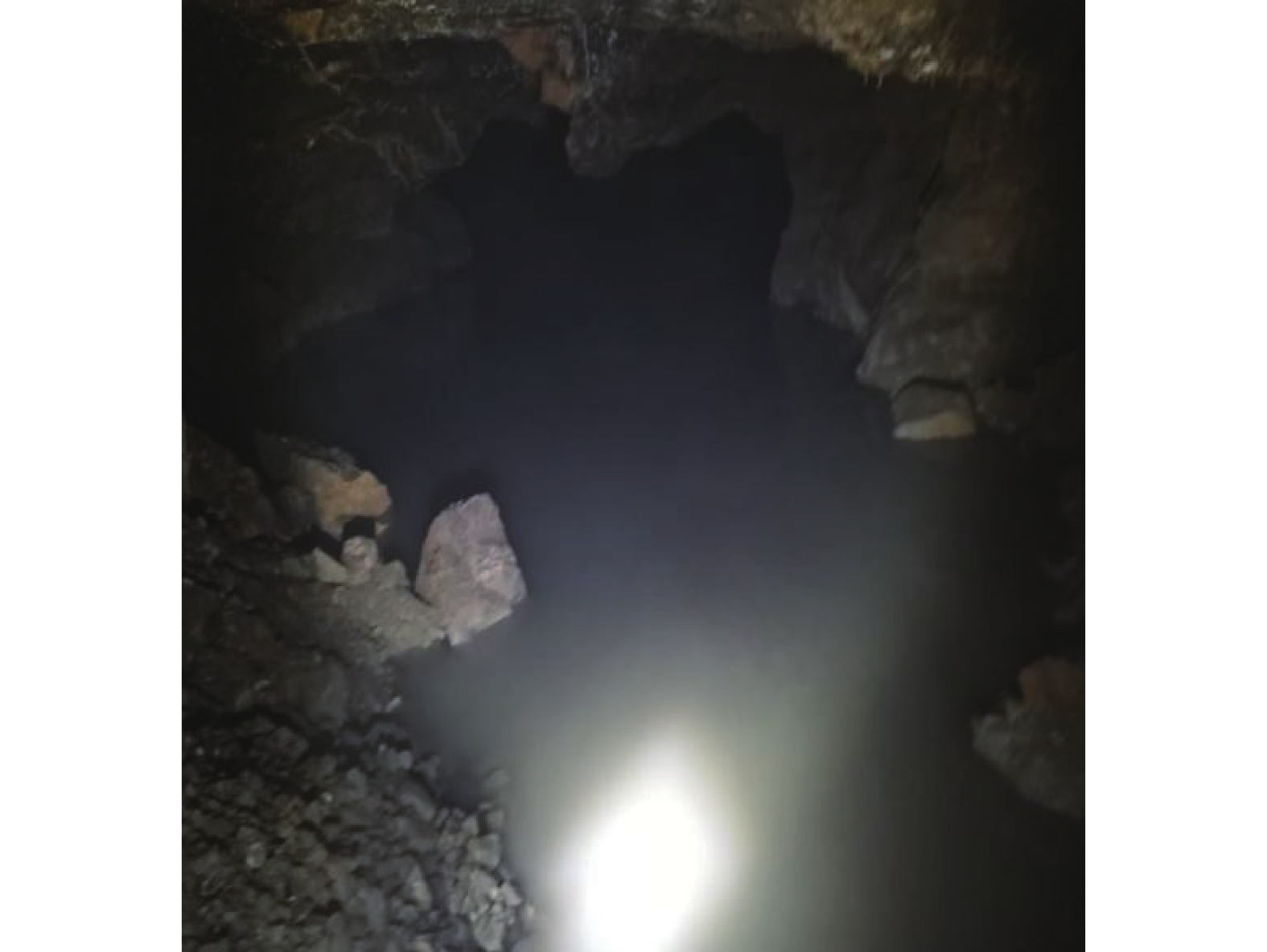
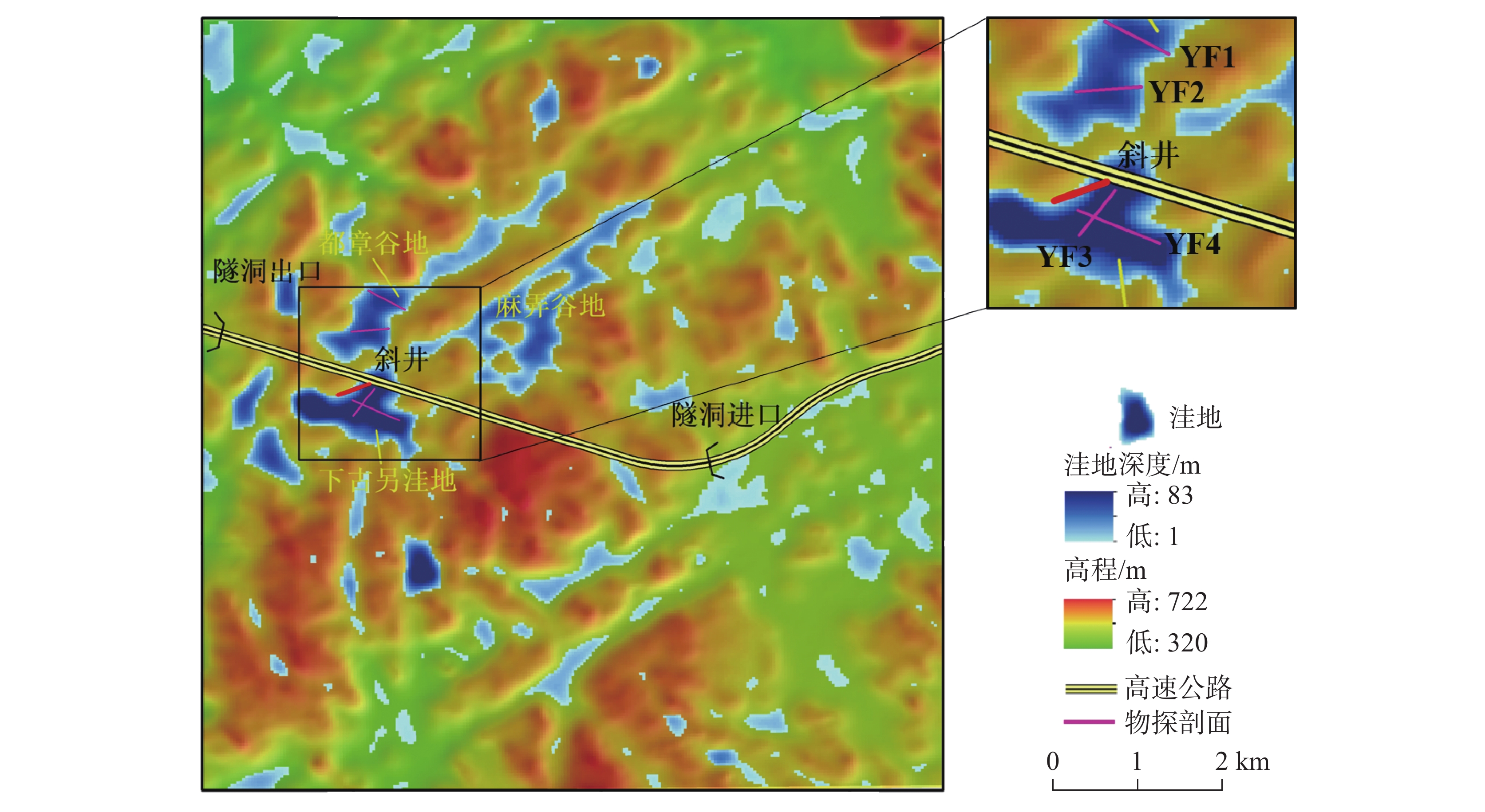
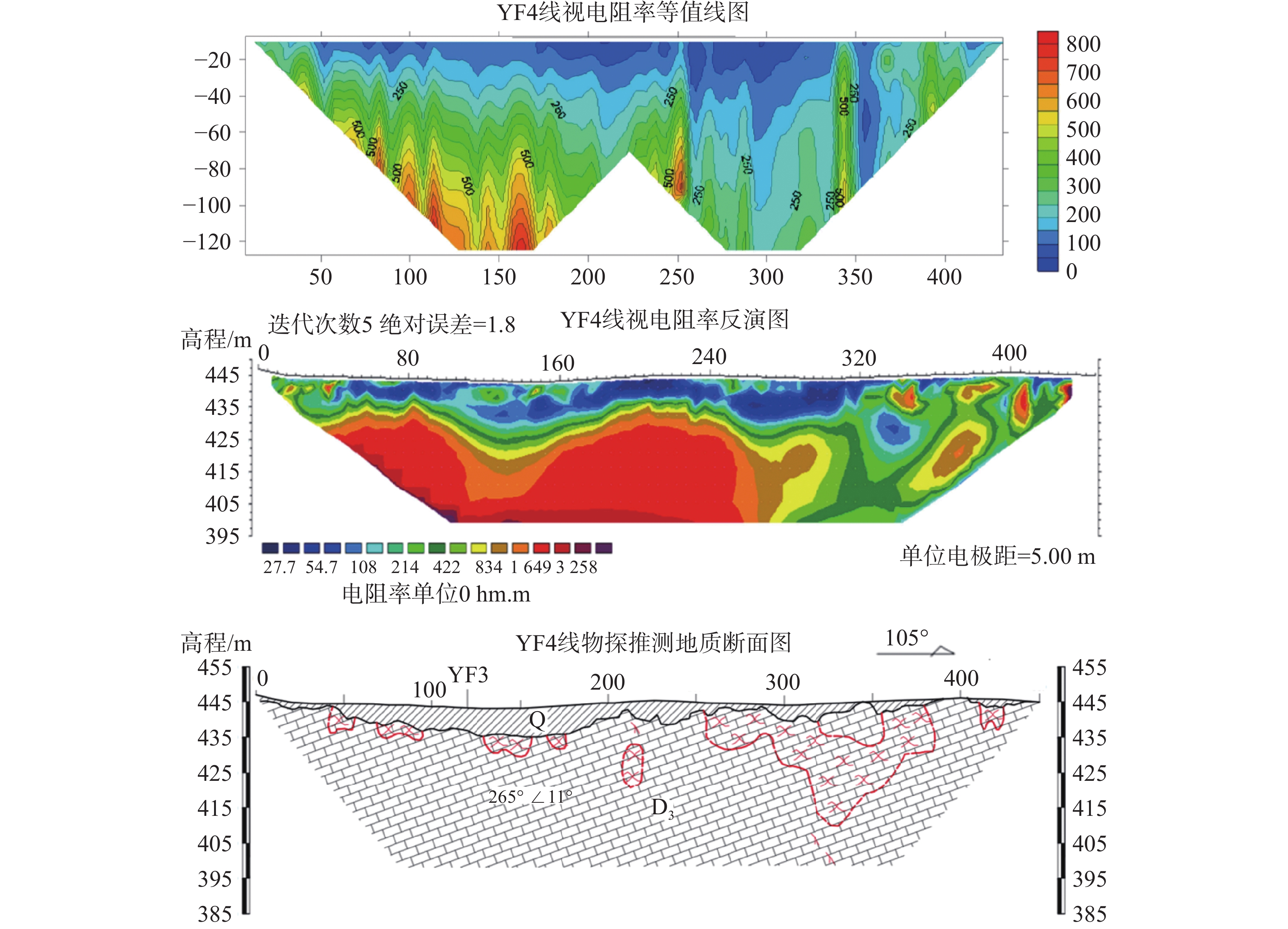
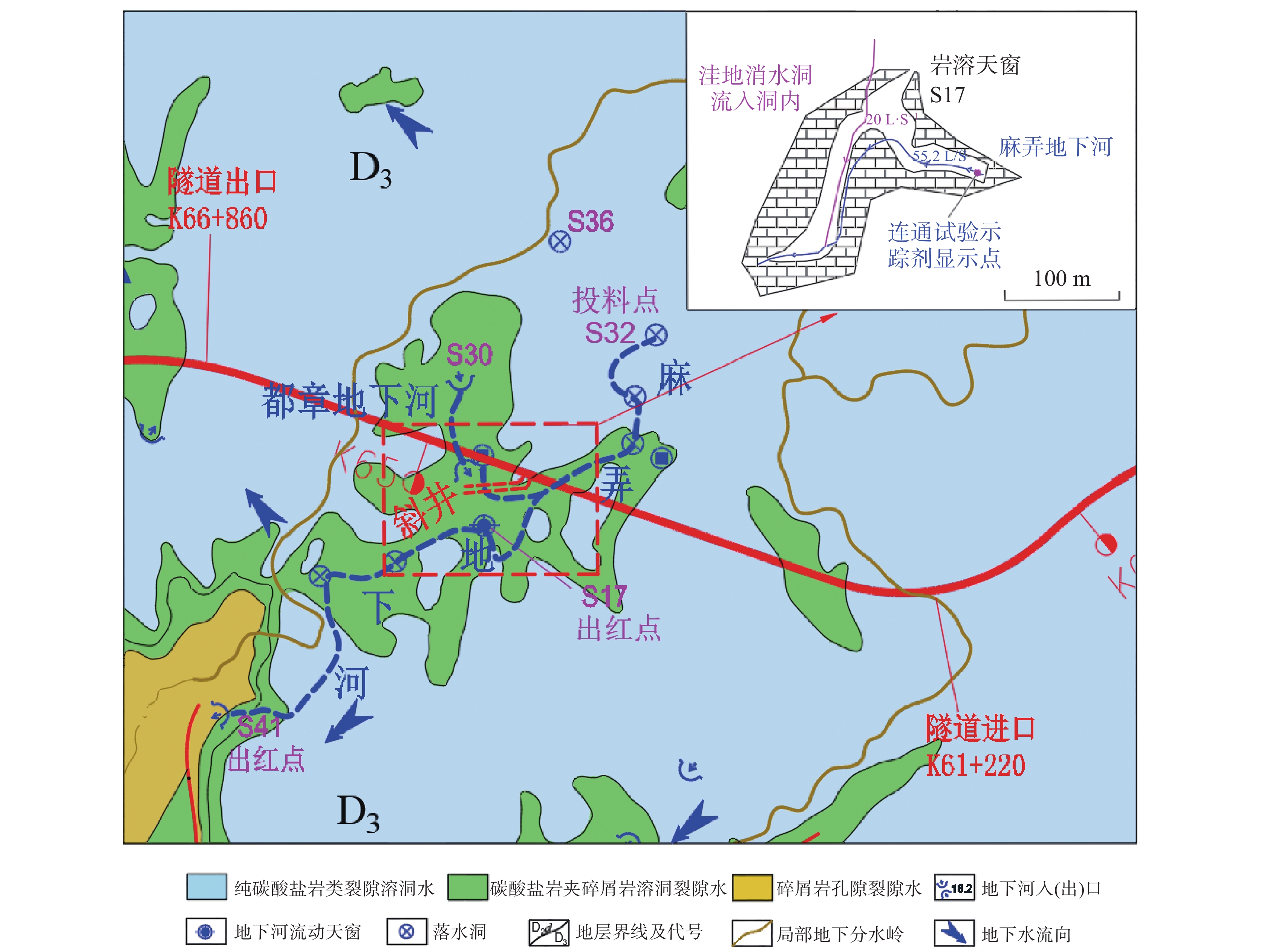
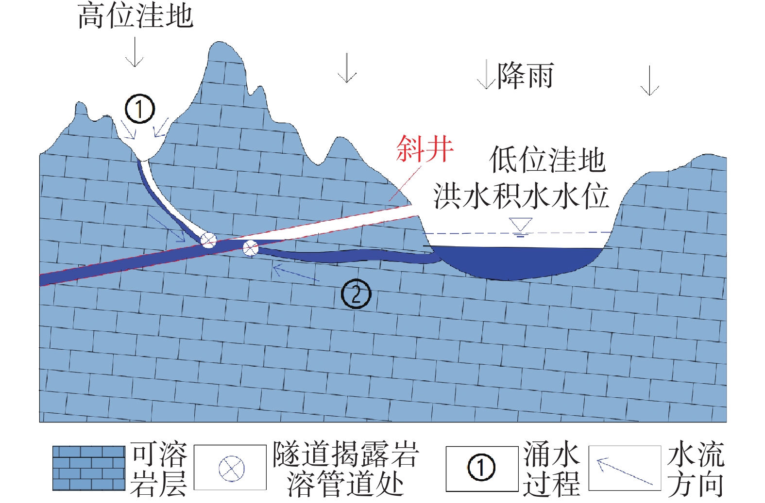
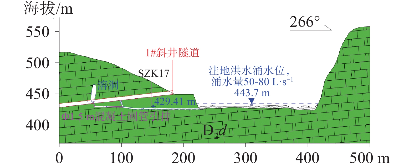
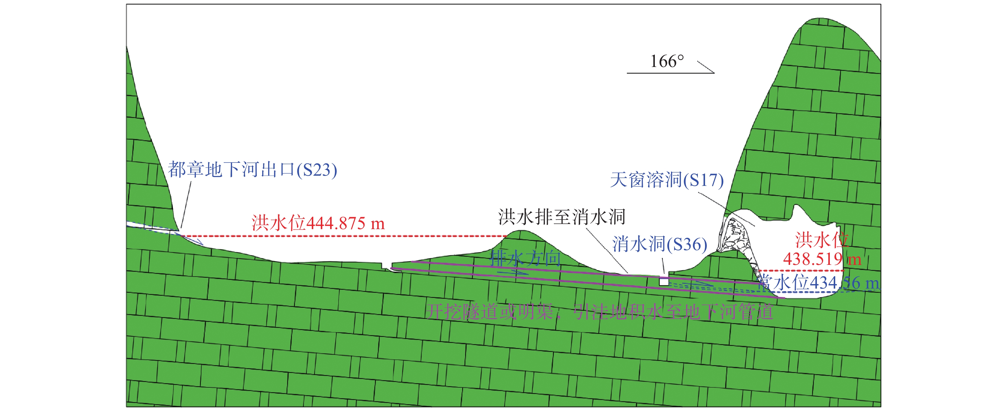
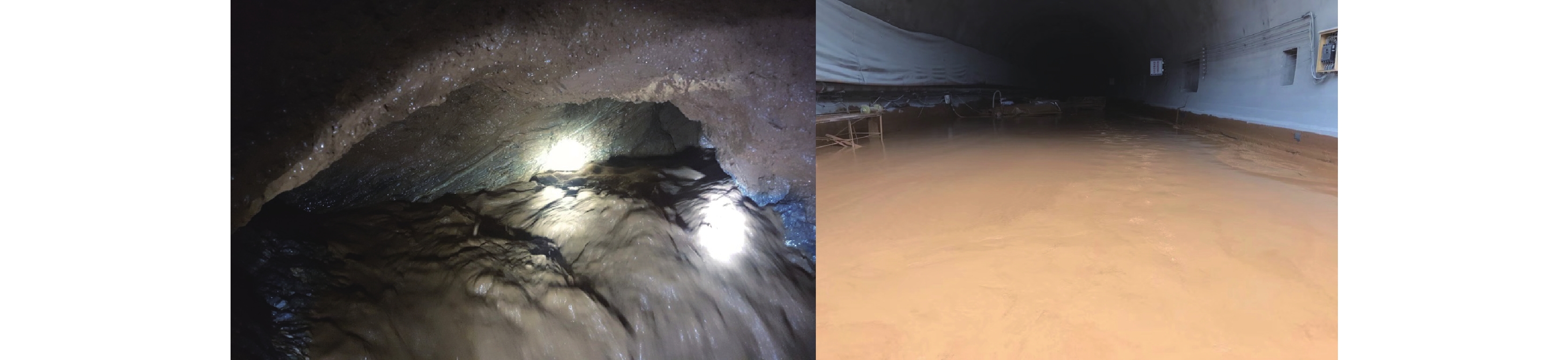
The problem of water inrush and mud gushing is a major hazard encountered during the construction of karst tunnels. During the excavation of the inclined shaft of the Siding tunnel on the Guilin–Liucheng expressway in Guangxi, karst caves were discovered at XK0+410 m and XK0+365 m, respectively. The karst pipelines exposed by the inclined shaft excavation caused groundwater to gush from the karst cave at XK0+365 m after rainfall, flowing back into the tunnel along the inclined shaft and disrupting construction. In May to June of 2020, the tunnel site experienced a rainstorm that significantly increased water inrush at XK0+365 m due to the karst cave, with a maximum flow rate of approximately 300 m³·h−1. Meanwhile, large-scale water accumulation occurred in the Xiaguling Depression, located south of the inclined shaft entrance, with water depths ranging from 1.50 to 4.67 m and a flood level of 444.874 m. The massive inflow of accumulated water into the tunnel made construction impossible, severely impeding project progress.This study takes the water inrush from the inclined shaft of the Siding tunnel on the Guilin–Liucheng expressway as the research object. Through karst hydrogeological surveys, high-density electrical resistivity prospecting, and connectivity experiments conducted in the tunnel site area, the study identified the water inrush channels and sources associated with the inclined shaft. It elucidated the genetic mechanism of water inrush, predicted the volume of water inflow, validated the accuracy of prediction in conjunction with the water inrush mechanism, and comprehensively compared three treatment measures. The results indicate the following: (1) During the construction of the Siding tunnel inclined shaft, a karst conduit was exposed,through which rainfall surged into the working area,resulting in a water inrush disaster.The primary sources of the water inrush are identified as:water from gullies on the hillslope,groundwater discharged via underground river conduits from the Duzhangtun depression from the north,and groundwater discharged from underground river tributary near Malong village from the northeast. All of these sources originate from atmospheric precipitation collected in karst negative terrains. (2) The formation process of the water inrush disaster at the Siding tunnel was as follows:during the construction of the inclined shaft,the upper conduit of the Duzhang underground river was exposed,resulting in immediate water inflow upon the occurrence of rainfall.Under heavy rain conditions,in addition to the drainage of rainwater from high-elevation depressions,the water level in the Xiaguling depression rose to 443.7 m, causing backflow into the tunnel's inclined shaft.The synergistic effect of these two factors led to a major water inrush.The water inrush mechanism at the inclined shaft of the Siding tunnel is classified as karst conduit-type water inrush, which can be divided into two processes: ① Rainwater drainage from high-elevation karst depressions. When the elevation of a karst depression is higher than that of the tunnel, after rainfall,water accumulates within the depression and flows along the karst conduit,discharging into the inclined shaft through the karst cave opening exposed during excavation. ② Backflow from low-elevation karst depressions. When the elevation of a karst depression is lower than that of the tunnel, during heavy rainfall,a large volume of rainwater accumulates instantaneously in the depression.Due to poor drainage, the water level rises continuously.When the water level exceeds the elevation of the karst conduit exposed by excavation,a hydraulic head difference drives the accumulated water to backflow into the inclined shaft via the karst conduit,resulting in a major inrush. (3) Based on the principle that groundwater in karst areas should be drained rather than blocked, and considering the sources of water inrush, channels, topography, and karst development characteristics of the inclined shaft of the Siding tunnel, a measure of intercepting and externally diverting water was adopted. This involved intercepting part of the floodwater in the Duzhangtun depression and using the natural drainage channel developed at the northwestern foot of the mountain in Duzhangtun to divert some of floodwater to Matang’ao village by raising the water level. Simultaneously, the accumulated water in the depression was directly diverted into the Tianchuang karst cave through tunnels or open ditches to achieve rapid drainage, reduce the flood level in the depression, and thereby decrease recharge sources and the water pressure in karst conduits. This approach effectively solves the water inrush problem in the inclined shaft and provides a basis for the treatment of water inrush in shallow-buried tunnels in similar karst areas. This study not only ensures the construction safety of the Siding tunnel, but also holds significant importance for ecological protection in the tunnel site area.
Analysis of development characteristics, treatment schemes, and effectiveness evaluation of mud and water inrush in tunnels within karst area
HE Wei, ZHANG Shilin, XU Kaiqi, ZHAO Geli
2026, 45(2): 411-419. doi: 10.11932/karst2026y013
Abstract:
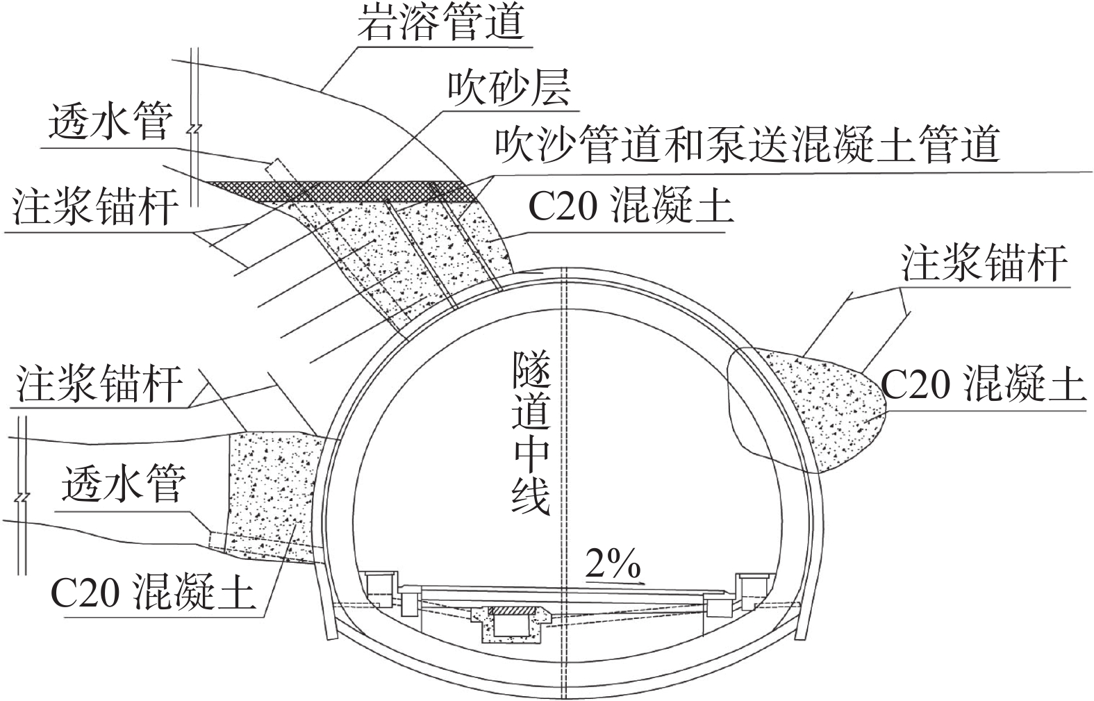
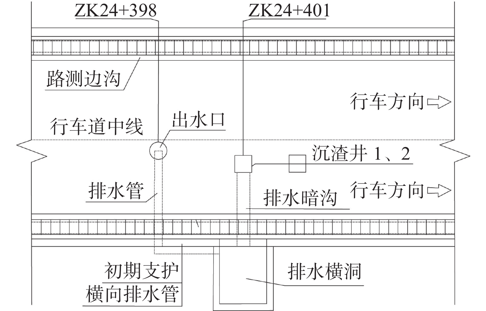
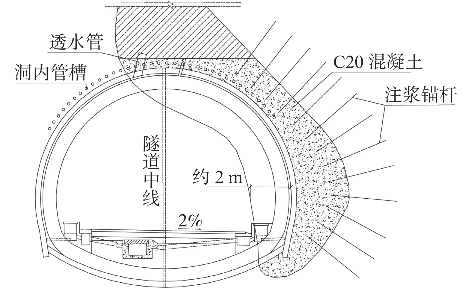
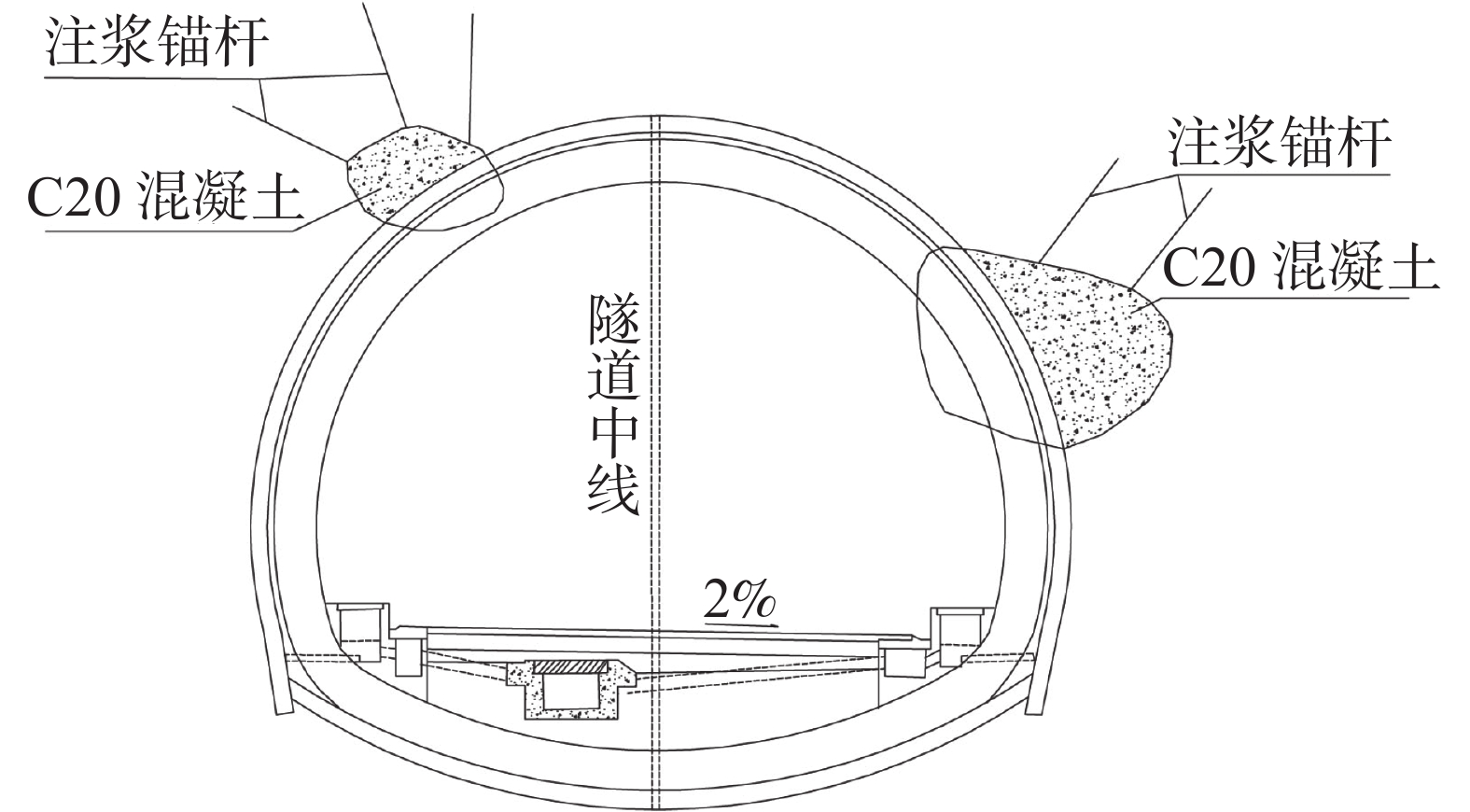
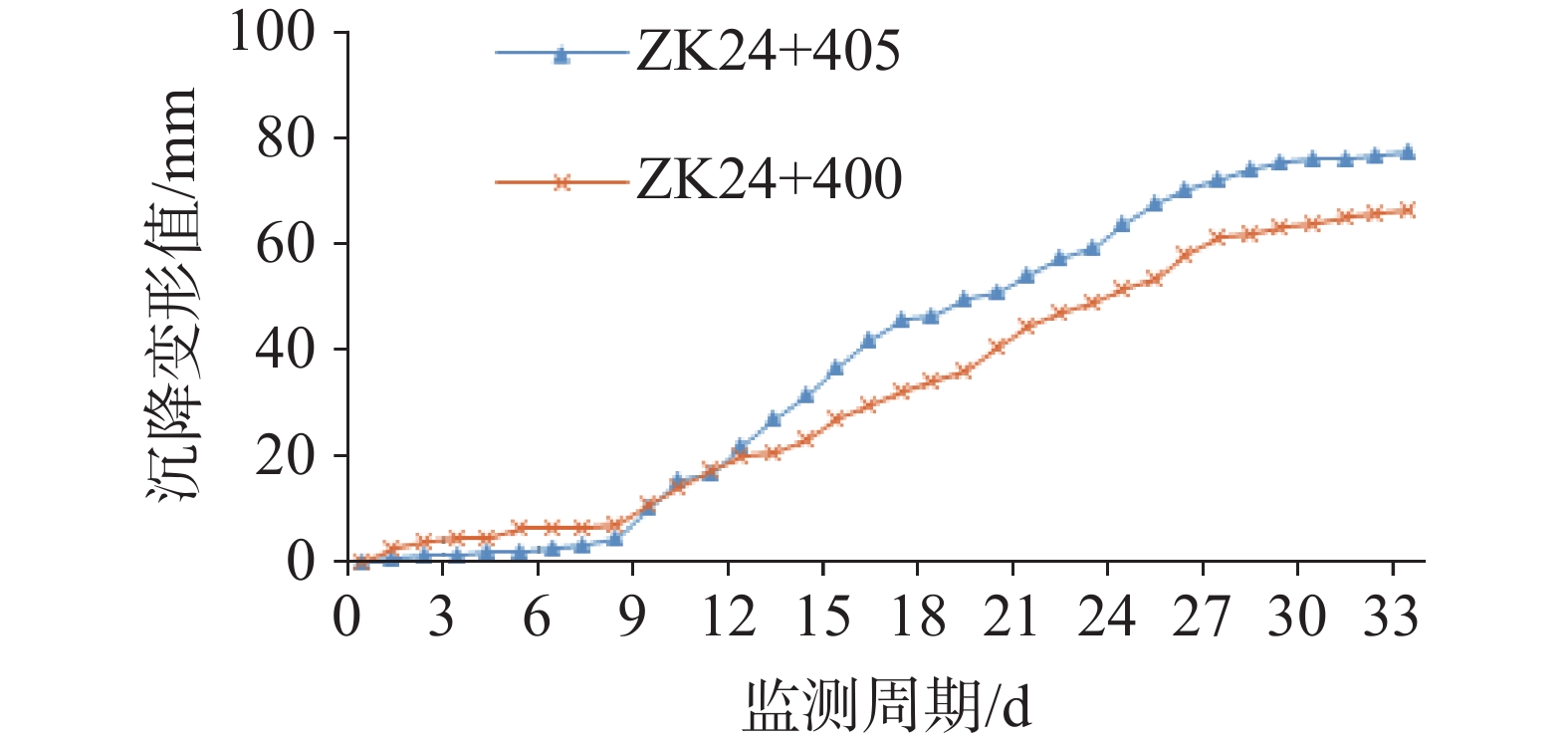
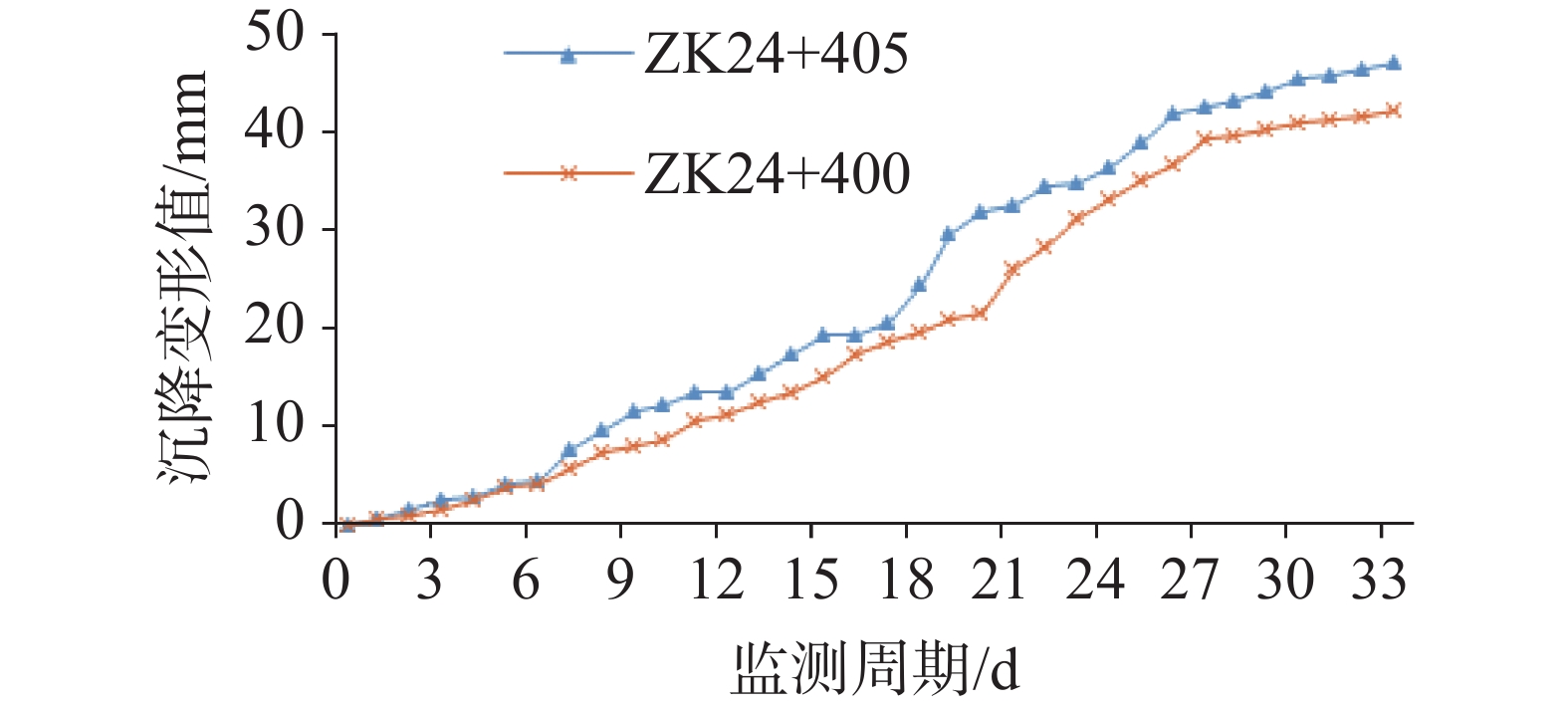
To ensure the safe construction of tunnel sections prone to mud and water inrush disasters in karst areas, taking the Naqing Tunnel of the Luowang Expressway in Qiannan Buyi and Miao Autonomous Prefecture, Guizhou Province as a case study, the developmental characteristics and genesis of such disasters were first analyzed. Based on the evaluation results and considering practical engineering conditions, treatment solutions were designed from aspects such as advanced pre-support, karst cavities, lining, and waterproofing-drainage measures. Finally, a deformation prediction model for tunnels was jointly constructed using the Sparrow Search Algorithm and Support Vector Machine, namely the Sparrow Search Algorithm-Support Vector Machine model (SSA-SVM). This model was then applied to predict the deformation at sections ZK24+405 m and ZK24+400 m, with the prediction results used to understand the deformation patterns of the tunnel after disaster treatment and evaluate the rationality of the mitigation measures.The analysis results indicate that at the left tunnel section ZK24+405 m, mud ejection occurred during drilling at the left arch waist of the upper step on August 29, with a spraying distance exceeding 30 meters. The mud pressure in the borehole pushed the drill rod out, triggering a mud and water inrush disaster. By September 6, the inflow gradually decreased and stabilized, with on-site measurements showing a maximum flow rate of approximately 6,651.33 m3·d−1, indicating significant developmental characteristics of the disaster at this section. Measures such as advanced pre-support, segmented reinforcement of karst cavities, enhanced lining, and improved waterproofing-drainage were proposed to ensure safe construction in the disaster-prone section. Specifically, advanced pre-support involved grouted small guide pipes, with their length extended to 6 m. For the karst cavity from ZK24+405 m to ZK24+390 m, a "concrete backfill" measure was adopted; for the cavity from ZK24+390 m to ZK24+375 m, a "bentonite pre-support + protective arch + concrete backfill" approach was used; and for the cavity from ZK24+375 m to ZK24+348 m, a "concrete (shotcrete) backfill" measure was implemented. Lining reinforcement primarily involved "water diversion + pressure-resistant lining", while drainage enhancement primarily utilized a double-layer EVA waterproof membrane semi-encapsulation and C30 concrete self-waterproof structure, supplemented by additional drainage holes and densified circumferential drainage systems. In the prediction results for the ZK24+405 m section, the relative error for arch settlement ranged from 1.36% to 2.08%, and the relative error for horizontal convergence was between 1.63% and 1.80%; In the deformation prediction results of the ZK24+400 m cross-section, the relative errors for vault settlement were 1.78% and 2.14%, while the relative errors for horizontal convergence were 1.73% and 1.91%, respectively. Therefore, both cross-sections exhibited high prediction accuracy in the two types of monitoring items, with convergence trends observed in both categories. Except for the general convergence trend in vault settlement at the ZK24+405 m cross-section, all other deformation trends showed strong convergence. This confirms that tunnel deformation consistently remained within the design-required control limits, validating the effectiveness of various treatment measures.The study conducted through this paper has accumulated experience in the prevention and control of mud and water inrush disasters in karst tunnel areas, and the research findings possess certain practical value.
Study on the characteristics of Jurassic Buqu Formation carbonate paleokarst reserviors in the Qiangtang Basin
ZHANG Qingyu, BA Junjie, JI Shaocong, LI Zhen
2026, 45(2): 420-430, 442. doi: 10.11932/karst20260208
Abstract:
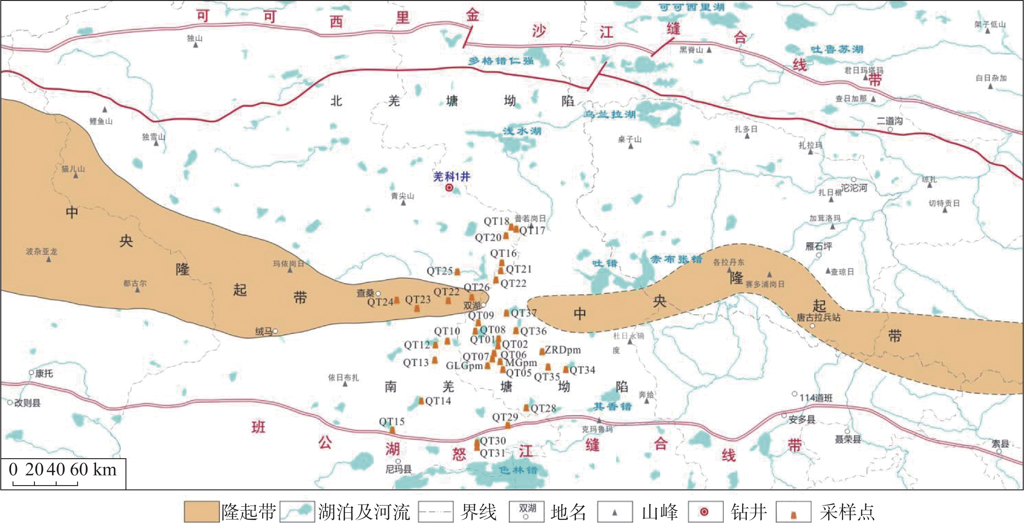
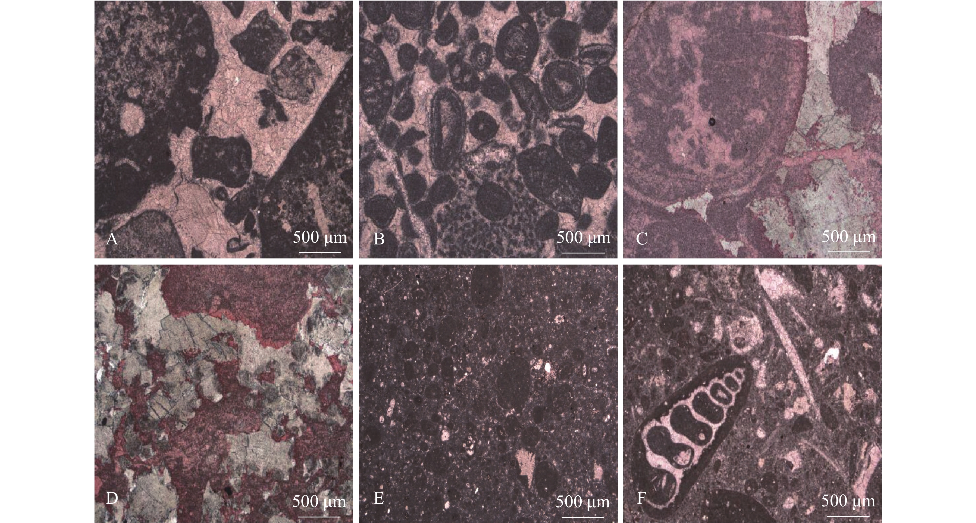
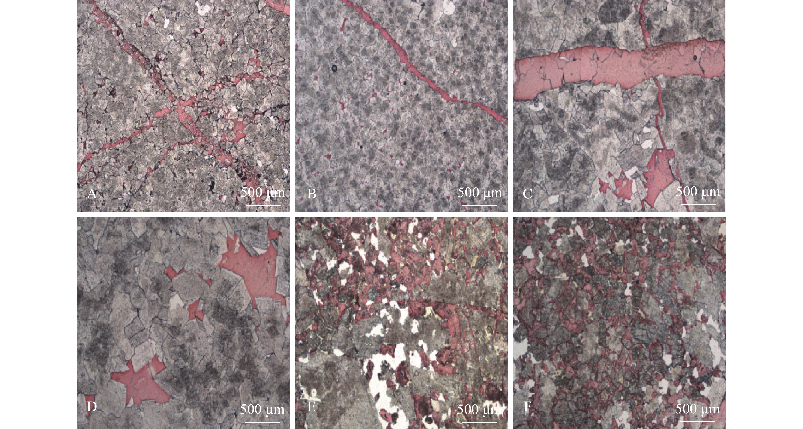
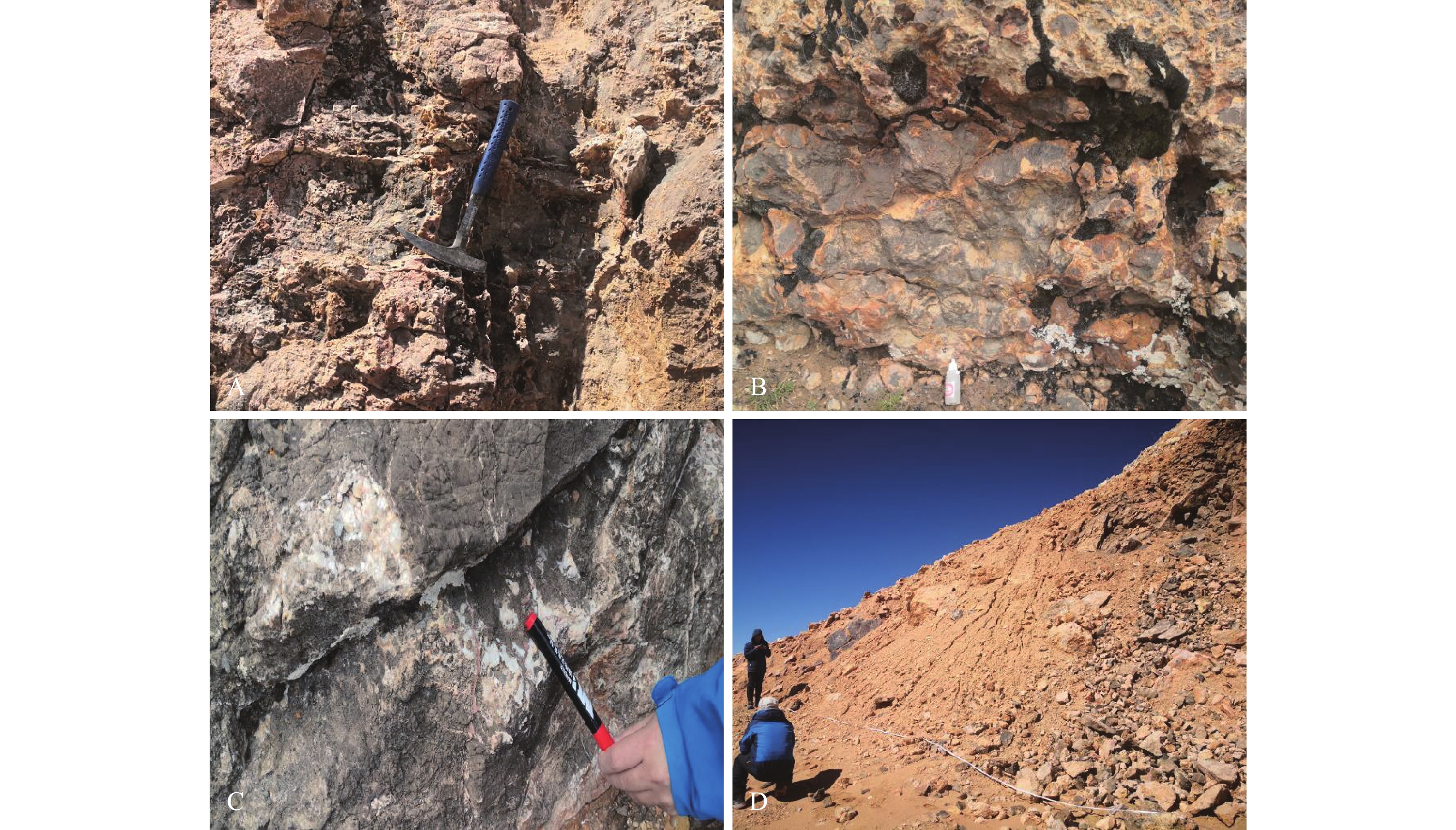
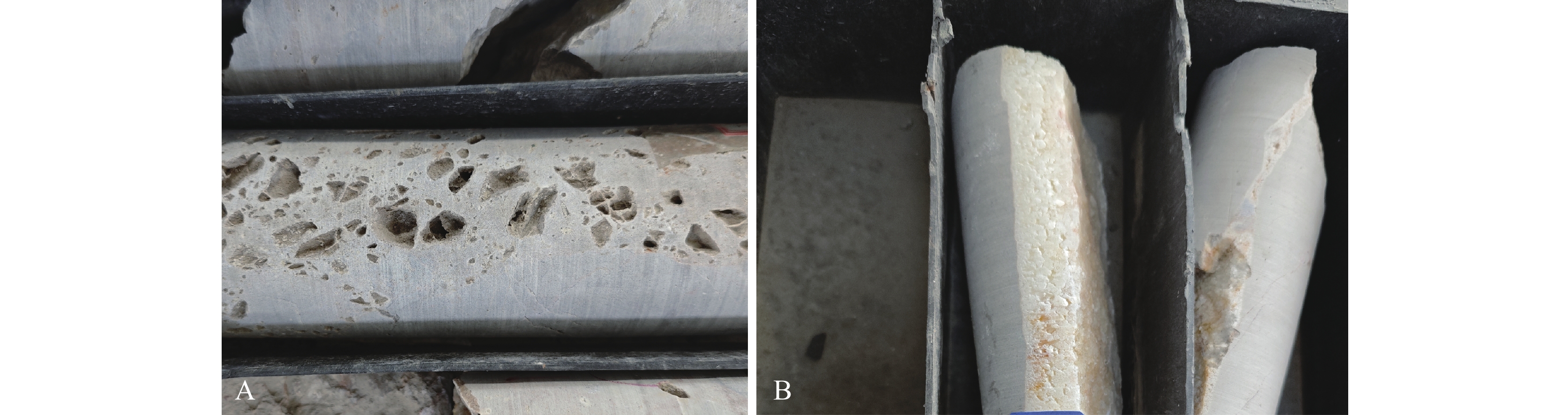
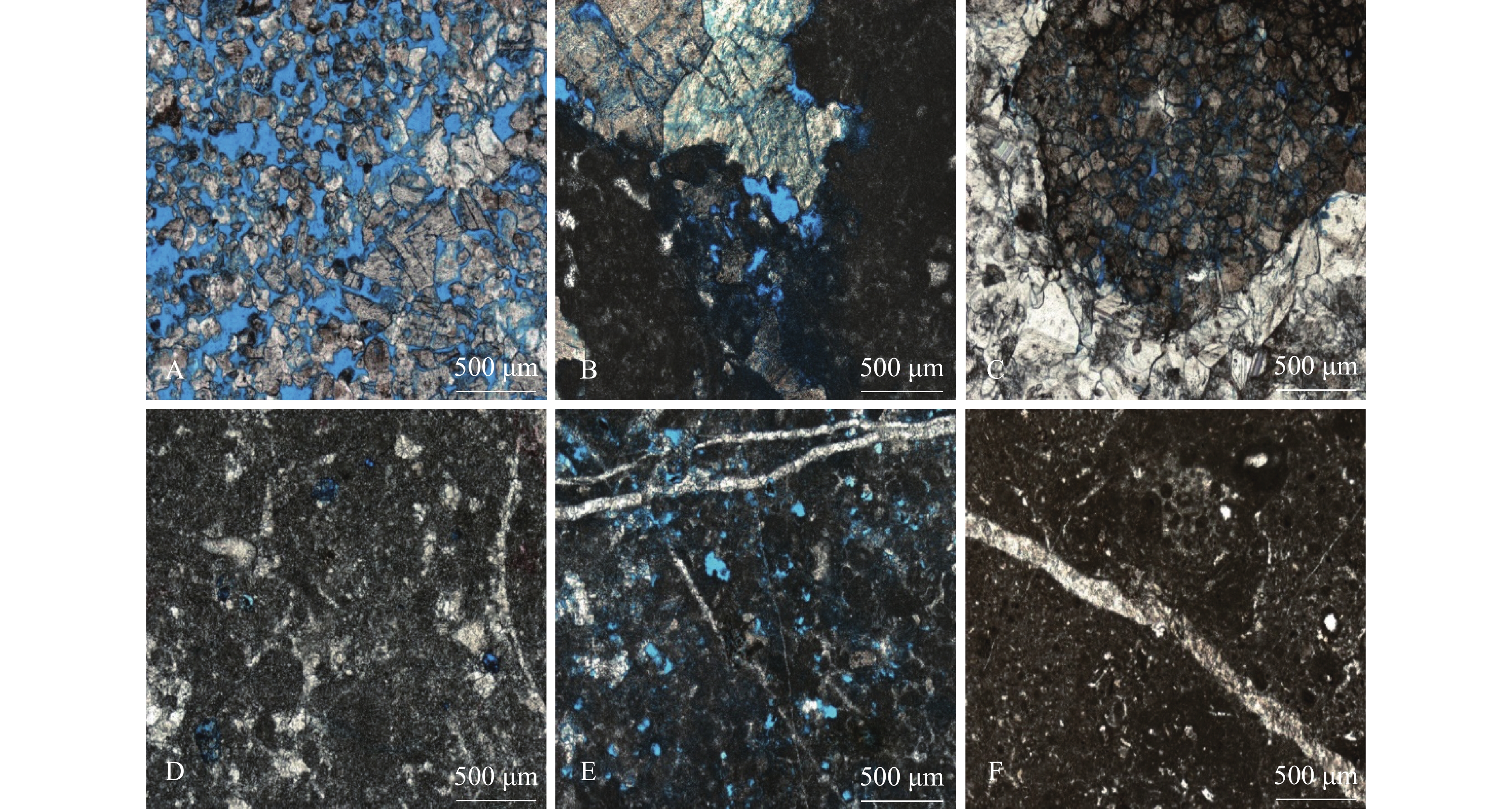
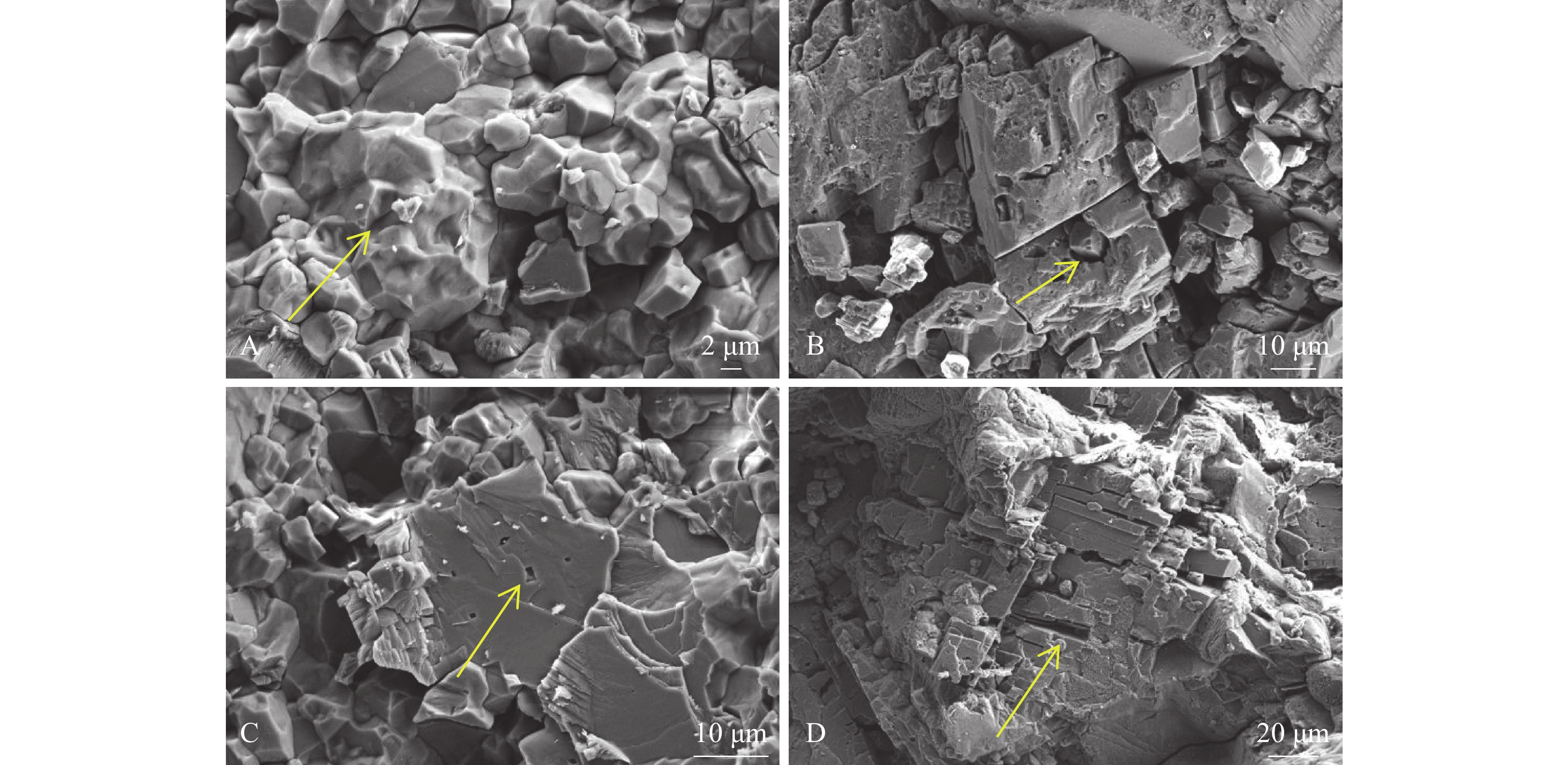
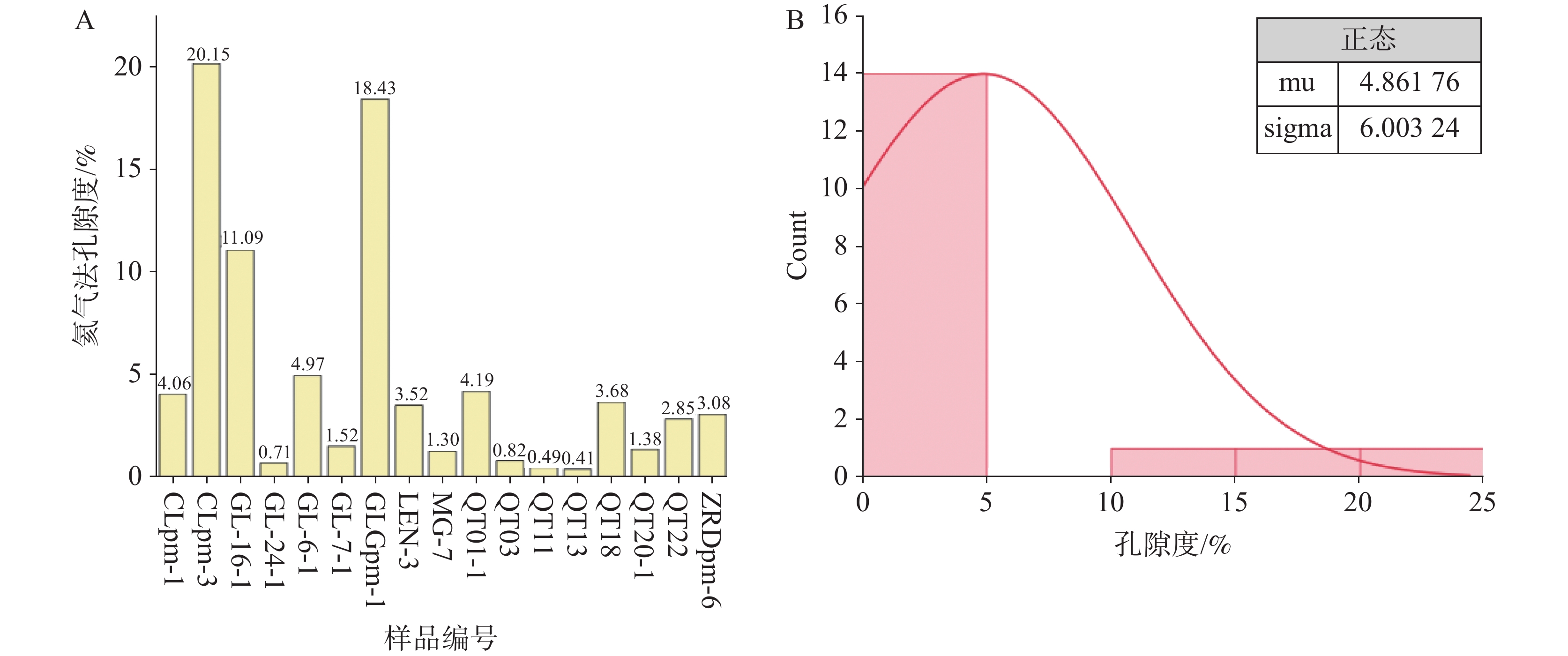
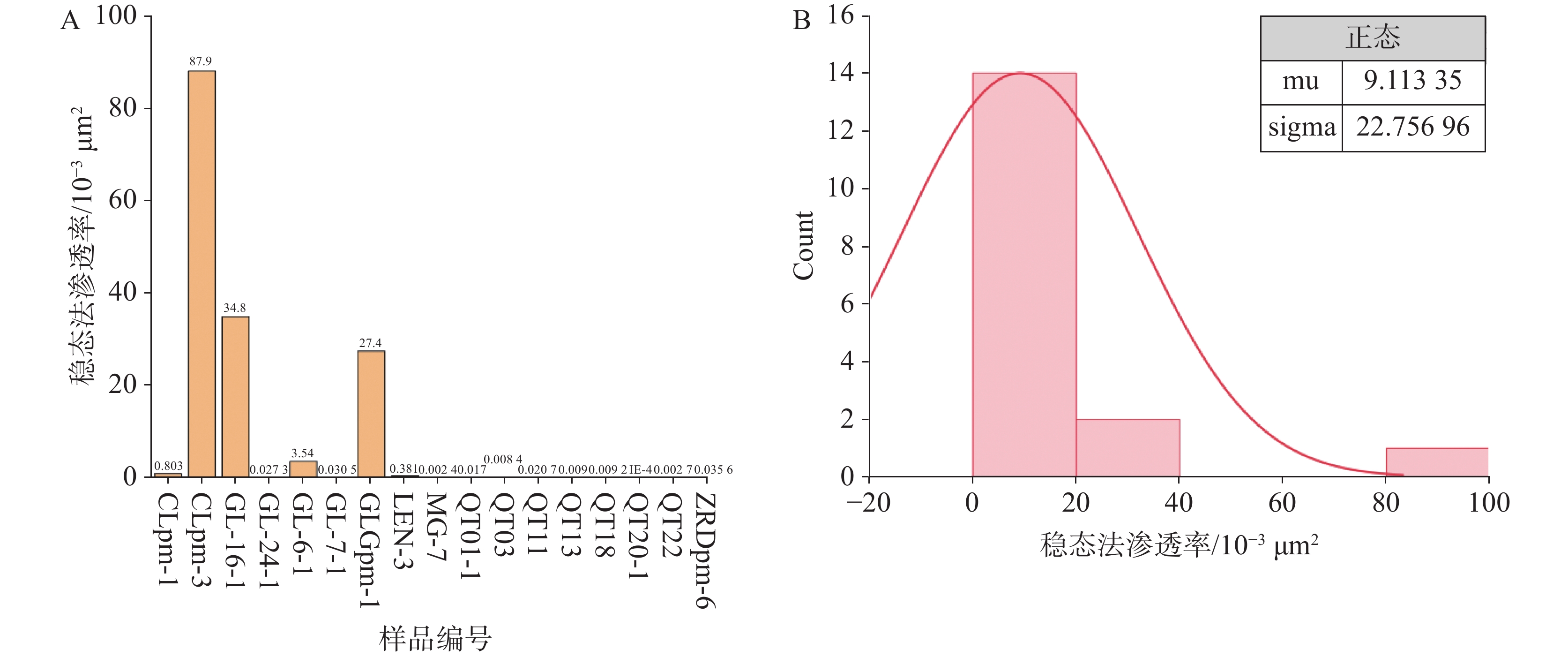
The Qiangtang Basin, situated in the northern part of the Qinghai-Xizang Plateau, is China's largest Meso-Cenozoic marine sedimentary basin. Jurassic dolomite of the Buqu Formation are regarded as the basin's most promising hydrocarbon-bearing interval, yet their palaeokarst reservoir architecture and petrophysical distribution have not been quantified systematically. In this study, building on 1∶250, 000 regional geological maps and new fieldwork, we measured three detailed stratigraphic sections-two N-S and one E-W-across the Long'eni, Angda'ercuo and Sairen blocks, collected 171 fresh hand specimens, and carried out optical microscopy, casting-thin-section analysis, SEM observation, helium porosimetry and steady-state permeametry. Integrating outcrop and subsurface data, we characterised carbonate facies associations, reservoir space types and the coupling between petrophysical properties, stratigraphic packages and tectono-stratigraphic blocks.Results indicate that: (1) The Buqu Formation comprises two primary lithologies:limestone and dolomite. Limestones are subdivided into grain-supported, mud-supported, and bioconstruction types, while dolomite include silty-crystalline, fine-crystalline, medium- to coarse-crystalline, and calcareous varieties. (2) Reservoir spaces are classified into two main categories-pores and fractures-encompassing intercrystalline pores, intercrystalline dissolution pores, intercrystalline dissolution pores, vugs, structual fractures, dissolution seams, and pressure-solution seams.(3) Porosity ranges from 0.41% to 20.15%, with an average of 2.526%;the majority of samples fall between 1% and 5%, indicating predominantly low to ultra-low porosity. Permeability varies from 0.0002 × 10⁻³ to 64.58 × 10⁻³ μm2, with an average of 4.434 × 10⁻³ μm2, and most values are below 1× 10⁻³ μm2, reflecting low to ultra-low permwability.Based on porosity criteria, the carbonate reservoirs of the Buqu Formation in the study area are classified as Class Ⅲ (41.18%), representing high-quality palekarst hydorcarbon reservoirs.We further propose a refined palaeokarst layering scheme, quantitatively constrain low-porosity/low-permeability cut-offs, and evaluate reservoir heterogeneity, thereby providing target optimisation and parameter calibration for future horizontal drilling and integrated acidising−volumetric fracturing. These findings not only advance the carbonate-reservoir assessment framework for the Qinghai-Xizang Plateau, but also offer a model for exploring complex karstification hydrocarbon systems in ultrahigh-elevation basins worldwide.
Hydrogeological analysis of paleokarst conduits at a well area in the western Tahe Oilfield
HE Shiwei, YUAN Feiyu, ZHANG Shiliang, ZENG Cheng, LI Jingrui, FU Yafei, WANG Dong
2026, 45(2): 431-442. doi: 10.11932/karst2026y007
Abstract:
Paleokarst fractured-vuggy hydrocarbon reservoirs represent a core component of global carbonate hydrocarbon reservoirs, with the Tahe Oilfield in the northern Tarim Basin being the most typical example in China. The Ordovician marine carbonate rocks in this oilfield serve as the main producing formation of China's first ultra-large Lower Paleozoic hydrocarbon field with reserves exceeding 100 million tons. The paleo-subterranean river systems formed by epigenic karstification constitute the core framework of reservoir fractured-vuggy bodies. Accurate analysis of their hydrogeological characteristics is not only crucial for the exploration and development of deep hydrocarbon resources, but also holds significant exemplary value for analogous studies worldwide.The Tahe Oilfield has undergone multiple phases of tectonic movements, resulting in complex karst geological conditions that pose significant challenges to the identification of paleokarst conduits at the well area scale. This study focuses on the TH12402 well area in the western Tahe Oilfield, which is geographically located in the western part of the Akekule Uplift within the Shaya Uplift of the Tarim Basin. The study area features the development of multiple stratigraphic units, including the Yingshan Formation and Yijianfang Formation of the Ordovician System, with reservoir burial depth exceeding 6,000 meters. Influenced by the intercalation of four stratigraphic pinch-out lines, superimposed karstification of multiple phases is well-developed in this region.Guided by the "present-to-past analogy" research methodology and drawing on the experience of modern karst hydrogeological surveys in southern China, this study integrates high-precision 3D seismic data and actual drilling logging data. The residual thickness trend surface superposition with residual error method was employed to restore the paleogeomorphology of the dominant karstification period (Middle Caledonian Episode Ⅱ). By combining well data with seismic analysis to interpret seismic response characteristics, a set of geophysical identification criteria for the recharge-runoff-discharge elements of karst water systems was established.A key innovation of this study lies in the proposal of seven core principles for identifying paleokarst conduit pathways, namely: (1) Potential sink analysis (to determine the overall flow direction of karst water based on the general topographic trend of paleokarst); (2) Fault framework identification (to recognize fault patterns such as grid-like, single-branch, and conjugate faults using multiple 3D seismic attributes); (3) Judgment of the hydrogeological properties of faults (to assess water-blocking or water-conducting capabilities based on fault mechanical properties, fault-paleoflow angle relationships, and dynamic connectivity); (4) Coupled analysis of fault formation stages (to examine the coupling relationships between faults, river systems, and karstification, and distinguish between constructive and destructive roles of faults in karst development); (5) Topographic slope analysis (to identify the direction of maximum slope gradient from paleokarst geomorphology); (6) Karst conduit orientation matching (to ensure consistency with paleoflow direction); and (7) The principle of minimum resistance (to determine that the main flow prioritizes paths with the least energy consumption when multiple pathways coexist).The results indicate that the paleogeomorphology of the study area exhibits a topographic trend of "higher in the northwest and lower in the southeast," with a local elevation difference of 40 to 80 meters and a regional elevation difference of 180 to 300 meters. Typical negative topographies such as peak cluster depressions and karst valleys are well-developed, and the paleoflow direction is from northwest to southeast. Based on the seven identification principles, 11 main conduits, 19 branch conduits, and 8 fracture flows were identified, and the karst water system was classified into two types: the northeastern reticular fracture flow system (where dispersed flow forms labyrinthine cave systems) and the southwestern dendritic conduit flow system (where strong runoff zones develop pinnate karst conduits).This study confirms that the migration of tectonic highs in the northern Tarim Basin controls the hydrodynamic conditions of the well area. The relatively high CO2 concentration and hot-humid climate during the Ordovician Period laid a favorable hydrodynamic environment for karstification, while the principles of modern karst hydrogeology provide important insights for paleokarst identification. The well area-scale paleokarst conduit identification method and technical system established in this study not only provide accurate geological support for potential tapping in the mature Tahe Oilfield and well pattern reconstruction, but also offer valuable references for hydrogeological research and hydrocarbon exploration in analogous marine carbonate paleokarst fractured-vuggy reservoirs globally.