Influence of hydrogeological conditions on the pollution of karst underground rivers
-
摘要: 通过收集基础资料、岩溶水文地质调查、水体污染指标分析等多种手段,分析了水文地质条件对贵州西南部某岩溶暗河地下水污染的影响。认为:(1)暗河出口所包含的六处泉点、两处溶洞,平面分布位置集中,但其水质污染情况各异,表明其分属于不同的地下岩溶水系统,暗河岩溶地下水系统极为复杂。岩溶暗河出口在空间平面上呈多股、条带状泉眼展布出露,主要受地质相变带附近构造及岩体本身异质性控制。(2)调查区受新构造运动的强烈抬升和河流快速下切的影响,形成了发达的地下岩溶水系统和岩溶洞穴系统,存在多股明流与伏流组成的水文地质单元体,客观上为暗河污染创造了条件。(3)暗河污染物来源为秧家坝岩溶洼地内某养猪场养殖废水,且是集中式、间断性通过落水洞进入地下岩溶管道。建议该岩溶暗河补给区应当控制发展大型养殖业及大中型集镇建设,污废水应当加强回收利用和减少外排,加强区内水源地建设与保护工作。Abstract:
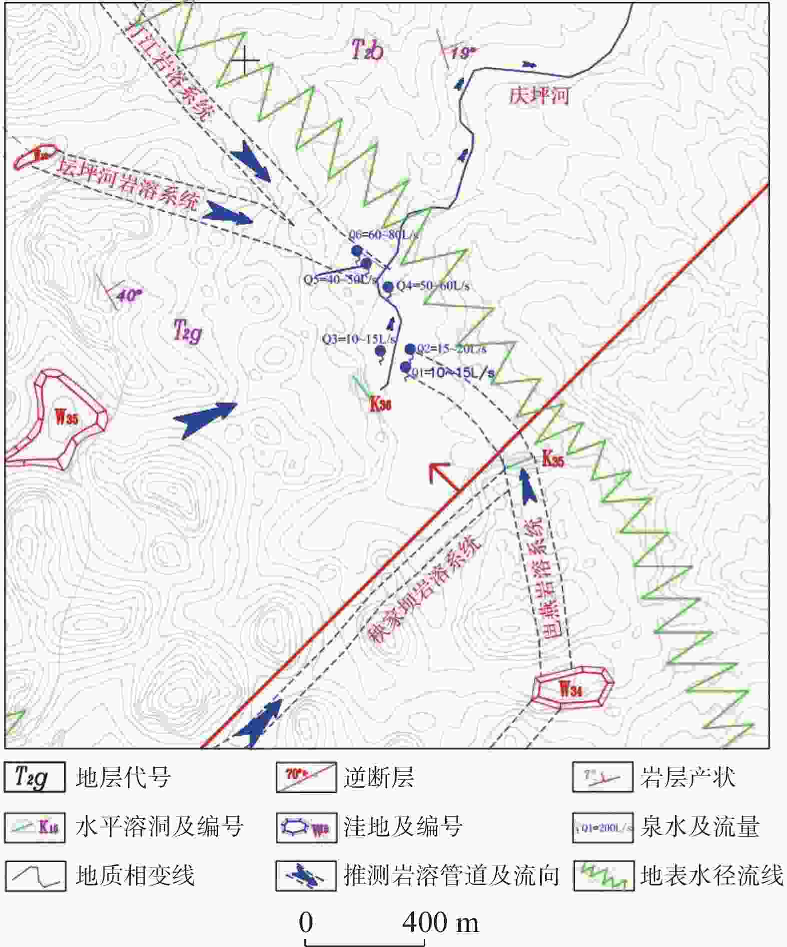
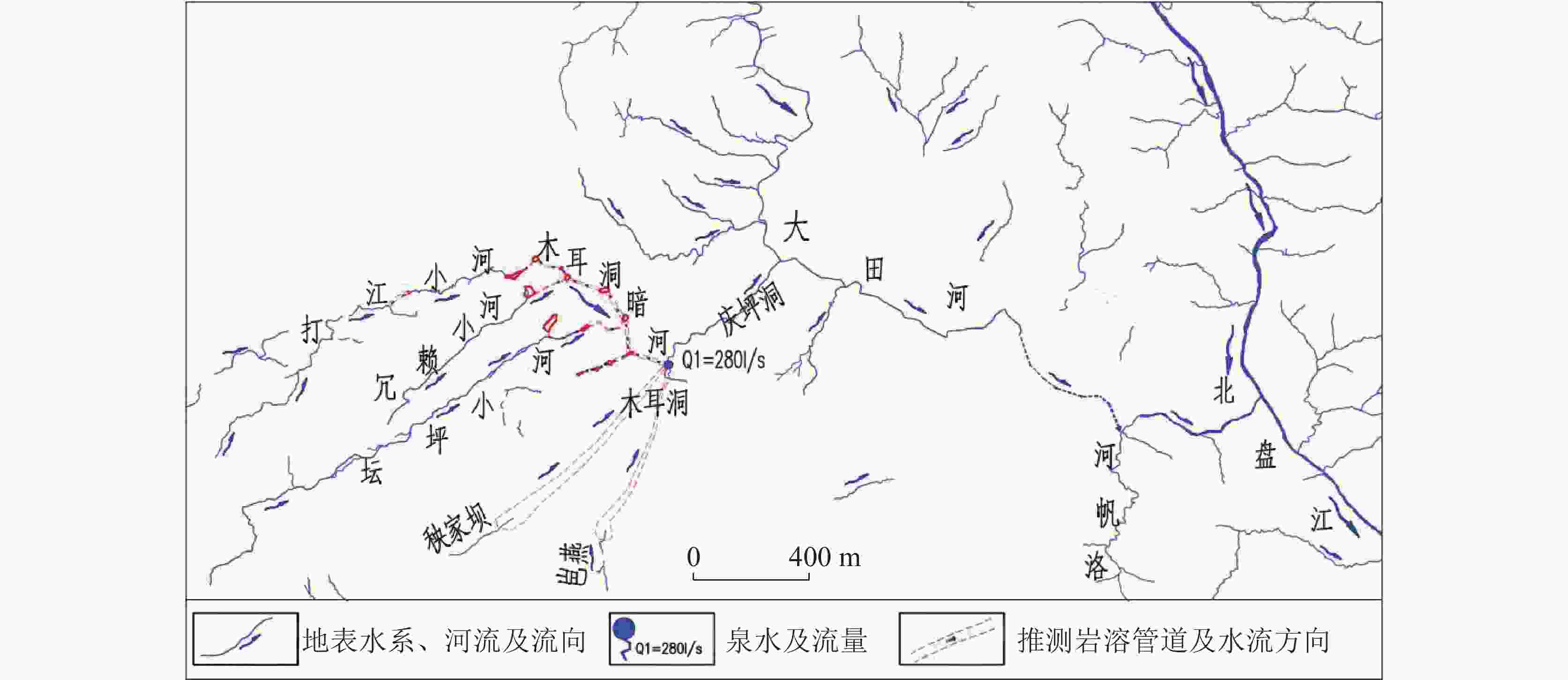
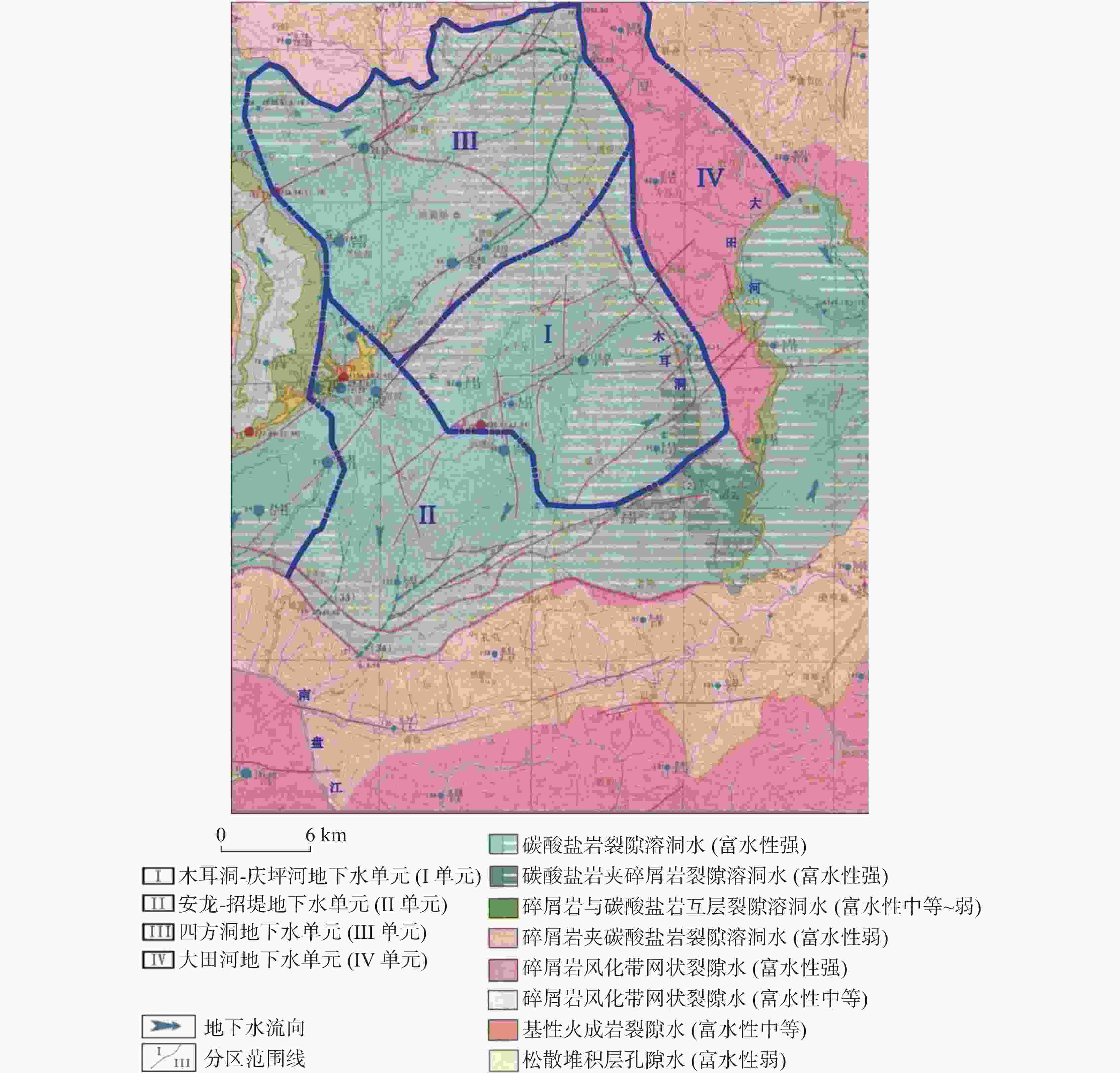
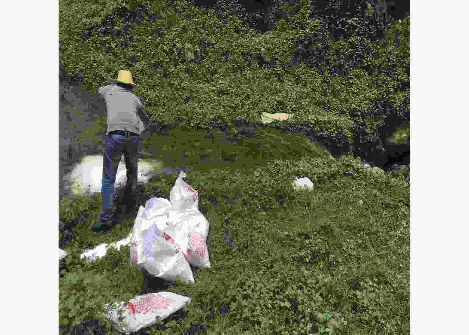
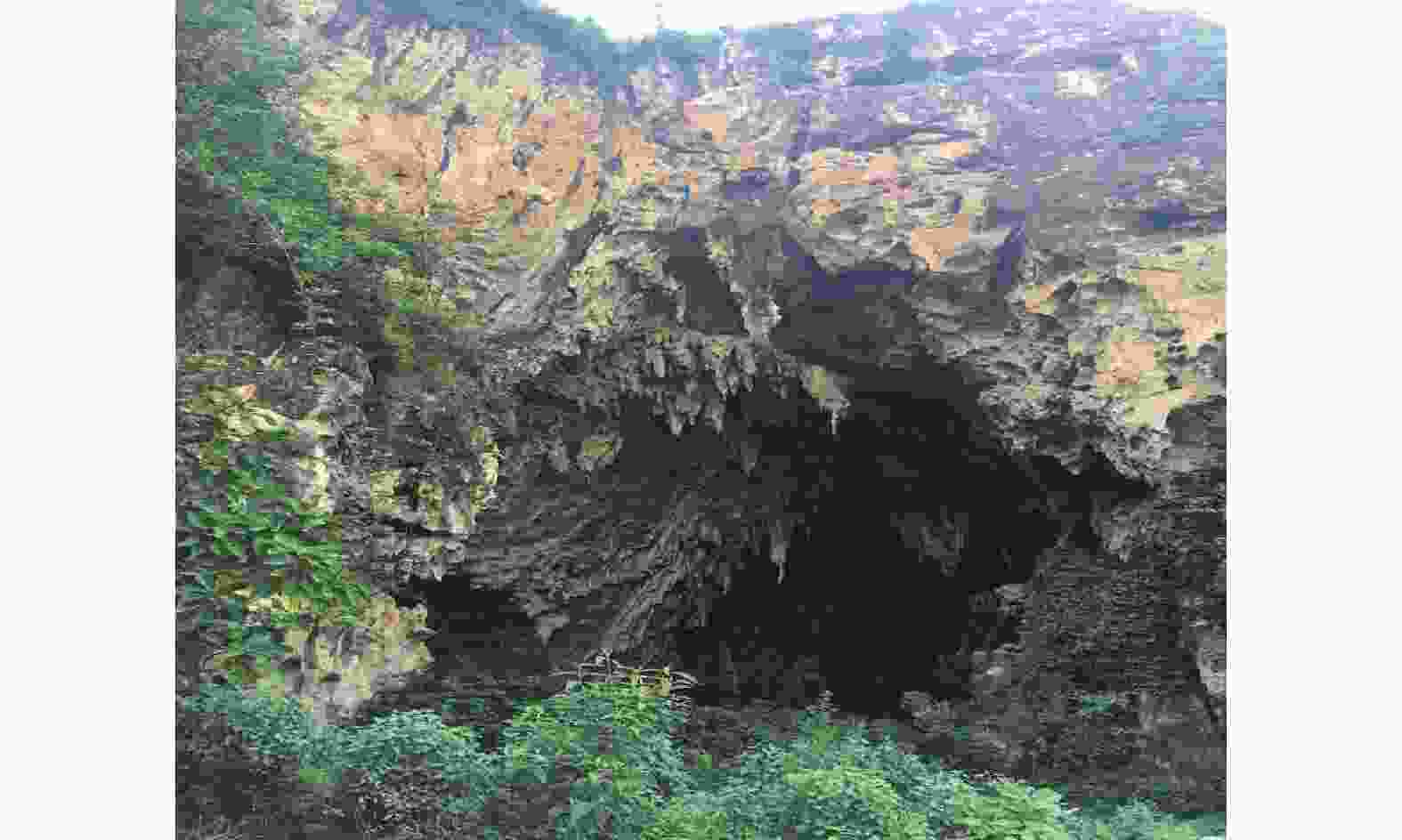
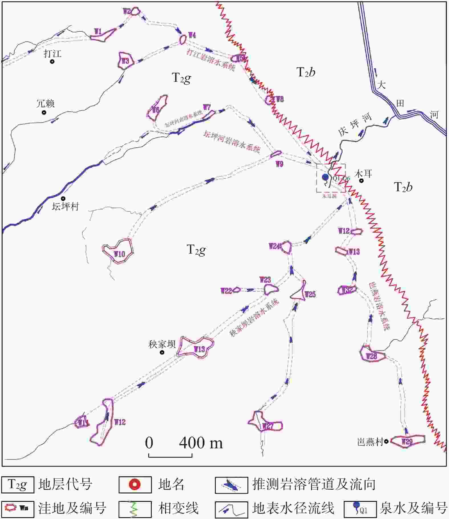
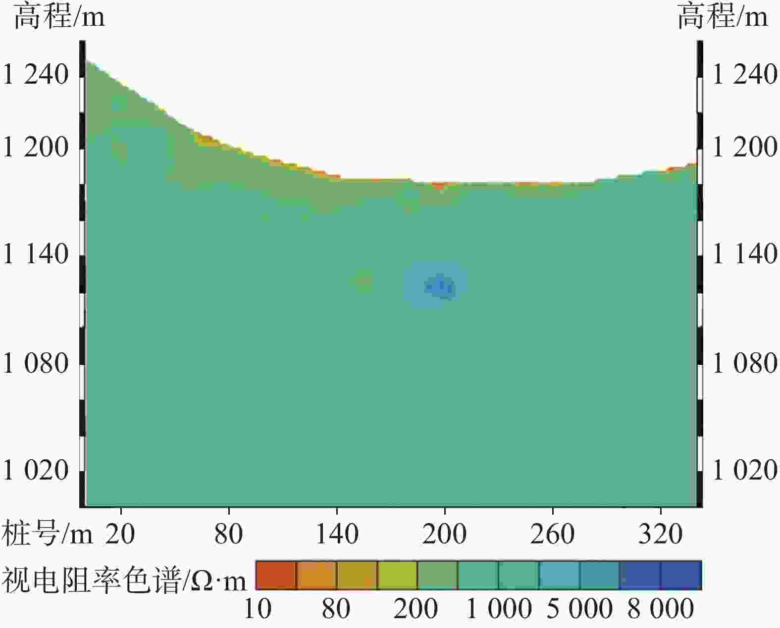
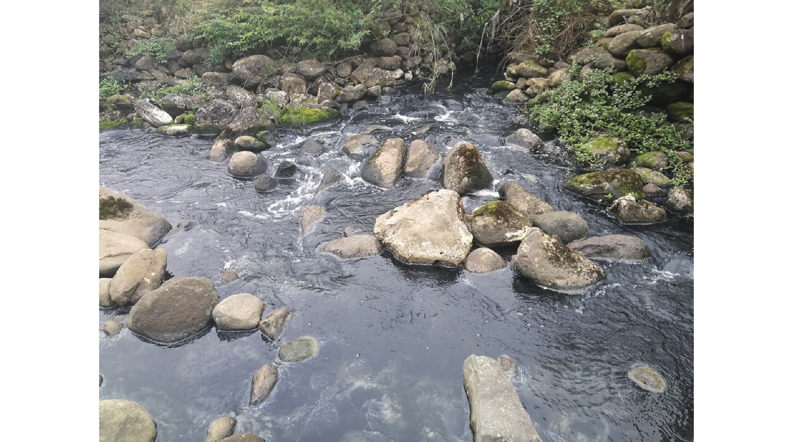
With an area of about 5×10⁵ km2, the largest contiguous karst area in the world is distributed in Southwest China. Karst underground rivers are the most important karst landscapes in karst areas, and also important water sources for human production and life in karst areas of Southwest China. However, with the development of industry and agriculture, the intensification of human activities, and the openness and vulnerability of the karst aquifer system, karst groundwater is facing many threats such as water pollution, depletion of water resources and so on. The water body of a karst underground river in southwestern Guizhou Province was seriously polluted, which resulted in the pollution of the water body of Qingping river downstream. Muer cave, one section of the Qingping river, is a first-class protection area of drinking water source. There are about 30,000 people living in the surrounding towns, in which water for drinking and irrigation is taken from the Muerdong underground river; therefore, the pollution of this river will greatly influence the people's life. This paper studies the influence of hydrogeological conditions of pollution in the karst underground river by means of basic data collection, analysis of karst hydrogeological conditions, microbial indicators and water pollution indexes. The results show as follows: (1) Muer cave is located near the phase transition zone between karst and non-karst rocks, with highly permeable carbonate rocks in the west and weakly permeable clastic rocks in the east. Groundwater in this area is discharged to the surface in the form of karst underground river in Muer cave near the lowest discharge datum. (2) Because of the strong uplift of neotectonic movement and the rapid cut-off of rivers, the underground karst water system and karst cave system have been developed in this area, and there exist multiple complex hydrogeological units formed by surface flows and underground flows, which may create conditions for the pollution of underground river caused by surface pollutants penetrating into underground karst water system. (3) Six spring points and two karst caves are concentrated at the outlet of the Muerdong underground river, but their water quality is different, which indicates that they belong to different underground karst water systems. This also indicates that the range of recharge source of Muerdong underground river is wide, the regional karst groundwater system is very complex, and the ecological environment of the underground river is vulnerable. (4) The characteristics that pollutants are discharged in a concentrated way and in a large amount indicate that the discharge channel is relatively unblocked after the infiltration of pollutants into the underground. It is likely that pollutants are discharged through channels with large cross-sections such as karst pipelines developed in the soluble rock, instead of small channels like bedrock fractures in non-soluble rocks. Therefore, sources of pollution may be distributed in the area west of the Muludong river. Few households are scattered in the upper reaches of the Muerdong underground river, and the sewage such as residents' excreta is mainly stored in septic tanks and used for irrigation. Besides, given that no large industrial and mining enterprises or schools, etc. have been established, there exist no conditions that sewage such as human excrement is discharged in a concentrated way and in a large amount. Therefore, we can exclude the possible pollution caused by the discharge of human excrement and other sewage into the underground river. According to the field investigation, water quality monitoring and microbial index analysis, the pollutants may be the excrement of livestock. By tracer connectivity test and investigation of the surface, we can exclude the pollution sources from the areas of Dajiang (Ronglai) trough and Tanping trough. The Yangjiaba karst depression is characterized by high elevation and thick water-rich rock mass. Under the control of topographic height difference and fault structure, groundwater flows from west to east along the karst cave and karst pipeline system to the outlet of the Muerdong underground river. The geophysical prospecting results also show that there is a deep karst pipeline system in the lower part of Yangjiaba karst depression. At the same time, combined with microbial indicators of water samples from this depression and from Muerdong spring, the source of discharge of livestock was from a piggery in Yangjiaba karst depression. Several sinkholes located in this piggery become the channels of discharging sewage and pig excrement which are likely the source of pollutants in the Muerdong underground river. In this study, some suggestions have been put forward. In the economically underdeveloped karst areas, the protection and treatment of karst spring water is relatively difficult under the background of economic and social development. In accordance with the principles of controlling, recycling, and reducing pollutant discharge, strengthening the protection of water sources and improving the environment, the development of large-scale aquaculture and the construction of large and medium-sized towns in the recharge area of the Muludong underground river should be controlled, sewage of livestock and domestic sewage should be recycled to reduce the discharge of pollutants. At the same time, it is suggested to strengthen the local construction and protection of water sources and increase new stable and reliable drinking water sources. -
表 1 调查区连通试验测试成果表
Table 1. Results of connectivity tests in the study area
序号 投放及监测点位 高程/
m监测指标 pH 温度/℃ 电导率/μs·cm−1 初始均值 最高值 初始均值 最高值 初始均值 最高值 变化率/% 1 投放点 坛坪槽谷落水洞 K2 1 067 7.9 8.0 19.4 19.5 410 —— —— 2 坛坪槽谷-冗赖
海子落水洞K7 1 057 8.0 8.0 19.2 19.3 485 —— —— 3 打江槽谷落水洞 K19 990 7.9 7.9 19.5 20.5 464 —— —— 4 监测点 木耳洞河泉点 Q1 754 8.5 8.8 18.4 18.5 1 810 1 825 0.1 5 Q2 754.3 8.6 8.8 18.0 18.1 1 795 1 805 0.05 6 Q3 754 7.9 8.0 18.1 18.2 650 665 2.3 7 Q4 750 7.8 7.9 18.2 18.3 424 15 500 3 556 8 Q5 750.5 7.5 7.6 18.1 18.3 501 22 400 4 371 9 Q6 750 7.5 7.7 18.3 18.4 458 18 600 3 961 10 K35 770 9.0 9.1 17.5 17.6 2 050 2 080 1.5 11 K36 754 8.4 8.9 17.8 17.9 650 680 4.6 表 2 岩溶含水岩组划分表
Table 2. Classification of karst water-bearing rock groups
岩溶层组 岩溶特征 水文地质岩组 平面分布范围 类别 地层 岩性 地下水类型 透水性划分 弱岩溶
含水岩组三叠系上统把南组(T2b) 黏土岩、粉砂岩夹薄至中厚层灰岩及泥灰岩 埋藏深度较浅、水动力条件弱,少量溶蚀裂隙发育 含风化带网状裂隙水 以弱透水层为主 木耳洞河以东 中等岩溶
含水岩组三叠系下统安顺组(T1a) 薄层泥质白云岩、杂色黏土岩,粉砂岩互层 埋藏深度深、水动力条件中等-强,溶蚀裂隙、溶洞发育、少量管道发育 裂隙水+溶隙水+少量岩溶管道水 以中等-强透水层为主 岜燕洼地 强岩溶
含水岩组三叠系中统关岭组(T2g) 厚层至块状白云岩、角砾状白云岩夹泥质白云岩 埋藏深度深、水动力条件强,溶蚀裂隙、溶洞、管道、暗河发育 裂隙水+溶隙水+岩溶管道水+暗河 以强透水层为主 打江、坛坪河、秧家坝槽谷/洼地 表 3 岩溶洼地统计表
Table 3. Statistics of karst depressions
编号 高程/m 地层 形状 尺寸/m×m 长轴方向 水文特征 W1 1 067 T2g 槽状 645×180 N67°E 明流分布 W2 1 055 T2g 漏斗状 215×185 N61°E W4 975 T2p 漏斗状 240×140 N20°E W5 1 063 T2g 碟状 415×385 N37°W 明流分布 W7 888 T2l 漏斗状 230×200 N68°E W8 1 057 T2g 槽状 675×200 N36°E W9 997 T2p 槽状 350×100 N62°E 明流分布 W10 880 T2p 槽状 270×80 N65°E W16 1 235 T2g 碟状 340×320 N32°E 表 4 落水洞及溶洞统计表
Table 4. Statistics of sinkholes and karst caves
编号 高程/m 地层 备注 水文特征 K6 1 063 T2g 落水洞 明流分布 K14 1 244 T2g 落水洞 K15 1 235 T2g 落水洞 K24 880 T2p 落水洞 K25 1 485 T1a 落水洞 K35 1 025 T2l 地表溶洞 K36 1 050 T2g 地表溶洞 K37 1 050 T2g 地表溶洞 K38 1 075 T1a 地表溶洞 表 5 庆坪河木耳洞地下水监测点监测数据统计表
Table 5. Statistics of monitoring data on groundwater at the monitoring point in Muer cave of the Qingping river
序号 监测项目 高锰酸盐
指数/mg·L−1化学需氧
量/mg·L−1氨氮
/mg·L−1总磷
/mg·L−1亚硝酸盐
/mg·L−1细菌总数
/CUF·mL−1粪大肠菌
群/个·L−1备注 1 检出限 0.5 4 0.25 0.01 20 参照《地表水环
境质量标准》
(GB3838-2002)
Ⅲ类;粪大肠菌群
参照Ⅱ类标准限
值进行评价2 标注限值 6 20 1 0.2 0.013 1000 2 000 3 庆坪河监
控断面2019.1 1.1 4 0.20 0.01 70 4 2019.4 0.8 ND 0.16 0.01 ND 110 5 2019.7 1.5 ND 0.1 0.06 ND 100 6 Q1 2019.11 14.88 51 4.35 0.206 0.026 1.2×10⁶ 5 500 7 2019.12 5.29 16 4.05 0.292 1 500 8 Q2 2019.11 15.65 57 6.45 1.192 0.013 1.1×10⁵ 4 900 9 2019.12 5.65 23 6.60 0.47 1 800 10 Q3 2019.11 1.18 5 ND ND ND 650 60 11 Q4 2019.11 1.17 7 ND ND ND 590 50 12 Q5 2019.11 1.23 6 ND ND ND 420 60 13 Q6 2019.11 0.72 1 ND 0.012 ND 460 80 14 打江岩溶
水系统D1 2019.12 1.21 2 0.03 0.011 1 700 15 D2 2019.12 4.11 13 0.17 ND 170 16 D3 2019.12 1.4 2 ND 0.016 1100 17 坛坪河岩溶水系统 T1 2019.12 1.42 2 0.18 ND 800 18 T2 2019.12 1.58 3 0.09 0.012 2 200 19 秧家坝岩溶水系统 Y1 2019.12 5.71 10 5.60 0.63 26 000 -
[1] 袁道先. 论岩溶环境系统[J]. 中国岩溶, 1988, 7(3):179-186.YUAN Daoxian. On the karst environmental system[J]. Carsologica Sinica, 1988, 7(3): 179-186. [2] 梁永平, 韩行瑞. 中国北方岩溶地下水环境问题与保护[M]. 北京:地质出版社.LIANG Yongping, HAN Xingrui. Environmental problems and protection of karst groundwater in Northern China[M]. Beijing: Geological Press. [3] 林永生, 裴建国. 广西马山地下河系统地下水质量及污染特征分析[J]. 广西师范大学学报(自然科学版), 2015, 33(2):127-133.LIN Yongsheng, PEI Jianguo. Groundwater quality and characteristics of karst groundwater pollution in the Mashan subterranean River, Guangxi, China[J]. Journal of Guangxi Normal University (Natural Science Edition), 2015, 33(2): 127-133. [4] 高旭波, 王万洲, 侯保俊, 高列波, 张建友, 张松涛, 李成城, 姜春芳. 中国北方岩溶地下水污染分析[J]. 中国岩溶, 2020, 39(3):287-298.GAO Xubo, WANG Wanzhou, HOU Baojun, GAO Liebo, ZHANG Jianyou, ZHANG Songtao, LI Chengcheng, JIANG Chunfang. Analysis of karst groundwater pollution in Northern China[J]. Carsologica Sinica, 2020, 39(3): 287-298. [5] 孙斌, 邢立亭, 李常锁. 趵突泉泉域岩溶水典型污染组分变化特征及污染途径[J]. 中国岩溶, 2018, 37(6):810-818.SUN Bin, XING Liting, LI Changsuo. Variation of typical pollution components and pollution way of karst water in Baotu Spring region[J]. Carsologica Sinica, 2018, 37(6): 810-818. [6] Meiman J, Groves C, Herstein S. In-cave dye tracing and drainage basin divides in the Mammoth Cave karst aquifer, Kentucky[R]. U. S. Geological Survey Water-Resources Inves-tigations Report, 2001, 01-4011: 179-185. [7] 廖昱, 孙玉川, 王尊波, 梁作兵, 张远瞩. 甾醇对南山老龙洞地下河粪便污染的指示[J]. 环境科学, 2016, 37(8):3034-3040.LIAO Yu, SUN Yuchuan, WANG Zunbo, LIANG Zuobing, ZHANG Yuanzhu. Fecal contamination in Laolongdong underground river as measured by the sterol biomarkers[J]. Environmental Science, 2016, 37(8): 3034-3040. [8] 曾莘茹, 姜光辉, 郭芳, 汤庆佳, 刘凡. 桂林甑皮岩洞穴遗址地下水示踪及污染来源分析[J]. 中国岩溶, 2016, 35(3):245-253.ZENG Xinru, JIANG Guanghui, GUO Fang, TANG Qingjia, LIU Fan. Tracer tests for pollutant sources of the Zengpiyan remainder cave in Guilin, China[J]. Carsologica Sinica, 2016, 35(3): 245-253. [9] 段逸凡, 贺秋芳, 刘子琦, 张远瞩, 张弘, 赵瑞一. 岩溶区地下水微生物污染特征及来源:以重庆南山老龙洞流域为例[J]. 中国岩溶, 2014, 33(4):504-511.DUAN Yifan, HE Qiufang, LIU Ziqi, ZHANG Yuanzhu, ZHANG Hong, ZHAO Ruiyi. Characteristics and source of microbial contamination of groundwater in Laolongdong basin[J]. Carsologica Sinica, 2014, 33(4): 504-511. [10] 张恒. 黔西南煤区岩溶地下河污染调查方法探析[J]. 地下水, 2016, 38(4):93-95.ZHANG Heng. Pollution sources survey in karst underground river in coal-producing regions southwest of Guizhou[J]. Ground Water, 2016, 38(4): 93-95. [11] 徐昕, 孙玉川, Md.Jahangir Alam. 重庆老龙洞地下河流域水体有机氯农药污染及来源初步研究[J]. 中国岩溶, 2013, 32(2):189-194.XU Xin, SUN Yuchuan, Md.Jahangir Alam. Preliminary study on OCPs in water body of the Laolongdong underground river basin in Chongqing[J]. Carsologica Sinica, 2013, 32(2): 189-194. [12] 梅正星. 我国喀斯特地下水示踪概况[J]. 中国岩溶, 1988, 7(4):371-377.MEI Zhengxing. An outline of the underground water tracing in karst regions of china[J]. Carsologica Sinica, 1988, 7(4): 371-377. [13] 张祯武. 岩溶地下水管流场类型与示踪曲线对应关系及在生产中的应用[J]. 中国岩溶, 1990, 9(3):211-219.ZHANG Zhenwu. Types of conduit flow field of karstic groundwater versus tracer curves and their practical application[J]. Carsologica Sinica, 1990, 9(3): 211-219. [14] 李扬, 杨桢, 康凤新, 刘金勇, 孙彦伟, 黄静波. 东阿水文地质单元地下水硝酸盐污染来源的同位素分析[J]. 中国岩溶, 2019, 38(1):19-27. doi: 10.11932/karst20190103LI Yang, YANG Zhen, KANG Fengxin, LIU Jinyong, SUN Yanwei, HUANG Jingbo. Isotope analysis on the source of nitrate contamination to groundwater in the Dong'e hydrogeologic unit[J]. Carsologica Sinica, 2019, 38(1): 19-27. doi: 10.11932/karst20190103 [15] Smart C C. Artificial tracer techniques for the determination of the structure of conduit aquifers[J]. Groundwater, 1988, 26(4): 445-453. doi: 10.1111/j.1745-6584.1988.tb00411.x [16] 曹卫峰. 贵州岩溶大泉和地下河水资源[J]. 贵州地质, 2021, 16(66):37-43.CAO Weifeng. Water rersources involving karst large spring and underground river in Guizhou Province[J]. Guizhou Geology, 2021, 16(66): 37-43. [17] 王开然, 姜光辉, 郭芳, 周文亮, 陈国富, 梁毅. 桂林东区峰林平原岩溶地下水示踪实验与分析[J]. 现代地质, 2013, 27(2):454-459.WANG Kairan, JIANG Guanghui, GUO Fang, ZHOU Wenliang, CHEN Guofu, LIANG Yi. Karst groundwater tracer test and analysis of peak forest plain area in eastern Guilin[J]. Geoscience, 2013, 27(2): 454-459. [18] 樊连杰, 裴建国, 邹胜章, 杜毓超, 卢丽. 重庆市南川区南部岩溶地下水水文地球化学特征[J]. 中国岩溶, 2017, 36(5):697-703.FAN Lianjie, PEI Jianguo, ZOU Shengzhang, DU Yuchao, LU Li. Hydrogeochemical characteristics of karst groundwater in southern Nanchuan district, Chongqing[J]. Carsologica Sinica, 2017, 36(5): 697-703. [19] 李义连, 王焰新, 刘剑, 罗朝晖. 娘子关泉域岩溶地下水SO4 2−、Ca2+、Mg2+污染分析[J]. 地质科技情报, 1998, 17(2):111-114.LI Yilian, WANG Yanxin, LIU Jian, LUO Chaohui. Pollution analysis of SO4 2−, Ca2+, Mg2+ in karst water in Niangziguan spring area[J]. Geological Science and Technology Information, 1998, 17(Suppl.2): 111-114. [20] 彭淑惠, 王宇, 黄成, 李芹, 王裕琴. 昆明大板桥岩溶地下水系统污染边界及其防污性能研究[J]. 中国岩溶, 2015, 34(4):362-368.PENG Shuhui, WANG Yu, HUANG Cheng, LI Qin, WANG Yuqin. A study on the pollution boundary of karst groundwater system and its antifouling performance in Dabanqiao, Kunming[J]. Carsologica Sinica, 2015, 34(4): 362-368. [21] 时坚, 王晶, 刘德深, 韩行瑞. 山西岩溶泉域水污染现状、趋势与防治对策研究[J]. 中国岩溶, 2004, 23(3):219-224.SHI Jian, WANG Jing, LIU Deshen, HAN Xingrui. Study on the pollution status, trend and protection measure of Shanxi karst springs[J]. Carsologica Sinica, 2004, 23(3): 219-224. -


 下载:
下载:
